
01 / Start here
Start here
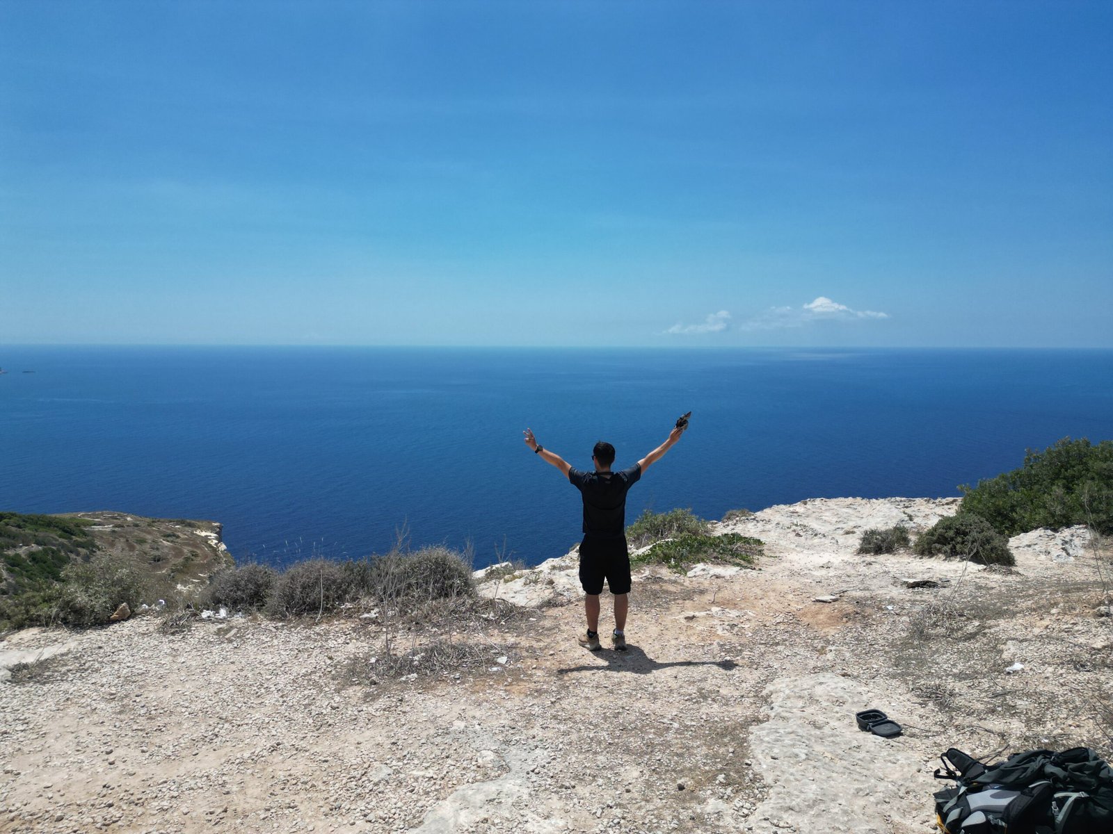
Ta’ Dmejrek is the name widely used for Malta’s highest point, commonly given as 253 m above sea level. The Dingli high ground is a coastal landscape, not a mountain climb: the important decisions are where you can walk legally, how you will get there and how you will handle sun and road traffic.

02 / What is the highest point called?
What is the highest point called?
Names and precise pins are not completely consistent. A Transport Malta study ↗ calls the highest point Ta’ Żuta and gives 253 m. My original account uses Ta’ Dmejrek. Do not assume that differently named pins establish the same accessible spot or that a map point gives permission to enter land.
03 / Compare your options
Compare your options
A short visit to publicly accessible Dingli Cliffs viewpoints needs the least planning; a longer coastal walk offers more scenery but needs careful transport and route planning. A GPS high-point visit is the most uncertain option: turn back if the line crosses a gate, private land or restricted facilities.

04 / Choosing your route
Choosing your route
Use the official walking guide ↗ to investigate the Dingli–Fawwara–Wied iż-Żurrieq walk. It is a separate, longer outing, not a promise that the precise highest point is accessible. Confirm its current route and return transport before starting.
05 / The short visit
The short visit
Choose a public stopping place near Dingli Cliffs, walk only where access is allowed and enjoy the high-ground scenery from a safe distance. Do not rely on a summit monument: the landscape is subtle, and the exact legal approach may change.
06 / Starting from Dingli
Starting from Dingli
Dingli is a useful area for planning the approach, but your bus stop, parking place and walking line depend on your chosen public viewpoint. Check the map at street level and avoid assuming that every rural track is public.
07 / On the road
On the road
Some rural roads have traffic and limited space for pedestrians. Malta’s pedestrian safety guidance ↗ advises walking on the right facing traffic where there is no pavement. Use crossings when available and step aside safely when vehicles approach.

08 / Fields and boundaries
Fields and boundaries
Dry-stone walls, fields and gates are part of a working rural landscape. Remain on clearly permitted routes, leave gates as found and never cross a fence or enter a restricted installation to reach a GPS pin. If access is unclear, choose a public viewpoint instead.
09 / Cliff safety
Cliff safety
The cliffs are a serious fall hazard even though the outing is short. Keep well back from the edge, supervise children and avoid unstable ground, cliff bases and exposed places in strong wind. A photograph or pin is never worth approaching a drop.
10 / The high-point area
The high-point area
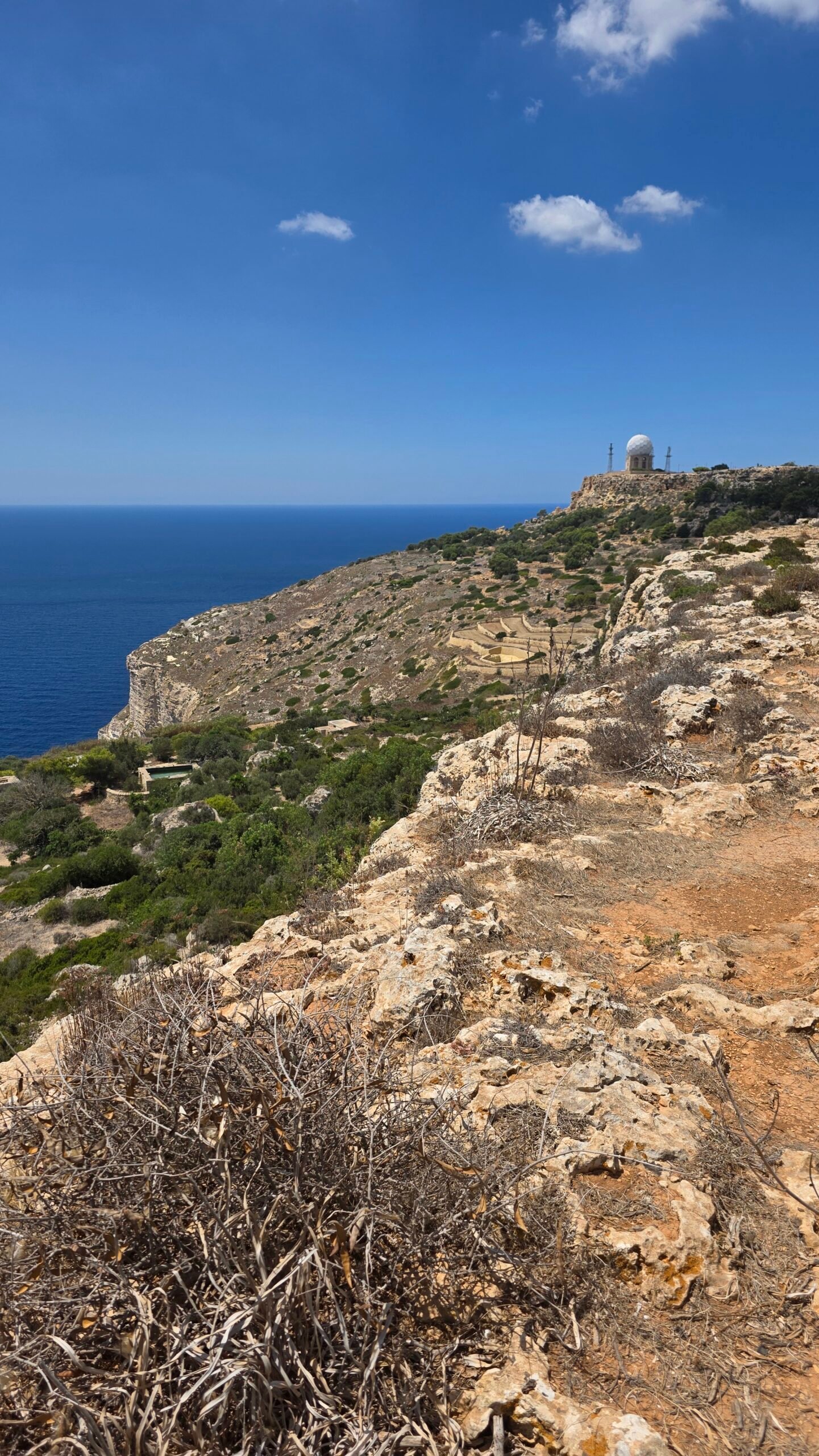
At the location I visited, the ground felt more like open farmland above the sea than a marked mountain summit. This is my recollection, not evidence that a particular plot is open today. Enjoy the landscape without treating an unverified coordinate as a right of way.
11 / Returning safely
Returning safely
Retrace your permitted route or use a planned public connection. On a longer one-way walk, arrange the return before setting off; allow time for missed connections, heat and changing conditions. Do not plan a tight flight connection around an assumed bus frequency.
12 / A longer coastal walk
A longer coastal walk
The official Dingli–Fawwara–Wied iż-Żurrieq itinerary can turn a brief stop into a day outdoors. Read the current official route description first and check terrain, exits and onward buses; its distance and duration should not be inferred from my short visit.
13 / Getting to Malta
Getting to Malta
Malta International Airport is the main air gateway. Build a generous margin for border procedures, baggage, traffic and airport check-in. My same-day flight connection worked in 2025; it is not a recommendation to copy the timing.

14 / Public transport
Public transport
Use Malta Public Transport ↗ to check your date, stops, changes, last bus and current fares. A journey from the airport or a resort may need a connection. Check both directions before committing to a short airport layover.
15 / Driving and parking
Driving and parking
If driving, choose a lawful parking space that does not block entrances, farm work or emergency access. Narrow lanes and pedestrians require patience. Parking availability, restrictions and road conditions can change; a roadside space visible on an old map is not a reservation.
16 / Where to stay
Where to stay
Dingli or nearby Rabat can suit a countryside-focused trip; Valletta or other larger bases may offer more transport and accommodation choices. Compare the actual route to your chosen stop rather than selecting on map distance alone. Book ahead when your dates are fixed.
17 / When to go
When to go
Cooler months can make daytime walking more comfortable, while summer sun makes even a brief exposed stop demanding. Conditions vary in any season: review the forecast and daylight for your actual date and adjust the route to your group.

18 / Weather and wind
Weather and wind
Check the Malta weather service ↗ for forecasts and warnings. Wind can make exposed clifftops uncomfortable or unsafe, and rain can make limestone slippery. Postpone or use a sheltered alternative if conditions exceed your experience.
19 / Water food and heat
Water food and heat
Carry water and food appropriate to the weather and your itinerary; do not count on a shop, shade or a refill at the high-point area. Take a hat and sunscreen, pace yourself and return to shade if heat becomes a problem. Check available services in advance.
20 / Footwear and equipment
Footwear and equipment
For a short public-road visit, comfortable closed shoes with grip are useful; a longer walk needs footwear appropriate to uneven stone. Bring a charged phone, offline map, sun protection and a light layer for wind. After rain, allow for slippery surfaces.
21 / Navigation and access
Navigation and access
Download an offline map, but cross-check it with official walking information and signs on the ground. A mapped path, GPS coordinate or old trip report does not establish public access. Never enter fenced or signed restricted property; have a public alternative ready.

22 / Accessibility and families
Accessibility and families
A short stop may suit visitors who do not want a full hike, but surfaces, pavement continuity, parking and cliff protection vary. Check the exact viewpoint and facilities before travel. Keep children close, away from the edge and moving traffic.
23 / Emergency plan
Emergency plan
For an immediate emergency call 112; Malta’s Civil Protection Department ↗ responds through this number. Move to a safe place if possible and give the dispatcher your location, the nature of the incident and a callback number. Do not attempt a dangerous cliff rescue yourself.
24 / Respect the landscape
Respect the landscape
Take litter home, leave plants and stones in place and respect residents, farming and wildlife. Quiet, permitted paths make a better visit than trying to turn a sensitive cliff landscape into a technical summit challenge.
25 / Things to see nearby
Things to see nearby
Rabat and Mdina offer a contrasting town visit, while the Dingli coast offers viewpoints and walking. Further afield, Heritage Malta ↗ lists cultural sites and visitor information. Verify opening times, tickets and transport for the specific place before travelling.
26 / A practical day plan
A practical day plan
Start after checking the weather and return transport, travel to the Dingli area, then visit a permitted viewpoint or follow a suitable official walk. Leave time for breaks and a meal, and keep the return flexible. Add Rabat or Mdina only if your schedule allows.
27 / Plan and costs
Plan and costs
Enter quotes for your own travel, lodging and food below. A short viewpoint stop can be simple, but transport and accommodation often matter more than the walk itself. Check current prices with the provider; the calculator is an estimate, not a booking quote.
Enter your own prices in euros. Vehicle and main travel are shared; the other amounts are per person. Blank entries count as zero.
Saved planning checklist
Saved only in this browser.
28 / My visit on 6 August 2025
My visit on 6 August 2025
The day before, Ben Nevis had brought rain and wind at around 9°C. After sleeping a few hours on the floor at Edinburgh Airport, I caught an early flight to Malta and stepped into what felt like another world: bright, dry heat around 35°C.
From the airport I took a local bus towards Dingli. In my 2025 account I recorded around 45 minutes and €2.50 each way, €5 in total. Those are details of my own journey, not current fares or a promise of a direct service today. I walked a short rural stretch to the GPS-marked area I knew as Ta’ Dmejrek.
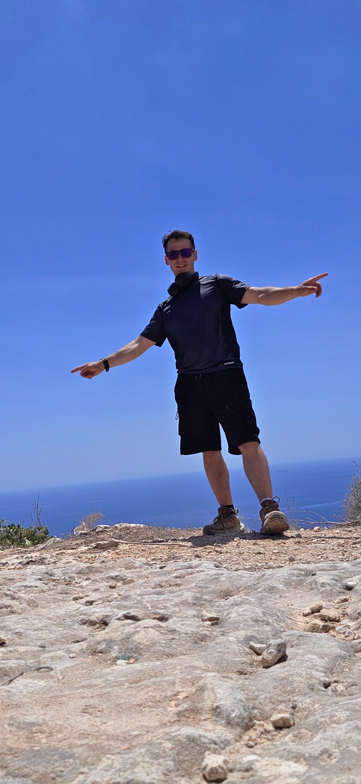
There was no dramatic ridge or cairn in my account, only farmland, pale limestone, dry grass and the sea beyond. I spent about half an hour taking photographs and absorbing the quiet. Afterwards I returned to the airport and flew to Barcelona for the Pyrenees. After the storm on Ben Nevis, Malta felt like a pause between extremes and a reminder that this journey was about all of Europe’s landscapes.
29 / Before you leave
Before you leave
Check your transport both ways, the forecast and the legal walking line on the day. Bring water, sun protection and time to change the plan. A safe public viewpoint is a worthwhile destination even if an exact high-point pin cannot be reached.

30 / Questions answered
Questions answered
What is Malta’s highest point?
Ta’ Dmejrek is commonly named at 253 m; a Transport Malta study uses the name Ta’ Żuta for the highest point. Sources do not settle access to a particular pin.
Is Ta’ Dmejrek a mountain climb?
It is better treated as a visit to high coastal ground than a technical mountain ascent. The main concerns are access, traffic, heat and cliffs.
Where is the high-point area?
It is associated with the Dingli Cliffs high ground in southwest Malta. Check a current map and permitted approach rather than following a pin across boundaries.
Can I reach the exact highest point?
Access at any precise coordinate is not guaranteed. Respect gates and signs, avoid restricted or private land, and use a public viewpoint if unsure.
Is there a summit marker?
My 2025 account did not describe a cairn or dramatic marker at the spot I visited. Do not rely on finding one today.
How long does the visit take?
My personal stop in the area lasted about half an hour, excluding travel. Your time depends on the legal route, conditions and transport; it is not a standard duration.
Can I take a bus?
Public buses serve the wider area, but check Malta Public Transport for the stops, connections and times that fit your actual journey.
Is there a direct bus from the airport?
Do not assume one. Check the current journey planner for your travel date and allow time for any change.
Can I do it on an airport layover?
Possibly, but only if the actual transport schedule and flight requirements leave a generous margin. My 2025 connection does not guarantee yours will work.
How much does it cost?
There is no reliable single trip price: fares and other expenses change. I recorded €5 for my return bus in 2025; check current fares and enter your own costs in the calculator.
What is the best season?
Cooler weather can make walking more comfortable. Check current forecasts in every season and avoid exposed cliffs in unsuitable wind or heat.
What should I wear?
Choose comfortable grippy shoes and clothing suitable for sun and wind. Longer, rougher walks require more preparation than a short roadside stop.
Is it suitable for children?
A short public viewpoint can work for some families, but keep children close and well away from cliffs and traffic. Assess the exact location first.
Is it wheelchair accessible?
Accessibility varies by viewpoint and road section. Check current surfaces, parking and facilities for the specific stop rather than assuming a continuous accessible route.
Can I walk along the cliffs?
Some official walks explore the wider area. Follow a current permitted route and keep well away from unprotected edges and restricted land.
Is drinking water available at the high point?
Do not depend on a supply there. Carry enough for your plans and verify services before leaving.
What number should I call in an emergency?
Call 112 for an immediate emergency in Malta, give your location and follow the dispatcher’s instructions.
Sources and current information
Research checked 2 November 2026. Conditions and services can change.