
01 / Start here
Croatia, beyond the coast.
A mountain worth a full day.
Dinara’s Croatian summit, also known as Sinjal, rises to 1,831 metres. Above Glavaš, ruined stone walls give way to open limestone, mountain grassland and a horizon that keeps getting wider.
This is the Croatia I wanted to find away from the beaches: a landscape to walk through slowly, with horses on the plateau and a flag waiting above the rocks. The summit is a national high point, but the approach is the real reason to come.


- Highest point in Croatia
- 1,831 mDinara / Sinjal
- Classic starting village
- GlavašNear Kijevo, in inland Dalmatia
- Published uphill reference
- 3½–4 hoursTourist-board booklet · ascent only
- My recorded outing
- 15.6 km · +1,286 mPersonal return-route record, not a universal trail measurement
- Time to set aside
- A full dayMy planning suggestion: roughly 7–9 hours including breaks
- My visit
- 26 August 202507:57 start · 11:01 summit · back before 14:00
Start with the route comparison, choose your actual trailhead and make a plan for the return. Then leave space for the Cetina springs, a fortress or a meal in the foothills. Official mountain introduction · Open the hiking map.
02 / Choose your route
Glavaš for the classic climb.
Brezovac for a different approach.
| Option | Why choose it | What needs planning |
|---|---|---|
| Glavaš → Martinova košara → summit → return | The approach I took: ruins, open slopes and the plateau | A long ascent and descent; my personal record was 15.6 km and +1,286 m |
| Knin side via Brezovac | A different side of the mountain and a possible hut-based outing | Exact road endpoint, walking distance, hut arrangements and return |
| Mirkovići approach | Another published approach through different terrain | Current route line, starting access and the complete descent |
| Guided ascent with an arranged transfer | Help with local decisions, pace and logistics | Guide qualifications, agreed route, transport, weather policy and price |
| Foothill day without a summit | Cetina springs, historic places and views of Dinara | A separate itinerary around the villages; no need to force the climb |
My choice for a first visit
For a fit walker comfortable with a substantial mountain day, I would start by looking at Glavaš. It gives the ascent a clear beginning and a memorable sequence of landscapes. If your group needs a different amount of walking, discuss another start with a local guide rather than assuming that a map’s mountain road is suitable for your car.
The regional tourist-board booklet gives 3½–4 hours uphill from Glavaš. That figure does not include the return. My 7–9-hour allowance is a planning suggestion with breaks and a buffer, rather than a quoted official duration.
Read the published approach overview, PDF pp. 64–65 · Find local walking contacts.
03 / Glavaš: getting started
Begin with the village.
Then follow the marked path.
Save the correct starting point
Search for the Glavaš walking trailhead near Kijevo, then compare the road endpoint with the hiking map. “Glavaš” also appears in the name of the Cetina spring. The spring viewpoint and the mountain trailhead are different destinations.

Arrive ready to walk
Buy water and food before reaching the village. Sort your bag, download the map and note where you have parked before setting off. Avoid blocking gates, farm access, houses or places used by residents; follow whatever parking instructions are present.
Find the walking line on the ground
Use the marked path and compare junctions with your saved route. A driving navigation app is useful for the approach, but the summit pin does not define a suitable walking itinerary.
Decide the return now
For a straightforward plan, return to the same start on a route you have studied. A crossing to a different valley needs a transport arrangement. Check that everyone in your group understands which descent you intend to take.
04 / The Glavaš ruins
The first landmark.
Stone walls beneath the mountain.
The ruined fortress above Glavaš gives the early ascent a sense of history. Its surviving walls stand out against the limestone and low vegetation, and they make a useful visual chapter before the landscape opens higher up.

A worthwhile pause, without losing the morning
Make a few photographs, look back towards the lower ground and carry on while the air is still comfortable. On a warm day, I would keep this first pause short and save a longer rest for later.
Photograph the structure from the path
Use the shape of the wall and its openings to give a sense of place. Keep away from loose masonry and exposed edges. The ruins are part of the landscape to appreciate, not a climbing obstacle on the way to the summit.
05 / The climb above Glavaš
Settle into the climb.
Keep something for the descent.
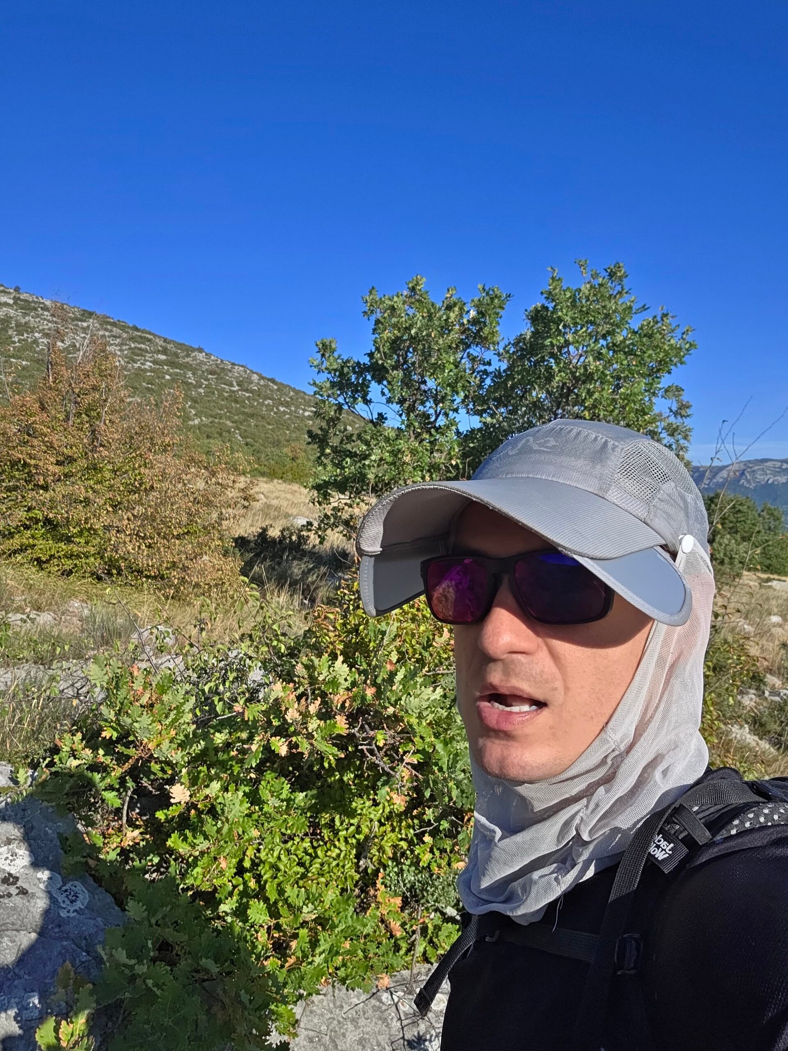
On my August visit, the lower climb felt open and warm. Pale rock, dry ground and scattered vegetation made the mountain feel very different from a shaded forest walk. I deliberately kept my pace steady.
Use a pace you can repeat
The first hour should leave you able to talk, drink and notice the landscape. Take short pauses before you are exhausted. A fast start buys little if the rest of the day becomes a struggle.
Check progress against the day, not someone else’s record
Compare the time, remaining climb, weather and how the slowest person feels. Set a latest turnaround time that still leaves room to descend comfortably. My summit time belongs to my own outing; it is not a target to beat.
Look back at junctions
The same path can look different when you reverse direction. Notice landmarks and the direction you arrived from. These little observations make the return feel more familiar.
06 / Horses on the plateau
An unexpected pause.
The mountain has its own rhythm.
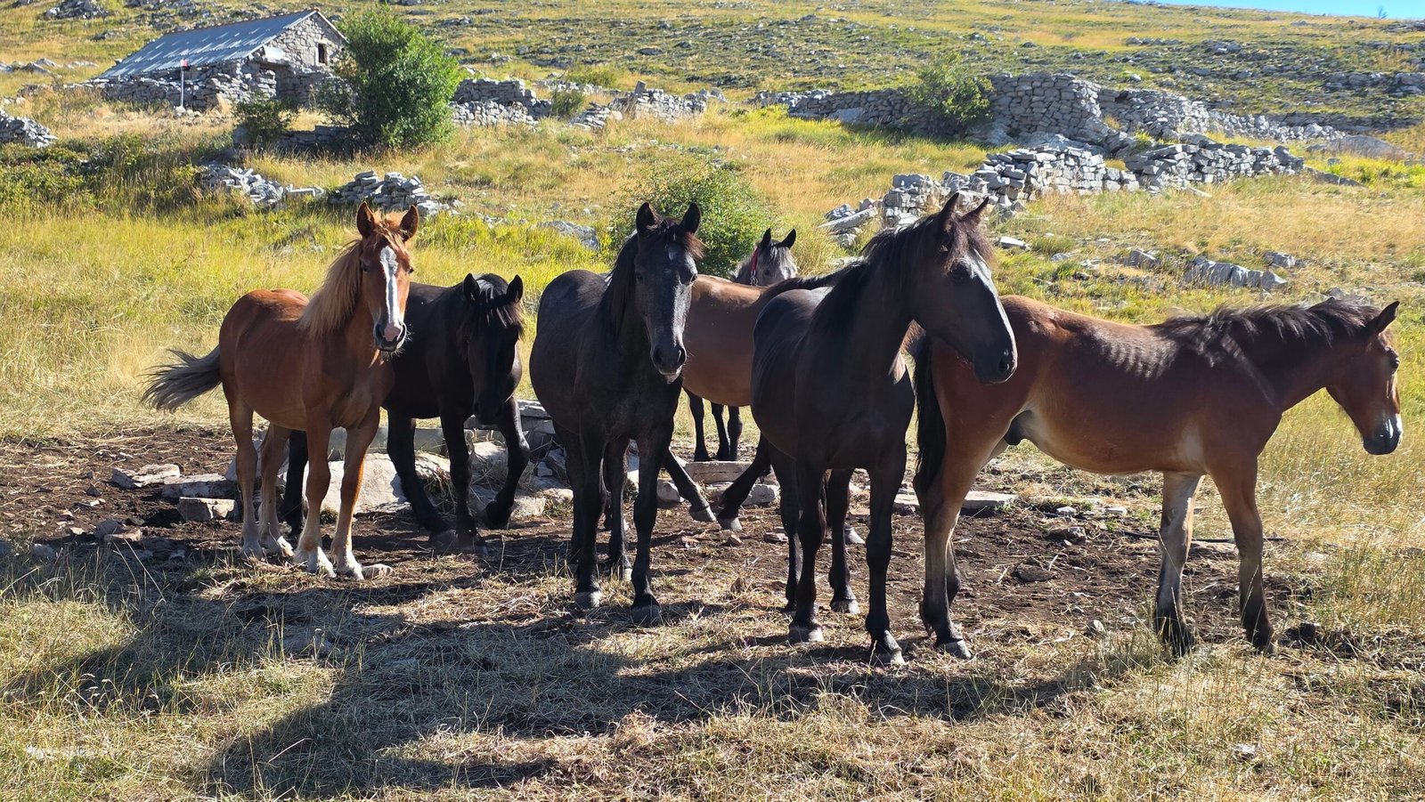
The horses were an extraordinary part of my visit. After the effort of the lower ascent, this open patch of mountain felt calm and full of life. It is the kind of scene that makes an outing memorable long before you reach the top.
Leave room for the encounter
If animals are beside the route, slow down and give them space. Keep food packed away, avoid feeding or crowding them and allow a clear path past. A photograph from a respectful distance usually tells a better story than a close encounter you have forced.

Wildlife and livestock move. Plan for the route and the landscape; treat an encounter like this as a bonus.
07 / Martinova košara
A stone shelter.
A useful moment to take stock.
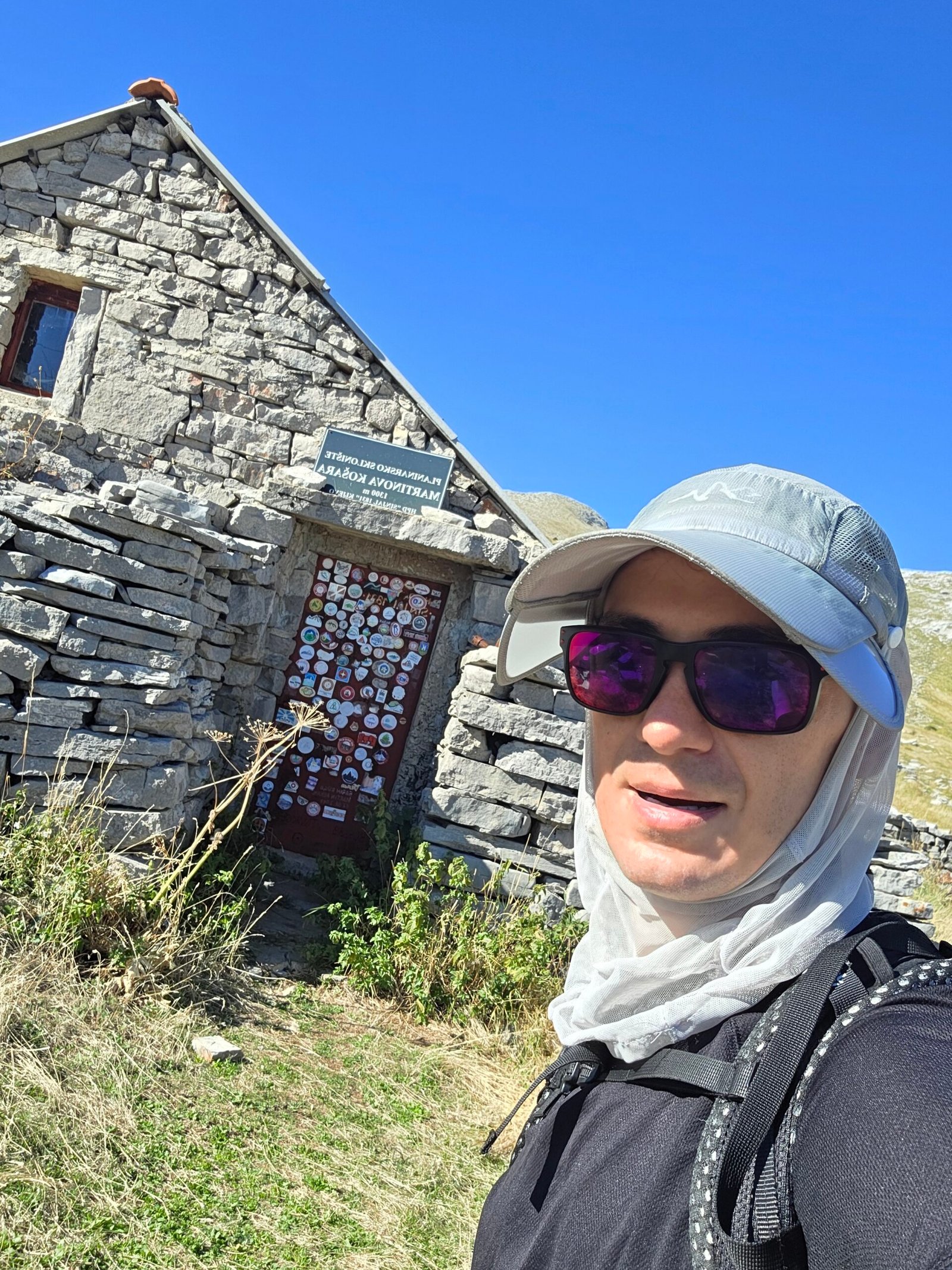
My route passed Martinova košara, a small stone building that sits naturally in the mountain landscape. The regional route overview identifies it as a shelter associated with an old shepherd’s cottage.

Use the stop to review the plan
Have a snack, check the next section on the map and think about the return while you are still making clear decisions. A building on the route is a good checkpoint, but it should not be the only thing holding your plan together.
Carry what you need from the start
Do not assume the door will be open, someone will be staffing it, meals will be served or a water supply will be usable. Confirm current arrangements if you intend to rely on a shelter or spend the night.
Published Glavaš approach overview · Locate the shelter and your route.
08 / The upper mountain
Follow your summit line.
Notice where the routes divide.
Higher up, the marked junctions become an important part of the day. My photographs show red direction signs towards Dinara / Vrh Sinjal, Martinova košara, Glavaš and other destinations. Read the destination, then compare it with your route.


Stay with the route you chose
A tempting alternative sign is not automatically a shortcut. Before changing your plan, check where the route finishes, the ground it crosses and whether it returns to your vehicle.
Keep the return visible in your thinking
Reaching the summit is only one stage. Leave enough food, water, battery and energy for the walk down. If conditions or your group’s pace no longer fit the plan, the mountain will still be here for another day.
09 / The summit of Croatia
The flag. The rocks.
A little time at 1,831 metres.
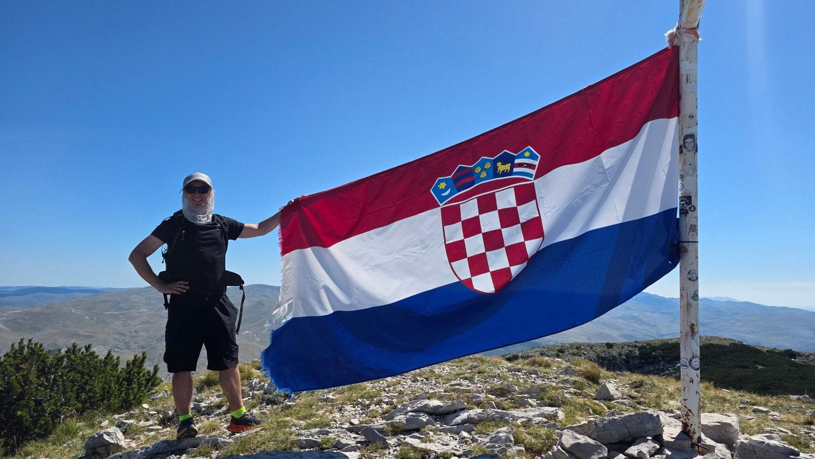
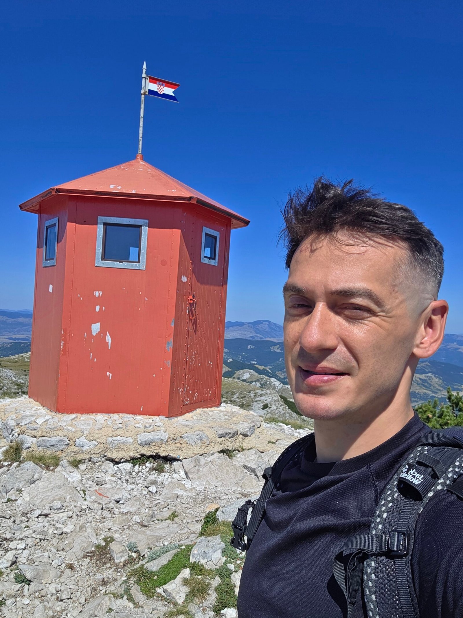
The summit area brings together the familiar Croatian flag, the painted height, a stone survey marker and a small red structure. On my visit, the scene was bright, quiet and wonderfully open.
Take in more than the marker
Make your portrait, then turn away from the flag and look across the ridges. A clear day gives the mountain its scale. A hazy or cloudy day will have a different mood, and photographs should reflect the conditions you actually find.
Keep the summit comfortable for everyone
Leave room beside the marker for other walkers. Find a stable place out of the walking line to rest and eat. Avoid approaching edges just to improve a photograph.
Dinara / Sinjal is the highest point within Croatia. The wider Dinara massif extends into neighbouring Bosnia and Herzegovina and includes higher ground, so these two geographical claims should not be confused. Explore the broader nature-park landscape.
10 / The return to Glavaš
The summit is halfway.
Give the descent its own attention.

Check before leaving the top
Confirm the correct descent, your water and the time. Repack loose items and put away the camera on rougher ground. Eating something before you leave can be more comfortable than waiting until you are tired lower down.
Walk the rocky sections carefully
Shorten your stride where the footing is awkward. Leave space between walkers and use poles if you are accustomed to them. Downhill concentration matters even when the climb has gone well.
Finish at the planned endpoint
Do not switch valley because it looks shorter from above. Once back, let your contact know that the outing is complete and check everyone is comfortable before driving.
I reached my car before 14:00. Other groups should allow the time they need rather than using that finish as a deadline.
11 / The Knin & Brezovac side
Another way onto Dinara.
Start with access, then count the walking.
The Knin side offers a different approach via Brezovac. Knin’s tourism information identifies the mountain house there at 1,050 m. It can be a useful starting point for planning a longer outing or a stay on the mountain.
The road endpoint changes everything
A description starting “from Brezovac” may omit a substantial approach. Before comparing it with Glavaš, establish exactly where you can legally and practically arrive, what vehicle is needed and how much walking remains.
Confirm the mountain-house arrangements
Ask about opening, overnight availability, bedding, food, drinking water and how to reach the agreed start. Treat a reservation and a current access explanation as separate pieces of information you need.
Study the complete return
A route from the Knin side and a descent to Glavaš finish in different places. A traverse can be an appealing itinerary when transport is arranged; it is an awkward surprise at the end of an unplanned day.
I climbed from Glavaš, so the Brezovac notes are planning context rather than a claim that I walked every approach. Knin’s mountain introduction · Compare the approaches on the hiking map.
12 / Independent hike or local guide?
Choose support that fits.
Ask practical questions first.
A local guide can help match the day to your group, interpret the landscape and arrange transport. That can be especially useful if you are unsure about route finding, unfamiliar with the terrain or considering an approach with a complicated road transfer.
Before booking, agree the whole day
Ask who will lead, what qualifications and local experience they have, the precise start and finish, the walking distance and ascent, the maximum group size and what happens if weather changes the route.
Check what the price includes
Transport, meals, equipment and accommodation may be separate. Ask whether a quoted fee is per person or shared by the group before entering it into the calculator below.
Be honest about experience
Describe your recent walking, comfort with rough ground and any needs that affect pace. A useful conversation about the day matters more than choosing the itinerary with the shortest advertised time.
13 / Getting to the region
From the coast to the foothills.
Make the trailhead a separate journey.
Split was my gateway: I flew in, hired a car and drove inland to Glavaš. Knin and the Vrlika–Kijevo area are useful places to orient a visit, depending on the side of the mountain you choose.
| Travel plan | What to arrange |
|---|---|
| Hire car | Arrival and collection time, suitable road route, fuel and a legal parking place |
| Bus into the region | A dated connection and the exact stop; the mountain trailhead may need a separate transfer |
| Stay in Knin | Onward transport to your chosen ascent and the return after the walk |
| Stay near Kijevo or Vrlika | Early departure, food supplies and the last road section to Glavaš |
| Guided day | Written meeting point, pickup time, expected return and weather arrangements |
Avoid the tight flight–summit combination
I would arrive the day before, sleep properly and leave the summit day free. Luggage delays, a late rental collection or a missed connection are easier to absorb when you have built in a night near the mountain.
Knin transport contacts · Search Split bus-station departures · Check Croatian road conditions.
14 / Driving & parking
Navigate to a start.
Keep the mountain roads out of the guesswork.
Use road navigation to reach the selected village, then a hiking map for the walking part. Compare the destination before driving: a route to a summit pin, a mountain shelter or a spring may send you somewhere quite different from your intended parking place.
For Glavaš
Arrive with enough time to understand the local signs and park considerately. Leave the car ready for your return, with valuables out of sight and your location saved. Check your return road route before leaving mobile coverage.
For higher approaches
Do not assume an unpaved track is suitable for a normal rental car. Ask for current local information and check the rental terms. The shortest line on a screen is not necessarily the best vehicle approach.
After the hike
Allow a pause before a long drive, particularly after a hot day or an early start. A night nearby can make the whole trip more enjoyable than rushing straight back to the coast.
15 / Where to stay
A good night below the mountain.
An easier morning on it.
Near Glavaš, Kijevo or Vrlika
This is the area I would investigate first for an ascent from Glavaš. Look at the real drive to the start, check whether you can leave early and ask about a packed breakfast if the usual service is later.
Knin
A useful alternative if you want town services and time at the fortress, or are arranging an outing from the western side. Match the base to the route rather than choosing by straight-line distance to the summit.
A mountain-house stay
If you want the overnight experience, confirm the actual booking and facilities directly. A shelter symbol on a map should not be read as a staffed hotel with reliable meals.
What I did
I slept in the hire car before my climb. That is a detail of the expedition, not my suggested accommodation plan for readers. With more flexibility, I would choose a proper bed, organise supplies and begin rested.
Browse Knin’s accommodation information · Explore the Vrlika area.
16 / When to hike Dinara
Choose the conditions.
Let the calendar come second.
My visit was on 26 August, with clear, warm and calm weather. The photographs show that day, not what Dinara looks like all year. For planning, think about heat, wind, visibility, daylight and the condition of the ground.
| Seasonal question | How I would approach it |
|---|---|
| Spring | Check how much snow remains higher up; a warm village morning does not describe the whole mountain |
| Summer | Give heat and water careful attention; start early enough for the complete return |
| Autumn | Use the shorter daylight in your timing and allow for colder, unsettled conditions |
| Winter or snow-covered ground | Make a separate winter plan with the appropriate experience and equipment; this summer account is not winter route instruction |
Read the forecast for the mountain day
Check DHMZ warnings, wind and precipitation, then seek current local information about your route. A coastal forecast alone is not enough to decide how the upper mountain will feel.
Keep a lower alternative
It is much easier to change plans when a worthwhile second option already exists. A foothill visit can still give you a satisfying day in the region.
17 / Water, food & the long day
Carry the day with you.
Make refills a bonus.
For this outing I would leave the start with the drinking water and food I expect to need for the full return, plus a reserve. Work out your amount for the forecast, your pace and your own needs before leaving; there is no useful one-size-fits-all number for every group and temperature.
Do not build the plan around an unconfirmed source
A water label on a map does not tell you that it is flowing today or suitable for drinking. Ask locally if a refill matters, and still give yourself a workable plan if it is unavailable.
Eat in small, comfortable stages
Keep a snack somewhere accessible and leave some food for the descent. A summit lunch is a pleasure when conditions allow, but eating should not depend on reaching the top first.
Plan the proper meal afterwards
Check the likely kitchen hours before relying on a late lunch. Buy an easy backup before the hike so that a closed restaurant does not become the final complication of the day.
18 / The landscape around you
Limestone above.
Water emerging below.
Dinara’s karst gives the visit its contrast: pale rock and grassland high up, springs and fertile lower ground beneath the mountain. The nature-park overview describes a landscape shaped by limestone and underground drainage.
It also helps explain why a mountain can feel dry on the surface while substantial springs appear at its foot. Seeing the Cetina after walking on the limestone makes the region feel more connected.
Notice the smaller things
Look at the gaps between rocks, the change from low vegetation to grassland and the way the path uses the terrain. Pause somewhere comfortable and let the view become more than a backdrop.
Travel lightly through the place
Stay with the walking line, take rubbish back down and leave plants, stonework and animals as you found them. Follow on-site instructions about access and fire restrictions.
Read the park landscape overview · Vrlika’s explanation of the mountain habitats.
19 / The Cetina springs
A different kind of blue.
A separate stop beneath Dinara.
Veliko vrilo, also called the Glavaš spring, is one of the Cetina’s best-known sources. The tourist board describes a group of karst springs, including Vukovića and Batića, below the mountain.
Keep the names straight
The famous spring viewpoint is not the same arrival point as the Glavaš hiking start. Save both places individually if you plan to combine them. A correct name still needs the correct pin.
Make this a viewing stop
I would come for the water’s colour and the surrounding landscape, remain on the established visitor approach and follow local signs. Keep away from unstable edges and leave the water undisturbed.
Pair it with Sv. Spas
The historic Church of the Holy Salvation nearby offers a very different subject from the blue spring. The municipality dates the early medieval church to the ninth century. Give the stonework and its setting a little time.
These are suggestions for a wider visit; the photographs in this guide are from my mountain climb. Official Cetina spring information · Read about Sv. Spas and local heritage.
20 / A day around Knin
Look back at the mountain.
Give the town a little time.
Knin Fortress
The fortress is an appealing way to see the town and understand its setting. Its walls, museum spaces and views make it a substantial visit of its own rather than a quick roadside photo.
Check the museum’s current opening before arranging the day around it. I would allow a relaxed visit separately from a long summit outing, especially if the afternoon is hot or your group is tired.
Krčić / Topoljski buk
The waterfall and river landscape near Knin provide another reason to stay in the area. Water conditions change; ask locally what the site is like during your visit and follow the current visitor approach.
Choose one main extra
A fortress visit, a waterfall stop and a long drive can easily fill what looked like a spare afternoon. Choose the part that most interests you and leave room for a proper meal.
Knin Fortress introduction · Museum and visitor information · Official Krčić river listing.
21 / Vrlika & Lake Peruća
A slower foothill day.
Views without another summit push.
Prozor Fortress
Above Vrlika, Prozor brings a medieval setting and views over the town, valley and Lake Peruća. It is a separate outing with its own approach, so check the walking involved before calling it an easy recovery stop.
Lake Peruća
The lake is a reservoir on the Cetina and a different landscape from the summit plateau. Choose a suitable public access point and use local information for any planned activity on the water.
Leave room simply to be in the region
A coffee, a meal and a viewpoint can be enough after a long day on Dinara. The trip does not need a second demanding walk to feel complete.
Plan a visit to Prozor · Lake Peruća visitor information · More places around Vrlika.
22 / A day or a weekend
Give the summit a day.
Give the region another.
| Part of the trip | My suggested plan |
|---|---|
| Arrival day | Reach your base, buy supplies, check the route and forecast, sleep properly |
| Summit morning | Leave early enough for the full outing; find the marked start and climb at a sustainable pace |
| Upper mountain | Pause, review the time and conditions, continue only while the whole return still fits |
| Summit and descent | Enjoy the view, eat, confirm the descent and return to the agreed endpoint |
| After the hike | Drink, eat and rest; avoid turning the drive into another endurance stage |
| Extra day | Choose Cetina and Sv. Spas, or Knin Fortress and a river stop, according to your interests |
If you have only one day
Prioritise the climb and the return. The extra sights should remain optional. A long journey from the coast is part of the time budget, even though it does not appear in your walking statistics.
If the mountain conditions are wrong
Move the summit to the better day if you have flexibility. Lower sightseeing still needs a sensible weather plan, but it gives you more choice than committing the whole visit to a single ascent.
23 / Who is the hike for?
Match the day to the group.
Keep a good alternative ready.
The Glavaš outing is a substantial mountain walk. My recorded ascent gain was 1,286 m, and the descent still needed care. I would choose it for people whose recent walking experience makes that amount of effort realistic.
With children
Base the decision on the actual child’s experience, the weather and the full return. A shorter outing in the foothills may make a much better family day than stretching everyone towards a national high point.
If rough ground or mobility is a concern
Do not infer easy access from the mountain’s height or from photographs of a wide plateau. Ask about the exact approach and ground conditions. The summit hike should not be described as a step-free visitor attraction.
With a mixed group
Agree the pace and turnaround plan together. If people split into different itineraries, arrange separate transport, a clear meeting place and a reliable check-in rather than an improvised halfway separation.
24 / Packing & saved checklist
Pack for the return.
Tick it off before you leave.
Use this list as a starting point and adapt it to your route, weather and group. Snow-covered or winter conditions need a separate equipment and skills plan.
Your ticks are saved in this browser. The downloaded file is a plain-text planning list you can keep offline.
25 / Costs & calculator
Build your own budget.
Use the quotes for your trip.
Enter your own prices in EUR. This is a planning calculator, not a live booking quote. Check the actual car, transfer, guide and accommodation arrangements before committing.
| Cost | How to budget |
|---|---|
| Travel to the region | Your actual flight, bus or other fare, with baggage where relevant |
| Hire car and local transport | Include fuel, possible tolls and the return transfer; share only the costs that are genuinely shared |
| Accommodation | Use a per-person nightly amount in the form |
| Food and water | Cover the walking day and the meal afterwards |
| Guiding | Confirm whether the quote is for the group or each person |
| Other costs | Parking, equipment, insurance and any separate sightseeing tickets that apply |
If you put a hire-car total into the shared box, do not add the same amount again under personal travel. For a per-person guide quote, enter it in a personal-cost field or convert it to a group total first.
Accommodation and daily food are per person; only the shared total is divided by the group size. All amounts must already be in EUR.
26 / Maps, contacts & emergencies
A route you understand.
A return someone knows about.
Plan with a hiking map
Sigurne staze is the interactive map promoted by HGSS. Use it to compare your exact start, the marked routes, shelters and the way back. Save usable offline navigation and carry a backup appropriate to your experience.
Open Sigurne staze · Read about HGSS mapping.
Ask about current conditions
A published guide and an old photograph cannot establish today’s access. Ask locally about the route, any restrictions and the arrangements you intend to use. Recheck your forecast shortly before departure.
Emergency: 112
If you need help, call 112. Explain where you are, what happened, how many people need help and the conditions at the location. Provide your phone number and coordinates if available, then follow the dispatcher’s instructions. Do not assume mobile reception is continuous.
27 / Photography notes
Tell the whole day.
From the first sign to the flag.
Begin with the approach
A trail sign and the old walls make the story feel grounded. Photograph them before the summit takes all your attention. One wide frame and one closer detail often do more than ten similar pictures.
Let people show the scale
A walker on pale rock, a pause outside a shelter or a portrait beside a direction sign gives a landscape a human reference. Keep the person in a comfortable, stable position rather than arranging a dramatic edge shot.
Work with the midday light
My photographs were made in strong August sunshine. Watch the bright limestone and the flag’s colours, and check the exposure before leaving a viewpoint. A hat and glasses are part of the real day, so there is no need to remove them just to make a more polished portrait.
Finish with the feeling
The best frame may be the horses, the shelter or a quiet moment after the climb. Keep the camera available when the ground is straightforward, and put it away when the walking deserves your full attention.
28 / My August climb
A quiet restart.
Strength, slowly returning.
Dinara came after a difficult pause in the expedition. I arrived in Croatia wanting to get back onto a mountain, but without the urge to prove anything through speed.
Back to the start
I flew from Kraków to Split, collected a hire car and drove to Glavaš. I slept in the car before the hike. The next morning was calm and clear, and at 07:57 on 26 August 2025 I began walking.
I felt tired and took the ascent carefully. The ruined fortress, the open limestone and the horses gave the morning its own rhythm. It helped to concentrate on the next section of path rather than the whole expedition.
11:01 on the summit
My diary records 15.6 km and 1,286 m of ascent for the outing. I reached the summit at 11:01, with dry ridges stretching away and a sense of space that was hard to put into words.

A pause rather than a performance
I made photographs, sat quietly and began the descent. I was back at the car before 14:00. The figures describe my day, including its own pace and pauses; they should not become a timetable for someone else.
What stayed with me
Dinara felt like a return to balance. The climb mattered because I was moving again, with enough space to enjoy the mountain around me. Sometimes the important part of a summit is simply reaching it at a pace that feels right.
The journey continued through Split and onwards to Hungary, where Farkas joined me on Kékes. Continue to the Kékes guide and story ↗.
29 / Questions answered
The useful questions.
Is Dinara the highest mountain in Croatia?
Yes. The Croatian summit, also known as Sinjal, reaches 1,831 m. The broader massif extends beyond Croatia and includes higher ground.
Are Dinara and Sinjal the same summit in this guide?
Yes. Both names are used for the Croatian national high point discussed here.
Where did Adrian start?
At Glavaš near Kijevo, following a route via Martinova košara and returning to the car.
How long should I allow from Glavaš?
The regional tourist-board booklet gives 3½–4 hours uphill. I would set aside a full day and roughly 7–9 hours with breaks and a buffer, adjusted to the group and conditions.
How far was Adrian’s outing?
My own record was 15.6 km with 1,286 m of ascent. Different starts and route variants change the figures.
Is the Glavaš spring the hiking trailhead?
No. The Cetina spring viewpoint and the Glavaš mountain start are separate places. Check the actual destination before driving.
Can I plan via Brezovac instead?
Yes, but establish your actual access point and mountain-house arrangements first. A route starting at a higher road endpoint cannot be compared directly with the full Glavaš ascent.
Can I assume water or meals are available at a shelter?
No. Carry a complete plan and confirm anything you intend to rely on before departure.
Do I need a local guide?
Choose according to your experience, route finding, group and conditions. A local guide can also help with access and transport; agree the complete itinerary and inclusions.
Does a sunny forecast in Split describe Dinara?
No. Check inland and mountain conditions, wind and the actual walking-day forecast.
Is this a winter route guide?
No. The personal account and photographs are from August. Snow and winter conditions require a separate plan, skills and equipment.
Are the horses guaranteed?
No. They were part of my visit. Animals move, and the photographs are not a promise of a future encounter.
What currency does the calculator use?
EUR. Enter your own quotes; the calculator does not retrieve current prices or exchange rates.
What can I visit nearby?
Consider the Cetina springs and Sv. Spas, Knin Fortress, the Krčić area, or Vrlika and Lake Peruća. Give each stop its own realistic time.
What is the emergency number?
112. Give your location, what happened, how many people need help and the conditions, then follow instructions.
When was Adrian’s climb?
26 August 2025: 07:57 start, 11:01 summit, back at the car before 14:00.
30 / Official links & sources
Your Dinara planning desk.
Research checked 1 November 2026. Expedition record and all photographs: Adrian Mazur, 26 August 2025. Personal timings, suggested allowances and itinerary ideas are identified separately from published references.
Use the live hiking map for the actual route, DHMZ for dated weather information and local contacts for access and facilities. HPS pages were intermittently unavailable during research; the linked 2024 journal is background rather than a current access notice.
Summit height, karst geology and mountain habitats
Regional mountain introduction and the Brezovac approach
Landscape, conservation and the broader Dinara massif
Pages 64–65: Glavaš ascent reference and alternative guided approaches
Plan the exact trailhead, marked walking line and return
Background to the rescue service’s maps and verified trail data
Published circuit and named checkpoints; HPS access was intermittent during research
Ask for current walking information and local guiding options
Read the actual issue date and relevant inland regional forecast
Emergency 112 and mountain rescue information
Route choice, company, equipment and changing conditions
What to tell rescuers and how to prepare for outdoor activities
Current traffic restrictions and weather-related road updates
Regional transport contacts; confirm dated services separately
Search current departures and connections for your travel date
Find a base and confirm early access and breakfast directly
Ideas for a proper meal before or after the walking day
Veliko vrilo / Glavaš and the historic church nearby
Glavaš heritage, Sv. Spas and the landscape beneath Dinara
Fortress, museum spaces and the town’s historic setting
Confirm fortress and museum opening for your date
Waterfall and river landscape near Knin
Choose a foothill day around Vrlika and the Cetina
Medieval fortress with views over the valley and Lake Peruća
Reservoir landscape and local recreation information