
01 / Start here
Hungary’s highest point.
A day beneath the trees.
Kékes rises to 1,014 metres in the Mátra Mountains. Its summit is a meeting of forest paths, a red-white-green marker and a television tower above the trees—a very different kind of national high point from an alpine ridge.
You can make a short visit near the top, walk up from Mátraháza or spend a longer day climbing through the forest from Mátrafüred. The best version leaves room for the approach, a good meal and the places around the mountain.
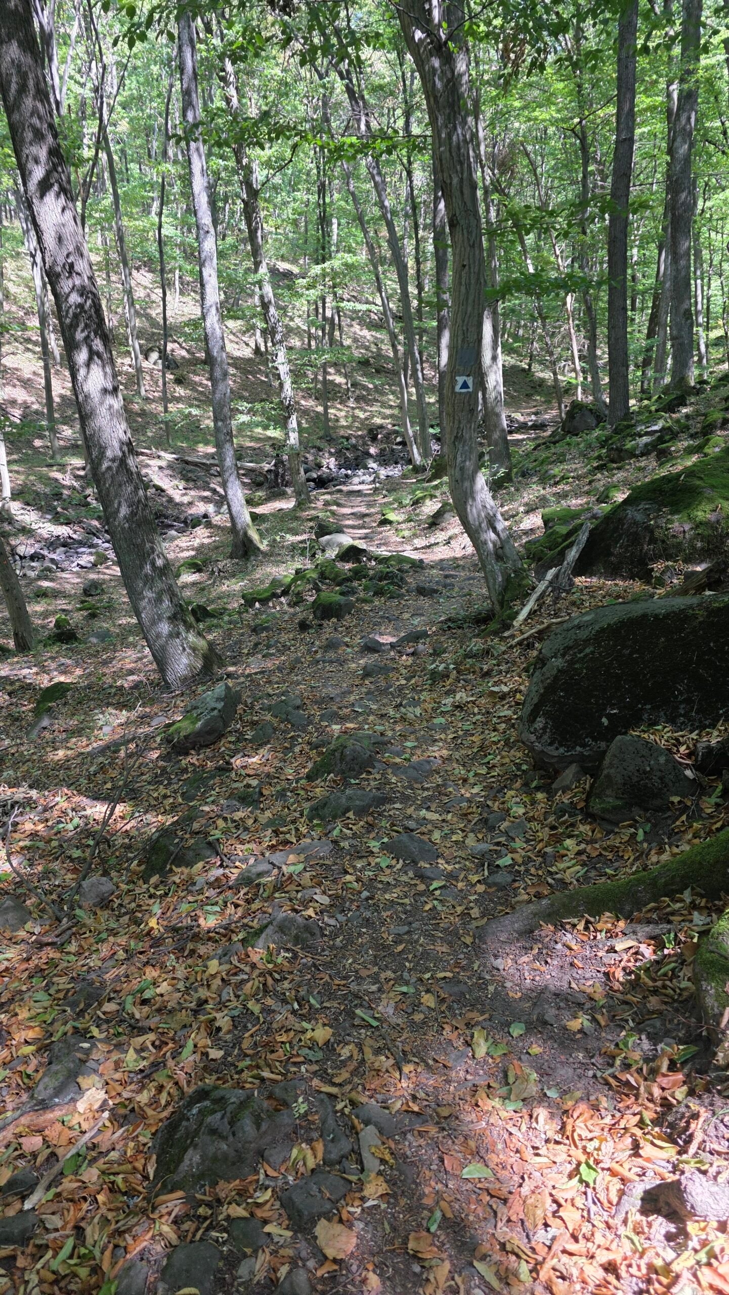

- National high point
- 1,014 mKékes · Hungary
- Mountain range
- MátraNorthern Hungary · forested volcanic hills
- Useful bases
- Mátrafüred & MátraházaDifferent starts with different amounts of climbing
- Mátraháza reference
- 3.6 km one wayMTSZ stamp-to-stamp route · 1 h 30 min · +345 / −45 m
- Summit visit
- Marker + optional towerThe ground-level summit and paid lookout are separate
- My day
- 27 August 202511:54 start · 13:42 summit · 16:53 back at the car
Use this guide to choose the scale of your day, find current transport and plan the summit visit. My own journey with Farkas follows the practical sections. Official Kékestető visitor website · Current Mátraháza walking reference.
02 / Choose your outing
A summit stop.
Or a proper forest day.
| Version | What you get | What to plan |
|---|---|---|
| Road or bus approach to Kékestető | A shorter ground-level summit visit and optional tower | The last walk from your actual arrival point, service hours and return |
| Mátraháza → Kékestető on the Blue Trail | A shorter marked mountain ascent | MTSZ reference: 3.6 km and 1 h 30 min one way between stamps; add the descent |
| Mátrafüred → Kékes → return | A longer climb through the southern forest | Choose a complete mapped route; my personal outing lasted nearly five hours including stops |
| Le és fel! via Mátraháza | A published loop starting high, descending, then climbing back | Operator lists 5.7 km and about three hours at a comfortable pace |
| Kékes nature trail | A longer interpretive mountain outing | BNPI lists 8.5 km, 410 m elevation difference and 4–4.5 hours; check present routing |
| Kékes plus lower Mátra sights | A broader day around Mátrafüred or Gyöngyös | Select one additional stop that fits your walking time |
My recommendation
For a first walking visit, Mátraháza makes the day easier to organise: a clearly referenced Blue Trail approach, a summit pause and a planned return. Mátrafüred suits someone who wants the forest climb to be the main event.
If time or mobility makes a long walk unsuitable, approaching near the summit is a reasonable way to enjoy the high point. Keep the tower optional, especially when cloud removes the view.
MTSZ route and GPX · Published summit–Mátraháza loop · BNPI nature-trail description.
03 / Walking from Mátraháza
The shorter climb.
Follow the current Blue Trail.
The Hungarian hiking association’s OKT-21 page lists Mátraháza → Kékestető as 3.6 km, 1 h 30 min, +345 / −45 m. These figures run between stamping locations. They are a useful route reference, rather than the distance from every hotel or car park to the summit stone.
1. Save the start and return
Identify the Mátraháza bus station or your actual parking place, the marked line uphill and the same-day return. Add any approach from accommodation before deciding what time to leave.
2. Follow the marked route uphill
The local destination description brings the route towards Veronika-rét and the southern ski-slope area. Keep to the current walking line and on-site instructions, particularly where walking and winter-sport infrastructure meet.
3. Find the summit area
Leave time for the marker, the surrounding clearing and the optional tower. The arrival point for a bus, a Blue Trail stamp and the national high-point stone are related landmarks, not interchangeable destinations.
4. Return with a buffer
A walking time of 1 h 30 min uphill does not make the entire visit a 90-minute outing. Add the descent, photographs, pauses and the connection you actually intend to catch.
04 / Walking from Mátrafüred
Begin lower.
Let the forest set the pace.
Mátrafüred was my starting point. Farkas and I walked up through shade and summer light, with conversation filling the quieter stretches. It gave the national high point a proper journey on foot.

Choose the actual line before leaving
There are several marked routes and junctions around the mountain. Save a complete route from your chosen start to the summit and back. My diary calls the ascent the “Blue Trail”, but it does not preserve a verified GPX of every junction. Use a current map for your own outing.
Allow a full walking day
My recorded day ran from 11:54 to 16:53, including the summit and pauses. I would allow a full daylight day for a relaxed visit from Mátrafüred, rather than treating my pace as a target.
Think about the whole climb
Beginning lower means more uphill walking than a summit-area visit. Carry enough water and food, decide where you will turn back if necessary and leave room for the descent when choosing your start time.
05 / A loop via Mátraháza
Down first.
Save energy for the climb back.
The official destination website publishes Le és fel!—“Down and up”—as a 5.7 km outing with about three hours allowed at a comfortable pace. Its listed ascent is 296 m and descent 320 m.
Understand the shape
The walk starts in the summit area, goes down towards Mátraháza and returns uphill. It suits someone already arriving high who wants more than a marker photograph. Keep energy for the final climb back to the starting area.
Use the published map
The operator’s page supplies a route description and GPX. Cross-check current markings and notices before setting out; do not reconstruct the entire walk from a few paragraphs here.
Carry your own water
The description itself notes that Jávoros spring is often dry. Plan drinking water from the start rather than relying on a mapped spring to be flowing or suitable for drinking.
06 / The summit stone
Three colours.
A place in the journey.
The summit marker is the simple, recognisable arrival: a stone painted in Hungary’s red, white and green, with the height as the reference point. The forest around it makes the scene feel intimate rather than vast.
Make the photograph, then look around
Wait for a clear moment at the marker, make your portrait and step aside. A wider frame including the clearing and trees explains the place better than a tightly cropped height number.

The tower is a separate visit
You do not need to treat a paid tower ascent as the summit itself. The marker gives you the geographical arrival; the lookout offers a higher viewing position when conditions and opening allow.
Stay a little longer
Find somewhere out of the walking line to eat a snack, take off the pack and enjoy being there. Even a modest high point is more memorable when you leave time for a real pause.
07 / The television-tower lookout
Above the canopy.
When the view opens up.
The television tower is the mountain’s most prominent built landmark. Its public viewing areas offer a different perspective from the tree-framed summit stone.

What the visitor information describes
The operator’s English page places the open lookout at 45 m and the covered circular café level at 42 m. Clear visibility makes the difference: cloud can hide the distant landscape even when the tower itself is open.
Confirm the actual visit
Check opening before travelling, especially if the lookout is the main reason for your trip. Ask about the entrance, current lift operation and any access requirements that matter to your group.
Plan the photograph
From outside, a little distance lets you include the tower with the trees and clearing. Inside, spend time looking before reaching for the camera; the point of going higher is to understand how the forested landscape fits together.
Lookout viewing-level information · Hungarian operator information and contact.
08 / Tower hours & tickets
Check the day.
Then choose the extra view.
The Hungarian operator page lists 1,200 HUF per adult and 1,000 HUF for children under 14 for the TV-tower lookout. These are published reference prices checked on 1 November 2026.
Opening
The English page gives 09:00–16:00 for November–March, with longer seasonal hours elsewhere in the year. It also carries older ticket figures. For planning, use the Hungarian fare listing and confirm the actual opening directly on +36 37 567 007.
Weather matters
The operator notes that opening can change with weather. Keep the tower as one part of the outing rather than the only acceptable outcome of the day.
Budget for the right people
Check age categories and any group arrangement directly. If using the calculator below, put your own applicable tower ticket in the per-person activities field.
Hungarian fare listing · Seasonal English opening information.
09 / Getting there from Budapest
From the city.
Into the Mátra.
By public transport
MÁV lists bus route 1045: Budapest–Gyöngyös–Mátraháza–Kékestető. Its route page links the current timetable, listed as valid from 20 June 2026 until further notice. Search your actual date before choosing a departure.
Choose the stop for the walk
Mátrafüred, Mátraháza and Kékestető create three different outing lengths. Do not select the summit stop simply because it has the mountain’s name if you intend to start lower and hike up.
Allow for the Budapest connection
Work backwards from the precise departure stop shown on your booked service. Include your city journey, time to find the correct platform and a margin if arriving from another long-distance journey.
My own arrival
Farkas met me after my overnight journey from Croatia and drove us from Budapest towards Mátrafüred. The 88 km in my diary belongs to that particular drive. It is not a universal road distance or a current transfer quote.
Route 1045 and timetable download · Search the actual journey.
10 / Local buses & walking returns
Make the return real.
Before you leave the stop.
MÁV’s June 2026 network announcement describes improved Mátra connections, including Kékestető services directly or with a Mátraháza change. Use that as an overview, then check the actual timetable for your date.
For a one-way walk
Save the arrival stop, planned finish and last useful return. Include the walk between the summit area and your bus stop. Choose an earlier service as your working target so the last departure remains a buffer.
For a return to a car
A bus descent can shorten the walking day, but it only works if it returns you to the right place. Check the exact stop and the remaining walk to the car.
Have the details offline
Save the route number, departure time, change point and a screenshot of the return. Keep a charged phone and enough flexibility to adjust if the day takes longer than expected.
Read the network overview · Check current journeys and connections.
11 / Driving & parking
Choose where to start.
Choose where to leave the car.
Road access near the summit makes a short visit possible. Starting in Mátrafüred or Mátraháza gives you a different amount of walking, so choose the parking around the outing rather than the other way round.
Summit parking reference
The Hungarian destination page lists the paid, unguarded Kékestető car park as available daily 08:00–18:00, with 800 HUF per car per day. Check the signs and applicable conditions when you arrive.
Do not mix old language versions
The English parking page has different historical figures and wording. The Hungarian listing is the reference used here; a published charge still needs checking against the actual car park.
At a lower start
Use designated parking, leave access clear and note the exact place. If you finish at another settlement, arrange the car retrieval before beginning the walk.
12 / Kékes & the National Blue Trail
A local summit.
A much longer blue line.
The National Blue Trail gives Kékes a place in a wider Hungarian walking journey. You can enjoy a short section without turning one visit into an attempt at the entire route.
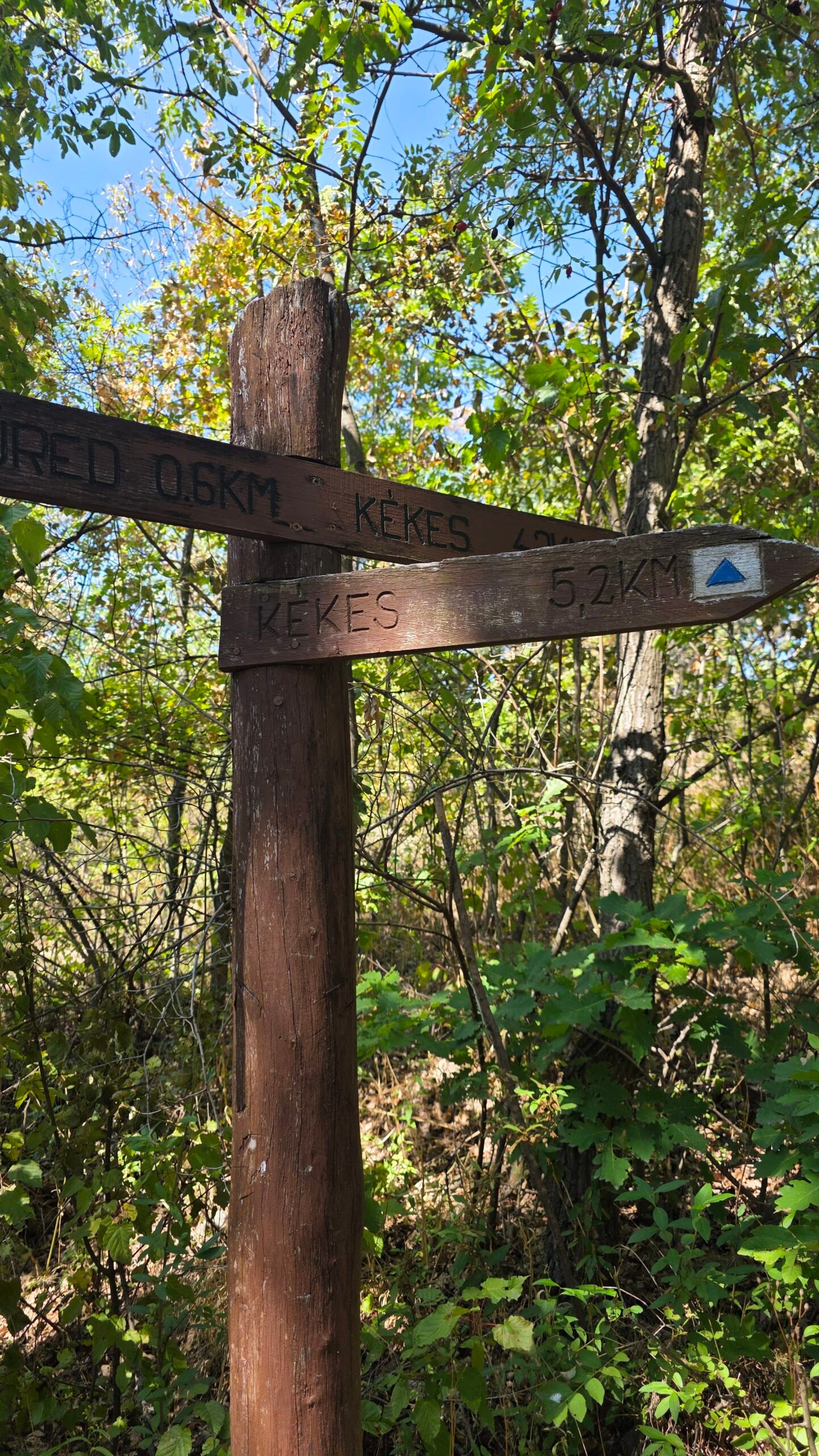
If collecting stamps
Use the hiking association’s current stamping information and completion guidance. A summit portrait and a correctly recorded trail stage answer different questions, so check the stamping point as well as the summit marker.
For a longer journey
The full official Mátraháza–Sirok stage is 26.1 km. That is a substantial ridge day rather than a casual extension after lunch. Match the distance, terrain and transport to the group’s experience.
Keep current maps with you
Routes and stamping arrangements can change. Use the trail organisation’s updates rather than an old screenshot copied from a travel blog.
Official Blue Trail information · The complete OKT-21 stage · Current trail notices.
13 / The Kékes nature trail
Look closely.
Plan a longer outing.
BNPI’s Kékes nature-trail listing describes ten stops over 8.5 km, with 410 m elevation difference and 4–4.5 hours for the outing. It covers the mountain’s geology, plants, animals and wider setting.
It is not a short paved summit circuit
The description identifies rocky, stony terrain. Choose it as a separate walking plan, with suitable footwear and enough time, rather than assuming that “nature trail” means a quick accessible loop.
Cross-check the route
The linked material includes older route instructions. Compare the current marked line, trail notices and any restrictions before following a booklet or GPX. If a connection has changed, choose an available mapped alternative.
Enjoy the interpretation
Leave time at the information stops and notice how the forest changes with height. Walking a little more slowly is part of the attraction when the landscape itself is the subject.
Read BNPI’s full nature-trail listing · Check current trail updates.
14 / The forest around the summit
Shade, stone.
And a quieter kind of mountain.
The Mátra’s volcanic landscape and wooded slopes give the walk its character. My strongest memory of the approach is the rhythm of footsteps under tall trees, with light opening and closing across the path.
Read the smaller details
Look for the pattern of roots, the darker rocks beside the trail and the way a clearing changes the light. These are the things a rapid summit stop can miss.

A forest is a living place
Leave plants, wood and stones where they are, keep rubbish with you and follow the current marked routes. Treat forestry signs and temporary restrictions as part of the day’s information.
Pause without blocking the way
Choose an established stopping place rather than spreading bags across a narrow path. It gives others room and makes your own rest more comfortable.
Municipal landscape background · BNPI’s Mátra nature information · Forest-manager information.
15 / Around Mátrafüred & Sástó
Keep some time.
For the lower Mátra.
A second walk from Mátrafüred
The BNPI Cincér trail runs from the Harkály Ház area towards Sástó, with interpretation of habitats, dead wood and forestry. It gives a different focus from the summit climb and can be a separate, slower outing.
Do not bolt everything onto summit day
After a long climb, a short local pause may be enough. If you want to explore a whole nature trail, give it its own time and check the actual length, starting point and return.
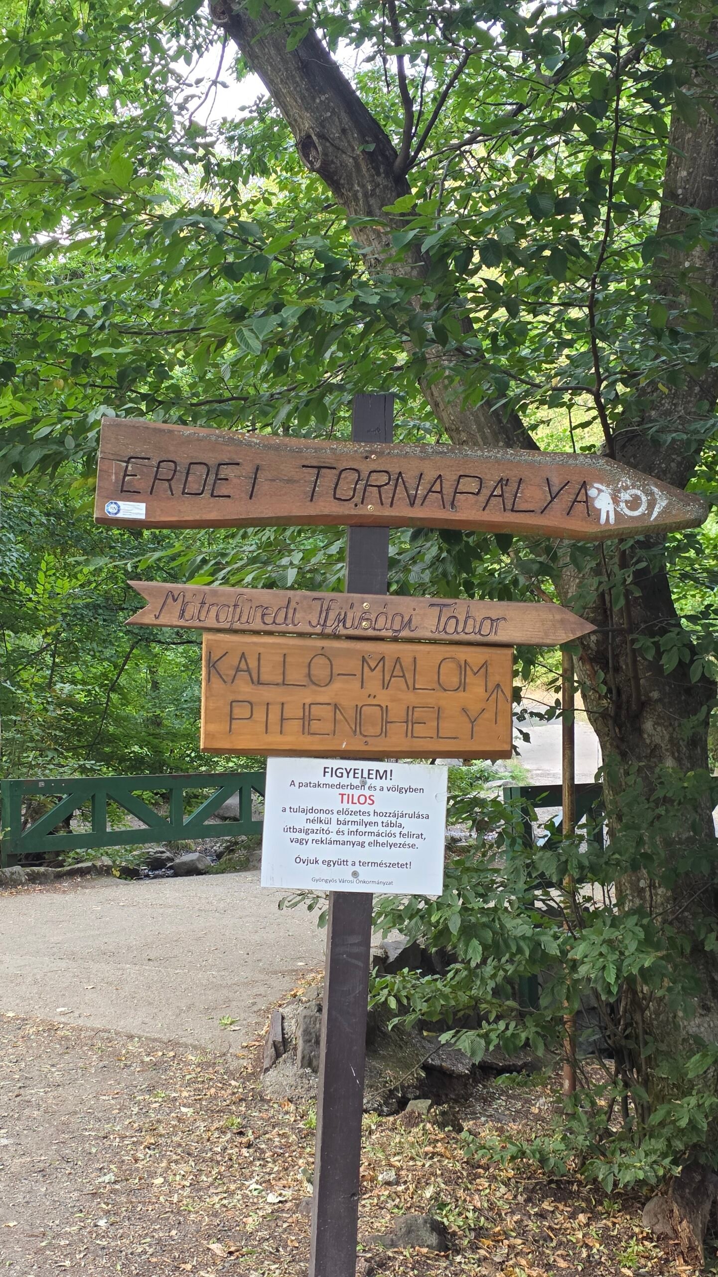
Choose by interest
A lake-side pause, an interpreted woodland walk and another uphill route offer different experiences. Pick the one that suits the day’s energy rather than filling the afternoon with unrelated pins.
BNPI Cincér nature-trail information · More about the southern Mátra.
16 / The Mátravasút forest railway
Another way.
To enjoy the foothills.
EGERERDŐ operates the Mátravasút and publishes its timetable and fares alongside its other forest railways. It can add a different rhythm to a visit around Gyöngyös and Mátrafüred.
Check the right route and date
Read the Mátravasút download, then match the operating day and destination. The same page includes Szilvásvárad and Felsőtárkány information; those are different railway systems.
Keep the summit connection separate
The forest railway is not a train to the Kékes summit. Plan any bus, walk or transfer beyond the railway journey in its own right.
Make it a complete outing
If you want a railway ride, a gentle walk and a meal, give that combination enough space. It can be an enjoyable second day rather than an extra connection squeezed into an already long climb.
17 / A Gyöngyös museum stop
A lower day.
A different view of the region.
Gyöngyös provides a practical town chapter for a Mátra visit. If the hill is in cloud or you want a break from walking, consider the Mátra Museum rather than forcing another outdoor itinerary.
Useful visitor details
The museum lists Tuesday–Sunday 09:00–17:00, with ticket sales ending at 16:30 and Monday closure. Its address is Kossuth Lajos utca 40, Gyöngyös. Check holiday arrangements and the exhibitions you want before going.
Fit it to the journey
A museum stop works best when it matches the transport and energy you have left. Keep the last admission time in mind and allow time to enjoy the exhibits rather than arriving only to rush through.
If travelling with a dog
The museum’s information says dogs and other animals are not admitted. Arrange an outing that works for everyone in the group rather than assuming every indoor stop has the same policy.
18 / Food & a proper pause
A forest climb.
A table worth staying at.
My Kékes memory includes a generous Hungarian meal with Farkas as much as the summit itself. After repeated travel days and mountain snacks, sitting together over proper food felt like a small luxury.

On the mountain
The destination website lists Kékesi Vendégház and Tető Étterem among the summit-area food options. Confirm actual opening if you want to plan around a meal there.
Carry a snack regardless
Keep enough food and water for the walk itself. A café stop is more enjoyable when you choose it, rather than needing it to be open to complete the route.
Give dinner some room
If continuing to Budapest or another city, decide how the meal fits the return first. A relaxed table is a good end to the day when you already know how you are getting home.
19 / One day or a weekend
Make the day fit.
Leave room to enjoy it.
A shorter summit visit
Travel near the summit, walk to the marker, consider the tower if visibility is good and take a comfortable food pause. Keep the whole return connection clear. My suggested allowance is a few unhurried hours locally, plus your travel.
A walking day from Mátraháza
Arrive early enough to avoid rushing. Follow the current mapped approach, pause at the summit and return by your chosen open route. Build the transport around the whole visit, not only the uphill walking reference.
A forest day from Mátrafüred
Start with a complete route and enough daylight, carry food and water, and make the ascent and descent the day’s main activity. Add a meal afterwards if the timing works.
My preferred weekend
Arrive and settle into the area on the first evening. Give the next day to Kékes. Use the following morning for one lower outing—an interpreted nature trail, the forest railway or the museum—before travelling onward.
These are my suggested itinerary shapes, not guided tours or guaranteed schedules. Choose one that suits the actual forecast, transport and group.
20 / Where to stay
Closer to the forest.
Or closer to the connections.
Mátrafüred
A useful base if the lower forest paths and a longer approach appeal to you. Check the walk from the accommodation to your actual start and whether meals are available when you expect to return.
Mátraháza
Worth considering if you prefer the shorter Blue Trail approach and a mountain-side starting point. Confirm the exact location; a property name containing “Mátra” does not establish that it is beside your chosen trail.
Gyöngyös
A town base can suit transport connections and a broader regional visit. Include the daily bus or drive into the hills when comparing it with staying closer to the walking start.
Before booking
Ask about arrival time, parking or the nearest stop, breakfast, luggage storage and the route back in the evening. A bed that fits the walking day is usually more useful than a slightly cheaper room with awkward transfers.
21 / Seasons & weather
Summer shade.
Different conditions higher up.
My August day was hot, sunny and calm. The shade made the forest feel comfortable, but that is one day’s memory, not a forecast for your visit.
In summer
Carry enough water, take sun protection for clearings and allow a pace that suits the heat. Check the possibility of thunderstorms before extending the day.
In autumn and spring
Bring an extra layer and check the actual daylight allowance. Wet leaves, mud and patches of ice can change how a familiar-looking woodland path feels.
In winter
Plan for the actual snow and ice, not a summer walking time. Check how the available walking line interacts with operating ski areas. Choose equipment you know how to use and turn back when the route does not suit the group.
Use observations and a forecast together
HungaroMet’s Kékestető page shows measured conditions with a timestamp. Combine that with a current forecast and the summit webcams rather than treating a single photograph as the whole day’s weather.
Kékestető observations · HungaroMet forecast · Summit webcams.
22 / Families, access & practical stops
Choose the distance.
For the people coming with you.
With children
Start with a distance they already enjoy, then choose the arrival point. A shorter summit visit and a longer forest ascent are different days. Keep food, water and an easy return in the plan.
Mobility needs
The summit photographs show a stepped platform at the marker. Confirm the route from parking or the bus stop, nearby surfaces and tower access directly before travelling. Road access nearby does not establish that every part is step-free.

With a dog
Check the rules for the precise route, transport and indoor attractions you choose. Keep the dog close, carry water and confirm the tower policy directly. A woodland walk and a museum visit may have very different requirements.
Simple facilities
Check essential stops at the base or with the chosen visitor business. Do not assume a café or toilet is available everywhere a map shows a place name.
23 / Costs & calculator
A simple outing.
Your own complete budget.
The biggest difference is often the way you reach the mountain: a shared car, public transport or an overnight stay. Add the optional lookout and food you actually want rather than assuming every visitor buys the same package.
| Item | Published reference checked 1 November 2026 | Budget it this way |
|---|---|---|
| TV-tower lookout | 1,200 HUF adult; 1,000 HUF child under 14 | Per visitor; confirm the applicable ticket |
| Summit car park | 800 HUF per car per day on the Hungarian operator page | A shared group expense; confirm signs on arrival |
| Bus, railway, meals and accommodation | Use your actual dated quotes | Enter the journey and overnight stay you have chosen |
The tower and parking pages use Hungarian forints (HUF). Their older English versions show different figures. The Hungarian listings are the references used here; confirm the actual charge before paying.
Use one currency
Enter every calculator quote in HUF. Convert any euro or other quotes yourself using your expected payment rate. There are no live prices or exchange rates. Put a whole-car parking or transfer quote in the shared field, and each person’s tower ticket in activities.
Only the shared group quote is split between people. Accommodation and food are one person’s rate multiplied by the night/day counts. Do not add the same transport expense in two fields.
Hungarian tower fares · Parking reference · Search actual transport and fares.
24 / Packing & checklist
A comfortable pack.
A day with fewer loose ends.
Pack for your chosen version of Kékes. A short summit stop and a long forest loop need different amounts of food, water and time. Adapt this list to the actual conditions.
25 / Maps & useful contacts
Save the next junction.
Keep the return easy to find.
Before leaving
Save an offline map with the entire route, the actual start and finish, return stops and any planned visitor attraction. Read current trail notices when an older GPX or nature-trail booklet is involved.
Fire sites and forest notices
A picnic area or fireplace on a map does not establish that a fire is allowed today. Use BNPI’s current restrictions and follow the signs at the site.
If you need emergency help
Call 112. Explain what happened, how many people need help and the best location you can give: coordinates, a named junction, a trail marker or a clear landmark. Follow the dispatcher’s instructions and keep the phone available.
MTSZ map portal · Trail notices · Forest-manager information · Current fire restrictions · Official emergency-calling guidance.
26 / Photography notes
The forest light.
The people in the picture.
Kékes works well as a small visual story: trees and rock on the approach, the coloured stone at the top, the tower’s vertical line and a meal at the end.
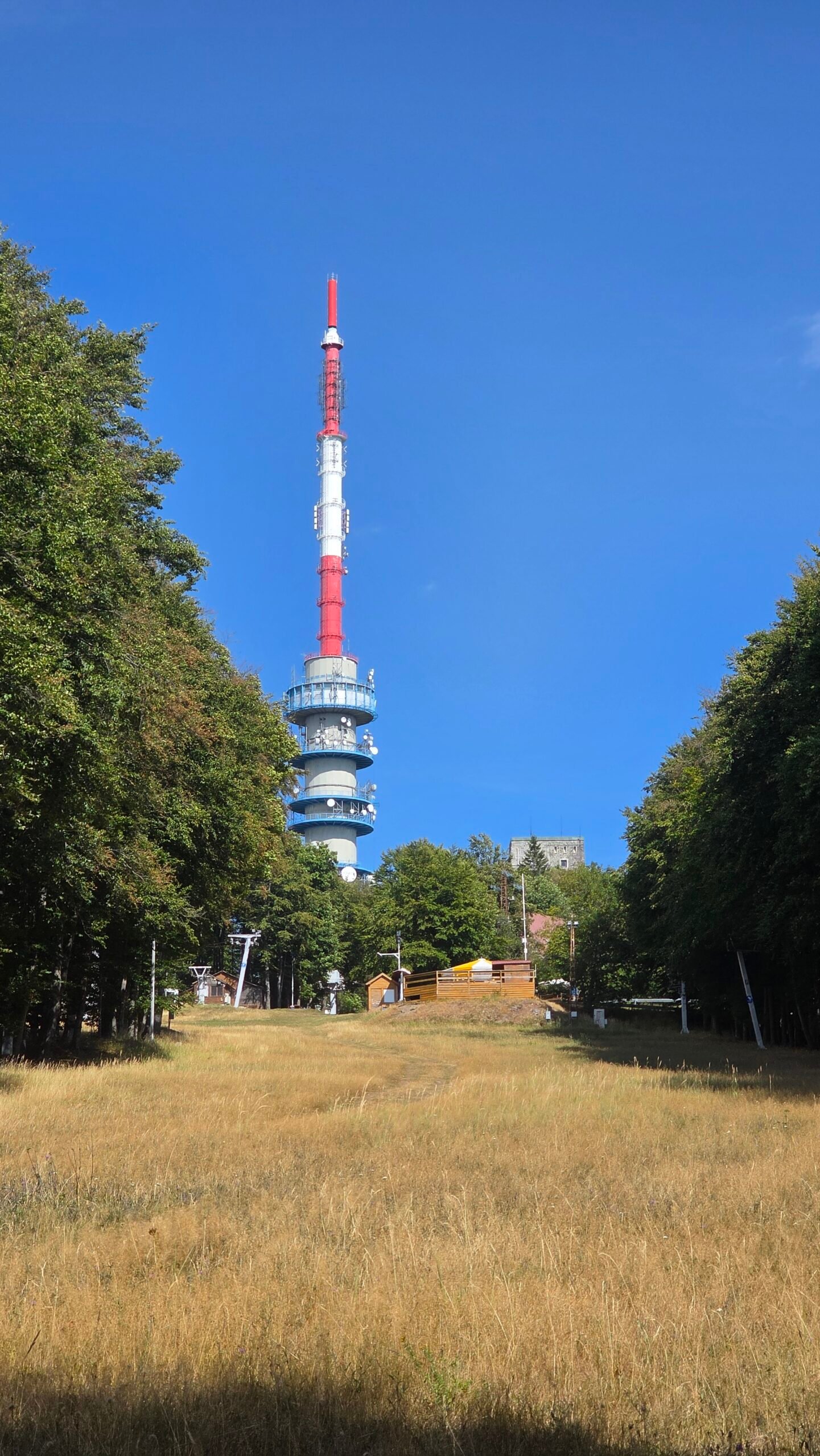
Let the shade do some work
Bright summer light can be difficult in a clearing. Under the canopy, look for a face turned towards softer light or a path where patches of sun create depth.
Vary the scale
A forest detail, a wide summit portrait and a photograph of the table tell different parts of the day. Keep the ordinary moments too; they often carry the feeling of the trip later.
Give people room
Do not block the summit marker or a narrow path while arranging a portrait. A brief, clear photograph is easier for everyone than trying to remove every other visitor from a shared place.
All photographs in this guide are mine from 27 August 2025.
27 / My August visit
A friend at the start.
A calmer day on the road.
27 August 2025. After Dinara, an overnight journey brought me from Croatia to Budapest. Farkas was there to meet me, and for once the next mountain came with familiar company.
I had returned the car at Split Airport, taken a bus into the city and continued overnight towards Hungary. By this point the rhythm of stations, buses and early arrivals had become part of the expedition.
Farkas offered to join the climb. After so many solitary summits, it felt good to have someone beside me: conversation, laughter and a walk that did not need to be a race.
We started from Mátrafüred at 11:54. The day was hot, but the forest gave us shade, with sunlight breaking through the tall trees. We kept a steady pace and reached the summit at 13:42.

The tower and visitor area gave the top a recognisable shape. Around us the landscape was green and the atmosphere relaxed. It was an easygoing day in the personal sense: no altitude stress, no urgent final push, just a good walk with a friend.
After the summit pause and photographs, we came back down, reaching the car at 16:53. Those are my recorded expedition times. They describe our day, including stops, and are not recommended timings for every walker.
The meal afterwards
Instead of going straight back, we stopped for a generous Hungarian meal. The meat board felt extraordinary after weeks of airports, quick travel food and mountain snacks. Sitting outside with Farkas, talking over cold drinks, made the journey feel human again.
What stayed with me
Kékes was a pause in the travelling: friendship, a shady path, proper food and a little normality before another overnight journey. It reminded me that a high point can matter because of the person beside you as much as the landscape ahead.
The next chapter was Sněžka / Śnieżka, reached after travelling on towards Prague. Continue to Sněžka / Śnieżka ↗.
28 / Questions answered
The useful questions.
Is Kékes the highest mountain in Hungary?
Yes. Kékes reaches 1,014 m above sea level in the Mátra Mountains.
Are Kékes and Kékestető the same destination?
Kékes is the mountain name; Kékestető is commonly used for the summit area. Use the exact arrival point when planning transport or parking.
Do I have to make a long hike to visit?
No. You can approach near the summit by road or bus and make a shorter visit, or start lower for a longer forest day.
Which walking start is best for a first visit?
Mátraháza offers the shorter, clearly referenced Blue Trail approach. Mátrafüred suits a longer forest ascent. Choose the complete route and return before leaving.
How long is the current Mátraháza Blue Trail reference?
MTSZ lists 3.6 km, 1 h 30 min and +345 / −45 m between stamping locations. Add the walk to your actual start, the summit pause and descent.
What is the Le és fel! walk?
A published outing starting in the summit area, going down towards Mátraháza and climbing back. The operator lists 5.7 km and about three hours at a comfortable pace.
Is the Kékes nature trail a short accessible loop?
Do not assume so. BNPI lists 8.5 km and rocky terrain, with 4–4.5 hours allowed. Check its current routing and choose for your group.
Does bus 1045 connect Budapest with Kékestető?
MÁV lists the Budapest–Gyöngyös–Mátraháza–Kékestető route. Check the current timetable and your actual date and stops.
Does the forest railway reach the summit?
No. Plan Mátravasút as a separate foothill railway outing and arrange any onward bus, walk or transfer.
Is the summit marker inside the tower?
No. The ground-level coloured summit stone and the optional paid tower visit are separate experiences.
What tower prices does this guide use?
The Hungarian operator page lists 1,200 HUF for adults and 1,000 HUF for children under 14. Confirm the applicable fare; the older English page differs.
Can I rely on tower opening in all weather?
No. Opening can vary. Confirm directly if it matters to the day, especially when visibility is poor.
What is the summit parking reference?
The Hungarian operator page lists 800 HUF per car per day and daily 08:00–18:00 availability. Check the actual signs and conditions on arrival.
Which currency does the calculator use?
HUF only. Convert other currencies yourself before entering quotes. No live prices or exchange rates are retrieved.
What time did Adrian reach the summit?
13:42 on 27 August 2025. We started from Mátrafüred at 11:54 and returned to the car at 16:53.
Who joined the climb?
My Hungarian friend Farkas met me after the overnight journey and joined the day in the Mátra.
Are the photographs from Adrian’s visit?
Yes. All images are from 27 August 2025, including the forest, summit area, portraits and meal.
Where did the expedition continue?
The next mountain chapter was Sněžka / Śnieżka on the Czech–Polish border.
29 / Official links & sources
Your Mátra planning desk.
Research checked 1 November 2026. Photographs and expedition memories: Adrian Mazur, 27 August 2025. Mapped route-reference figures are identified by source; personal visit allowances and suggested itineraries are my planning advice.
Use MTSZ for the current Blue Trail line, MÁV for dated journeys, BNPI and EGERERDŐ for local nature and access information, and the destination operator for the tower and parking. Older language versions and route booklets may differ from current listings.
The 1,014 m summit, visitor information and live webcams
Current Mátraháza–Kékestető reference, GPX and the longer eastern ridge stage
Trail organisation, walking information and official completion guidance
Check diversions and updates before using older route descriptions
Map the actual start, route junctions and return
Published 5.7 km outing with about three hours allowed at a comfortable pace
An 8.5 km interpretive outing; check current routing before following its older booklet
A separate lower nature outing with interpretive stops
Regional geography, volcanic landscape and the different visitor bases
Nature information, programmes and interpreted trails in the Mátra
Forest manager’s notices, visitor services and local access information
Hungarian-language operator listing: tower tickets and contact details
Viewing levels and seasonal hours; its older fare figures differ from the Hungarian page
Hungarian operator listing: 800 HUF/day for cars, operating hours and conditions
Budapest–Gyöngyös–Mátraháza–Kékestető, with the current timetable download
Regional connections and the revised service pattern
Search the actual travel date, stops, connections and return
Mátravasút operator timetable and fare downloads
Gyöngyös museum hours, address and last ticket sales
Mountain observations; read the measurement time
Forecast context for the walking day
Check current restrictions before using any forest fire site
Local preparation and practical walking advice
Official emergency calling information