
01 / Start here
Lithuania’s highest point.
A gentler kind of adventure.
Aukštojas is a quiet high point: a short countryside walk, a wooden viewing tower and a landscape of fields and trees southeast of Vilnius. The pleasure is in the pause—and in what you choose to discover around it.
Come to stand at Lithuania’s highest natural point, then give the surrounding Medininkai area some time. A nearby medieval castle, a neighbouring hill with its own history and an evening in Vilnius can turn a brief summit stop into a varied day.
- Highest point
- 293.84 mUsually rounded to 294 m; elevation above sea level
- Location
- Juozapinė · MedininkaiVilnius district, southeastern Lithuania
- Protected landscape
- Juozapinė ReserveA geomorphological reserve in the Medininkai upland
- Ordinary visit
- A short hill walkChoose the signed approach and current public parking
- My suggested allowance
- 45–60 minutesAn unhurried site visit; not an official route time
- My expedition stop
- 30 August 2025My diary records the summit at 16:00
This guide combines practical research with my own photographs and diary. For the location and height, start with the official municipal listing; for the landscape, use the regional visitor guide.
02 / Know Aukštojas
294 metres.
A landscape with a longer story.
Why such a modest hill matters
A national high point does not need an alpine skyline to have a sense of place. At Aukštojas, the attraction is a small collection of features within a wider rural landscape: the summit markers, the sculpture, the tower and the view towards the surrounding upland.
What does the height mean?
The municipal listing gives 293.84 m. That is height above sea level, not the amount you climb from your car. The familiar “294 m” is a rounded figure. Keep those two ideas separate when deciding whether the outing suits your group.
Different from an alpine summit
For an ordinary snow-free visit, think in terms of a short local walk with time at the destination. Footwear, a suitable layer and a clear return plan are more useful than an elaborate mountain kit. Conditions and individual mobility still matter.
The name on your map
Save Aukštojas Hill near Medininkai, along with the actual visitor start. A general search for “highest hill” or a nearby place called Juozapinė can lead to the wrong objective. Use the official listing and the signs together.
03 / Choose your visit
A summit stop.
Or a Medininkai day.
| Option | What you get | What to plan |
|---|---|---|
| Aukštojas only | The summit area, sculpture and tower if accessible | The current approach, weather and return to your start |
| Aukštojas + Juozapinė | Two separate nearby hills and their different stories | Public access between the sites; no assumed signed loop |
| Aukštojas + Medininkai Castle | A short walk followed by history and another viewpoint | Museum opening, ticket and enough visiting time |
| A day from Vilnius | Countryside, a castle and an evening in the city | Transport, a meal and a realistic order of stops |
| A Baltic highpoints journey | Lithuania alongside Latvia and Estonia | Substantial driving between small summit outings |
For a first visit, I would choose the hill and Medininkai Castle, then return to Vilnius without rushing. If the castle is closed, give the countryside visit its own value and choose a city activity afterwards.
How long should you allow?
My starting allowance is 45–60 minutes at Aukštojas for a relaxed approach, photographs and time at the site. This is a personal planning suggestion, not a published completion time. Add more for a mixed group or a visit that includes the neighbouring hill.
A walk from a nearby parking area and a walk beginning in Medininkai village are different outings. Measure the route from your actual start rather than applying a single distance to every visit.
04 / Getting there
Leave Vilnius.
Keep the last kilometre clear.
By car
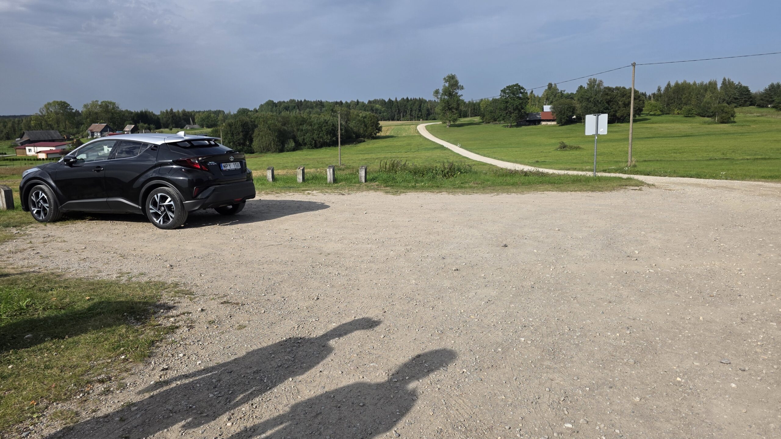
Plan for the Medininkai area and then the signed Aukštojas visitor approach. Before leaving the main road, check that navigation points to the public entrance rather than a summit coordinate or a private track. Park considerately and leave access clear.
From Vilnius Airport
My diary records a 33 km drive from Vilnius Airport to Aukštojas. That is my journey record, not a current guaranteed route distance or driving time. The airport’s own transport page links to rental and onward options. Compare your collection time, rental return and accommodation location. Official airport transport information.
With a taxi or arranged driver
Ask for a complete quote that includes the final approach, waiting if needed, and return or onward drop-off. A cheap-looking outward journey can become inconvenient if nobody is available to collect you. Share the actual visitor location and establish the meeting point.
Without a car
Search the travel date and stops, then check the walk from the stop to the hill and the last return service. Intercity coach search and city transport planning help with different parts of the trip; neither should be treated as proof of a direct bus to the summit entrance. Coach journey search · Vilnius city transport and parking.
Before committing
Be able to explain the whole day in order: arrival, final transfer, hill visit, any second stop and return. Keep a screenshot of essential times and booking details. A clear final connection makes a modest outing far easier to enjoy.
05 / The walk to the summit
Follow the signs.
Let the pace settle.
1. Identify the intended start
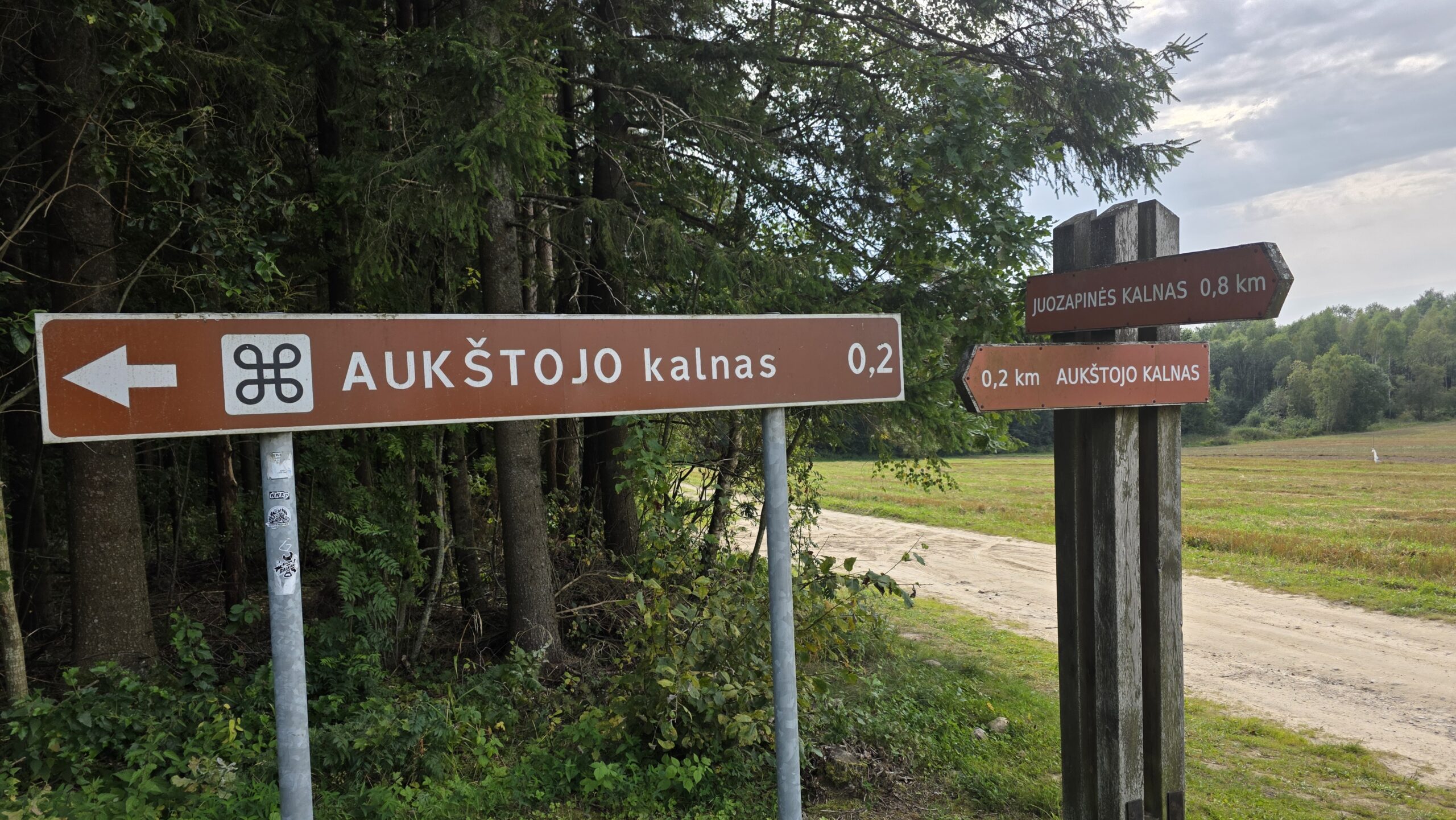
Use the visitor information on arrival and locate the hill before setting off. Check where the public approach begins and where you will return. The brown direction sign in my photograph belongs to my 2025 visit; current signs take precedence.
2. Walk to the summit area
Allow the change from road travel to a slower pace. Notice the fields, the trees and the gradual rise rather than looking for a dramatic final climb. Give other visitors room and avoid creating shortcuts across vegetation.
3. Look beyond the tower
The viewing structure is easy to notice first, but the summit area has its own markers and cultural features. Leave time to read the information and look at the sculpture as well as taking a portrait.
4. Return to your actual start
A convenient downhill path is not necessarily the route to your vehicle or bus stop. Keep the map available and retrace the intended public approach if that is your plan. Add a separate hill only when you understand the connection and have time to return.
06 / The viewing tower
A wooden platform.
A wider perspective.
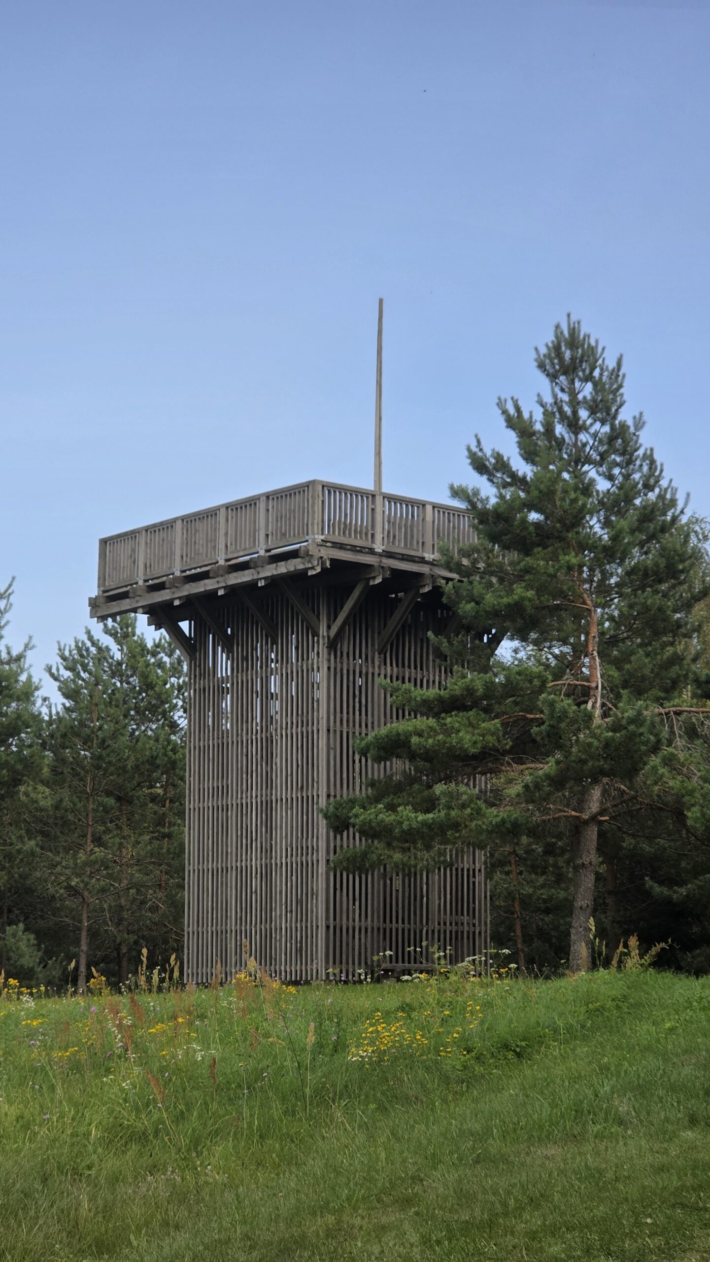
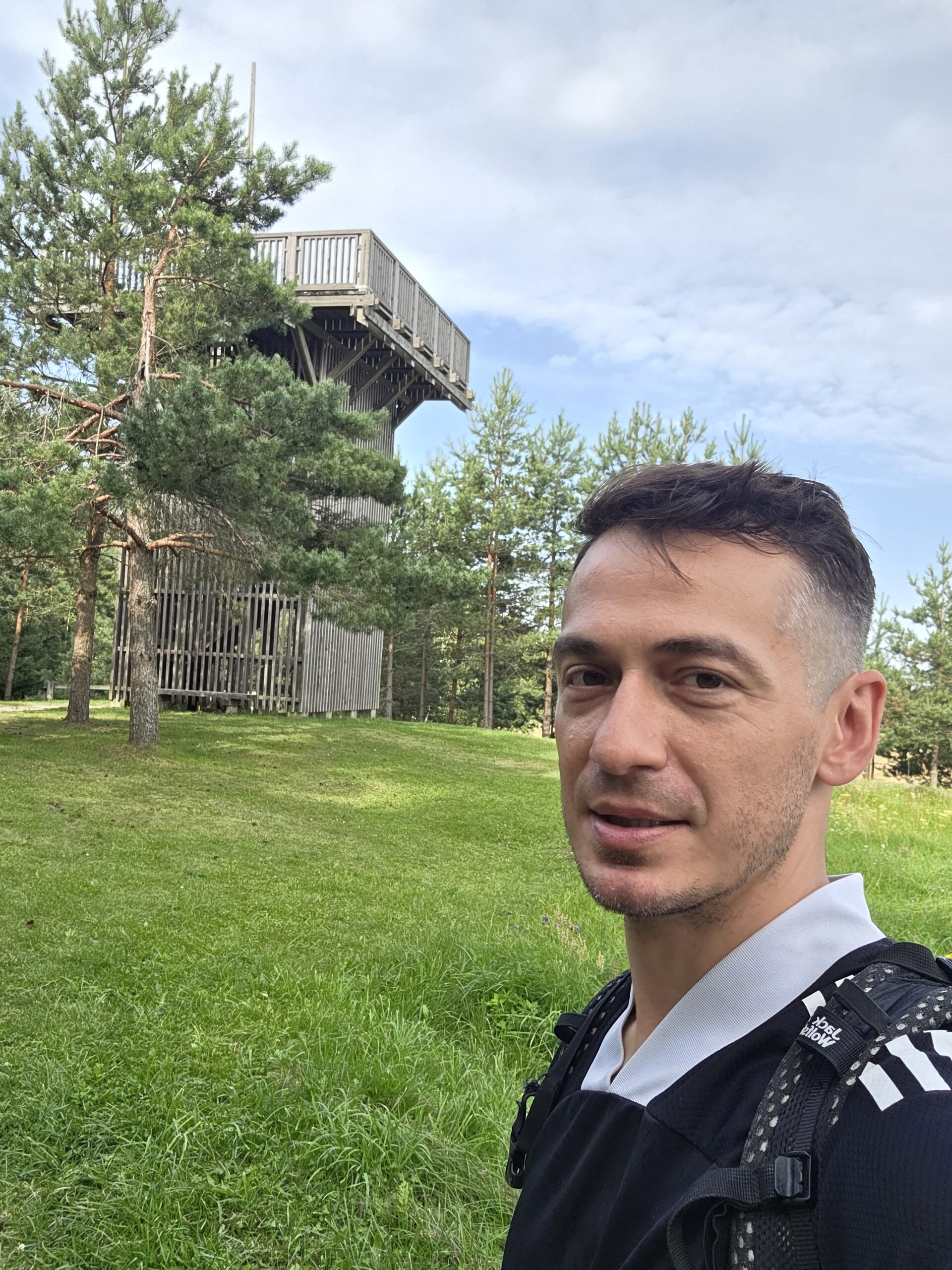
The municipal visitor page identifies the observation tower as the place to take in the view. My photographs show the wooden structure beside grass and trees: a compact landmark rather than a major indoor attraction. Official tower reference.
Check the structure on the day
Use current access signs and any posted restrictions. I am not presenting a 2025 photograph as proof that the platform is open on every future visit. If the tower is a central reason for your trip, ask local tourist information about current access first.
Climb only as far as you are comfortable
Read the local instructions, leave space on the stairs and take care if surfaces are damp or icy. Keep loose belongings secure. Anyone who dislikes heights can still enjoy the ground-level summit area while others use the platform.
A view on a small scale
Look at the relationship between the trees, open land and gentle upland rather than expecting a jagged horizon. Visibility and the season change the experience. Mist or a grey sky can make the forest atmospheric while hiding more distant detail.
Tickets and opening claims
I did not find a current formal tower tariff or a reliable year-round admission timetable in the primary visitor pages used for this guide. Check local notices and ask the tourist office if you need certainty. The castle’s published ticket prices apply to the castle, not automatically to this hill.
07 / The summit & Sun Circle
A stone, a crown.
A story in the clearing.
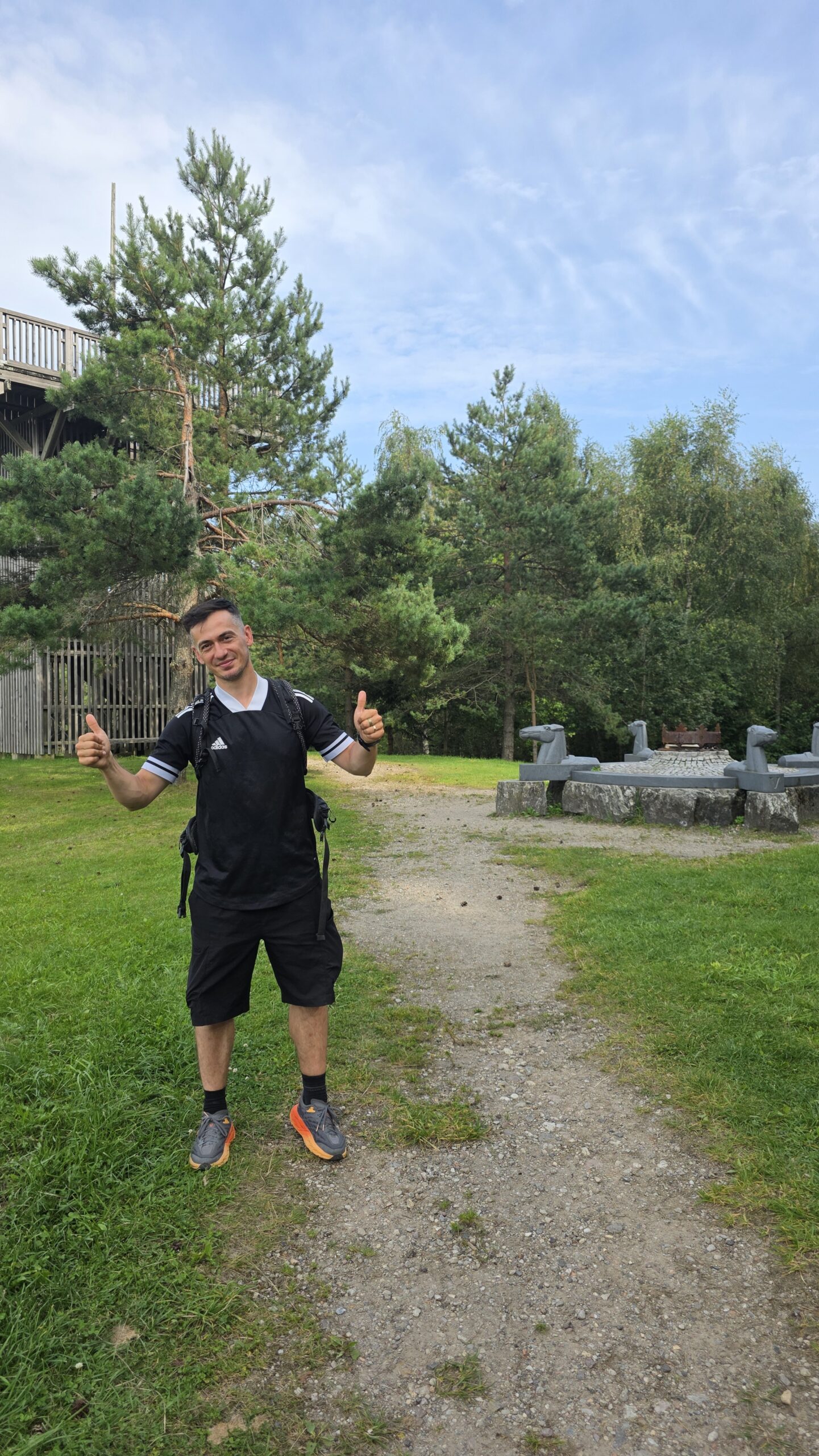
The regional guide describes a summit stone and geodetic marker, together with the Balts’ Sun Circle. Unveiled in 2012, Dalia Matulaitė’s sculpture evokes an ancient altar, with a crown surrounded by four granite horse heads. It gives the visit a cultural focus as well as a geographical one.
Read the place in stages
Find the summit information, look at the sculpture and then use the tower if appropriate. A photograph of the viewing structure does not replace identifying the actual high point. Keep the markers and artwork intact and give others time to read them.
A name with a meaning
The municipal cultural map associates the name Aukštojas with a chief deity in Baltic mythology. Treat the naming story as part of the hill’s cultural identity rather than as an explanation of its geology. Municipal cultural introduction.
Local visitor account of the summit artwork. The site is small enough to notice details without needing a lengthy walk. That is part of its appeal.
08 / Aukštojas or Juozapinė?
Two nearby hills.
One national high point.
Juozapinė belongs to the story, but Aukštojas is the destination if you want Lithuania’s highest natural point.
The Lithuanian Geological Survey’s field guide describes the measurements that established the southern hill as higher. It gives Aukštojas at approximately 293.8 m and Juozapynė at 292.83 m. It also identifies Žibartonys as another higher point than Juozapynė. Avoid repeating the old claim that Juozapinė is still the national summit—or that these are automatically the country’s highest two hills.
Why older accounts differ
Place names, older height figures and historical recognition can remain in travel descriptions long after better measurements. For the current national high point, use the 293.84 m Aukštojas reference from the municipal page. Historical importance is a different question.
Can you visit both?
They are nearby, separate sites. Use the current public route and identify each destination. Do not assume that a straight line between map pins is a signed or permitted loop. If you want a longer outing, ask the local tourist office for the best current connection.
Geological Survey field guide PDF · Juozapinė visitor reference.
09 / The protected upland
An old landscape.
Quietly shaped by ice.
Aukštojas lies within the Juozapinė geomorphological reserve, in the Medininkai upland. The regional guide dates the reserve’s establishment to 1992 and gives its area as 251 hectares. Its purpose is connected to preserving the old moraine landforms.
What to notice
Look for the gentle folds of the ground and the relationship between open fields and woodland. This is a place where elevation is subtle. The fact that you can approach without a spectacular climb is consistent with the landscape, rather than a reason to dismiss it.
For a little more background
The Geological Survey’s guide discusses the Medininkai heights and their glacial origin. It is a useful starting point if you want more than a list of summit heights. Read the landscape section before arrival and see whether you can recognise its broad forms from the viewpoint.
Reserve and landscape overview · Geological context from the national survey.
Respect the small site
Stay with the public visitor routes, take litter away and leave the woodland, artwork and information boards as you found them. A protected landscape remains a protected landscape even when the outing is short.
10 / Medininkai Castle
A small hill.
A substantial castle.
Medininkai Castle is the most natural substantial second stop for this outing. Go Vilnius describes a restored castle with exhibitions in its main tower and an observation deck. It offers a different perspective on the surrounding area and a historical contrast to the hill walk.
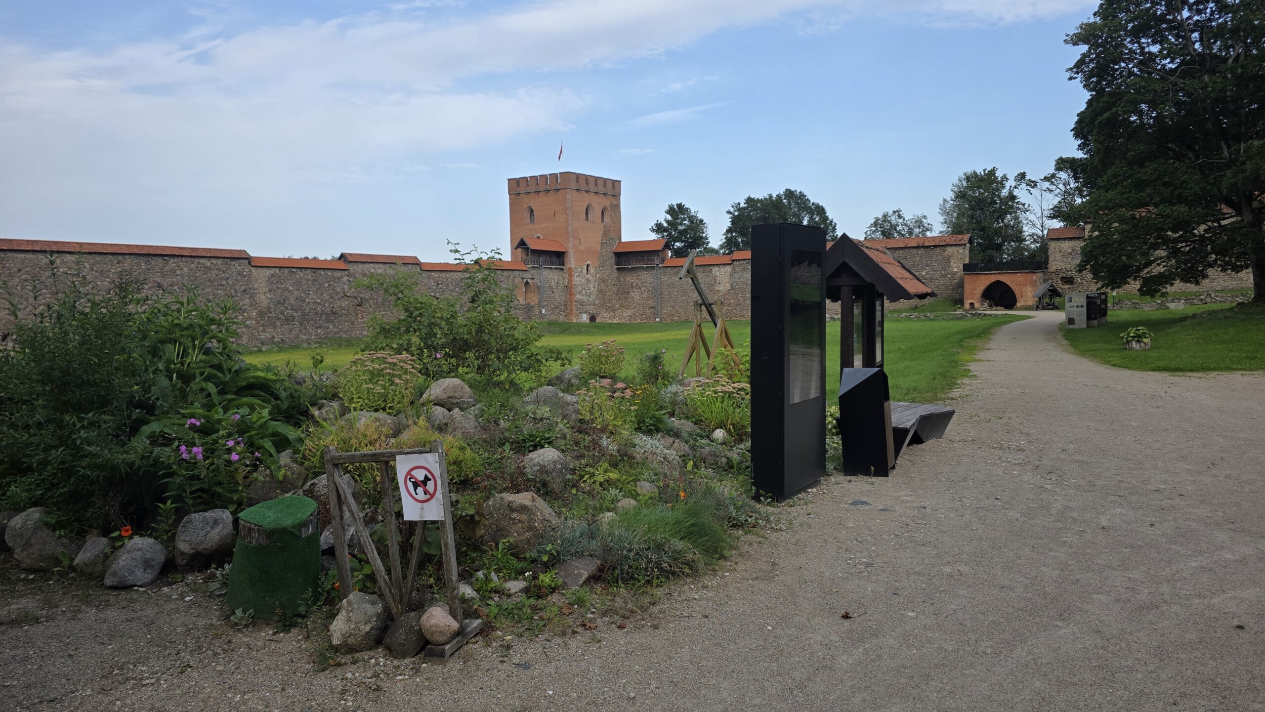
Visit it as more than a backdrop
Give the museum enough time if you plan to go inside. The walls and courtyard make a memorable arrival, but the exhibition and viewing deck deserve a separate allowance. Keep the castle’s admission time in mind when choosing whether to visit the hill first.
The right address
The operator lists Šv. Kazimiero g. 2, Medininkai. This is Medininkai Castle, not Trakai Island Castle. They share a museum operator but sit in different places and have their own opening and ticket details. Museum contacts and arrival information.
Before choosing the day
Check the Medininkai section of the operator’s schedule. If your only available day falls outside its published opening, choose a different plan rather than assuming a ticket desk will be open because the grounds appear on a map.
Official city-tourism introduction · Castle opening details.
11 / Castle hours & tickets
Plan around the museum.
Keep the hill flexible.
The operator’s Medininkai schedule, checked on 1 November 2026, lists Wednesday–Sunday, 10:00–18:00 throughout the year. Confirm holidays, last entry and any exceptional closure for your date.
| Medininkai Castle admission | April–September | October–March |
|---|---|---|
| Adult | €9 | €7 |
| Student / senior category | €5 | €4 |
| Family: 1 adult + up to 3 children | €13 | €10 |
| Family: 2 adults + up to 3 children | €18 | €14 |
These are the published categories, not a live quote or a guarantee of eligibility. Check the full tariff for age definitions, concessions, additional services and guided visits. Use the correct attraction section: Trakai’s prices are different. Read the full current tariff.
Build an order that works
If the museum is the fixed part of the day, work backwards from a comfortable admission time. Fit the hill, transport and meal around it. Leave a margin so that a delayed rental collection or a slower walk does not erase the castle visit.
12 / More around Medininkai
A village stop.
A wider Vilnius region.
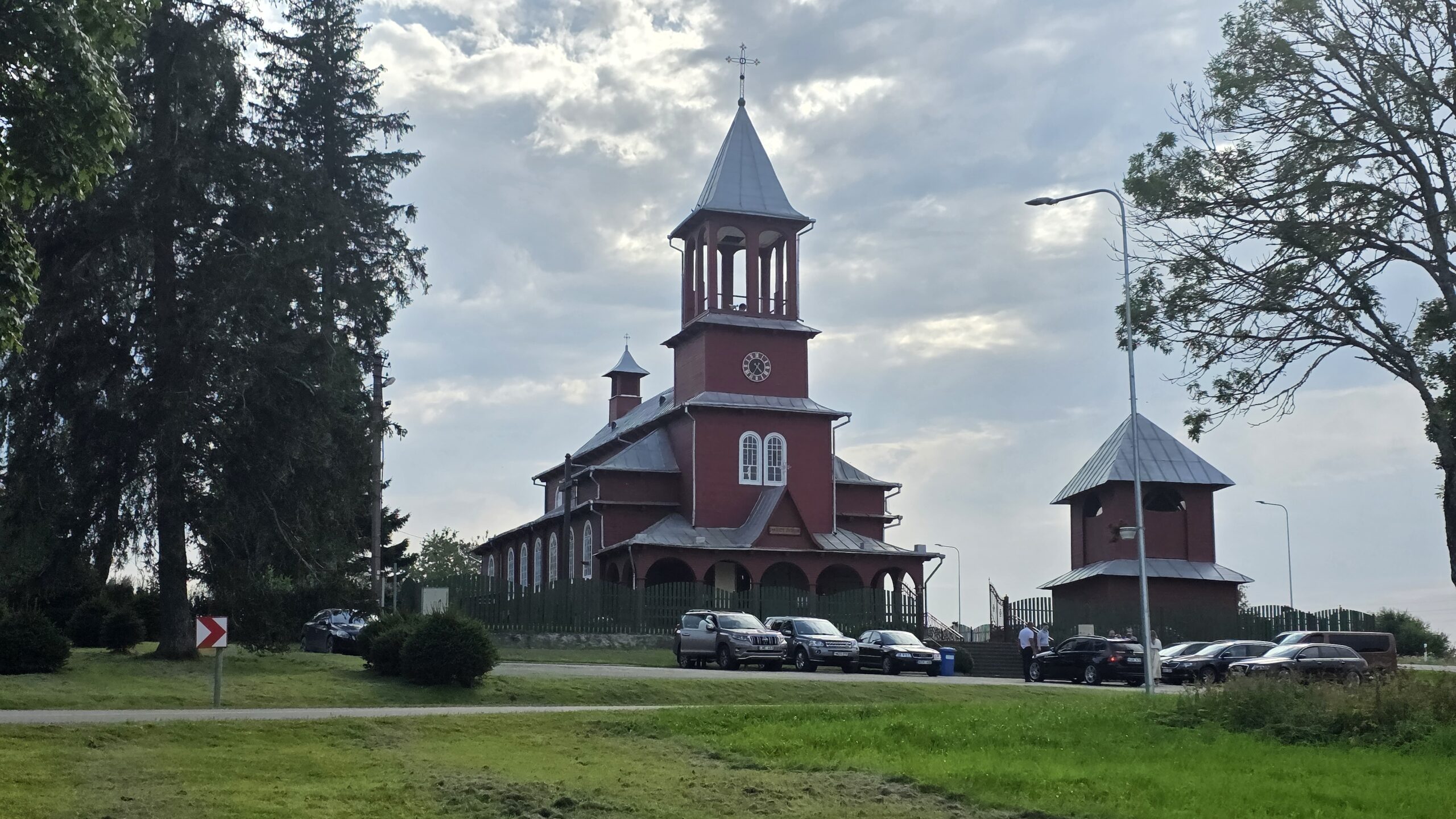
The church at Medininkai
The district’s one-day route brochure includes the Church of the Holy Trinity and St Casimir at Šv. Kazimiero g. 4. My photograph shows its distinctive wooden exterior. Treat an active church as a place of worship: check any visiting arrangements and avoid interrupting a service.
Vladislavas Sirokomlė Museum in Bareikiškės
The same district brochure includes the poet’s museum at V. Sirokomlės g. 5. It can add a literary theme to a regional day, but check the actual museum opening and location before adding it to your route. It is a separate stop, not an attraction at the summit.
Choose a theme
For a simple first day, the hill and castle are enough. If local history or literature interests you more, use the district brochure to select one extra place that fits your direction. A short list leaves time to read, look and talk to people.
Official one-day regional routes PDF · District tourist information in Polish.
13 / An evening in Vilnius
From the quiet hill.
Into the old streets.
Aukštojas works well as a countryside chapter in a Vilnius stay. The city gives the day a different scale: streets, courtyards, churches and a proper evening meal.
Keep the first walk simple
Choose a manageable section of the historic centre rather than trying to complete every famous sight after the drive. Start with the official city map, mark your accommodation and the place you need to reach afterwards, and leave time to wander between them.
A World Heritage city
UNESCO’s listing for the Vilnius Historic Centre explains the city’s layered architecture and urban development. It is a useful background for a walk that goes beyond taking a photograph of one church. UNESCO’s Vilnius account.
Use a themed walk
Go Vilnius publishes city maps and guides covering heritage, neighbourhoods and family visits. Choose a theme that interests you, then let your pace and remaining daylight decide how much to see. Download official maps and visitor guides.
If you are returning a car
Work out the return location, fuel arrangement and transport back to the city before the evening. A pleasant old-town walk becomes much easier when you are not watching the clock for an unclear handover. Check parking through the official city service. Vilnius transport and parking information.
14 / Plan your day
An easy afternoon.
Or a Vilnius weekend.
A countryside half-day
Travel from Vilnius with a clear parking or drop-off plan. Walk to Aukštojas, look at the summit features and use the tower if conditions and access allow. Return with enough time for a meal and a gentle city walk. This is the version I would choose when the hill is the main objective.
The hill and castle day
First confirm that Medininkai Castle is open. Visit either the museum or hill first according to your arrival time, giving both their own space. Add the church exterior if appropriate, then return to Vilnius. Keep a picnic or meal arrangement flexible around the actual pace.
A two-day Vilnius stay
Day one: arrive, settle in and choose a city walk or museum that suits your interests. Day two: make Aukštojas and Medininkai the countryside outing, then leave the evening for a relaxed meal. Swap the order if the forecast favours one day outdoors.
Where Trakai fits
Trakai Island Castle is a separate excursion, in a different direction from the Medininkai outing. Give it its own half-day or day rather than treating every castle near Vilnius as a neighbour of Aukštojas. Use its own visitor listing and the museum operator’s relevant schedule. Plan Trakai separately.
My suggestion
Pick one main countryside plan and one enjoyable city evening. The trip becomes richer when there is enough time for the places between the headline attractions.
15 / Where to stay
A city base.
Or a quiet rural night.
| Base | Why it may suit you | Check before booking |
|---|---|---|
| Vilnius historic centre or nearby | City walks, meals and a wider stay | Parking if needed, collection point and transfer to the hill |
| Near Vilnius Airport | Practical around flight or rental times | Actual airport connection and access to food |
| A rural stay in Vilnius district | A quieter countryside visit | Exact address, road, meals and arrival arrangement |
| Medininkai area, if a suitable property is available | Less travel around the local outing | Real availability and how the rest of your journey works |
Choose the actual location
A property described as “Vilnius district” may be in a quite different direction from the hill. Check the map against Aukštojas, your arrival point and any second attraction. A charming rural stay needs a practical transport plan as much as a city hotel does.
Keep the diary separate from hotel advice
My night before the Lithuanian visit was in an apartment in Minsk, as part of the expedition. That is background to my journey, not a suggested base for a holiday outing from Vilnius.
Ask the district tourist office about local stays · Use the official city visitor information.
16 / Seasons & weather
Late-summer light.
A different hill each season.
Spring
Allow for damp ground and changing temperatures. Check the final access before choosing footwear and leave room for a shorter visit if the weather is unpleasant. The modest distance does not remove the need to dress for the day.
Summer
A pleasant visit can be as simple as a short walk, some time at the viewpoint and a meal elsewhere. Carry water and suitable sun or insect protection. Keep the tower decision tied to the conditions on arrival.
Autumn
Woodland colour and softer light can make a small hill appealing. Allow for wet timber, leaves and earlier darkness, especially if your plan adds a village walk. Fit the museum around its actual opening rather than assuming every attraction follows daylight.
Winter
Check snow, ice and the state of the approach. Ask about current access if the tower is essential. A normal summer description does not establish how a wooden staircase or rural road will feel in winter.
Use Lithuania’s official forecasts and warnings. My own 30 August visit was mild and sunny with a light breeze; that is a memory of one afternoon rather than a forecast for your trip.
17 / Families, access & practicalities
Choose the right amount.
Enjoy it together.
With children
A short outing with a clear destination can make a good break from driving. Let children find the direction sign, notice the trees and look for the summit features. Keep them close where steps or a raised platform need attention, and bring a snack for an unhurried pause.
Pushchairs and reduced mobility
Do not assume the complete experience is step-free. My photographs show a raised wooden viewing structure. Ask local tourist information about current surfaces, gradients, parking distance and suitable ground-level access for your exact needs. A manageable visit for one person may not be comfortable for another.
Facilities
The regional description lists visitor infrastructure including benches, bicycle racks, parking and information signs. It does not establish that a café, drinking-water point or accessible toilet will be available for every visit. Plan essential needs before leaving your base.
Border-area location
The Medininkai area is near Lithuania’s external border. Keep this as a hill and regional sightseeing visit, follow current signs and carry appropriate identification for your journey. For current access questions or any plan involving restricted areas, check directly with the State Border Guard Service. My 2025 crossing story does not establish today’s rules. Official Border Guard information · Administrative access services.
18 / Food & simple stops
A picnic in the bag.
A meal worth sitting down for.
Aukštojas is a short outdoor stop, so it is easy to bring water and something simple to eat without turning the visit into a complicated packing exercise. If the day includes a museum, choose a meal around the actual opening and your return journey.
Do not rely on an unconfirmed summit café
Confirm a business directly if it is important to the plan. A symbol on an old map is not a guarantee of a serving kitchen. A small picnic gives you room to enjoy the hill even when the next meal is back in Vilnius.
In Vilnius
Use the official city visitor site to find a meal that fits your interests and location, then check the restaurant’s own menu and reservation arrangements. I would leave enough time to sit down properly instead of trying to eat between a car return and a nearly departing bus.
The meal in my Baltic diary
The cepelinai and kvass mentioned in my combined Estonia–Latvia account were eaten in Vilnius on the following evening, 31 August. They are part of the Lithuanian city chapter of the journey, not a food recommendation at the hill.
19 / Costs & calculator
The hill is small.
Budget for the whole day.
The most useful comparison is the complete outing: shared car or driver, fuel or transfer, food, any overnight stay and chosen museum tickets. Use actual quotes rather than assuming a short hill walk makes every part of the day inexpensive.
Castle example
At the published Medininkai adult tariff, two adults would pay €14 in October–March or €18 in April–September, excluding extras. Recheck the tariff and compare a qualifying family ticket if relevant. This is castle admission, not a hill-entry quote. Current museum tariff.
Keep shared and personal costs separate
Enter a whole-party vehicle or driver quote only in the shared field. Put each person’s accommodation, meals, tickets and other costs in the per-person fields. Do not count fuel or a transfer twice if it is already part of the group quote.
20 / Simple packing checklist
A small bag.
A clear plan.
For the ordinary snow-free visit, prepare for a short countryside walk and the weather you actually have. Add what your group needs, and keep longer regional walks or winter conditions as separate decisions.
21 / Maps & useful links
Save the real start.
Keep the return simple.
The location in my original diary is 54°31′43″N, 25°37′37″E, approximately 54.528611, 25.626944. Treat this as a hill reference, not an instruction to drive onto the summit. Use the municipal listing’s map and current public access signs.
Save three different things
Keep the destination, actual start and return arrangement. A summit pin answers where you want to go; it does not answer where to leave a car or catch a bus. Save the castle separately if you are visiting it too.
Download the city map as well
If the day finishes in Vilnius, save a map before going out. Mark the accommodation, transport terminal or car return and the part of the city you want to walk. It is easier to enjoy a detour when you know how to get back.
Municipal hill map · Regional routes PDF · Official Vilnius maps · Weather forecasts.
If emergency help is needed
Call 112 for an emergency, describe what happened and where you are, and follow the dispatcher. Keep the hill name and nearby Medininkai location available so that you can explain your position. Official emergency-number guidance.
22 / Photography notes
Wood, grass and sky.
People make the memory.
My favourite part of this visit was not a difficult ascent. It was the ease of sharing a small place with people I had met on the road. The photographs hold the signs, the tower, the village and the company around them.
Make a short sequence
Begin with the approach and direction sign, photograph the tower with some of its surroundings, then make a portrait. Include a small detail if it helps explain the place. Several different distances tell a fuller story than repeated close-ups of the same landmark.
Keep the skyline honest
There is no need to make the hill look like an alpine peak. Use the open sky, wooden structure and trees to show what the place feels like. Soft light and a simple portrait can carry the story perfectly well.
Give everyone room
A viewpoint is shared space. Make the frame, step aside and avoid leaving bags in the walking line. At the church and castle, respect the site’s own photography and visiting arrangements.
23 / My August visit
16:00.
A friendly pause between long roads.
30 August 2025. After a tense part of the expedition, Lithuania gave me a gentle afternoon—and unexpected company.
The previous night had been in an apartment in Minsk after visiting Dzyarzhynskaya Hara. In my original diary, I remembered the relief of a bed, a quiet evening and time to breathe before travelling again.
The next morning, I took a bus towards Vilnius Airport. My account describes that particular border crossing as calm. It is a memory of a journey in August 2025, not advice about current cross-border travel or a suggested way to reach Aukštojas today.
In Vilnius I rented a small car and headed towards Medininkai. On the road I picked up two Polish hitchhikers. They joined the short walk to Lithuania’s highest point, turning a simple stop into one of those easy shared moments that travel sometimes gives you.
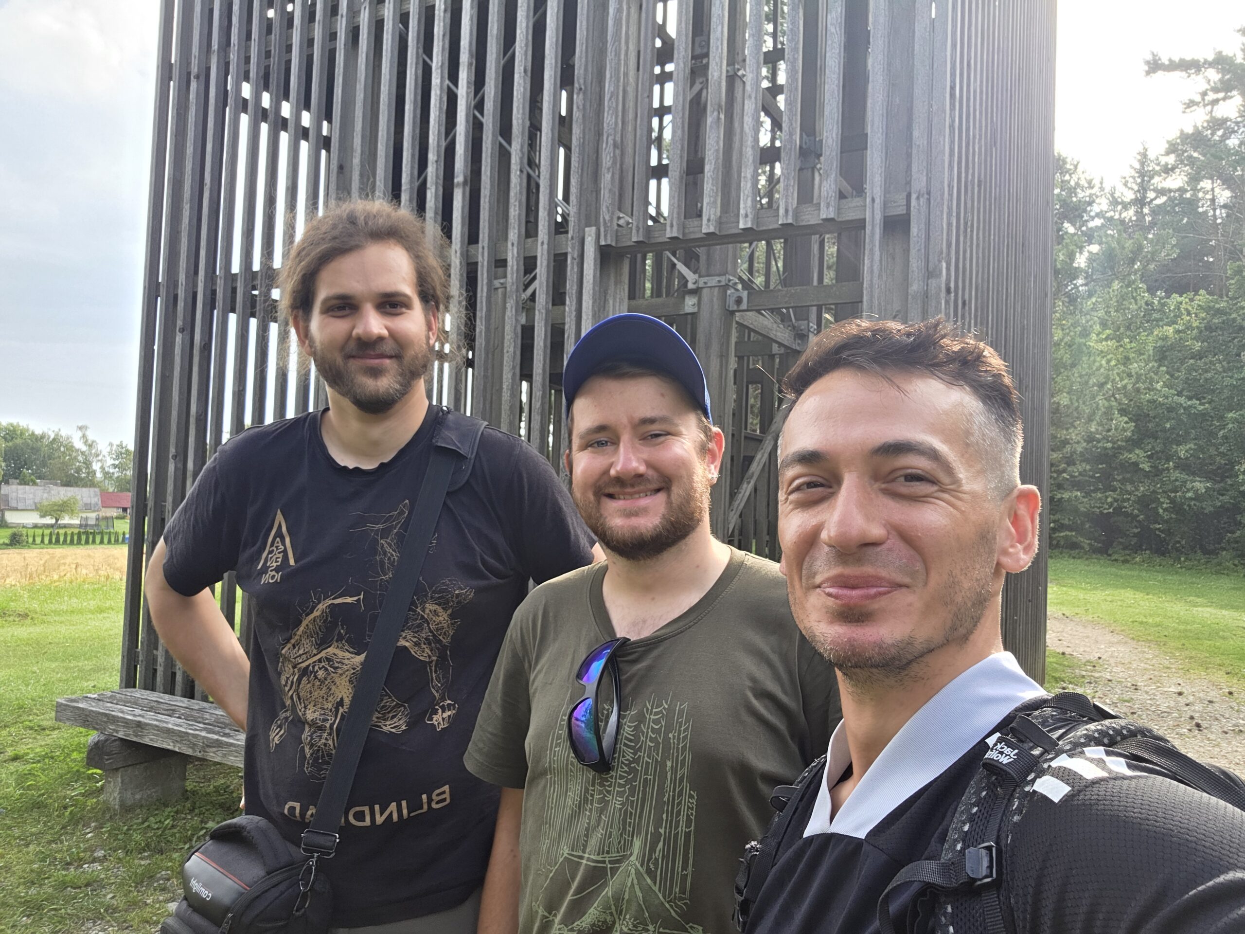
My diary records the summit at 16:00. The weather was mild and sunny, with a light breeze. The wooden tower, the grass and the surrounding trees made the whole place feel uncomplicated. Conversation and a few photographs were enough.
After the visit, I drove my companions back towards Vilnius before continuing the journey. The following morning brought Suur Munamägi in Estonia and then Gaiziņkalns in Latvia. Those small Baltic high points gave the expedition room to breathe between bigger mountain days.
The lasting memory is the company: a quiet place became a shared story. For a holiday visit, I would keep that same unhurried spirit and give the castle and Vilnius their own time.
Continue to Suur Munamägi in Estonia ↗ · Explore Gaiziņkalns in Latvia ↗.
24 / Questions answered
The useful questions.
Is Aukštojas Lithuania’s highest point?
Yes. The official municipal listing gives 293.84 m, commonly rounded to 294 m. This is elevation above sea level, not the climb from the visitor start.
Is Juozapinė the same hill?
No. It is a separate nearby hill, historically regarded as the highest. Use Aukštojas if your objective is the modern national high point.
How long should I allow?
My suggested starting allowance is 45–60 minutes for an unhurried site visit. It is not an official route time. Your actual start, pace and time at the tower change the plan.
Is there a standard long hiking route?
This guide describes the short visitor outing. A walk from Medininkai village or a connection to another hill must be planned separately; do not assume a single advertised loop.
Is the tower open every day?
Check current local access signs and ask district tourist information if the platform is essential. The primary visitor pages used here do not provide a reliable formal year-round admission timetable.
Is there a hill or tower ticket?
I did not find a current formal tariff in the primary hill visitor pages. Verify any local charges on arrival. The published castle ticket is a separate attraction.
Can I visit without climbing the tower?
The hilltop, markers and sculpture are separate from the raised viewpoint. Check current public access and choose the experience that suits your group.
Is the whole visit wheelchair or pushchair accessible?
Do not assume full step-free access. Ask about actual ground surfaces, gradients and parking distance; the viewing structure shown in my photographs is raised.
What is the best nearby attraction?
Medininkai Castle is a strong second stop. Verify its museum hours and leave time for the exhibitions and observation deck.
When does Medininkai Castle open?
The operator’s schedule checked on 1 November 2026 lists Wednesday–Sunday, 10:00–18:00 year-round. Confirm your actual date, holidays and last admission.
What does the castle cost?
The checked adult tariff is €9 in April–September and €7 in October–March, with other categories. Recheck the full operator tariff before travelling.
Can I use a bus from Vilnius?
Check the actual dated journey, stop, final walk or transfer and return. Do not assume a city route or an intercity coach reaches the hill entrance.
Should I add Trakai on the same outing?
It is a separate excursion in another direction. I would give Trakai its own half-day or day rather than rush both castle areas.
Do I need to cross into Belarus?
No international crossing is part of the Vilnius–Medininkai hill itinerary described here. My expedition’s earlier crossing belongs to the historical diary, not this visitor plan.
What should I check near the border?
Follow current signs and use official Border Guard information for access questions, especially if planning to leave ordinary visitor areas. Do not apply old diary details to current rules.
What number should I call for emergency help?
Call 112, explain the incident and precise location, and follow the dispatcher’s instructions.
25 / Useful links & sources
Your Lithuania
planning desk.
Research checked 1 November 2026. The photographs are Adrian Mazur’s own images from 30 August 2025. My diary times and journey figures describe that expedition; transport, visitor access, museum schedules and tariffs should be checked for the actual travel date.
Use municipal tourism information for the hill, the Geological Survey for the high-point distinction, the museum operator for castle visits and official city sources for the Vilnius part of the day.
Official municipal location, elevation and tower introduction
Reserve, summit features, cultural meaning and regional context
Local visitor information and the Sun Circle sculpture
Measurements, Medininkai upland and the distinction between nearby high points
A separate neighbouring hill, not the modern national high point
Medininkai church, Aukštojas and regional cultural stops
The nearby castle, museum and observation deck
Read the Medininkai section, separately from Trakai Castle
Current Medininkai seasonal ticket categories
Medininkai Castle address and booking contact
Regional advice, accommodation and Polish-language planning
Plan the city part of a longer visit
Downloadable maps and themed city walks
The historic centre’s World Heritage inscription
A separate excursion in a different direction from the hill
Arrival, car rental and connections into the city
Dated intercity travel and tickets
City transport and parking; verify the separate district journey
Current official advice and contact for border-area questions
Current service information for access questions; not a blanket permit claim for the hill
Local forecasts, warnings and forest-fire information
Official emergency contact information