
01 / Start here
The roof of the Baltics.
A forest at your feet.
Suur Munamägi is a small hill with a very large horizon. In the wooded uplands of southern Estonia, a pale observation tower rises above the trees—and a national high point becomes the beginning of a much slower journey.
Come for the highest hill in Estonia and the Baltic states. Stay for Haanja’s woods, the lakes around Rõuge, an inventive viewing tower, a sandstone canyon and the culture of Võromaa. This is a landscape that rewards curiosity more than speed.
- Where
- Haanja · Võru CountySouthern Estonia, within Haanja Nature Park
- Highest hill
- About 318 mThe Environmental Board also gives 317.2 m
- Observation tower
- 29.1 m tallA paid attraction with seasonal opening hours
- Standard approach
- 800 m to the towerOperator’s description; includes stairs
- Typical visit
- 45–60 minutesOperator’s average; allow more for your pace and stops
- My visit
- 08:44 · 31 August 2025A quiet early summit visit, not a promise of early tower admission

Start with the route and tower information below, then choose one extra outing that fits your day. If you are collecting Baltic high points, give this region more time than a summit photograph. Official tower overview · Environmental Board hill reference.
02 / Know Suur Munamägi
A high point.
Not a high-altitude climb.
Suur Munamägi sits in the Haanja upland. Its appeal is the contrast between a modest walk and an expansive landscape: forest, folds in the countryside and lakes beyond the immediate summit.
What does 318 m actually mean?
The operator uses 318 m in its visitor introduction; the Environmental Board’s hill page gives 317.2 m. Treat “about 318 m” as a useful rounded description. It is elevation above sea level, not the climb from the parking area. The Board describes roughly 60 m from the hill’s foot to its top.
The hill and the tower are different objectives
Standing at the hilltop and entering the observation tower are separate parts of a visit. The wooded setting is enjoyable in its own right, but the tower is the main way to get above the canopy. A hill visit outside admission hours does not guarantee the tower panorama.
Find the right Munamägi
Save the full name Suur Munamägi, Haanja. Do not book an outing around a similarly named hill elsewhere in Estonia. Match the village, county and tower before committing to a long drive.
Read the official hill description · Understand Haanja Nature Park.
03 / Choose your visit
A hilltop pause.
Or a full southern day.
| Visit | Best for | What to decide first |
|---|---|---|
| Hill approach + observation tower | A first visit and the classic panorama | Tower opening, weather, ticket and the return walk |
| A short hilltop stop | Travellers passing through the area | Current site access; the tower may be closed |
| Hill + Rõuge / Pesapuu | A varied day of viewpoints and lakes | Transport, a meal and time for the valley |
| Hill + Vällamäe trail | Visitors who want a longer forest outing | Steep terrain, conditions and daylight |
| A regional weekend | Walks, local culture and less driving pressure | A practical base and one main outdoor plan each day |
For most first-time visitors, I would make the tower the anchor and add Rõuge if time allows. If walking matters more than collecting attractions, choose Vällamäe instead of trying to squeeze two trails and three viewpoints into an afternoon.
Do not turn the approach into a precise race
Published route lengths describe particular starts and paths. Your walk depends on where you park, which entrance you use and whether you return the same way. Add time for children, photographs and waiting at the attraction. A short distance is an invitation to slow down.
04 / Getting there
Aim for Haanja.
Plan the final connection.
By car
Use Haanja as the local reference and the signed Suur Munamägi visitor parking as your destination. Check the final approach and parking instructions on arrival. A summit pin is useful for orientation, but it is not permission to drive to the tower door.
From Tartu or Tallinn
Plan southern Estonia as a regional journey. Compare the actual route, breaks and accommodation with the time you want at the hill. A single attraction can feel rushed if most of your day disappears into the drive from the capital. An overnight base lets the countryside become part of the holiday.
Intercity buses
Use Tpilet to search dated connections towards a suitable regional hub such as Võru. Check departure and arrival locations carefully, then build the separate final stage. Do not buy an outward ticket until you can explain how you will return. Search intercity buses.
Regional buses and the last stretch
Search Peatus for the intended date, stop and direction. Read service notes and allow enough time to reach the trail start from the bus stop. If a transfer or taxi is needed, confirm it in advance rather than assuming a vehicle will be waiting in the village. Plan the local journey.
Winter and unfamiliar roads
Allow extra time when conditions change. Use current road information before a rural drive and choose a route appropriate for the vehicle. A scenic shortcut is less attractive when you are tired, it is dark or the surface is icy. Check Tark Tee road information.
05 / Walk to the tower
Through the woods.
Up to the clearing.
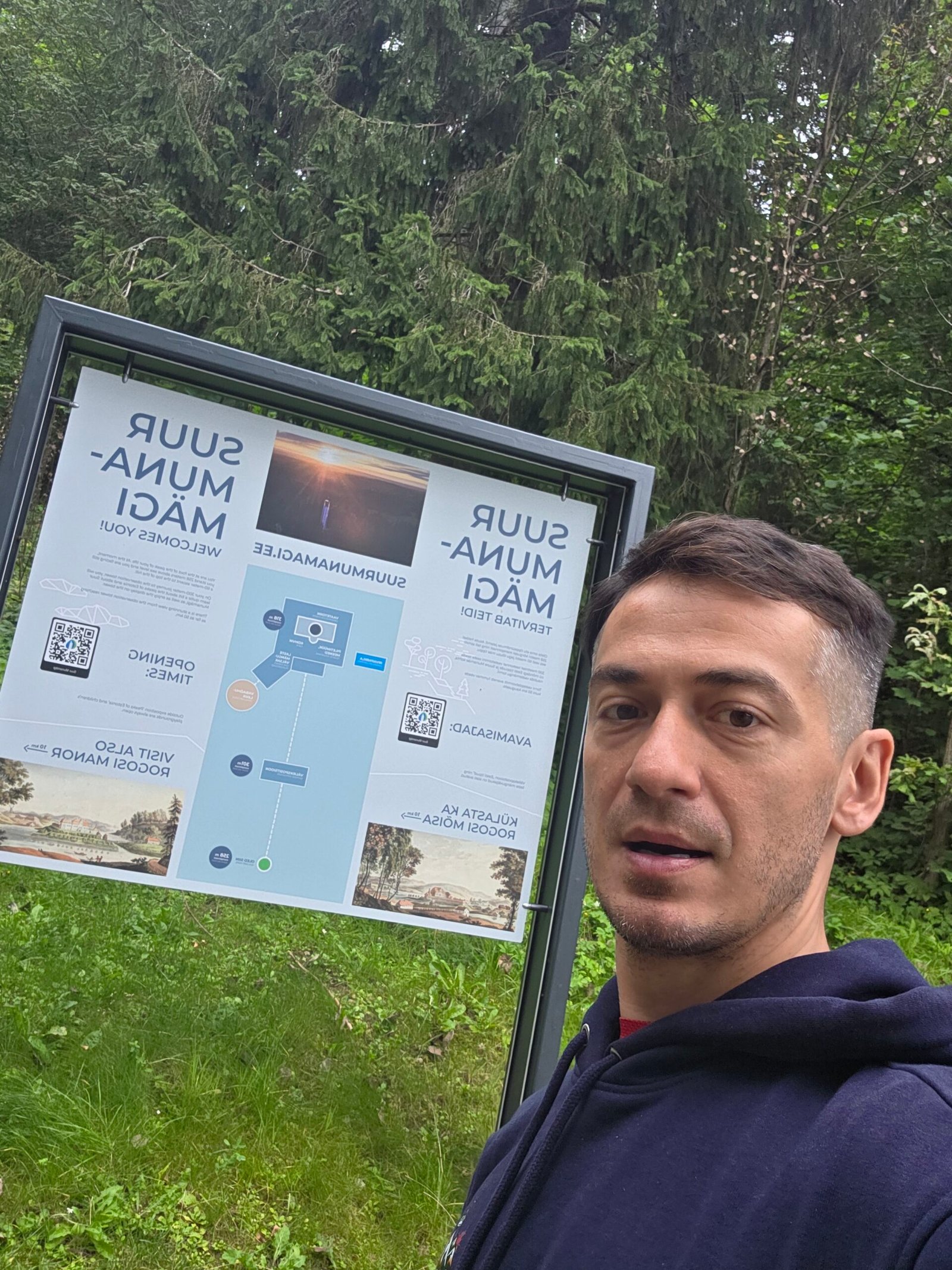
The operator describes an 800 m walk from the car park to the tower, with stairs on around a quarter of the route. Its typical overall visit allowance is 45–60 minutes. Those are useful starting figures rather than a guarantee for every group.
1. Read the entrance board
Locate the walking route and your return point before setting off. Check any current notices and settle the practical details while you are still near the parking area. Save a photograph of the map if that helps you remember the route.
2. Walk at a comfortable pace
Allow the ascent to feel like a woodland walk. Pause without blocking the path, and leave enough space for people using the steps. Comfortable shoes with grip matter more here than expedition equipment.
3. Reach the tower area
Notice the changing scale as the structure appears between the trees. A photograph from the approach can tell more of the place than a tightly cropped frame at its door. If you want to enter, follow the current ticket and entrance instructions.
4. Leave time for the return
Keep your transport departure in mind while allowing a relaxed descent. Wet leaves, frost or tired children can change the pace. Finish at the start you actually used rather than following another route simply because it heads downhill.
06 / Inside the observation tower
Above the canopy.
Let the horizon unfold.
The tower is the visual centre of the visit. At 29.1 m tall, it changes your perspective from enclosed woodland to a much wider landscape. The operator dates the building to 1939 and describes views reaching up to 70 km in suitable conditions. Visibility on your day may be much more limited. Official tower introduction.
Buy the experience for the day you have
Choose a time with an appealing forecast if the long view matters most. Mist can give the hill atmosphere while hiding distant scenery. A photograph taken on a bright day is not a promise of what you will see in rain or low cloud.
Keep the top comfortable for everyone
Make room at the railings, give other visitors a chance to look and keep your belongings secure. Step aside after making a portrait so the platform remains an observation place for everyone.
Look in layers
Begin with the nearest trees, then follow the landscape towards the horizon. Wide views become easier to appreciate when you notice several distances rather than trying to identify every faraway landmark. A binocular view and a quiet few minutes can be more rewarding than another rushed photograph.
For the exact lift arrangements and access limits, use the accessibility section below. Confirm facilities with the operator if a particular service is essential to your visit.
07 / Opening hours & tickets
Check the calendar.
Then choose your arrival.
Plan the tower around its detailed seasonal schedule. My 08:44 hilltop visit is a diary time, not an advertised admission time.
| Period | Published tower schedule |
|---|---|
| April–August | Daily 10:00–20:00 |
| September–October | Daily 10:00–17:00 |
| November–March | Weekends, school holidays and public holidays: 10:00–15:00 |
| Ticket | Published price |
|---|---|
| Standard | €7 |
| Reduced | €4: ages 7–18, pupils/students and seniors 63+ |
| Family | €15: two adults and children aged 7–18 |
| Children through age 6 | Free |
Checked 1 November 2026 against the operator’s detailed Estonian ticket page. Its homepage banners and language versions show differing general hours; use the dated seasonal detail and contact the tower when timing matters. Ask about the relevant school-holiday dates, exceptions and last admission.
The tariff also lists special group, disability and vehicle arrangements. Check eligibility and booking conditions directly. Do not assume a vehicle package means unrestricted public driving up the service road. Open the full current tariff and schedule.
Leave a margin before closing. Arriving at the car park a few minutes before the stated end is different from being ready to enter the tower.
08 / Families & accessibility
Choose the approach.
Know the lift’s limits.
The operator provides specific access guidance: visitors with reduced mobility can arrange the service-road barrier by calling the number posted there. For pushchairs it recommends that road rather than the stepped walking approach; a carrier is another option. Confirm the arrangement before relying on it.
Inside, there are stairs and a lift. Wheelchair access reaches the ninth floor, not the uppermost platform; the final levels involve metal stairs. An available lift does not mean every viewpoint is step-free. Contact the tower about your exact needs, assistance and current operation. Read the detailed accessibility instructions.
With children
Plan a small adventure with time for stops. Agree simple rules for the steps, doors and viewing area, and bring a layer for a cooler wait. Avoid making the whole day depend on reaching a particular platform if someone is uncomfortable with heights.
With a mixed group
Decide what each person wants from the visit before buying tickets. A shared meal and a gentle regional stop can make a good day even when people choose different amounts of walking. Establish a clear meeting place and allow enough time for everyone’s route.
09 / The tower’s story
A changing tower.
A lasting landmark.
The present structure belongs to a longer history of looking out from this hill. The operator’s historical account describes earlier towers and the recurring problem of trees growing around viewpoints. It is a good reminder that the panorama is a constructed visitor experience as well as a natural landscape.
| Milestone | Why it matters |
|---|---|
| 1939 | The present substantial tower was completed, originally 25.7 m high |
| 1969 | An additional level raised its height to 29.1 m |
| 24 July 2005 | Reopened after major renovation, including the external glass lift |
The operator’s history names architect Artur Jürvetson for the 1939 building. Look at the tower as architecture, not merely as a staircase with a view: its shape, windows and later additions all belong to different moments in the site’s life.
Read the tower’s own historical account. Treat historical stories and current visitor arrangements separately; an older photograph cannot establish today’s access or opening.
10 / Seasons & weather
Green summer.
Colour, frost and mist.
Spring
Let actual path conditions decide the outing. The forest may be fresh and appealing while shaded ground remains damp or slippery. Bring footwear that works for the approach rather than dressing only for a town café afterwards.
Summer
Longer days give more flexibility for the hill and a regional stop. Carry water and weather protection, and choose the tower time around both its opening and your priorities for visibility. A quiet arrival is enjoyable, but early morning is not automatically an admission window.
Autumn
Woodland colour can make the walk as interesting as the platform. Allow for wet leaves, changing weather and less daylight for a second trail. Check seasonal hours before planning an afternoon arrival.
Winter
Check the reduced tower schedule, road information and the condition of the approach. A maintained visitor site does not make every surface ice-free. Longer forest trails have their own winter limitations, so treat them as separate plans rather than extensions of the tower walk.
Check the official weather warnings. In strong wind, storms or unpleasant visibility, adapt the day and follow local access instructions. There is no need to force a viewpoint into the schedule simply because you have already driven there.
11 / Rõuge & Pesapuu
Two bird nests.
A valley full of possibilities.
Rõuge makes a natural second chapter: a different viewpoint, a chain of lakes and the possibility of a much longer walk.
Pesapuu watchtower
The separate tower at Rõuge resembles a tree with two bird nests. Visit Estonia gives its total height as 30 m, with the upper observation platform at 27 m, and lists it as open around the clock. Night lighting changes its character. Official Pesapuu visitor listing.
Choose a visit that suits the people with you and the conditions. An outdoor tower can feel quite different from an enclosed lift-assisted structure. Read any local notices, take care on the ascent and leave space for others.
Ööbikuorg / Nightingale Valley
Use the valley as a place to pause rather than just another pin between attractions. Decide whether you want a viewpoint visit or a proper walk before leaving the parking area. The regional map helps explain how the places relate. Open the regional tourism map.
The important distance distinction
RMK’s current Rõuge trail description gives 10 km one way and 20 km out and back. It warns of a rerouted section and asks walkers to avoid the old route through the Ratasjärve farmyard. Use its current app/map, not an old downloaded track. Check the current route and rerouting notice.
If you want a shorter taste of the valley, choose and measure your own out-and-back section, then turn around with enough time and energy to return. A 10 km headline does not promise a 10 km circular route back to your car.

12 / Hinni Canyon
Sandstone walls.
A smaller, closer view.
Hinni offers a change from distant horizons: a narrow sandstone ravine with boardwalks and steps. RMK describes a depth of roughly 15–20 m and a canyon about 200 m long. Focus on the rock, vegetation and enclosed atmosphere rather than expecting a vast mountain gorge.
A useful rule if you travel with a dog
Pets are not allowed on the Hinni Canyon trail. RMK explains that the route crosses private land close to residential outdoor areas. Do not apply Suur Munamägi’s pet arrangements to this separate destination. Read RMK’s access rules before visiting.
Make a considerate visit
Use the marked route and provided structures, avoid scrambling onto soft rock or vegetation and keep room for passing walkers. Wet timber and stairs deserve attention. Leave the canyon without carvings, collected fragments or a new shortcut.
Plan it as its own stop
The canyon can be approached separately; you do not need to walk the entire Rõuge valley route to appreciate it. Confirm the intended entrance and parking on the current RMK map. If you connect it to the longer trail, work out your actual return transport first.
13 / Vällamäe forest walk
More forest.
More climbing than you expect.
For a more substantial woodland outing, RMK currently lists the Vällamäe hiking trail as 3.3 km, marked red. Older material can show different lengths. Use the current route rather than an old distance copied into a travel blog.
The attraction is the varied terrain. RMK gives the hill’s relative rise as 84 m, more than Suur Munamägi’s approximately 60 m, and describes very steep sections. The route passes woodland and bog-edge scenery. This is a separate forest walk, not a step-free extension of the tower approach.
Before starting
Read the route map, recognise the red marks and check conditions. The trail partly overlaps another RMK route with different markings; pay attention at junctions. Allow time for pauses, the climb and the return, especially after rain.
In winter
RMK says this trail is not cleared of snow. A short summer distance should not determine the winter decision. Choose the outing for your actual skills, equipment and daylight. Open RMK’s current Vällamäe route.
My preference would be to make this the main walking activity of the day, with the tower as a separate visit. Leave room to enjoy the woods rather than treating the trail as a task between two closing times.
14 / Võromaa & smoke sauna
A landscape.
And the people who know it.
The region is more than its highest point. A meal, a conversation with a host or a carefully chosen cultural visit can make the journey feel rooted in a place rather than assembled from viewpoints.
Smoke sauna as living heritage
UNESCO inscribed the smoke sauna tradition in Võromaa on its Representative List of Intangible Cultural Heritage in 2014. The listing concerns community knowledge and practices, not a blanket UNESCO label for every sauna business. Read UNESCO’s account of the tradition.
If you would like an experience, ask a local host what is offered, how it is led and what needs booking. Confirm timing, etiquette, language and the people in your party. Approach it as a hosted encounter, not just a facility you can turn on whenever you arrive.
A regional day with fewer kilometres
Use Võrumaa’s visitor directory for local food, accommodation and activities that match the part of the region you are actually visiting. A nearby experience with time to enjoy it can be a better addition than a distant famous attraction. Explore official Võrumaa visitor information.
15 / Plan your day
A hill visit.
Or a slower southern weekend.
Option 1: a simple half-day
Arrive with enough time to walk to the tower during admission hours. Enjoy the viewpoint, return without rushing and have a confirmed local meal. Keep spare time for weather and photographs. This works well when you are already staying nearby.
Option 2: viewpoints and a valley
Visit Suur Munamägi, then choose Rõuge and Pesapuu for the second part of the day. Add a measured short valley walk if the group wants one. Give the meal and transfers proper space; leave the entire 20 km valley outing for a different plan.
Option 3: a walking day
Choose Vällamäe as the main forest walk and fit the observation tower around its current hours. Carry food and water, check the forecast and avoid a late start that leaves the steep woodland descent in darkness.
Option 4: a two-day regional stay
Day one: travel into Võrumaa, settle in, enjoy a manageable viewpoint or town visit and a local meal. Day two: make the hill and one chosen walk the focus. Swap outdoor and indoor parts around the weather, and pre-book a hosted cultural experience if wanted.
For a Baltic highpoints journey
Combine Estonia, Latvia and Lithuania only with a coherent road plan. The hills are modest; the travel between them is not. My expedition was intentionally compressed. A holiday itinerary can give each country its own day and avoid turning a peaceful walk into pressure to reach the next border.
16 / Where to stay
A practical base.
A quieter morning.
| Base | Why choose it | What to check |
|---|---|---|
| Haanja and nearby countryside | Close to the hill and the upland landscape | Exact address, access road, meals and arrival arrangement |
| Rõuge | A base for the valley, Pesapuu and a regional day | Your actual transfer to Suur Munamägi |
| Võru | A town base for supplies and transport planning | The final connection and the last return service |
| A rural guesthouse or booked campsite | A slower stay with room for the landscape | Opening, facilities, legal pitch and the host’s conditions |
Choose the real property, not just a broad region on a booking map. Check distance to the hill, breakfast or kitchen arrangements, and how you will arrive after a long journey. A remote stay can be lovely with a car and difficult without one.
For camping or a forest hut, use an actual listed facility and follow its booking and site rules. A quiet clearing does not automatically become an overnight pitch. Begin with the official regional directory and RMK listings. Browse regional accommodation · Find RMK recreation places.
17 / Food & practical stops
A short walk.
Time for a proper meal.
Suur Muna in Haanja
The café-restaurant’s own website provides its menu, hours and booking contact. It is an option to investigate for a meal around the hill visit, rather than a restaurant I claim to have tested during this expedition. Confirm the day’s opening and kitchen time; reserve ahead if a table is important or you have a group. Check Suur Muna directly.
Picnic planning
Carry water and a small snack for the walk. If your day includes a longer trail, bring enough food for that outing rather than counting on a café at the far end. Use permitted resting places and pack out everything you bring.
Facilities and pets
The tower operator lists toilets by the parking area and behind the tower. Its pet rules require a leash on the site and a carrier for entry into the tower. Confirm current arrangements if these determine your day. Check the site’s visitor rules.
The cepelinai and kvass in my original Baltic story were an evening meal in Vilnius, Lithuania. They belong to the onward travel diary, not a claim about dining in Haanja.
18 / Costs & calculator
A small ticket.
The journey is the bigger cost.
Use the operator’s current tariff for admission, then add the real transport and overnight costs. For many visitors, the drive or final transfer matters more to the budget than the tower ticket. A shared car estimate and a solo bus-and-taxi visit can look very different.
Worked example: admission only
At the listed standard tariff, two adults would pay €14 in total. A qualifying family should compare its party with the €15 family-ticket definition. These examples exclude travel, meals and extras, and prices should be rechecked for the visit. Verify the actual ticket categories.
Use your own figures
The calculator deliberately starts without invented hotel or taxi prices. Enter current quotes, divide only the shared group costs, and avoid including the same journey twice. Put entry tickets in the activities field.
19 / Packing checklist
Pack for the visit.
Leave room to enjoy it.
For the ordinary snow-free tower outing, prepare for a short hill walk and a viewpoint. Add appropriate supplies and preparation if you choose a separate forest trail, a winter visit or a long regional day.
20 / Maps & useful planning
Save the entrance.
Keep the route current.
The Environmental Board gives the hill reference as approximately 57.714018, 27.059841. This is a geographical reference for the attraction, not a car-park instruction. Match it with the current visitor entrance and parking signs. Official hill reference.
Before leaving a reliable connection
Save the accommodation, actual start, tower schedule and your chosen trail map. Keep a screenshot of the return transport details as well as a map pin. Those answer different questions when the connection is poor.
For a longer trail
Use RMK’s current route and notices, particularly for the rerouted Rõuge valley section. Keep the downloaded map recent and check junctions on the ground. An old route crossing a farmyard should not override a current closure or rerouting instruction.
Regional tourism map PDF · RMK’s Haanja destinations · Local transport search.
If help is needed
For an emergency call 112. Explain what happened, the precise location and whether anyone is injured, then follow the dispatcher. Save the name of the site and nearby village so that you can describe where you are. Official emergency-call instructions.
21 / Photography notes
The pale tower.
The green around it.
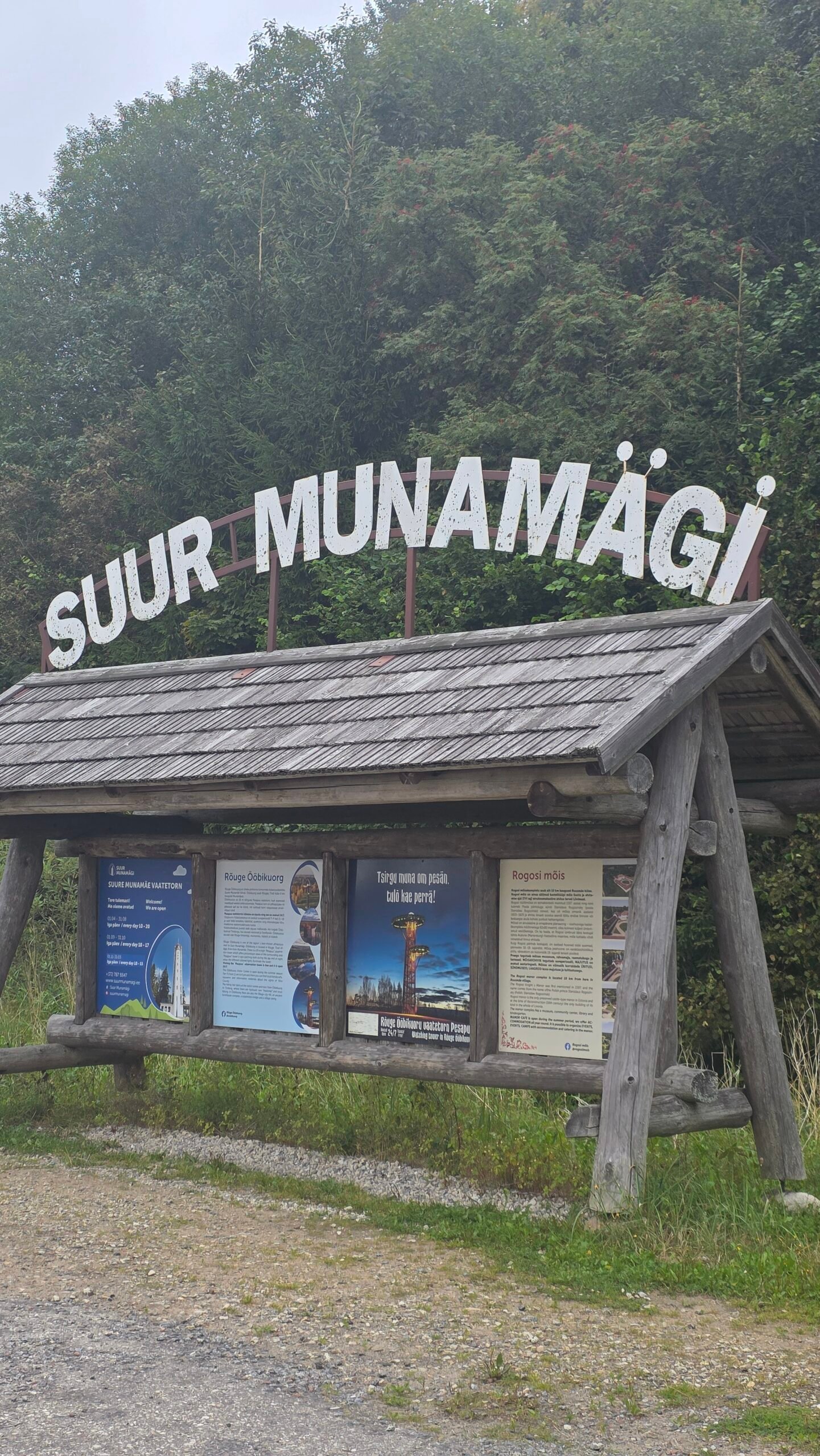
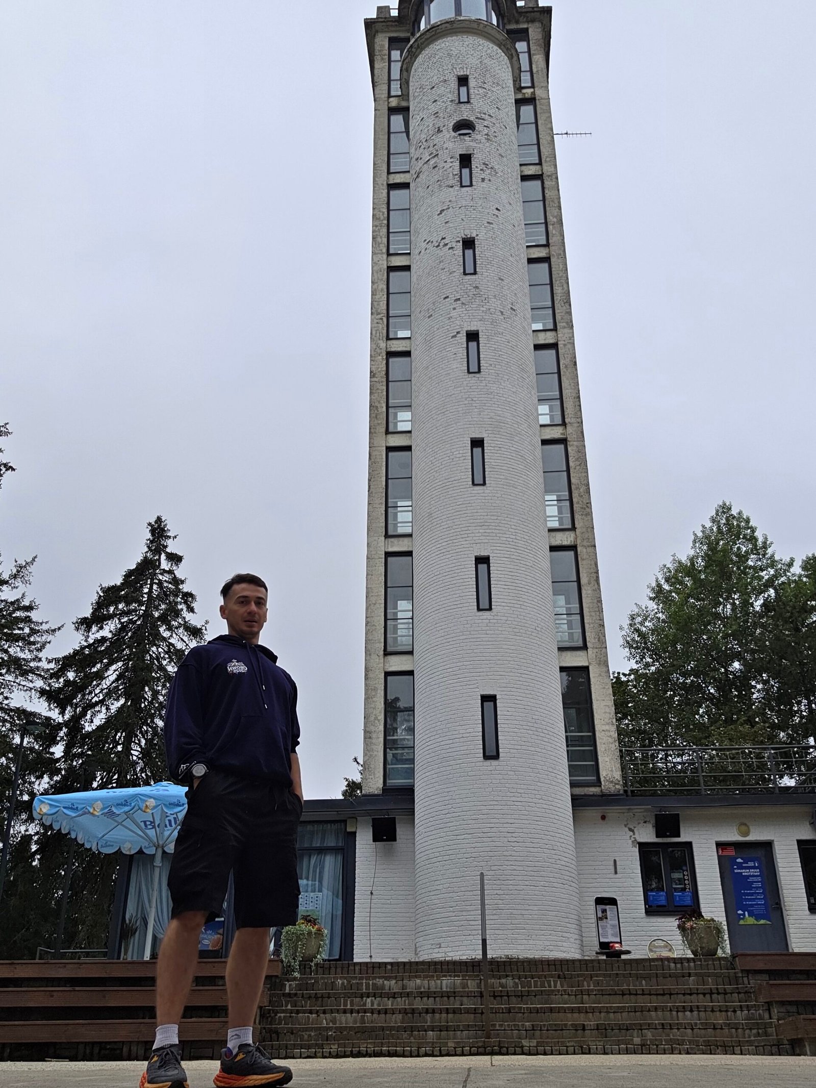
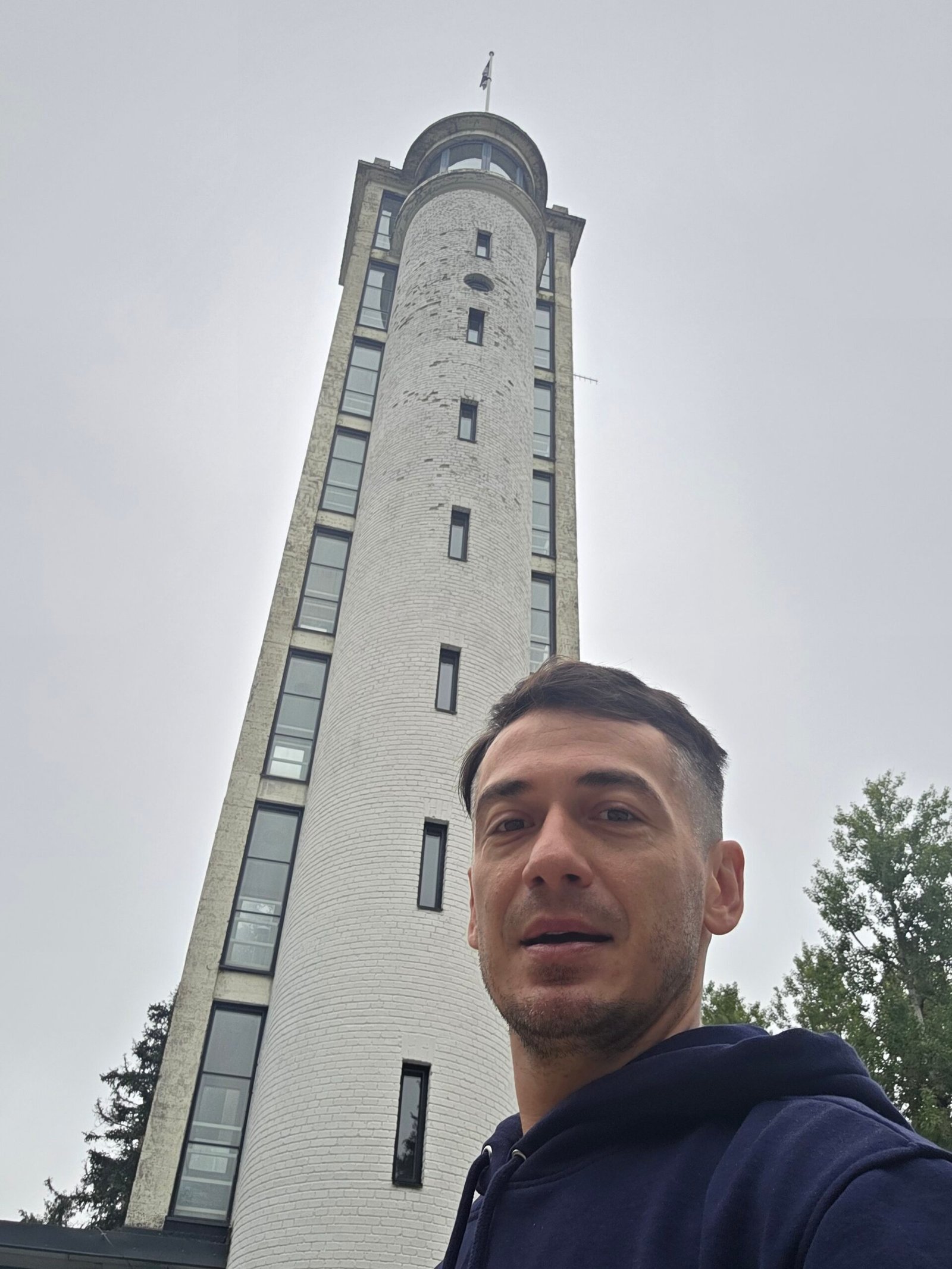
My photographs from this visit are quiet: a sign at the edge of the forest, the approach between the trees and portraits beside the tower. The appeal is in the relationship between the building and the woodland, rather than a dramatic mountain skyline.
Tell the walk in three frames
Begin with the entrance, photograph the tower from the path, then make a portrait that keeps some of the structure in view. These different distances describe a place better than several near-identical close-ups.
Let the weather belong in the photograph
A pale sky and soft forest light can work well with the tower’s colour. Protect the camera if the air is damp. There is no need to pretend every visit happened under a brilliant blue sky.
On a viewing platform
Keep straps secure and avoid blocking a railing while reviewing photographs. Make the frame, then give someone else the space. Respect notices and other visitors rather than treating the whole attraction as a private shoot.
22 / My August visit
08:44.
A quiet Baltic morning.
31 August 2025. Between Lithuania and Latvia, this was a moment to breathe.
After visiting Aukštojas in Lithuania, I drove north and spent the night at Villa Roza in Latvia. The next morning brought me to Suur Munamägi and a very different rhythm from the bigger mountain days.
I followed the short approach through the woodland to the observation tower. At 08:44, the summit area felt still and empty. In my original account I remembered cool air, forest and mist—the sort of place where the absence of noise becomes the strongest part of the memory.
The early time belongs to my hilltop visit. I am not presenting it as proof of admission to the tower at that hour. If the upper panorama is your priority, use the current schedule rather than copying my expedition arrival.
Afterwards, I turned south. My diary records about 170 km between Suur Munamägi and Gaiziņkalns, where I reached Latvia’s highest hill at 11:02 under heavier cloud. These were my journey figures, not a recommended two-stop driving timetable.
That evening I was in Vilnius before the bus to Kraków. The Baltic chapter had been brief, but its gentler high points made space for a kind of travel that an expedition can too easily hurry past. If I returned for a holiday, I would give the southern Estonian countryside a slower day.
Read my original combined Estonia and Latvia diary ↗ · Plan Gaiziņkalns in Latvia ↗.
23 / Questions answered
The useful questions.
Is Suur Munamägi the highest point in Estonia?
Yes, and the highest hill in the Baltic states. The operator rounds its elevation to 318 m; the Environmental Board’s page gives 317.2 m.
How long does a normal visit take?
The operator suggests an average of 45–60 minutes and describes an 800 m approach from the car park to the tower. Allow more for your group, stops and any waiting.
Can I enter the tower at 08:44 like Adrian?
Do not assume that. 08:44 records my personal hilltop visit. Tower admission follows the current operator schedule.
Is the tower open every weekday in winter?
The detailed tariff page lists November–March opening on weekends, school holidays and public holidays, 10:00–15:00. Confirm your actual date and any exceptions.
How much is the standard ticket?
The detailed tariff checked on 1 November 2026 lists €7 standard admission. Recheck the operator’s page before travelling.
Is it a technical mountain climb?
The ordinary snow-free visitor approach is a modest hill walk with steps. Prepare for weather and surfaces rather than treating it as an alpine ascent.
Does the lift make the top platform wheelchair accessible?
No. The operator says wheelchair access reaches the ninth floor, while the uppermost platform is not accessible by wheelchair. Ask about current assistance and the service-road arrangement.
Can I bring a pushchair?
The operator recommends the service-road approach because the main walking route has steps. Confirm the practical arrangement for your party before arriving.
Can I take a dog?
The tower site requires a leash, with tower entry only in a carrier. Other places have different rules: RMK does not allow pets on the Hinni Canyon trail.
Is Vällamäe still described as 2.2 km?
Use the current RMK listing: the red-marked route is 3.3 km. Older descriptions can give different lengths.
Is the Rõuge valley trail a 10 km loop?
RMK’s current description says 10 km one way and 20 km out and back, with a rerouted section. Plan a measured shorter return walk or arrange the full journey properly.
What is the easiest second stop?
For a varied regional day, investigate Rõuge and Pesapuu. Choose the amount of walking and the transfer to suit your group and weather.
Can I use public transport?
Search dated intercity and local services, then check the final stop, walking approach and return. A bus to a regional town does not automatically reach the attraction.
Is the panorama guaranteed?
No. Mist, rain and low cloud can limit visibility. Choose the forecast and tower hours together if the long view is your main objective.
What is the emergency number?
Call 112 when emergency assistance is needed, describe what happened and where you are, and follow the dispatcher’s instructions.
24 / Useful links & sources
Your South Estonia
planning desk.
Research checked 1 November 2026. Photographs are Adrian Mazur’s own images from 31 August 2025. Opening, tickets, access arrangements, transport and trail notices should be checked for the actual travel date.
Use the tower operator for admission and accessibility, RMK for current trail descriptions, the Environmental Board for the protected landscape, and official regional tourism information for a wider visit.
The operator’s introduction to the hill and observation tower
Use the detailed Estonian schedule; headline banners can differ
Approach, access assistance, lift limits, facilities and pet rules
The 1939 tower, later extension and 2005 renovation
The more precise hill-height reference and approximate relative ascent
The wider protected upland and its visitor destinations
Official trail and recreation-site listings
Current red-marked route; steep slopes and winter maintenance limits
Current rerouting notice and 10 km one-way / 20 km return distinction
Sandstone gorge, steps, parking and the no-pets restriction
The separate bird-nest-shaped tower above Nightingale Valley
Places to stay, food, maps, regional attractions and sauna culture
A regional overview; use current operator pages for the day’s details
Living cultural heritage, rather than a generic hotel-sauna label
Menu, contact, opening and table reservations
Search actual travel dates and available coach connections
Check the final regional journey, stops and return connection
Road conditions, restrictions and the approach on your travel date
Current official warnings; combine with the local forecast
When to call and how to explain the incident and location