
01 / Start here
A high summit and a serious day.
Zugspitze rises to 2,962 m on the German–Austrian border. The Reintal route is the least technically difficult of the main approaches, but remains a long and serious mountain outing. The German Alpine Club gives its single-day itinerary as 21 km, 2,300 m ascent and 9–11 hours before a lift descent. DAV route guide.

02 / Compare routes
Choose the route, not just the summit.
Reintal trades technical difficulty for distance and ascent. Höllental includes via ferrata and glacier travel; Gatterl crosses from the Austrian side and has its own exposed and secured sections. Conditions, route choice and previous experience change what is appropriate. DAV route overview.
03 / Reintal route
Follow the valley toward the plateau.
The DAV route starts at the ski stadium in Garmisch-Partenkirchen, passes Partnachklamm and follows Reintal toward Reintalangerhütte. It continues to Knorrhütte, Zugspitzplatt and Sonn-Alpin, then up steep scree and partly secured ground to the summit. Confirm gorge access and conditions before setting out. Detailed route.

04 / One day or several
Break the climb into stages.
A one-day ascent is reserved for very fit, experienced hikers. Reintalangerhütte or Knorrhütte can divide the distance into two days; the DAV also describes a three-day trip. Reserve beds, check opening and plan each stage with daylight and your group in mind.
05 / Mountain huts
Make reservations early.
Reintalangerhütte and Knorrhütte are on the Reintal approach. Check seasonal operation, reservations, payment, meals and cancellation rules directly. A hut reservation does not remove the need for a weather and return plan. DAV hut options.
06 / Höllental
A different level of difficulty.
Höllental combines exposed climbing protected by fixed cables with glacier terrain and a potentially difficult bergschrund. It requires appropriate equipment, alpine experience and current conditions; consider a qualified guide. Do not treat it as an interchangeable hiking shortcut. DAV route comparison.
07 / Gatterl route
Approaching from Austria.
The Gatterl approach begins on the Austrian side and crosses into Germany. Its distance, access and cable-car options differ from Reintal. Check border access, exposed sections, lift schedules and current trail conditions before selecting it. DAV route comparison.
08 / Summit cross
The station and the cross are distinct.
The developed summit area and the summit cross are not the same point. The final approach to the cross is exposed and can be slippery or crowded; snow, ice, wind and poor visibility can make it unsuitable. A lift ticket does not make the final rocks safe.


09 / Cable cars
Plan the descent before starting.
Several mountain railway and cable-car services serve the Zugspitze area. Check the exact station, operating day, last descent, tickets and connection back to your starting point. Weather or technical problems can interrupt service. Operator information.
10 / Mountain safety
A conservative decision is part of the plan.
Cold, thunderstorms, snow and poor visibility can turn a long walk into an emergency. Start early, set turnaround times, monitor the forecast and keep a practical alternative to the last lift. In an emergency call 112 and provide your location.
11 / Weather
Check the mountain forecast.
Valley weather does not describe the summit. Review wind, temperature, precipitation and thunderstorms from reliable sources immediately before departure, then reassess on the mountain. Wet rock and an icy summit approach demand particular caution. German Weather Service.
12 / When to go
Summer is not a guarantee.
Snow can persist into summer and return early. Huts, gorge access and lifts operate on their own schedules. Ask local alpine sources about current snow, ice and trail closures; avoid choosing dates solely from the calendar.
13 / Fitness and experience
Train for distance and ascent.
The Reintal day is an endurance undertaking with a substantial climb and steep terrain near the end. Build experience on long mountain days, walk at a sustainable pace and choose a shorter trip if your group is not ready.
15 / Food and water
Carry enough between reliable stops.
Start with sufficient food and water for the route, plus a reserve for delays. Hut opening and water availability change, and mountain streams are not automatically safe to drink. Check the current situation before departing.
16 / Equipment
Prepare for conditions at nearly 3,000 metres.
Wear suitable mountain footwear and pack waterproofs, insulation, gloves, a headlamp, first aid and emergency shelter. Additional technical equipment and the skills to use it are essential for glacier or via ferrata routes.
17 / Getting there
Use Garmisch-Partenkirchen as a base.
The Reintal itinerary described by DAV starts at the ski stadium. Plan travel to the start and the separate journey from your lift arrival point back to your accommodation or car. Check current public transport. Deutsche Bahn.
18 / Parking
Check the full loop.
If arriving by car, use an authorised parking area and read the current restrictions and fees. A cable-car descent may finish away from the trailhead, so check the onward connection before leaving the car.
19 / Where to stay
Choose a base or a hut.
Garmisch-Partenkirchen offers a base for transport and supplies; mountain huts enable a staged Reintal ascent. Compare locations, reservation terms and current opening rather than assuming a bed or late arrival is available.
20 / Families and alternatives
Consider a mountain visit without the long hike.
The cable cars offer an alternative way to experience the high mountain environment, subject to weather and operations. Altitude, cold and exposed viewing areas still matter. Check accessibility and suitability for each member of your group with the operator.
21 / Care for the Alps
Respect a fragile mountain landscape.
Stay on appropriate routes, take litter away, respect wildlife and other visitors, and follow local closures. Avoid dislodging rocks onto people below, particularly on steep and crowded sections.
22 / Itinerary
Give the mountain enough time.
One option is to travel to Garmisch, check conditions and complete the Reintal over two days with a booked hut. Plan the lift descent and onward transport separately. Keep an additional weather day if your schedule allows.
23 / Costs
Budget with current quotes.
Allow for transport, parking, huts, food, lift tickets and optional guiding or equipment. Use current operator prices and your own amounts in the calculator below; services and fares change.
24 / Emergency plan
Know when to turn around.
Agree on turnaround points and a safe response if the lift closes or someone is unwell. Calling 112 connects emergency services; report location, number of people and injuries. A rescue may take time in bad weather.
25 / Explore the region
Stay longer in Bavaria.
Garmisch-Partenkirchen and the wider Werdenfelser Land offer lower-level walks and local sights. Check opening and transport with the destination before adding a gorge visit or another hike. Local visitor information.
28 / Saved checklist
Prepare for a long alpine day.
Saved only in this browser. The Reintal is a very long alpine route. Check weather, snow and lift schedules, and turn back if conditions deteriorate.
29 / Cost calculator
Use your own quotes.
Plan in euros.
Enter your own current prices in EUR. Vehicle and main travel are shared; the other amounts are per person. Include any park, guide and transfer quotes under the appropriate fields. Blank entries count as zero.
My story, FAQ & sources
Seven hours in the rain.
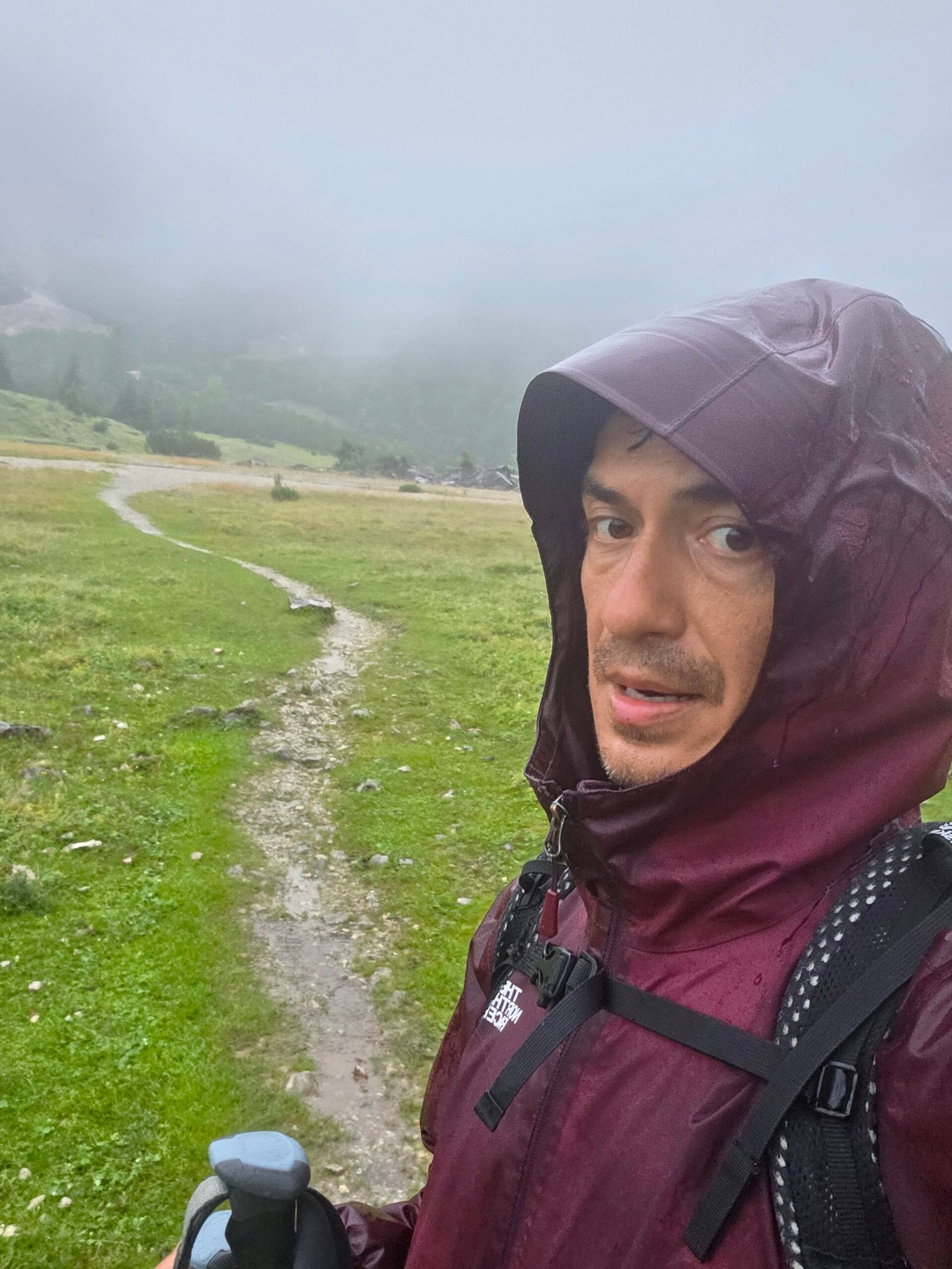
After Grauspitz, I drove overnight to Garmisch-Partenkirchen and slept for around three hours in the car. On 26 July 2025 I started at 03:26, heading into Reintal in the rain.
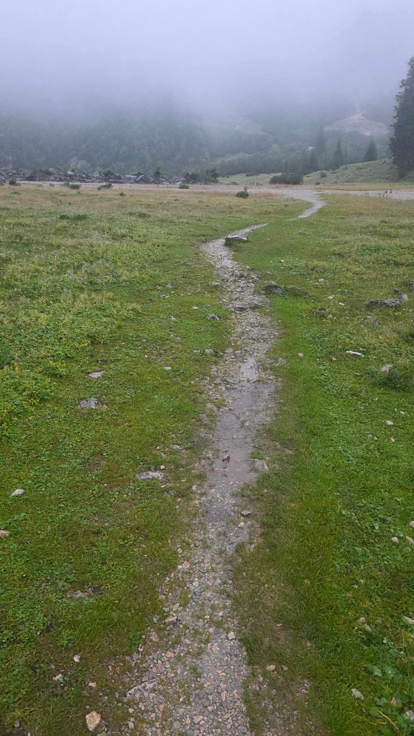
By six the rain had strengthened. Fog reduced visibility, streams swelled, and mud and wet roots made each step more demanding. Higher up, snow and freezing gloves added to the struggle; my phone stopped working.
Around 10:30 I reached the summit cross in wind and fog, with no view. My recorded ascent was 23.78 km with 2,474 m of gain and 7 hours 6 minutes moving time: my own figures, not a route estimate. I took the cable car down and warmed up with coffee. The experience is a reminder to check conditions and turn back when necessary.


Frequently asked questions
How high is Zugspitze?
The summit is 2,962 m above sea level.
Where is Zugspitze?
In the Wetterstein Alps on the German–Austrian border.
What is the easiest hiking route?
The DAV describes Reintal as the least technically difficult main approach, although it is very long and demanding.
How long is Reintal?
The DAV gives about 21 km, 2,300 m ascent and 9–11 hours for its one-day ascent, followed by a lift descent.
Can I split it over two days?
Yes, with a reservation at a suitable hut and a plan for current conditions.
Is Höllental suitable for beginners?
It involves via ferrata and glacier travel, so it requires appropriate skills, equipment and conditions.
Can I take a cable car?
Yes, lifts serve the summit area, subject to current schedules, weather and tickets.
Does the cable car reach the summit cross?
The cross requires a separate exposed final approach; assess conditions and your ability.
Do I need to book a hut?
Reserve ahead and check opening directly, especially in busy periods.
Can snow occur in summer?
Yes. Snow, ice and cold can occur high on the mountain even when the valley is warm.
Can I hike in rain?
Wet rock, cold and low visibility can be dangerous. Check the forecast and postpone or turn back when needed.
What is the emergency number?
Call 112 and provide your location and details.
When did Adrian climb?
On 26 July 2025, via the Reintal, descending by cable car.
Are costs fixed in the calculator?
No. Enter your own current quotes in euros.
Sources and current information
Research checked 2 November 2026. Conditions, access and prices can change.
- German Alpine Club: Reintal route ↗ — Route, timing and huts
- German Alpine Club: five routes ↗ — Comparing approaches
- Bayerische Zugspitzbahn ↗ — Lift operating information
- German Weather Service ↗ — Weather and warnings
- Garmisch-Partenkirchen tourism ↗ — Local visitor information
- Deutsche Bahn ↗ — Rail journeys