
01 / Start here
A wild limestone summit.
A journey into Prokletije.
Zla Kolata rises to 2,534 m on the Montenegro–Albania border. Montenegro’s national tourism organisation identifies it as the country’s highest peak; its Prokletije setting rewards a longer visit as much as the summit itself.
The approach from Vusanje is a demanding mountain day over steep, rocky ground. Conditions, route-finding and the return matter more than a fast ascent. Explore Prokletije.
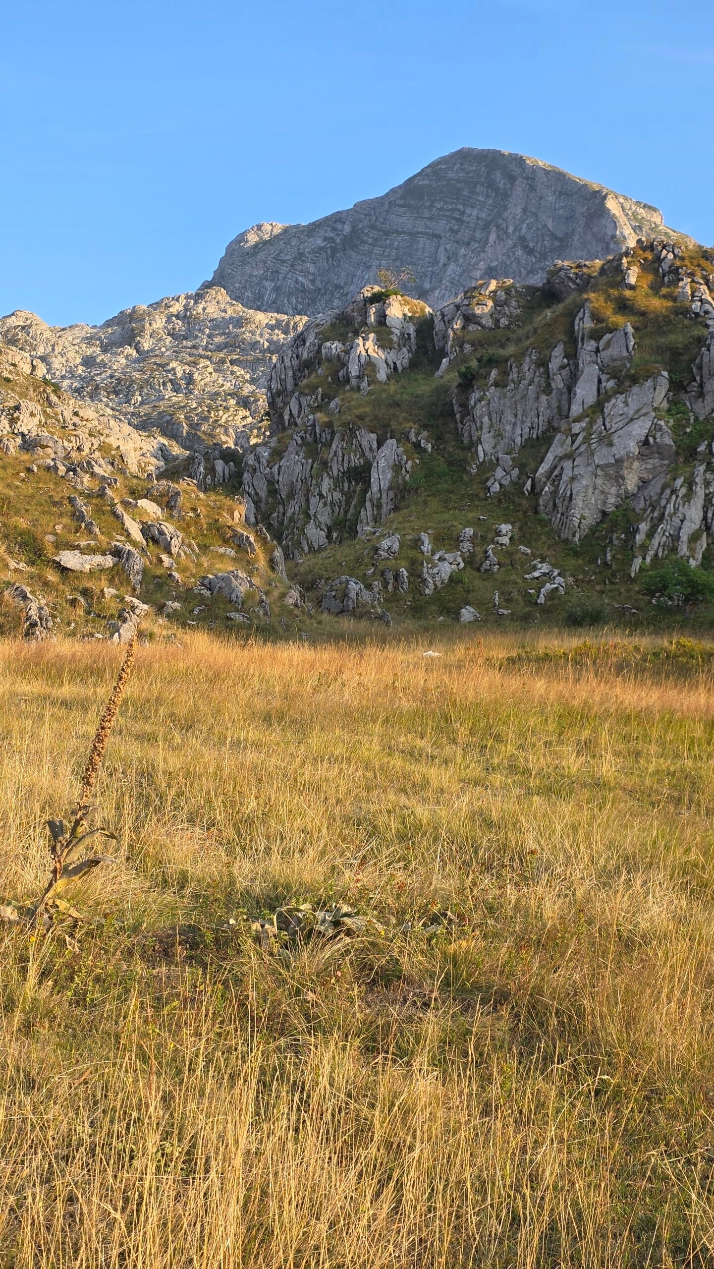
- Summit
- 2,534 mMontenegro–Albania border
- Approach
- VusanjeVia the Prokletije mountains
- Terrain
- DemandingSteep rock and route-finding
- Season
- Summer windowSnow and weather can change the plan
- Emergency
- 112Montenegro emergency service
- My visit
- August 2025Personal diary below
02 / Choose your route
Plan a full return, not a one-way line.
For a first summit attempt, plan Vusanje to Zla Kolata and return by the same confirmed route. A published trail map describes a 9.6 km one-way route that continues beyond the summit towards Qafa Prosllopit; its distance and ascent figures are not a Vusanje return. Its elevation profile and summit height also differ, so check the map and current line with a local guide rather than doubling those figures. Review the route map.
The national tourism hiking map lists Maja Kolata at 2,534 m and gives an 8-hour, 1,474 m ascent proposal, without making its exact start and complete return clear on the map. Treat it as historical planning context, not a guaranteed schedule. National hiking map.
03 / Start at Vusanje
Find the right starting point.
Use Vusanje as the practical starting village near Gusinje. Ask your accommodation or a local guide where the currently recommended trail begins and where your vehicle may be left. Confirm the route through the village before starting: walking from a different parking place changes the day.

04 / Village and forest
The approach sets the pace.
From the Vusanje area the route climbs through lower vegetation before opening towards rocky mountain terrain. Follow the current marked line and compare junctions with your offline map. Do not assume a sign or a downloaded track is still correct after storm damage or trail changes.
Start slowly enough to reserve energy for the steep upper ground and the return. Establish a time at which the group will turn around regardless of the summit.
05 / Bora Pass
A landmark, not the end.
The published Vusanje route identifies Bora Pass on the way to the upper mountain. Confirm the spelling, position and line with a current map: Qafa e Borit and Bora Pass refer to the same area in local descriptions. The distance remaining still includes steep and rocky terrain. Route waypoints.

06 / Ice cave area
Snow can survive the summer.
The route map marks Ledena Pećina, an ice cave, above Bora Pass. Stay on the planned route and do not enter a cave or snow feature without appropriate expertise. Lingering snow can obscure the trail, cover holes and make a familiar summer route significantly more serious. Check conditions locally before departure. View the mapped landmarks.
07 / Kolata saddle
Navigate deliberately on limestone.
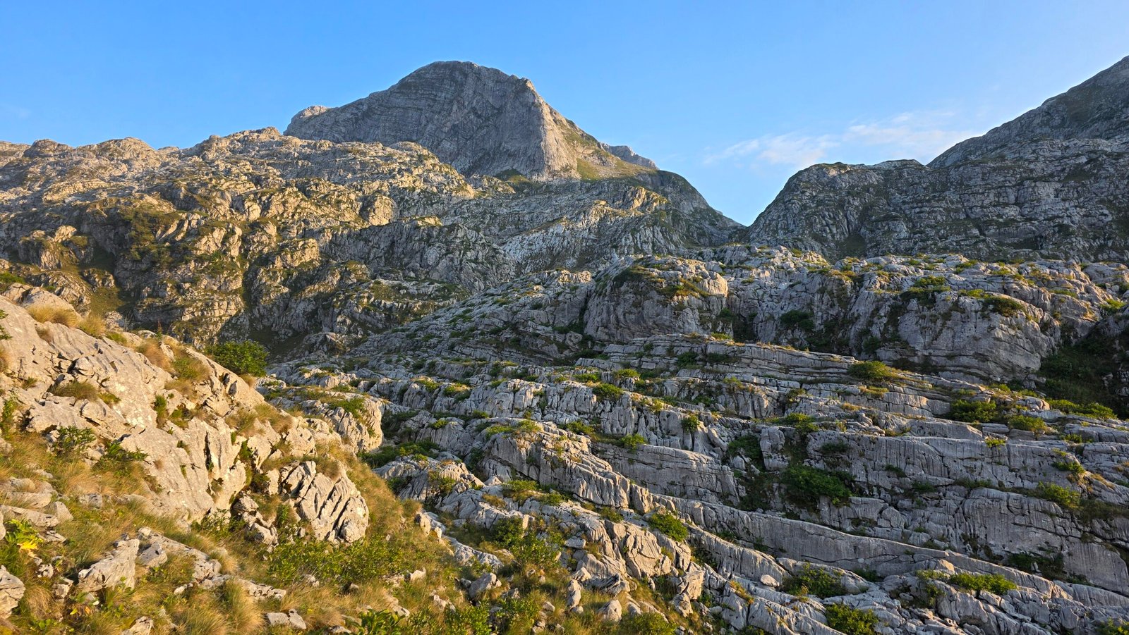
Above the cave area the mapped route leads towards the Kolata saddle. Loose stones, exposed slopes and indistinct paths can slow a party, particularly in fog. Keep the group together, identify the safe line and avoid dislodging rocks onto people below. A GPS line is an aid, not proof that a slope is safe.
08 / The summit
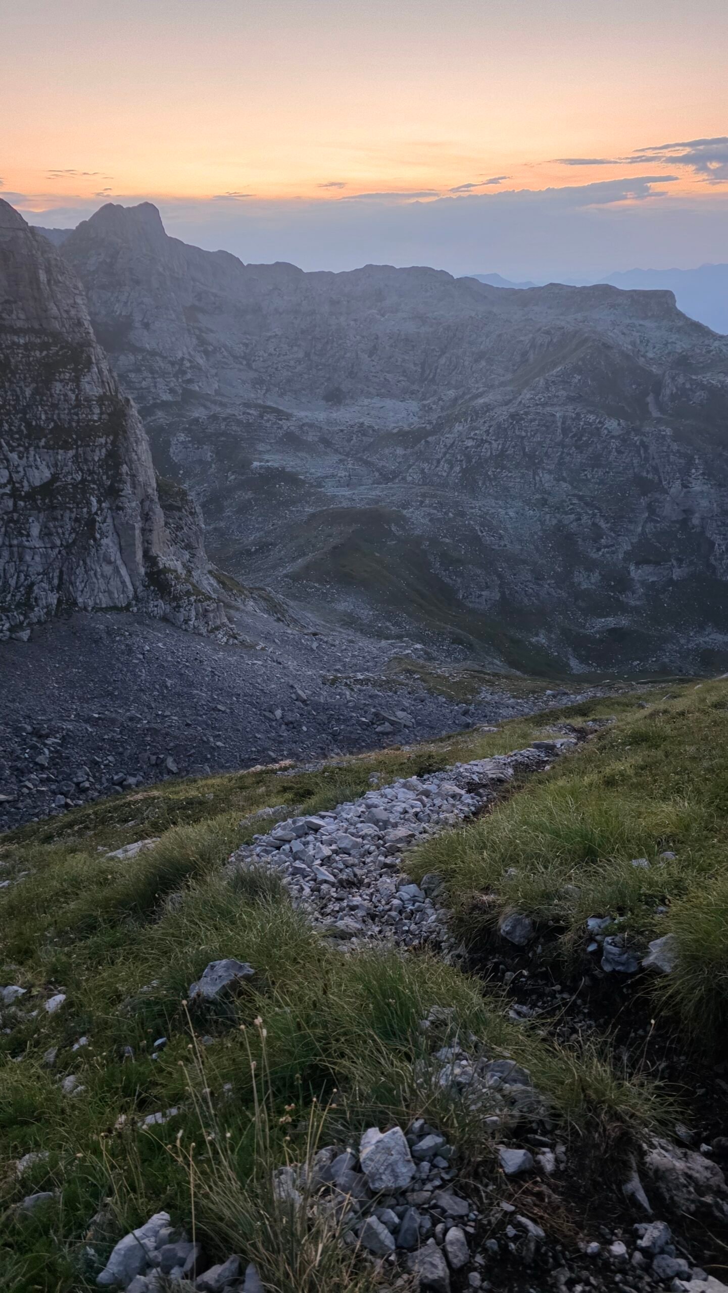
A border ridge above the valleys.
Zla Kolata is commonly given as 2,534 m by Montenegro’s national tourism organisation. Other sources differ by a metre or two. Identify the correct summit rather than assuming every nearby high point has the same name. Weather can change quickly on the open ridge; allow time and energy to return. Official park overview.
09 / The descent
The summit is only halfway.
For an out-and-back hike, retrace the confirmed ascent while there is still ample daylight. Descending loose rock may be slower than expected. Recheck junctions, watch the whole group and turn back earlier if the weather or your progress threatens your return.
10 / Alternative hikes
Choose another day or another destination.
In poor conditions a lower outing can be more rewarding. National tourism information suggests Grebaje near Gusinje, Lake Plav and the area towards Hridsko Lake as alternatives; these are separate routes requiring their own transport, forecast and local checks. Do not treat a different route as automatically safe. Explore other hikes.
11 / Border planning
The ridge is an international boundary.
The summit lies on the border with Albania. A line on a map is not permission to cross into another country: check the current requirements, permitted crossing points and documents with the relevant authorities for your nationality and precise itinerary. Ask the park and your guide before combining this hike with a cross-border trek. Official border information.
12 / Getting there
Make Plav and Gusinje part of the trip.
Plan your journey to the Plav–Gusinje region first, then arrange the final leg to Vusanje. Montenegro’s tourism map describes the road around Lake Plav towards Gusinje and recommends the park visitor centre for local information. Check the current road situation, border rules and rental terms for your own itinerary. Regional overview.
13 / Road and parking
Confirm the last kilometres.
Ask your host or the park about the exact trailhead, road surface, closures and permitted parking for your vehicle. Road conditions can change; do not assume an unpaved road is covered by a rental agreement. Leave access for residents and emergency vehicles and account for any extra walking if parking lower down.
14 / Without a car
Arrange the last leg before you arrive.
Check current intercity connections to Plav or Gusinje with operators and arrange a local taxi or host transfer to Vusanje and back. Do not assume a scheduled bus reaches the trailhead or that a late return transfer will be available. Agree the pickup point, time and price directly.
15 / Where to stay
Give yourself a proper night’s sleep.
Vusanje, Gusinje and Plav offer useful bases for different budgets and transport plans. Ask accommodation providers about opening, an early breakfast, current road access, parking and a pickup after the hike. Book an extra night if possible to avoid making a long drive immediately after a demanding day.
16 / Season and snow
The calendar is only a starting point.
Montenegro’s national tourism organisation describes summer as the best trekking period in Prokletije and warns that snow can remain even then. Snow or ice on steep ground requires appropriate skills and equipment; if your group cannot assess and manage them, turn back or choose another route. Official seasonal advice.
17 / Forecast and storms
A clear valley is not a mountain forecast.
Check the official forecast and warnings, including wind and thunderstorms, and ask locally about conditions at altitude. The ridge offers little protection in a storm. Set an early turnaround time, carry warm and waterproof layers, and postpone when the forecast or visibility is unsuitable. Montenegro weather service.
18 / Water and food
Carry enough for the whole outing.
The route map marks a spring on the approach, but flow and water quality are not guaranteed. Ask locally whether it is currently usable; carry sufficient water, food and an emergency reserve instead of relying on a refill. Do not leave packaging or food scraps behind. Check mapped water points.
19 / Difficulty
Fitness is only one part of the decision.
This is a long and strenuous mountain route with steep, rocky ground, possible exposure and navigation challenges. You need sure footing, endurance and confidence descending rough terrain. A fast time in my diary is not a standard: use a conservative plan appropriate to your slowest party member.

20 / Rescue and safety
Plan for delay and limited reception.
Share your route and return deadline, carry first aid, a headlamp and backup power, and understand your insurance and rescue arrangements. Do not depend on phone coverage. In Montenegro call 112 in an emergency; give the dispatcher your location, condition, group size and the side of the border. Official 112 information.
22 / Hiring a guide
Local knowledge can change the day.
For unfamiliar terrain, arrange a qualified local mountain guide and discuss fitness, route, snow, group size, equipment, pickup, price and cancellation before booking. Montenegro’s national tourism organisation recommends organised groups and licensed guides; the Gusinje visitor centre can help connect visitors with local information. Guide advice · Park visitor centre.
23 / Protect the park
Walk lightly in a working landscape.
Stay on established paths where possible, respect livestock and residents, take all litter home and avoid disturbing wildlife. Ask the park about current access rules, camping and any fees rather than assuming arrangements from an old account still apply. Ask the national park.
24 / Explore the region
More than a summit.
Visit Ali Pasha’s springs near Gusinje, the park visitor centre or Lake Plav; the national tourism organisation also highlights the Redžepagić Tower and local heritage. Grebaje offers another landscape for a separately planned outing. Confirm opening and access before setting out. Regional sights.
25 / Trip ideas
Leave space for weather.
One day: start early from an agreed trailhead, follow a confirmed route, return in daylight and allow for the drive back.
Three days: arrive in Gusinje or Vusanje and visit the springs; use the best weather day for Zla Kolata; explore Plav or Grebaje on the remaining day. Swap days if the forecast deteriorates.
26 / Photography
Make the landscape part of the story.
Photograph valley, limestone and changing light from secure ground. A wide view gives scale; a person on a safe section can convey it. Keep your camera accessible without compromising balance and do not delay a safe return for sunset. My own late descent is a reminder that light is never worth losing your margin.
27 / Saved checklist
Prepare before the road.
Saved only in this browser. Snow and ice demand additional skills and equipment.
28 / Cost calculator
Use your own quotes.
Plan in euros.
Enter your own current prices in EUR. Vehicle and main travel are shared; the other amounts are per person. Include any park, guide and transfer quotes under the appropriate fields. Blank entries count as zero.
29 / My Zla Kolata day
The mountain that lived up to its name.
After climbing Korab I had little rest: I slept partly in a car near Skopje Airport, then travelled by bus and taxi through North Macedonia and Kosovo, with border checks and delays. At Pristina Airport I collected another rental car and drove 151 km towards Vusanje.
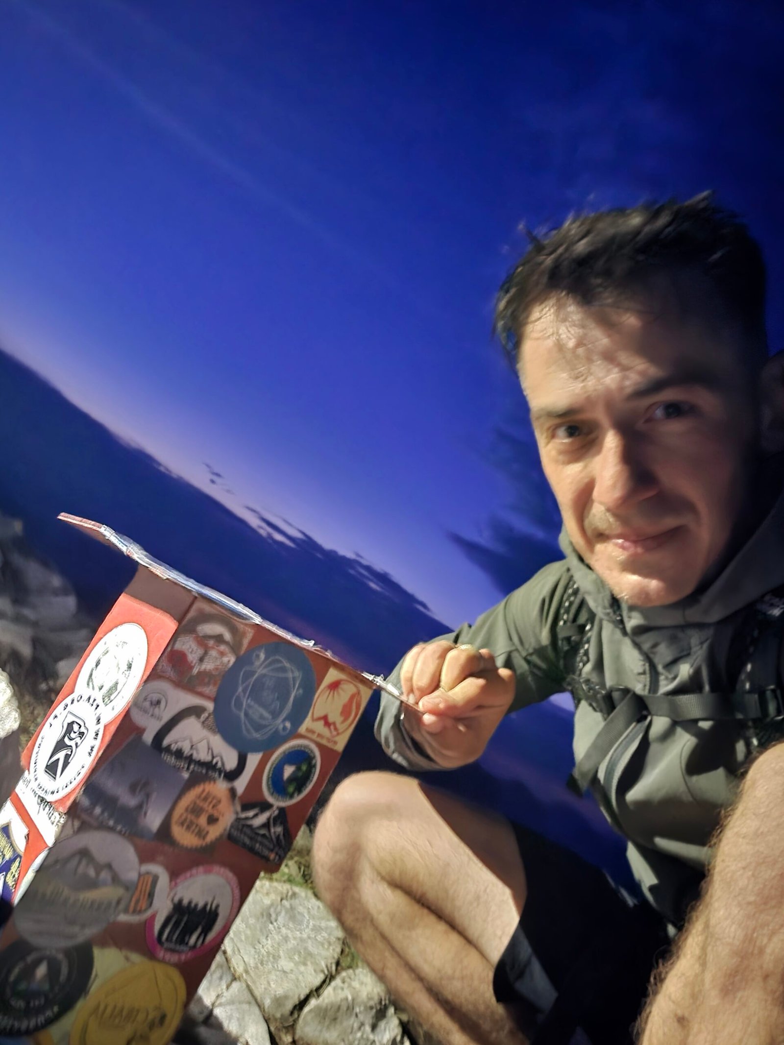
My plan to start early disappeared in the delays and exhaustion. I left the trailhead at 17:57 as the light was already falling. I moved quickly on steep, rocky ground and reached the summit at 20:20, just after sunset. My original account records 15.8 km and over 1,300 m of ascent for the outing; these are my own figures, not a standard route measurement.
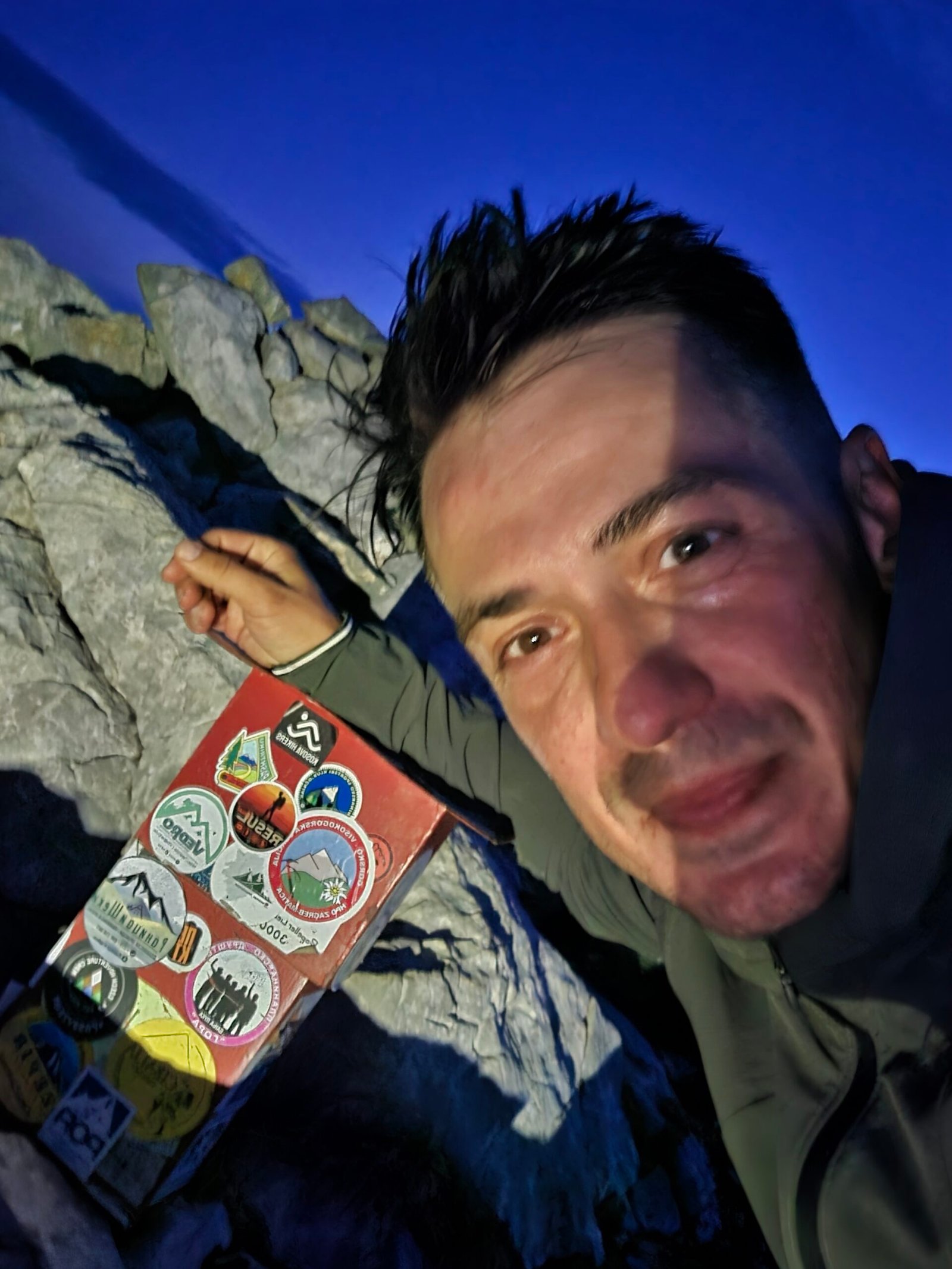
Descending, I followed a rough trail that at times seemed to disappear among rocks and bushes. I switched on my headlamp and heard animals in the darkness without knowing what they were. I reached the car at 22:35 exhausted, and slept there afterwards. The experience reminded me how much timing and fatigue matter, even when determination gets you to the top.
The original article gives 18 August 2025, while my expedition summary lists 17 August and the photo filenames also begin 20250817. The exact date remains unconfirmed.
Starting late and descending alone in darkness added serious risk. Plan an early start, a generous daylight margin and a realistic turnaround time; do not copy my pace or sleep-deprived travel.
30 / FAQ and sources
Before you go.
Is Zla Kolata Montenegro’s highest mountain?
Montenegro’s national tourism organisation lists Zla Kolata at 2,534 m as its highest peak. It lies on the Albanian border.
Is this suitable for beginners?
It is a demanding mountain day. Choose a route suited to your experience and consider a qualified local guide.
Can I hike there in snow?
Snow and ice can change the difficulty significantly. Check conditions and only proceed with the appropriate skills and equipment.
Can I cross into Albania on the ridge?
Check the current legal requirements and permitted crossing points with the relevant authorities before planning a cross-border itinerary.
How long should I allow?
Plan a full mountain day with generous buffers. Published figures describe different routes; confirm the complete return with a guide or park.
Sources and current information
Research checked 2 November 2026. Conditions, access and prices change.
- Montenegro National Parks: Prokletije contacts ↗ — Ask for current access and conditions
- Montenegro National Tourism Organisation: Prokletije ↗ — Regional information and summit height
- Montenegro National Tourism Organisation: hiking ↗ — Season, guides and hiking advice
- Montenegro National Tourism Organisation: hiking map ↗ — Published Prokletije route overview
- Travel to Montenegro: Vusanje–Zla Kolata ↗ — Route map and waypoints; check its route profile carefully
- Montenegro Hydrometeorological Institute ↗ — Forecast and warnings
- Montenegro Ministry of Interior: 112 ↗ — National emergency number
- Montenegro Ministry of Interior: borders ↗ — Border information
- National Parks: Prokletije visitor centre ↗ — Park visitor centre in Gusinje