01 / Start here
Golden pastures.
A quiet Balkan horizon.
Velika Rudoka is a long walk into the open Šar Mountains: pale tracks, grazing animals, a dark mountain lake and a summit on the Kosovo–North Macedonia border.
It is a rewarding place to slow down. The landscape changes gradually, from village and forest to pasture and rock, with space between the landmarks. That openness is part of its beauty. It also means you need a considered route and a plan for the full return.
This guide separates my approach from Gjurgjevishte in North Macedonia from the Brod / Arxhena approach in Kosovo. They share a summit, not a trailhead, road journey or set of practical arrangements. My photographs and personal record come from the North Macedonian side.
- Massif
- Šar / Sharr MountainsA protected landscape across a border
- Summit reference
- About 2,660 mAlso commonly published as 2,658 m
- My walking start
- GjurgjevishteNorth Macedonia, not Kosovo
- Kosovo approach
- Brod / ArxhenaA separate route through the Sharr landscape
- My recorded outing
- 24.20 km · +1,596 mHistorical activity, not a standard specification
- My summit moment
- 14:49 · 2 September 2025A clear day with an unexpected descent
I remember a calm summit and a frightening encounter with shepherd dogs on the way down. Both belong in a useful guide: the reason to visit and the practical detail that a pretty photograph cannot explain.
Three decisions to make first
Choose the side you will start from, establish the actual route and return, then confirm park and border arrangements for that route. A name saved in a navigation app does not resolve those questions.
02 / Names & the high point
One summit.
Several names on the map.
You may find Velika Rudoka, Golema Rudoka, Rudoka e Madhe and Maja e Njeriut in different languages and trip accounts. Save the summit location and the starting village with the name, especially when arranging transport.
2,658 m or 2,660 m?
The Discover Shar Mountain project lists 2,658 m, while an operator’s Rudoka programme uses 2,660 m. This guide uses about 2,660 m and preserves the 2,658 m label in my original expedition record. Published figures differ; I am not presenting a new survey. Regional summit reference · Operator’s alternative elevation reference.
Why Gjeravica appears in other lists
Rudoka is commonly counted as Kosovo’s high point in country-highpoint projects because the summit lies on the border. Gjeravica also appears under “Kosovo’s highest mountain” in older and other reference material. Do not confuse the two destinations: Gjeravica is a different mountain and journey, not another name for Rudoka.
A border summit reached through North Macedonia
My expedition counted Kosovo at Rudoka, but my walking start was Gjurgjevishte in North Macedonia. Skopje, where I stayed beforehand, is also in North Macedonia. Keeping that geography clear makes the transport, accommodation and authority contacts much easier to understand.
The mountain is worth visiting beyond the highpoint label. The lake, grazing landscape and long views are the substance of the day; the summit gives them a destination.
03 / Choose your approach
Two sides.
Plan one complete journey.
| Approach | Useful starting point | Scale and planning questions |
|---|---|---|
| Gjurgjevishte, North Macedonia | A village start below the southern Šar landscape | My outing recorded 24.20 km and +1,596 m. Verify your line, current marking, park arrangements and return. |
| Brod / Arxhena, Kosovo | Mountain accommodation and an established regional walking base | A published operator itinerary gives 20.6 km and 1,320 m ascent for its variant. Other lines differ. |
| A shorter lake or pasture outing | An objective chosen with current local advice | Define its own route and turnaround; a shorter name does not guarantee an easy day. |
| A cross-border traverse | A separately organised multi-stage journey | Permission, both countries’ requirements, transport, accommodation and escape plans must fit together. |
Choose from logistics, not only map distance
If you are already travelling through Skopje, Tetovo or Gostivar, a North Macedonian itinerary may fit naturally. If the trip is based around Prizren, Dragash and Brod, research the Kosovo approach. Compare actual road access, accommodation, available guiding and the whole walking day.
Do not combine mismatched statistics
A distance measured from Arxhena cannot describe the walk from Gjurgjevishte. Neither can the height of a village define the ascent on a route with undulations. Use a single, identified route when calculating time, supplies and transport.
What the numbers tell you
Both examples describe substantial mountain days. The broad landscape can look gentle while the total distance and ascent are demanding. Choose a pace that leaves attention and energy for the descent, with time for navigation, photographs and delays.
Gjurgjevishte approach reference · Dated Brod itinerary · Discuss a guided Rudoka outing.
04 / Getting to the region
Choose your base
before your airport.
For the North Macedonian approach
Skopje is a useful arrival city. Continue towards the Tetovo–Gostivar region and arrange the final journey to the exact Gjurgjevishte start. Do not confuse the regional journey with a confirmed trailhead transfer. Save the village name in the spelling your driver uses and agree where you will meet afterwards.
From Skopje Airport
The airport publishes shuttle-bus information for reaching the city and links to the current operator timetable. Check that timetable against your actual flight rather than assuming every arrival has an immediate connection. You still need a separate onward journey to your walking base. Official airport bus information.
For the Kosovo approach
Build the road itinerary around Prizren, Dragash and Brod / Arxhena, with accommodation and transfers confirmed on that side. Do not route a car over a mountain footpath because two villages look close across the ridge.
With a rental car
Tell the rental company which countries and roads you intend to use and obtain its actual cross-border permission and insurance conditions. Confirm where to park without blocking village access. A rough track visible in a photograph does not establish either legal vehicle access or suitability for your car.
Without a car
Ask a host or guide for a confirmed transfer quote, pickup point and return arrangement. A one-way taxi estimate is not the cost of the full mountain day. Agree how to handle a changed finish time and what happens if there is no reception at the meeting place.
For this trip, an extra night near the walking start can be more useful than a late arrival followed by a rushed early drive. Resolve the final kilometre and the journey home while you still have a desk and a good connection.
05 / Gjurgjevishte approach
From village tracks
to open pasture.
The regional Discover Shar Mountain material identifies a Gjurgjevishte approach towards Rudoka. Its historical trail inventory also names Gjurgjevishte–Crno Ezero–Rudoka. Those references establish a route tradition; they do not certify today’s waymarks, vegetation or access.
Start with the exact line
Ask about the current trail and compare it with a suitable offline topographic map. Distinguish walking paths, vehicle tracks and grazing routes. Several lines in the same valley may lead towards different pastures rather than towards your summit.
Keep the lower approach steady
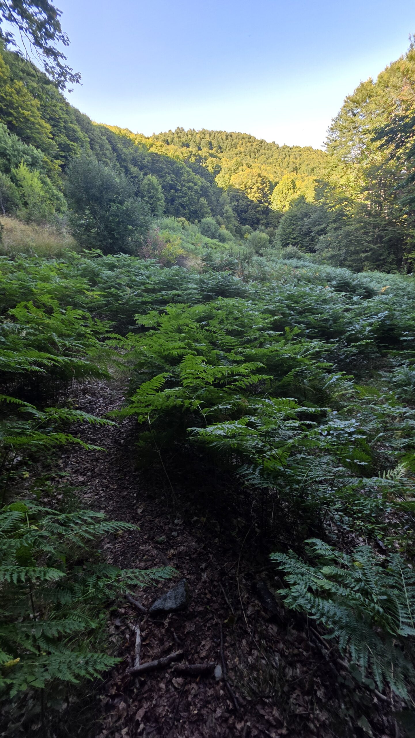
The forest and lower tracks are where a long day can become unnecessarily hard through a fast start. Set a pace the whole party can sustain, deal with footwear discomfort early and keep a record of junctions needed on the return.
The open ground
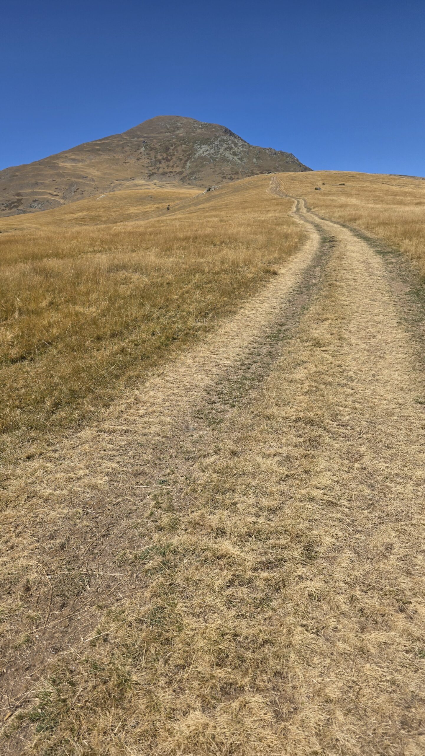
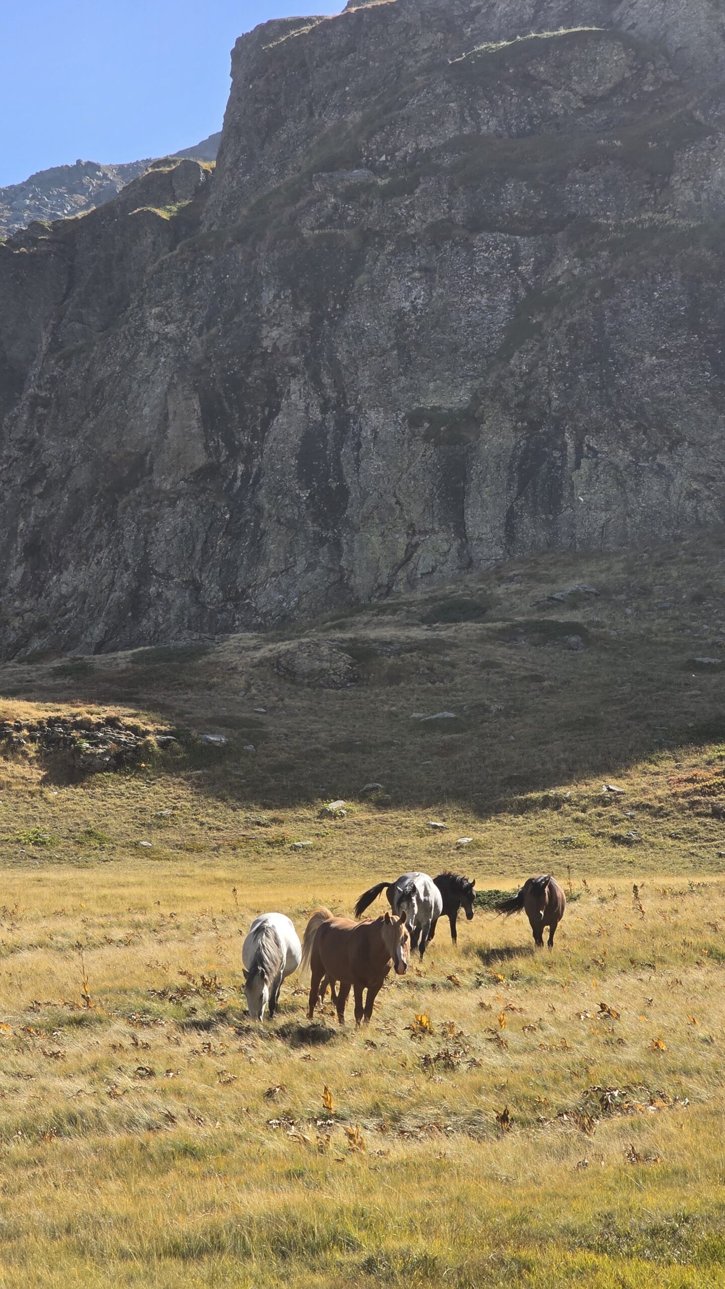
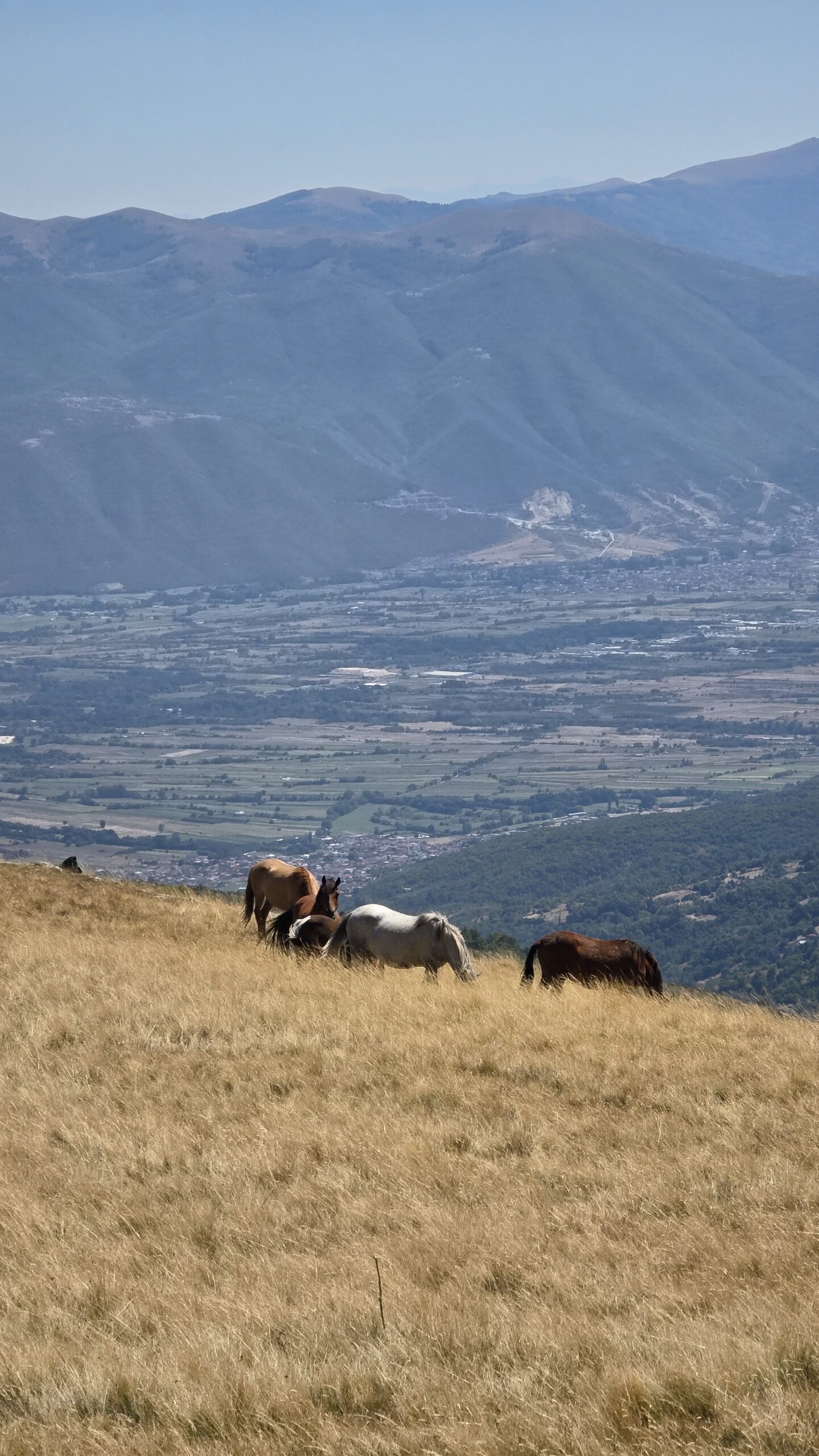
My photographs show dry golden grass, broad tracks and the valley spreading out below. Once exposed to the sun and wind, breaks and water need more attention. A distant ridge can remain distant for much longer than a photograph suggests.
Parking is not a promise of a high start
Plan from the place you can actually and lawfully reach. The park publishes restrictions on motor roads. Do not assume a paid vehicle charge authorises a drive up any track, or that an old report’s higher parking place is still available. Park motor-road map.
Historical trail inventory PDF · Ask the park about the intended approach.
06 / Crno Ezero & lake country
Make room
for the mountain lake.
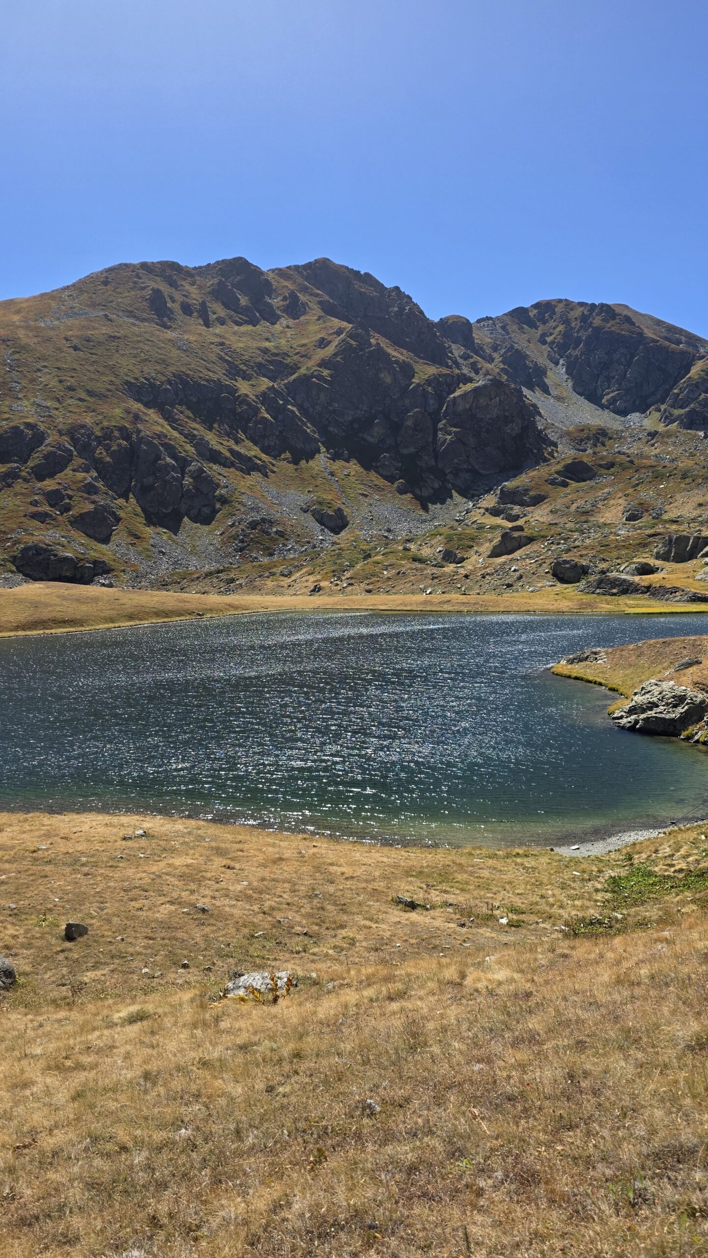
The lake below Rudoka was one of the most memorable parts of my visit: dark blue water, pale rock and grass turning gold around it. It gives the day a different scale from the summit view.
Names matter here too
The regional trail inventory places Crno Ezero on the Gjurgjevishte–Rudoka itinerary. Do not confuse it with Shutman Lake on a Kosovo-side programme, or with another “Black Lake” elsewhere in the Balkans. Match the lake to the exact route and map you are using.
A lake objective is its own outing
If you would rather enjoy the basin than continue to the summit, make that the plan from the beginning. Establish its actual distance, ascent, return and access with local advice. The word “lake” should not be used as a substitute for a difficulty assessment.
Time for a worthwhile stop
Choose a place on established ground, keep the return margin visible and look at the weather above you. This is a good checkpoint for the group: how much energy remains, whether the route ahead is clear and whether the summit still fits the day.
Water and the shoreline
Do not treat clear-looking lake water as a confirmed drinking supply. Bring enough safe water and verify any refill arrangement before departure. Avoid disturbing the shore or entering the water; check the park’s actual rules for the place rather than copying practices from a photograph.
I would leave space for the lake even on a summit-focused trip. It is one of the reasons the walk feels like a journey through a landscape rather than simply a climb to a number.
07 / The upper mountain
The ridge is a destination.
The descent is a commitment.
Higher up, the landscape becomes more open and rocky. The goal may be visible, but visibility is not a measure of the effort still required. Keep checking the route and the party rather than moving from one inviting skyline to another.
Know which high point you are approaching
Use a map that identifies Rudoka and the surrounding tops. A ridge may contain several rises, cairns or viewpoints. A photograph of the summit symbol is useful context, but it is not a navigation instruction or an official boundary marker.
Fitness and footing
In suitable snow-free conditions, visitors describe long hiking itineraries here. That should not be confused with effortless ground. Uneven surfaces, a long ascent and tired legs on the return require care. Snow or ice changes the undertaking and calls for a different assessment.
Make the last decision before the last rise
Review weather, time and how everyone is moving. If the return no longer fits, turn around while navigation is clear and the group is together. The summit can remain a future objective.
At the top
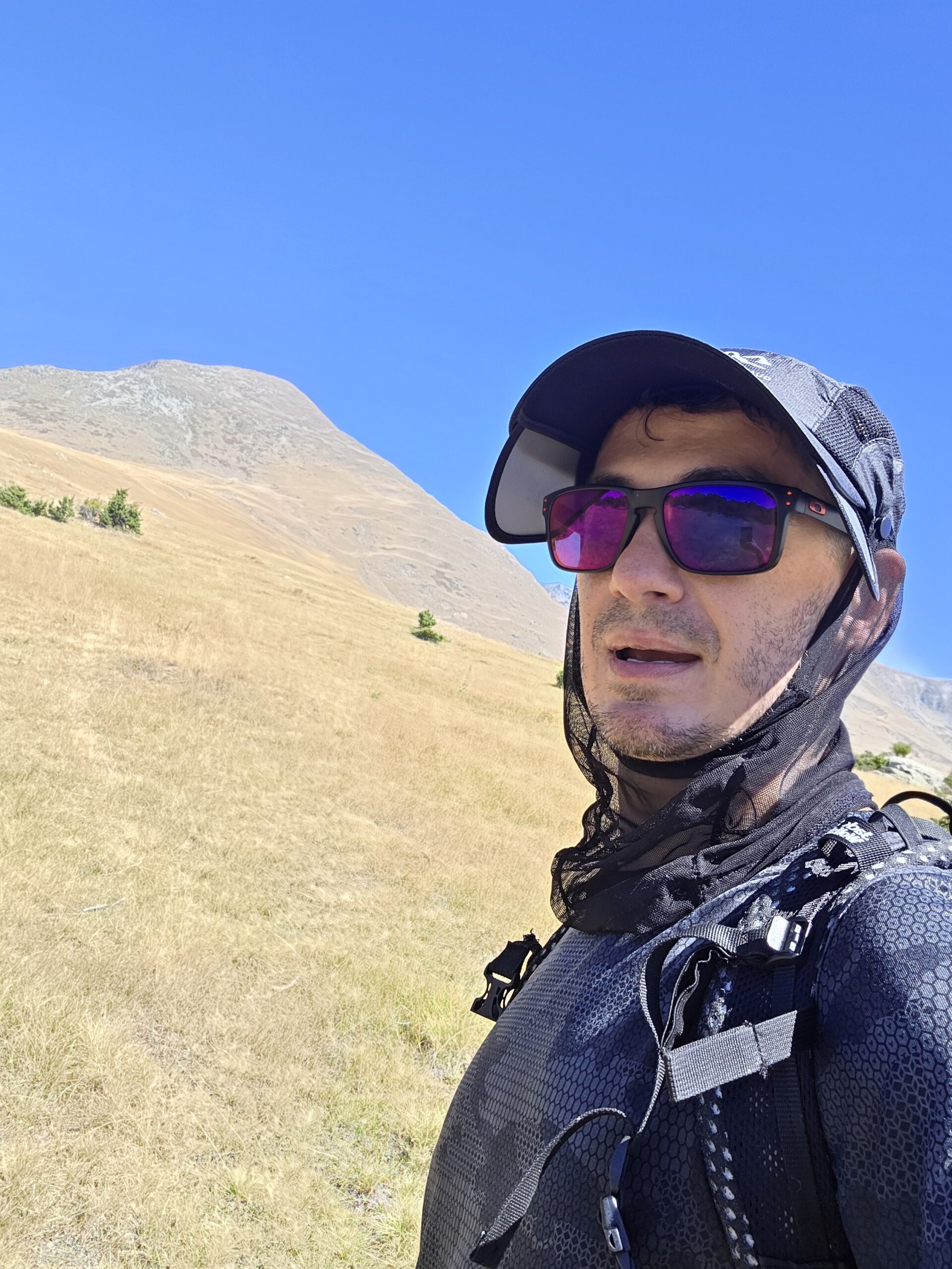
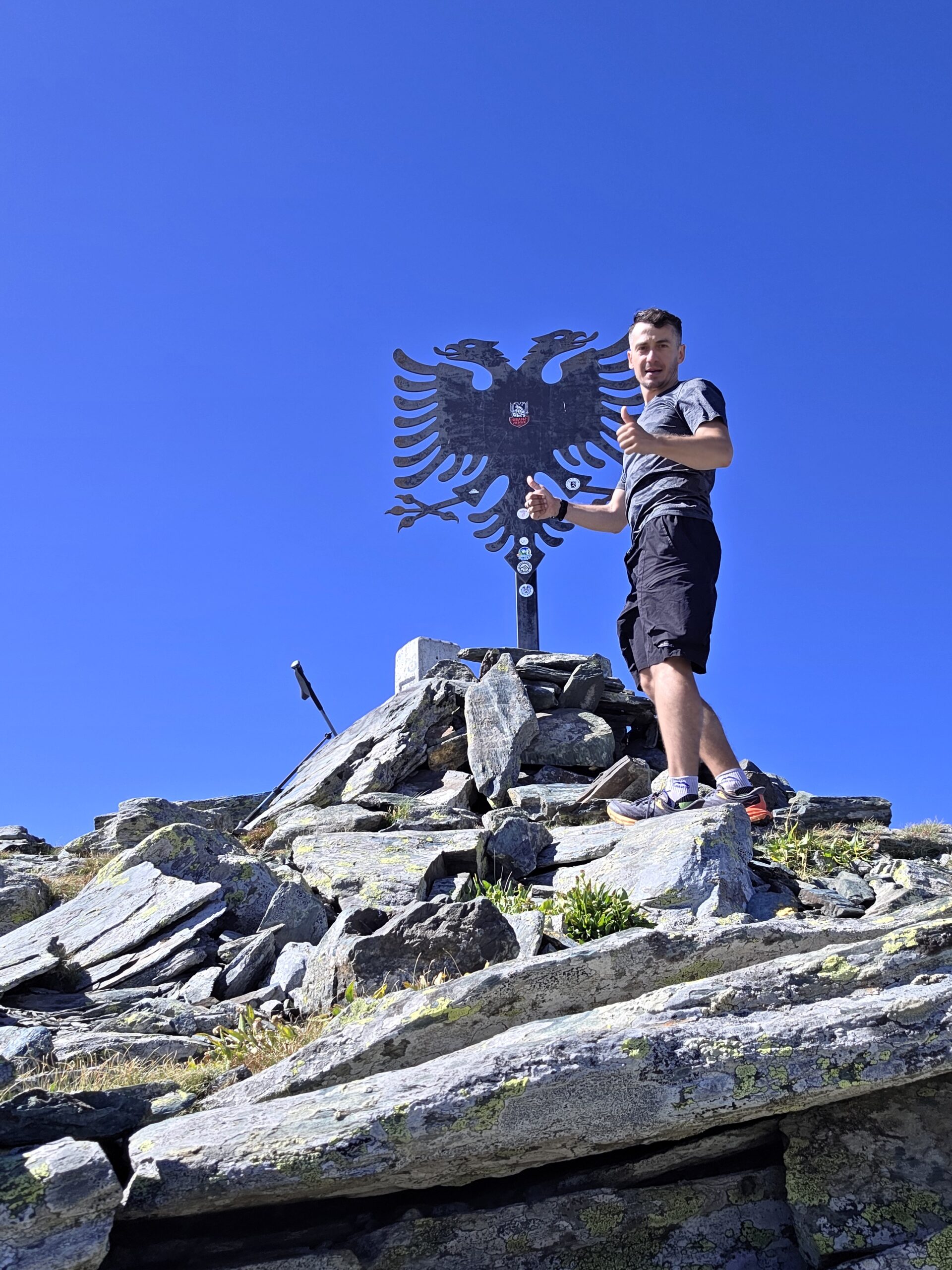
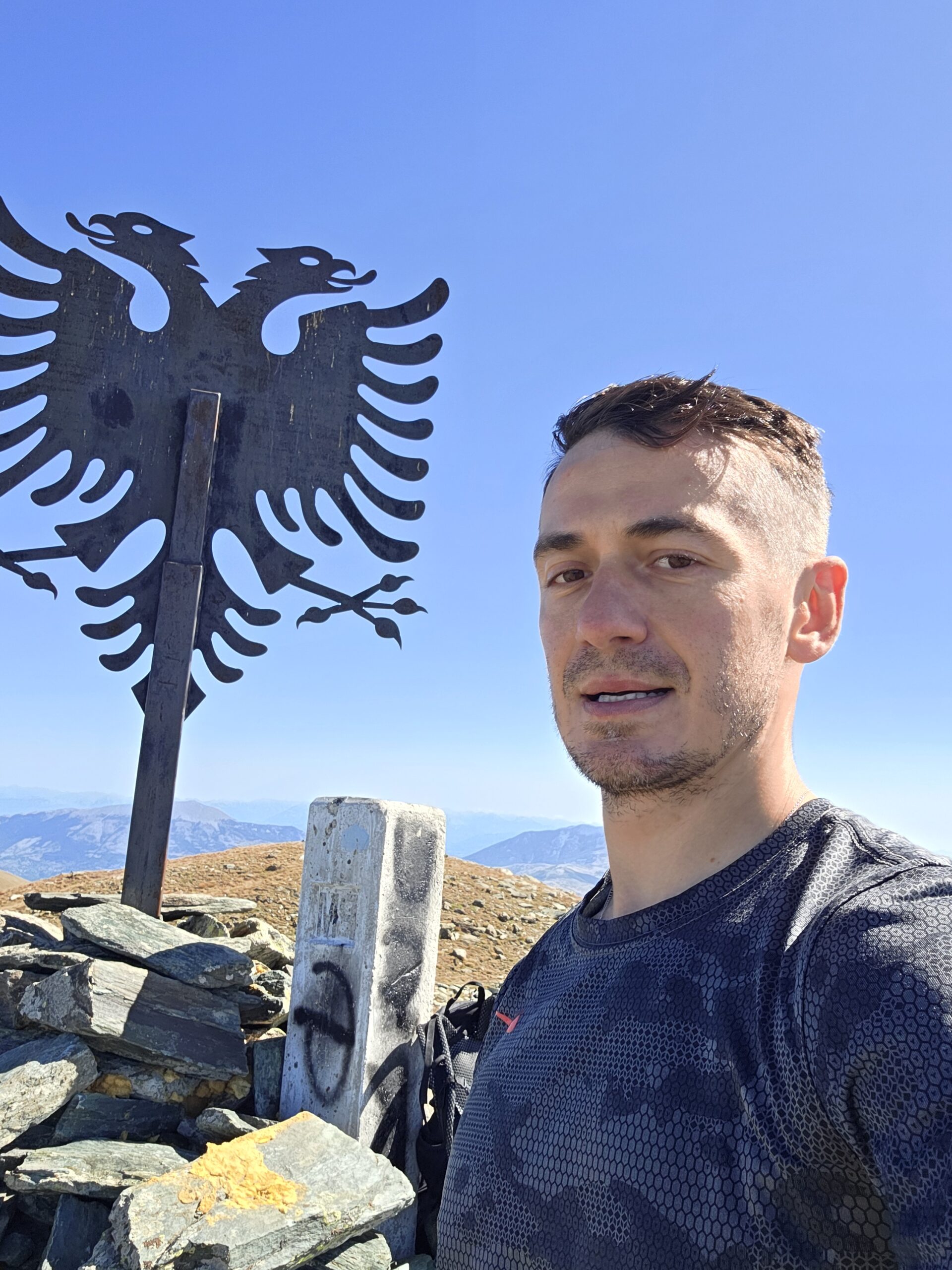
I arrived at 14:49 on a clear September day and photographed the distinctive metal eagle above the stones. Give others space, protect the structure and avoid using a symbol or the absence of a fence as a reason to wander across the border.
08 / Brod & the Kosovo approach
A different valley.
The same high horizon.
Brod and the Arxhena resort form a practical starting area for a Kosovo-side visit. The resort’s own website confirms accommodation in Brod, Dragash, and provides direct enquiry contacts. Use it to establish your actual stay and local arrangements. Arxhena’s official information.
What an example itinerary shows
A Serbia for Youth programme dated 2024 describes a route from Arxhena through the Brod valley and Shutman Lake towards Rudoka. It lists 20.6 km and 1,320 m of ascent for its outing. Treat those as the scale of that particular programme, not an exact specification for every track from the hotel. Read the dated operator itinerary.
Confirm the walking line
Ask which valley and lake route are intended, where the turnaround points are and how the route relates to the border. Similar-looking downloadable tracks may use different upper approaches. Resolve that with an experienced local guide or current detailed mapping before you go.
A lift is not an assumed shortcut
The resort mentions a cable car. That does not establish summer operation, its timetable, ticket price or suitability as part of your Rudoka plan. Ask directly and keep the walking itinerary workable without an unconfirmed ride.
Know which photographs you are seeing
The photographs on this page are from my Gjurgjevishte outing. I am not presenting them as images of the Brod trail. Choose this side for its own logistics and landscape, with advice from people who know the intended route.
09 / Park & border arrangements
A park registration
is not a border permission.
There are three separate questions: visiting the protected area, taking a vehicle on a particular road and approaching or crossing an international border. Answer each for the exact route, nationality and travel date.
1. Visitor registration on the North Macedonian side
A park notice dated 30 June 2025 required registration and a returned confirmation for forest visits during its fire-risk restrictions. The official visitor-record form remains available. Check the latest instructions with the park, submit the requested details through its own system and retain the confirmation. Do not assume a dated notice proves either an ongoing ban or unrestricted access today. Read the notice · Official visitor-record form.
2. Vehicle access and charges
The same notice distinguishes payment for motor-vehicle entry on permitted roads. Confirm the current charge and which road you may use. Payment is not permission to drive beyond authorised routes. Official payment portal · Permitted and prohibited motor roads.
3. Border-area and crossing arrangements
The park management plan says cross-border tourism should be coordinated with border police. Send the competent authority your actual start, summit objective, intended line, date and return side, and ask what is required. Reaching a border summit and traversing into another country should be described precisely. Park management plan.
Start with North Macedonia’s border authority, its official contact directory and Kosovo Police contacts. Ask the parks and your guide to help identify the responsible office. Do not copy a permit process for Albania–Montenegro into a Kosovo–North Macedonia itinerary.
Carry valid travel documents and any required written authorisation offline. This page does not arrange permits, and a historical activity trace cannot establish a lawful crossing for a future visitor.
10 / Shepherd dogs & pastures
Understand the pasture.
Give the working dogs space.
The most frightening moment of my Rudoka day happened below the summit, close to grazing land. This deserves preparation before you set off.
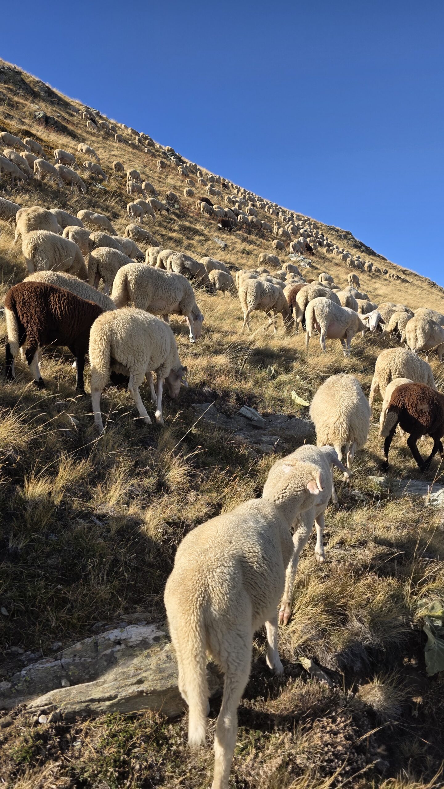
Livestock guardian dogs are working around a herd. Ask a local host or guide about current grazing areas, shepherds and sensible ways to pass. A quiet route one week can contain animals the next; there is no fixed “dog-free” line established by my diary.
Before you reach the animals
Notice livestock and shepherd buildings early. Keep a generous distance instead of walking directly into a flock. Where possible, communicate with the shepherd from a distance and follow appropriate local guidance without pressing through the animals.
If a guardian dog approaches
AGRIDEA’s specialist guidance advises stopping and staying calm, giving the dog time, avoiding sudden movements or provocative gestures with poles, and not feeding or petting it. Avoid staring into its eyes. If it does not settle, withdraw calmly rather than forcing a passage. Read the full guardian-dog guidance.
With your own dog
Companion dogs can provoke a stronger response from guardians. Discuss this before bringing one into working pasture; AGRIDEA recommends avoiding such areas with a companion dog. Its advice is general behaviour guidance, and its Swiss pasture maps do not describe Rudoka.
What my story can and cannot tell you
On my descent a shepherd called the dogs back. I was relieved, but that outcome is not a plan another walker can rely on. A guide’s knowledge of the current pastoral landscape can be useful for much more than finding the summit.
11 / Season & conditions
A summer landscape.
When the mountain agrees.
For a first hiking visit, choose genuinely snow-free ground and a settled forecast. My early-September photographs show one warm, dry day. They do not establish the conditions of a particular month, and a broad grassy ridge can become a different undertaking under snow or ice.
| Situation | What to consider | A useful response |
|---|---|---|
| Dry, snow-free conditions | Long distance, ascent, sun and the return | Plan the complete day with realistic group pace |
| Hot lower slopes | Water, shade and sustained effort | Adjust the start, supplies and objective |
| Rain or low cloud | Slippery footing and fewer visual references | Reassess navigation and whether to continue |
| Thunderstorms or strong wind | Long exposed upper ground | Choose a different day or suitable lower outing |
| Snow or ice | Route choice and movement skills change | Arrange a separate winter or alpine assessment |
| Fire restrictions | Actual park instructions may limit access | Check current notices and registration arrangements |
Check the mountain, not only the city
A comfortable forecast for Skopje or Prizren does not describe the wind, cloud or temperature on Rudoka. Use the national weather service for regional context, then obtain a forecast relevant to the summit elevation and ask locally about actual ground conditions. WMO links to the North Macedonian service.
Shorter daylight
A long return itinerary needs a different start and margin later in the year. Carry a headtorch, but do not use it as a reason to plan unfamiliar pasture and forest navigation after dark.
Keep a spare day if Rudoka is central to your holiday. Waiting for appropriate conditions is easier when you have somewhere interesting to spend that day.
12 / Fitness & a local guide
Train for the distance.
Save energy for the way back.
The numbers matter here. My own outing was 24.20 km with 1,596 m of recorded ascent. Even where the terrain looks broad and untechnical, a full day of climbing and descending can be tiring. Judge the whole return rather than the first hour.
A useful preparation walk
Before the trip, walk a substantial route with sustained ascent, rough ground and a long descent. Use the same footwear and a similar pack. Notice how your pace changes after several hours and whether you can still navigate and place your feet carefully when tired.
Build time from your actual group
Allow for the person who needs the most time, and include food, photographs, navigation and pauses. As an initial planning exercise, I would give a first Gjurgjevishte return outing a full day—potentially around nine to twelve hours—then replace that allowance with an assessment of the exact route, group and forecast. This is my conservative planning suggestion, not a published standard time.
What a guide can add
A suitable local guide can help with the walking line, grazing areas, current conditions, transport and the responsible authority contacts. That is useful even when the route does not involve a technical summit scramble. Ask who will lead, their relevant experience and qualifications, and the size of the group.
Questions before booking
- Which country, village and exact route are planned?
- What pace and experience does the day require?
- Are transfers, meals, charges and any formalities included?
- How are weather changes and turnaround decisions handled?
- What happens if a participant cannot continue?
One operator offering private Rudoka enquiries. This is an enquiry starting point, not an endorsement or a booking made through this guide.
13 / Plan your days
Make a mountain day
part of a better journey.
Day one — arrive on the right side
Reach your chosen base, confirm the final transfer and complete the current park and border arrangements. Check the route and forecast while there is time to change the plan. Get food, water and cash or other confirmed payment methods before the early start.
Day two — the full walking day
Set off early enough for your route, daylight and realistic group pace. Use the transition into open ground, the lake area if on your route and the upper ascent as checkpoints. Each decision should consider the return, not only the remaining climb.
Day three — recovery or weather margin
Keep the next day flexible rather than attaching an immovable early flight to a long mountain return. A cultural visit or a slower morning at your base can be part of the holiday instead of a consolation prize.
A North Macedonian version
Combine a practical base in the Tetovo–Gostivar region with the Gjurgjevishte outing and a separate cultural stop in Tetovo or Skopje. Put the long transfer before or after the mountain day, when you can give it proper time.
A Kosovo version
Build around Prizren, Dragash and Brod, with accommodation and transfers for the Arxhena approach confirmed. Add time to explore Prizren separately. Do not assume a mountain traverse is a convenient way to return to a car left in another country.
Could you split the walk?
Only with a real, lawful overnight arrangement and a route designed around it. A shepherd building is not automatically a visitor shelter. Ask the park and host about accommodation or camping rather than planning a night from a map icon.
The most useful itinerary is one you can shorten. Agree what a successful lake or pasture outing would look like before the summit becomes an obligation.
14 / Where to stay
Sleep near the plan.
Ask about the early start.
| Base | Why consider it | What to confirm |
|---|---|---|
| Tetovo / Gostivar region | A practical regional base for a North Macedonian itinerary | Exact road transfer, early departure, parking and late return |
| Skopje | Arrival city and a separate cultural stay | Additional travel before the walk; do not underestimate the morning journey |
| Brod / Arxhena | A Kosovo-side mountain base | Room, meals, local route advice and current transfer arrangements |
| Prizren | A cultural stop before or after the Kosovo approach | Travel to the actual walking start and a realistic pickup time |
Arxhena: book what you need
The resort’s website lists rooms, apartments and direct contact options in Brod. Ask about your actual date, room occupancy, early food, late arrival and any local hiking assistance. A general facilities page is not a confirmed reservation or a guide arrangement. Check accommodation with the resort.
On the North Macedonian side
Choose accommodation based on the real transfer to Gjurgjevishte, not a broad “near Shar Mountain” label. Ask whether the host understands the exact walking start and can help with local information. Confirm whether breakfast is available early or arrange food independently.
Do not improvise a high overnight stop
This guide does not verify a staffed refuge on my route. Bring what you need for the walking day and return, and arrange any overnight alternative in advance. Respect private and pastoral buildings even if they appear empty.
15 / Costs & calculator
Price the real route.
Keep the currencies clear.
Budget for arrival travel, accommodation, food, the final road transfer, any guide, insurance and applicable park or vehicle charges. Compare complete arrangements: a cheaper room can become expensive if it needs a long early taxi journey.
Euro and denar
Kosovo uses the euro; North Macedonia uses the Macedonian denar, MKD. The calculator below uses EUR only. Convert any denar quote using a rate you have checked before entering it; the calculator does not perform currency conversion. European Commission currency reference · Municipal visitor currency information.
A dated charge, not a promise of free access
The North Macedonian park’s 30 June 2025 notice listed 150 MKD for a car or motorcycle on permitted park roads. Confirm applicability and the current tariff. Published notice · Official payment portal.
Avoid counting the same transfer twice
If the guide quote includes transport, do not add it again under local travel. Split whole-room and whole-car prices into the correct share. Keep an explicit contingency for a weather delay and confirm the currency and payment method with each provider.
16 / Packing checklist
A light enough pack.
A complete enough plan.
A starting list for suitable snow-free conditions, adapted to the exact route, group and forecast. This is not a winter equipment list. Pack for the return and a delay rather than only the best hour of the afternoon.
Keep essentials accessible
Put a layer, water, food and navigation where you can reach them without unpacking everything. Protect dry clothing and electronics from rain. Know where the headtorch is before it gets dark.
Prepare the phone before leaving
Download the map over a reliable connection and check it works offline. Save confirmations, contacts and the meeting point in one note. Confirm your mobile plan’s coverage and roaming arrangements; a border ridge should not be where you first discover what the plan includes.
Technical additions follow the conditions
If snow or ice is expected, get a separate assessment of the route and the skills needed. Buying equipment without knowing how to use it does not turn a summer itinerary into a winter plan.
17 / Weather & rescue
Know where you are.
Leave time to come down.
Make decisions while the return is clear
Agree checkpoints and turnaround decisions before the walk. Review weather, navigation, fatigue and remaining daylight together. If the group has lost its margin, shorten the outing before a small delay becomes a night-time problem.
Open terrain and changing visibility
A ridge that is obvious in sunshine can become difficult to orient on in cloud. Keep track of the descent line, not just the summit direction. Avoid being committed high on exposed ground when thunderstorms threaten; use another day rather than trying to outrun a deteriorating forecast.
Emergency: 112
112 is the emergency number referenced by the North Macedonian Crisis Management Center and Kosovo’s environmental agency. Explain the incident, number of people, your coordinates, intended route and which side you believe you are on. Follow the dispatcher’s instructions. North Macedonia official reference · Kosovo official reference.
A check-in arrangement that means something
Tell a responsible person your start, route, objective and expected return. Agree when to raise concern if you do not check in. A vague message that you are “in the mountains” gives little help if the plan changes.
Insurance and communications
Check your policy for the countries, activity, altitude and relevant rescue and medical arrangements. Ask the provider directly about anything unclear. Do not assume a normal phone signal, immediate response or a particular rescue method will be available everywhere.
18 / Maps & navigation
An overview to understand.
A detailed map to walk with.
Use the map below to place the summit between the two approaches. It is not a verified walking track, a live border map or an access permission. My historical activity screenshot is also not a downloadable GPX file.
Marker uses the location in my original expedition diary. Geographical context only, not a surveyed boundary position. © OpenStreetMap contributors.
Before choosing a track
- Identify its actual starting place and country.
- Check whether it is a return, loop or traverse.
- Read the recording date, elevation profile and author’s notes.
- Compare it with current mapping and local advice.
- Establish any park and border arrangements independently.
Historical trail information has limits
The regional study records established routes but also discusses the age of marking. It is useful background, not proof that every paint mark remains visible. Carry the route offline and be able to make a safe decision when the line on the ground is unclear. Regional trail study.
Do not follow an attractive wrong line
Tracks used for livestock or vehicles can be more visible than a walking path. Keep comparing your position, terrain and next checkpoint. Turn back or seek appropriate help rather than forcing an unfamiliar steep shortcut to rejoin a saved line.
For road access, use the separate park motor-road map. A walking route and an authorised driving route are different layers of the plan.
19 / Protect the landscape
Pastures, lakes and villages.
More than a backdrop.
The Šar landscape contains national parks on both sides of the border. Their management and rules are not interchangeable. Contact the authority responsible for your actual approach: Shar Mountain National Park, North Macedonia or Sharri National Park contacts through Kosovo’s environmental agency.
Follow the appropriate route
Respect zoning, current closures and local signs. Stay on established ground where possible and avoid making new shortcuts across fragile vegetation. The park’s management map describes several protection zones; a clear track does not override the relevant access rules.
Carry out everything
Pack out wrappers, tissues and food waste. Avoid leaving objects at the summit or rearranging stones for a photograph. Do not use lakes or streams for washing with soap.
Keep fire out of the visit
The North Macedonian park explicitly prohibits lighting fires. Check current fire-related instructions before travelling and report an emergency through the appropriate channels. A quiet picnic does not need a flame.
Ask before camping or using a drone
Arrange any overnight stay lawfully with current park advice. Check both protected-area and aviation requirements before a drone flight. Remoteness is not permission, and an old photograph cannot answer the rules for your date.
Respect village life
Ask where to park, keep entrances clear and seek permission before photographing people closely. Buy supplies and meals locally where practical. The pastoral landscape exists because people work here; leave them room to do so.
20 / Beyond the summit
Choose a side.
Discover the places around it.
Tetovo and the Painted Mosque
On a North Macedonian itinerary, give Tetovo its own stop. The Painted Mosque is known for its colourful interior and exterior decoration. Check visitor access locally, respect worship and ask before taking photographs inside. Official destination information.
The Polog region
The national tourism site describes the wider region’s religious and cultural places. Choose a manageable visit that fits your road journey instead of trying to see every landmark after the hike. Explore the region.
Prizren
For a Kosovo trip, the historic city offers a different rhythm from the high pastures: the fortress, streets around the river and religious architecture. Use the visitor information to choose a few places and check actual opening arrangements. Prizren’s visitor landmarks.
Brod and the mountain base
Leave a little time for the place where your walk begins. A meal, a conversation with a host and a slower morning can be as useful as another summit. Ask about an appropriate shorter outing for the current weather and your energy.
More mountains need their own days
Regional club descriptions include many other Šar routes. They are research starting points, not additions to the end of a Rudoka return. Choose a new start, distance and transport plan for each one. Regional mountain-club descriptions.
A spare day with a purpose makes it easier to choose well when the mountain forecast changes. It also turns Rudoka into part of a journey through the region rather than a quick highpoint transaction.
21 / Photography notes
Tell the whole day.
Keep the quiet details.
The visual character of my Rudoka visit was simple: blue sky, dry grass, pale tracks and a dark lake. The open landscape rewards photographs that show scale. A person on a track, a small group of grazing animals or a distant ridge can tell more than another close summit portrait.
Build a sequence
Begin with the village or the first track. Add a frame of the open pasture, a view back into the valley and a lake photograph. At the top, make a portrait without blocking others. Save attention and a few frames for the return through the forest.
Working animals are not props
Use distance rather than approaching a herd for a better frame. Do not photograph while a guardian dog is assessing you. Put the camera away, give the animals space and deal with the situation calmly.
Protect the walking day
Include photography stops in the timetable. A long route does not become shorter because the light improves. Carry a camera you can use without repeated unpacking and secure it where it will not interfere with movement.
My clear September photographs show the day I had. Mist, softer light or a shorter objective can tell a different worthwhile story. There is no need to force your visit into the appearance of mine.
22 / My September climb
A peaceful mountain.
An unforgettable return.
2 September 2025. After the Baltic peaks, I travelled south into a very different landscape.
The expedition had taken me back through Vilnius and Kraków, then by air to Sofia and onward by road. I stayed in Skopje before driving to Gjurgjevishte. Both places are in North Macedonia; the summit on this stage was the high point I counted for Kosovo.
I started walking at 10:46. The day was warm and sunny, with open grassland, wide views and very few people. Higher up, the lake and rocky ground broke the rhythm of the pastures. By 14:49, I was on the summit.
Then the descent changed everything. Near a shepherd’s hut and grazing land, I saw a group of large dogs running towards me. My diary describes seven or more, barking and closing in. I froze, frightened by how quickly the calm afternoon had become something else.
A shepherd shouted from across the slope and called them back. I was shaken for a long time afterwards. The encounter was one of the most frightening moments of the expedition, and it changed what I thought a useful account of this mountain needed to include.
I returned to the car at about 17:20. My activity screenshot records 24.20 km, 1,596 m of ascent, 5:02:27 moving time and 6:33:18 elapsed. Those are historical personal figures, not a standard time or a route file for another visitor to follow.
I still remember Rudoka as a beautiful mountain: the lake, golden slopes and the long silence around the summit. The lesson was to see the whole landscape clearly, including the people, livestock and working dogs below the view.
23 / Questions answered
The useful questions.
Is Velika Rudoka Kosovo’s highest point?
It is commonly counted as Kosovo’s high point in country-highpoint projects because the summit lies on the border with North Macedonia. Gjeravica appears in other and older references; it is a different mountain, not another name for Rudoka.
Is the height 2,658 m or 2,660 m?
Published references differ. The regional Discover Shar Mountain material uses 2,658 m and the cited operator programme uses 2,660 m. This guide uses about 2,660 m without claiming a new measurement.
Where did Adrian start?
Gjurgjevishte in North Macedonia. The photographs and 24.20 km activity record on this page are from that approach.
Is Skopje in Kosovo?
No. Skopje is in North Macedonia, as is Gjurgjevishte. A border summit counted for Kosovo does not change the country of the walking start.
Can I start from Kosovo instead?
Yes, research the separate Brod / Arxhena approach. Establish its exact walking line, conditions, park requirements and border arrangements independently.
How far is the hike?
My Gjurgjevishte outing recorded 24.20 km and 1,596 m of ascent. A dated Brod operator itinerary lists 20.6 km and 1,320 m. These describe different outings, not a universal route specification.
How long should I allow?
Reserve a full day and assess the actual route, group and daylight. For a first Gjurgjevishte plan, around nine to twelve hours is my initial planning allowance, to be adjusted. My faster expedition record is not a recommended schedule.
Is it technically like Mytikas on Olympus?
The usual snow-free Rudoka outings are described as long hikes rather than the same exposed summit scramble. That does not remove fitness, navigation or footing demands. Snow and ice require a different assessment.
Do I need a guide?
A suitable local guide can be valuable for route finding, grazing areas, current conditions and the logistics of a border-region outing. Choose according to your experience and the exact plan.
Does registering with the park give border permission?
No. Visitor registration, vehicle access and border requirements are separate questions. Confirm each with the responsible authority for your exact route and date.
Is there an entry or vehicle charge?
Do not assume free access. The cited North Macedonian park notice includes motor-vehicle charges on permitted roads. Check the current tariff and whether it applies to your intended visit.
Can I take the lift at Arxhena?
Ask the resort about actual summer operation and the complete route before including it. A mention of a cable car does not establish a running service for your date.
Are there shepherd dogs?
Working pasture can have guardian dogs. Ask about current grazing areas, keep distance from livestock and read the specialist behaviour guidance linked in the dedicated section.
Can I bring my dog?
Discuss the route and park arrangements first. Companion dogs can provoke stronger responses from livestock guardians; specialist guidance recommends avoiding protected herds with a companion dog.
Can I camp beside the lake?
Do not assume permission. Ask the relevant park about the exact site and current rules, and arrange a lawful overnight plan in advance.
Can I drink from the lake?
Do not treat a lake photograph as evidence of safe drinking water. Carry adequate safe water and verify any refill plan before the outing.
Which currency should I budget in?
Kosovo uses euros and North Macedonia uses denars. This guide’s calculator is EUR only; convert denar quotes before entering them.
What is the emergency number?
112 is referenced by the official sources linked for both countries. Give your location, incident details and party information, and follow the dispatcher’s instructions.
24 / Useful links & sources
Your Rudoka planning desk.
Research checked on 31 October 2026. Photographs and personal activity figures are from 2 September 2025. Historical route inventories, a 2024 operator programme and a 2025 park notice are labelled with their dates; none is a live conditions report.
Use the relevant park for access, border police for the intended border-area itinerary, your host for actual services and a suitable local guide for current route context. Operator links are research and enquiry starting points, not a confirmed booking or an endorsement.
Official park information and announcements
The protected landscape, its settlements and management zones
Ask about your exact route, access and current visitor arrangements
Use the official form and keep the returned confirmation
Dated notice; check what applies on your travel date
Confirm the current charge and permitted road before paying
Road-access restrictions; payment does not permit driving everywhere
Cross-border coordination and the wider protected landscape
Regional project reference for the summit, height and Gjurgjevishte approach
Historical trail inventory; not evidence of present marking or access
Regional walking context and alternative outings
Includes the Directorate for Administration of Sharri National Park
Request the competent border-police contact for the intended route
The authority responsible for border control
Find the relevant authority rather than using old personal email addresses
Accommodation and local enquiries on the Kosovo approach
An operator offering the destination; verify the guide and exact service
A dated 2024 programme, useful for route scale rather than live availability
General behaviour guidance; Swiss pasture maps do not cover this mountain
Official emergency number 112 and crisis information
Official published reference including emergency number 112
Regional context and the national service; valley forecasts are not summit forecasts
Check the operator timetable for your flight date
A cultural stop on a North Macedonian itinerary
Regional places and cultural context
Fortress, religious buildings and the historic city
Kosovo uses the euro
North Macedonia uses the Macedonian denar, MKD