
01 / Start here
Forest below.
A mountain world above.
Olympus is a whole landscape, not a single summit. Walk beneath the pines, sleep above the valley and choose the high ground that is right for your journey.
The famous name draws people in; the variety is what makes them stay. The mountain rises through wooded slopes into pale rock and open sky. Litochoro, the Enipeas valley, mountain refuges and the nearby archaeological sites can turn a summit objective into a much richer Greek trip.
This guide focuses on the Prionia–Spilios Agapitos approach, with clear choices between Skala, Skolio and Mytikas. The last of those is an exposed scrambling objective. The walk to Skala and the continuation to Mytikas should be separate decisions, made with the conditions, the group and the descent in mind.
- Country & massif
- Greece · Mount OlympusA mountain range with several major summits
- Highest summit
- Mytikas · about 2,918 mThe figure used on the park trail map
- Useful town base
- LitochoroArrange the final transfer separately
- Classic road start
- Prionia · about 1,100 mA different start from the lower gorge walk
- Classic overnight stop
- Spilios AgapitosRefuge A, around 2,100 m
- My recorded outing
- 17.85 km · +2,011 mHistorical expedition data, not a standard route specification
I stood on Mytikas at 14:10 on 3 September 2025. My own fast day appears later in the guide. For a dedicated first visit, I would give the mountain more room: a confirmed refuge night, a suitable forecast and a summit choice that everyone understands. Park map · Official destination overview.
Choose the objective before chasing the altitude
Refuge A: a substantial forest-and-mountain hike.
Skala / Skolio: high hiking objectives in suitable conditions.
Mytikas: exposed scrambling that requires appropriate experience, equipment and judgement about the return.
02 / Know Olympus
One mountain.
Several very different goals.
Olympus is Greece’s highest mountain massif. Mytikas is the high point; Skala is the familiar decision point on the Prionia approach; Skolio is an alternative high objective; Stefani is the peak associated with the “Throne of Zeus”. They are not interchangeable names for the same place.
The height you will see
The park map and refuge route information use 2,918 m for Mytikas, while Visit Greece displays 2,917 m. This guide uses about 2,918 m as a practical reference, without presenting it as a new survey. The distinction that matters for planning is the terrain and the ascent from your chosen start. Park elevation reference · Visit Greece reference.
Myth and geography
The home of the Olympian gods is a powerful image, especially when cloud wraps the upper mountain. Enjoy that history without allowing it to blur the map: standing on Mytikas means reaching Greece’s high point; “Throne of Zeus” refers to Stefani in the destination literature. A good trip can include both the mythology and accurate place names.
Why the surroundings matter
The lower and upper mountain feel different enough to deserve their own attention. A quiet forest section can be as memorable as the final view. Leave room for the change of vegetation, the refuge terrace and the way the sea appears and disappears through the atmosphere.
Learn a few names before arriving: Litochoro / Λιτόχωρο, Prionia / Πριόνια, Mytikas / Μύτικας, Skala / Σκάλα and Skolio / Σκολιό. Save them with your booking and transport details so that a conversation about “the summit” becomes specific.
03 / Choose your objective
Hike high.
Or plan the scramble properly.
| Objective | Character in suitable snow-free conditions | What to decide |
|---|---|---|
| Prionia → Refuge A → return | A substantial hike with sustained ascent | Fitness, heat, water, daylight and the full descent |
| Refuge A → Skala | High mountain walking on increasingly open ground | Forecast, footing, group condition and a clear turnaround |
| Skala → Skolio | A hiking alternative to the Mytikas continuation | The correct marked line and suitable conditions |
| Skala → Mytikas via Kakoskala | Exposed scrambling with consequential falls | Experience, protection, guide arrangements and ability to reverse the terrain |
| Zonaria → Louki → Mytikas | A separate upper-mountain climbing route | Route-specific expertise and rockfall assessment |
| Gortsia → Plateau of the Muses | A distinct approach and hut itinerary | Stages, accommodation, navigation and a summit plan of its own |
For the hiking-focused visitor
Skala or Skolio can be an excellent destination. Choosing one deliberately gives the day a clear purpose instead of making Mytikas an obligation at the end. The alternative still takes place high on a mountain: snow, ice, wind and poor visibility can make an otherwise suitable hiking plan inappropriate.
For a Mytikas plan
Discuss the actual route and your experience before the trip. Comfortable walking fitness and confidence on a marked path do not automatically prepare you for exposed scrambling or downclimbing. A qualified mountain guide is a sensible planning choice when those skills are not already established.
Do not let a crowd make the decision
Other people continuing at a junction are not evidence that the continuation suits you. Neither is a track on a phone. Resolve the choice before you are tired, rushed or standing on unfamiliar ground.
Refuge A’s Skolio route · Skala–Mytikas overview · The separate Louki route.
04 / Getting to Litochoro
Reach the town.
Then organise the trailhead.
Litochoro is a useful base on the eastern side of Olympus. Arrange your arrival there, the final journey to Prionia and the return as separate legs. A ticket to the town does not deliver you to the start of the high mountain walk.
From Thessaloniki and Katerini
Use the actual KTEL operator information for your travel date. KTEL Pierias publishes regional Thessaloniki services and the Katerini–Litochoro connection, with weekday and weekend schedules. Check the departure station and any interchange rather than relying on a generic journey duration. Regional bus information · Litochoro bus services.
If you choose rail
Check Hellenic Train’s live planner and service notices, then arrange the onward transfer from the station you actually use. A station sharing a town’s name should not be assumed to be beside your accommodation or the mountain path. Rail planner and service updates.
To Prionia
The refuge route description places Prionia about 18 km by road from Litochoro. A car, agreed taxi or pre-arranged transfer can complete that leg. Confirm the road’s current status, the exact drop-off and how you will return. Do not build the day around finding an immediate taxi high on the mountain after dark.
With a hire car
Check parking and road information before departure, keep access clear and avoid leaving valuables visible. Do not assume that the end of the road provides a secure place to leave luggage. Give the driver time to rest after the mountain day rather than adding a long cross-border drive to a demanding descent.
An arrival night in Litochoro or another practical local base can make the following morning much simpler. It gives you time to collect supplies, check the forecast and speak with the refuge or guide.
05 / Prionia & the approach
Start with the forest.
Let the day build.
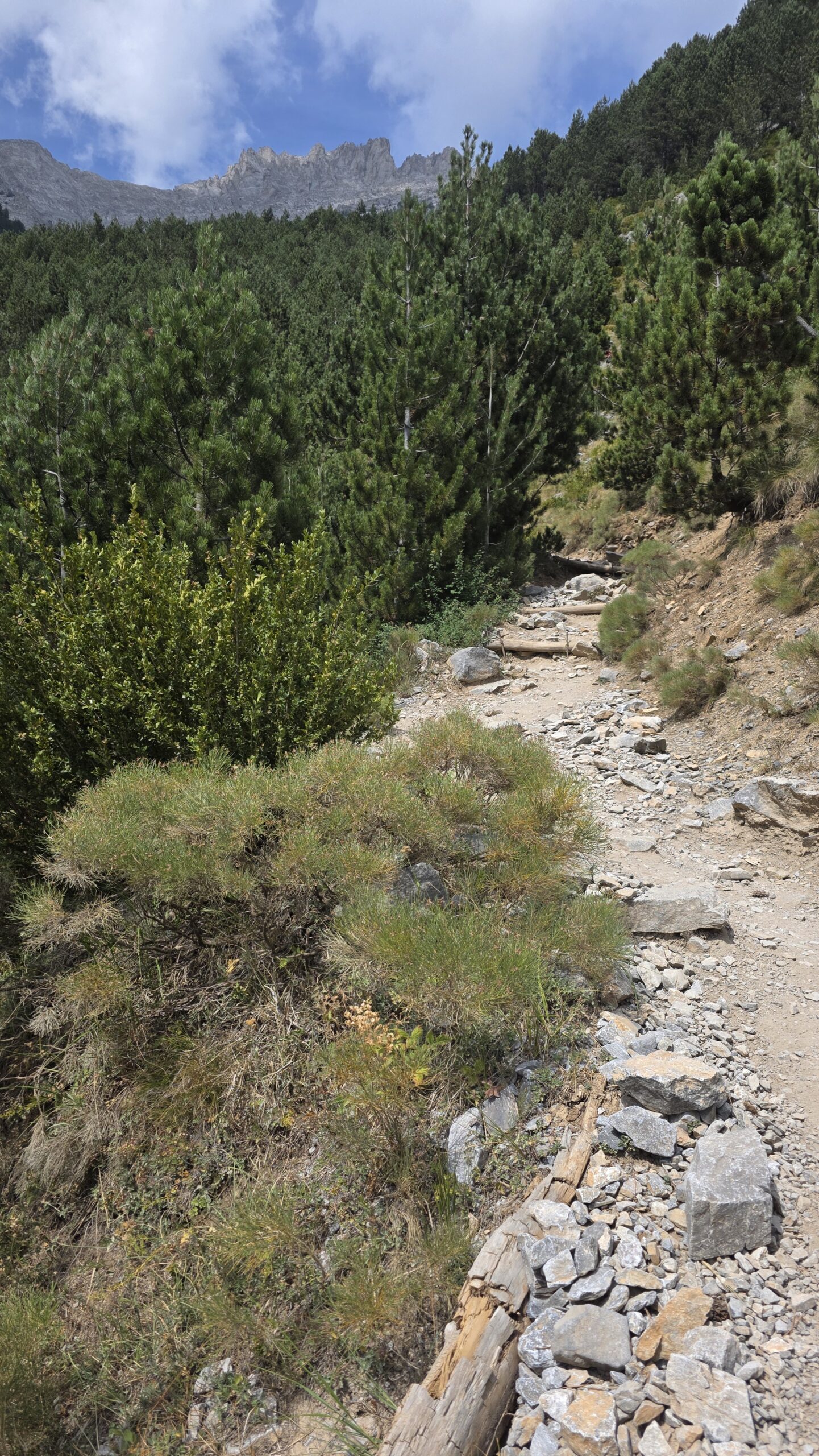
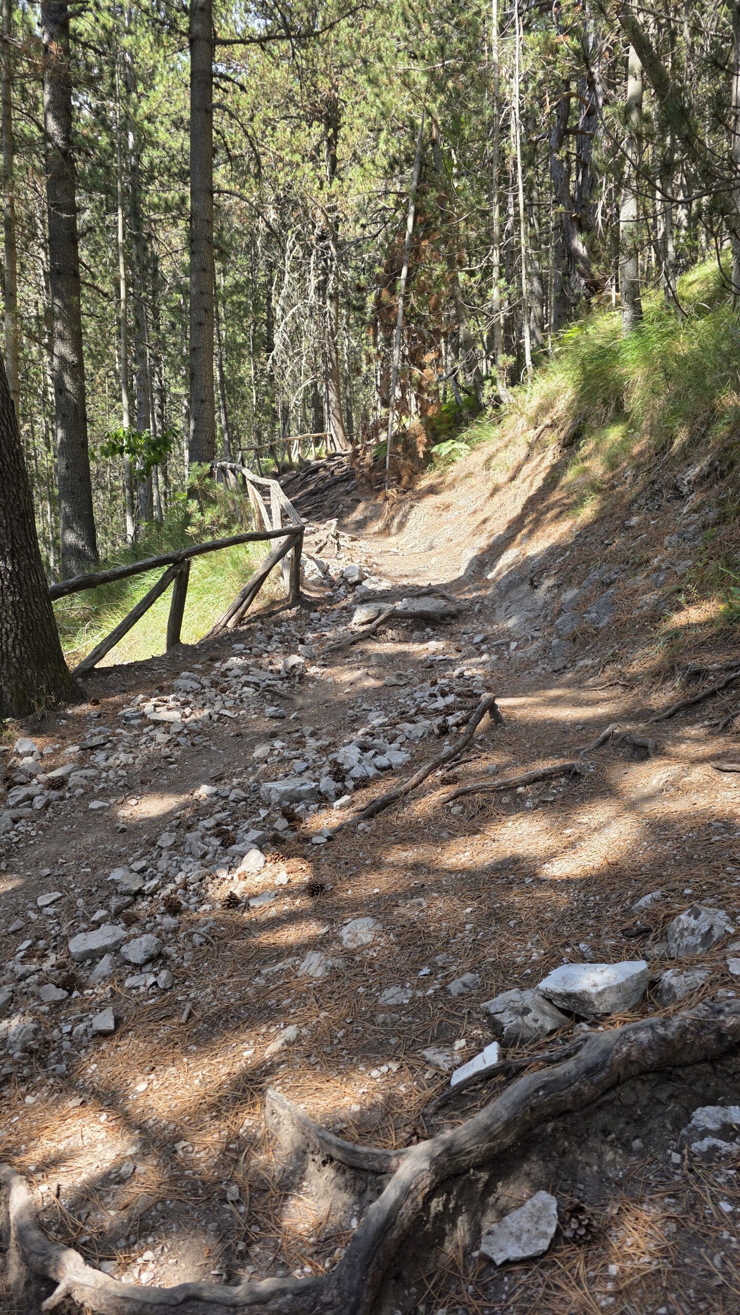
Prionia is the classic road-access start for the E4 approach to Refuge A. The path climbs through forest before becoming more open near the refuge. It is worth experiencing as a walk in its own right, not as an obstacle to complete before the interesting terrain begins.
Read the numbers as an ascent
The refuge FAQ gives roughly 2½–3 hours from Prionia to Refuge A as a general reference. That is not a return-day duration. Your pace, pack, heat and breaks may require longer. The height difference is approximately 1,000 m, so a slow, steady start is useful. Refuge approach and services.
Before leaving the road
Check water, food, layers, navigation and daylight. Confirm any planned refill or refreshment service locally rather than assuming it will be available because an old description mentions a spring or café. Carry what you need to reach the next confirmed supply.
Take the forest seriously
Shade helps, but does not remove the effort of sustained climbing. Keep the group together at junctions, take breaks before people become depleted and watch the condition of the least experienced walker. A night booked at the refuge is a reason to pace the approach well, not to race it.
The refuge is still above you
When the ground opens out, the sun and the distance to the building can feel different from the shaded section. Keep enough water and energy for the final approach. The sight of a roof does not mean the climb is finished.
06 / Spilios Agapitos Refuge A
A night above the valley.
Time to make a better plan.
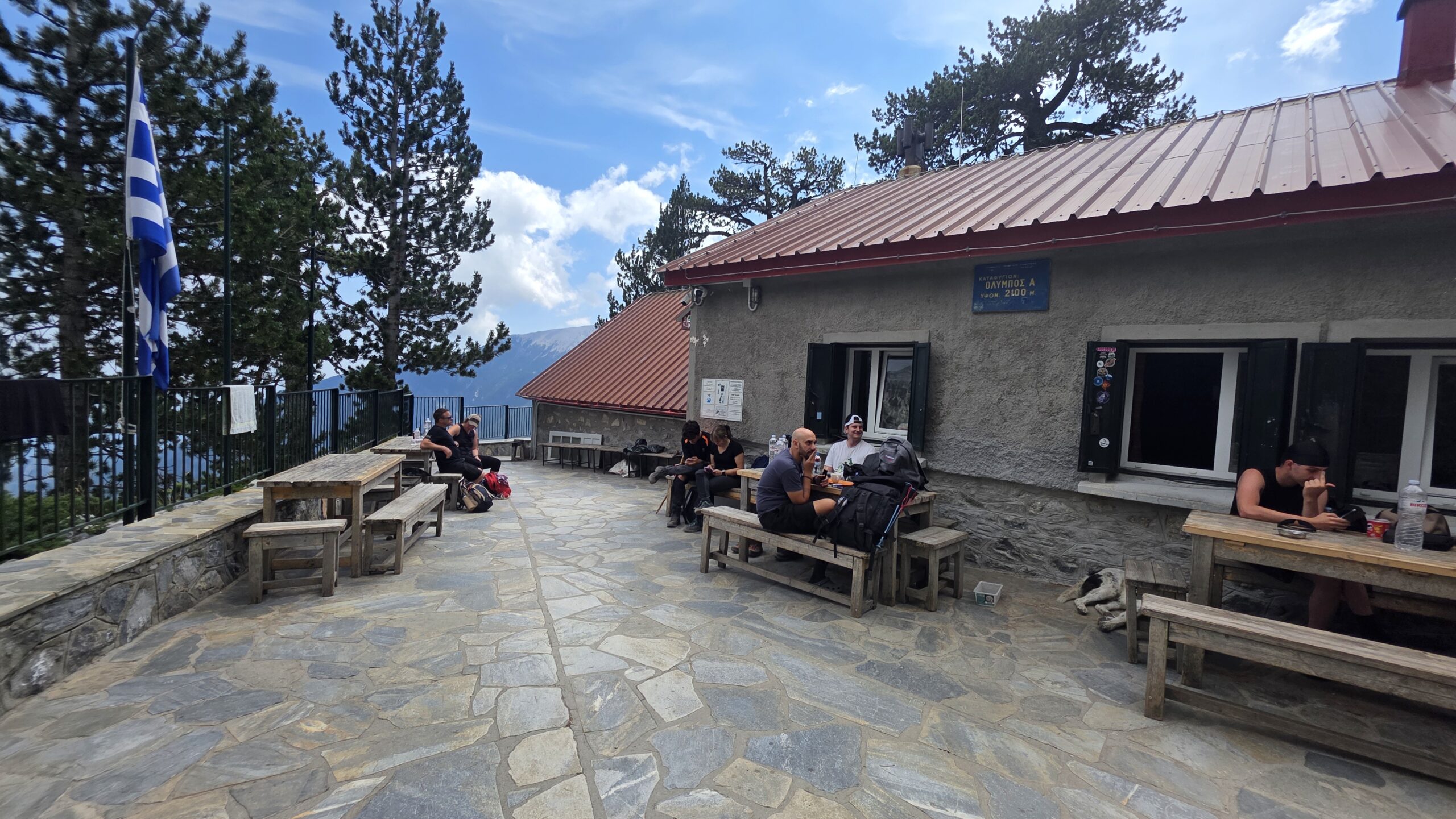
Spilios Agapitos—usually called Refuge A—is the natural overnight stop on this approach. Treat the booking as a real part of the itinerary: confirm a bed, the arrival time and what is included. A mountain refuge needs planning even when its website makes it look welcoming and straightforward.
Operating status is seasonal
On 31 October 2026, the refuge website showed it as closed. The operator describes a May–October season and a winter period with no staff or access to the secured building. Confirm the actual opening and your dates directly; do not assume a winter emergency room will be available. Operator’s seasonal information.
What to bring for the night
The operator asks guests to provide bedding or a sleeping bag, a pillowcase, personal wash items, a torch and clean indoor footwear. It provides blankets but is not a hotel; hot showers should not be expected. Confirm what applies to your booking rather than packing from a room photograph. Current overnight requirements.
Meals and the following morning
Check the menu and tell the host about essential dietary needs before travelling. Clarify what can be obtained for an early departure and what food you should carry independently. Plan lunch and the descent as well as dinner and breakfast. Refuge menu.
Keep a small evening checklist
- Review the actual upper-route conditions and forecast.
- Agree the summit objective and the route back.
- Fill or obtain water as advised by the host.
- Organise the pack before quiet hours.
- Confirm when and where everyone will meet in the morning.
A settled refuge evening is one of the pleasures of Olympus. It also gives you space to choose a different objective if the upper mountain, weather or the group says that is the better day.
07 / Refuge A to Skala
Beyond the trees.
One careful stage at a time.
Above the refuge, the route becomes more open and the ground rockier. The scale changes: the building drops behind you, views widen and wind or cloud can matter more. Keep attention on the path even when the landscape is asking for photographs.
Separate the walking stage from the scramble
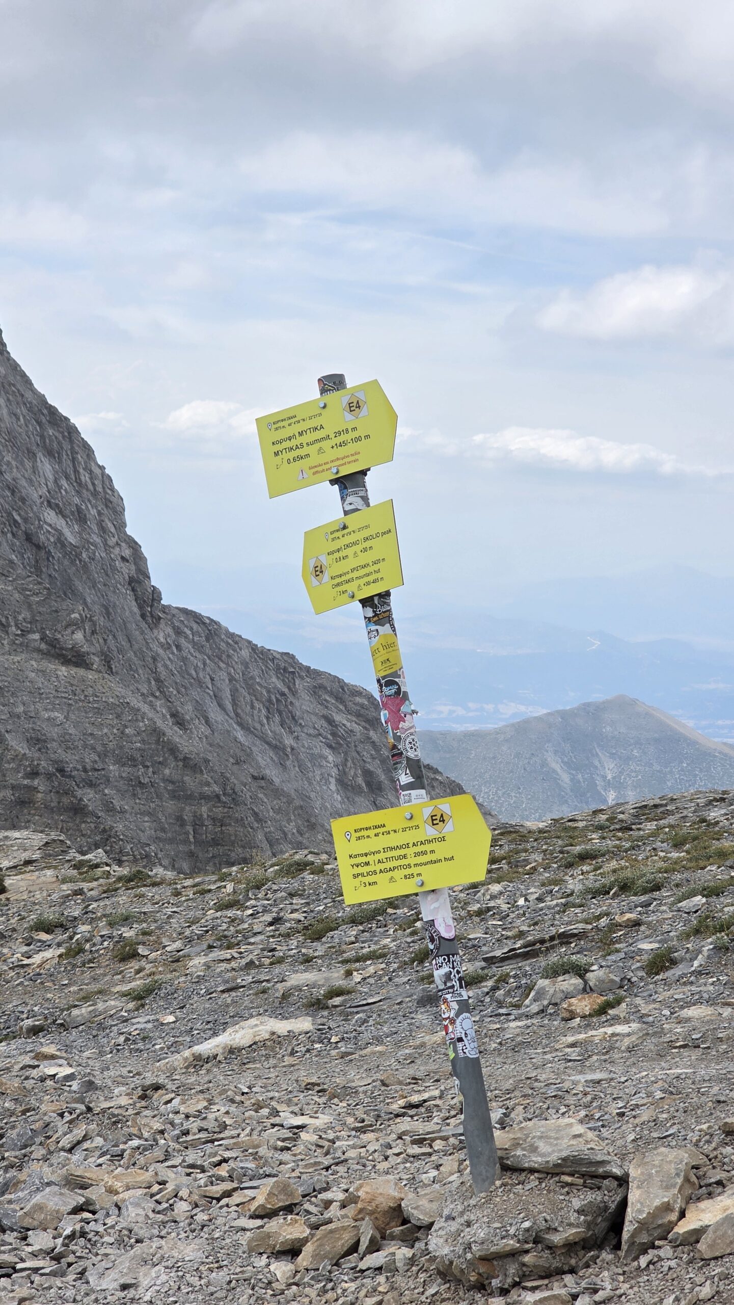
Skala is the decision point for the familiar Mytikas continuation and the Skolio option. Reaching it does not commit you to either. Review the time, footing, visibility and how every person feels before deciding what comes next.
Use times without turning them into promises
The refuge’s upper-route descriptions give approximately three hours for the hut-to-Mytikas itinerary and three hours for the hut-to-Skolio option. These are route references for the ascent, not complete return plans or equal-difficulty claims. Exposure, conditions and group pace can matter much more than the similar numbers. Mytikas reference · Skolio reference.
The first useful turnaround
If the group is already struggling on the walking approach, the final scramble is not a useful test of determination. Shorten the objective while the return is clear. Save energy for the rough ground on the way down; good legs at the start say little about careful movement several hours later.
Carry warm and waterproof layers where they can be reached. A sunny forest morning and a cold upper ridge can be part of the same day. A stop is easier to enjoy when you can put on a layer before getting chilled.
08 / Mytikas & exposure
The final section
deserves its own decision.
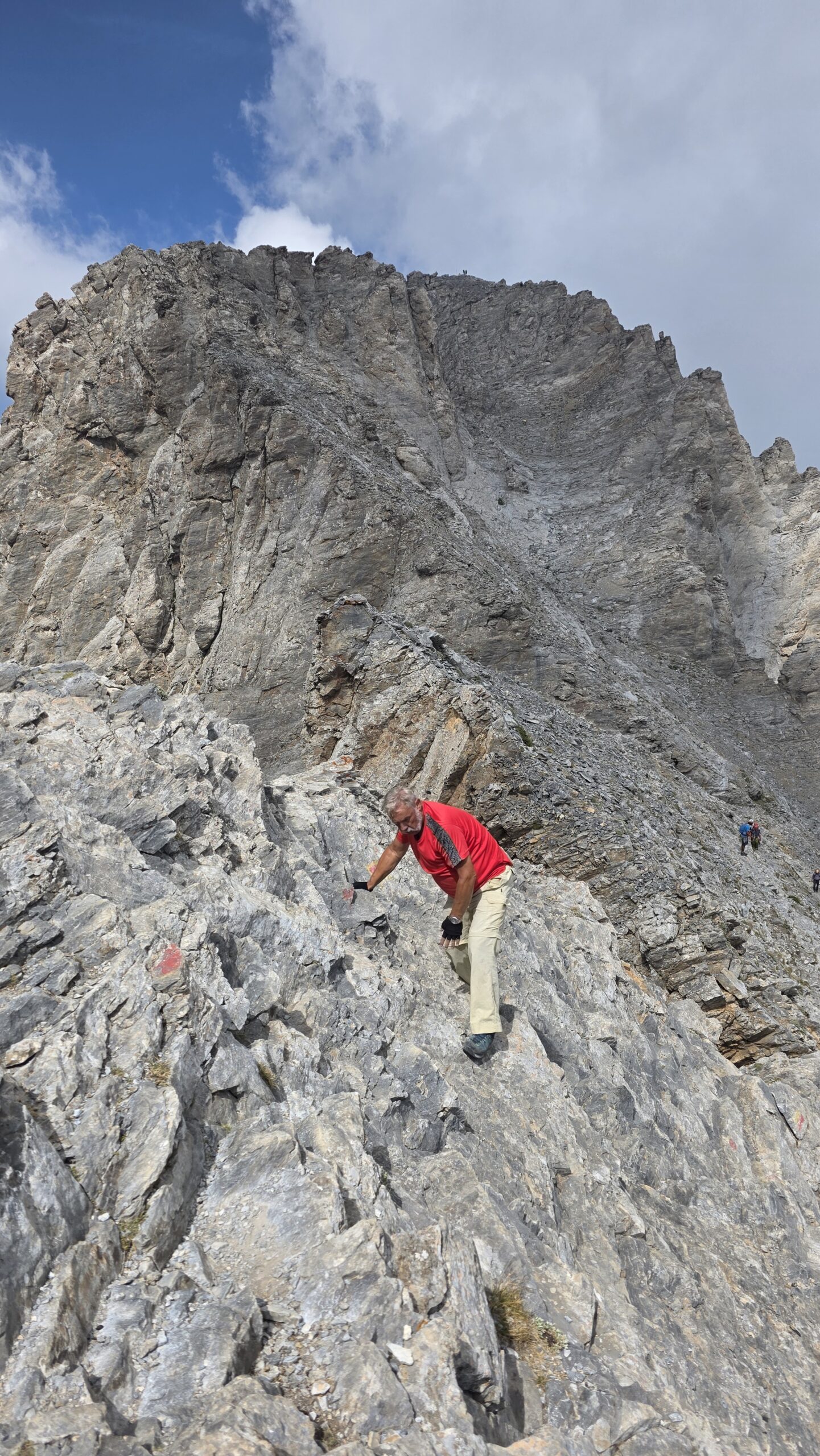
The continuation from Skala towards Mytikas via Kakoskala leaves ordinary mountain walking for exposed scrambling. You use your hands, and a mistake can have serious consequences. The small remaining height difference does not describe the difficulty.
Think about coming back before going forward
Being able to climb a step does not automatically mean you can reverse it confidently when tired, or when cloud reduces visibility. Consider the complete movement problem, including the descent and other people on the route. If that judgement is unfamiliar, make qualified guiding part of the plan.
Equipment and skills belong together
Discuss a climbing helmet and any harness, rope or protection arrangements with the person responsible for the outing. Wearing equipment without knowing how it will be used is not a substitute for a suitable system and competent leadership. This guide does not provide a rope technique or a line-by-line scrambling instruction.
Rockfall and other parties
Choose positions and spacing carefully under competent guidance and remain aware of climbers above and below. The Kakkalos team specifically highlights rockfall-prone terrain beneath the upper couloirs, particularly after heavy rain. A quiet path in a photograph does not describe the traffic or stability you will meet. Upper-mountain context from the Kakkalos team.
Louki is a different route
The Zonaria–Louki approach is not a convenient bypass for a visitor who dislikes Kakoskala. It has its own terrain and hazards. Changing between upper-mountain routes should be a deliberate decision with suitable expertise, not an improvised response to a queue or a difficult step. Separate Louki route information.
Skala or Skolio can be the right finish for your day. Reaching a national high point is one possible experience on Olympus; returning with a day you enjoyed is the more useful measure.
09 / Choosing a mountain guide
Book the person.
Understand the actual outing.
For a first Mytikas visit without established scrambling and downclimbing experience, I would arrange an appropriately qualified mountain guide in advance. Talk about your previous terrain honestly. “I am fit” and “I am comfortable on exposed rock” answer different questions.
Start with credentials and scope
The Hellenic Mountain Guides Association’s member information is a useful starting point. Check who will actually lead the day, their qualification and whether it covers the terrain and conditions in your booking. A general walking tour and an exposed summit ascent are not the same service. HMGA member information.
Ask before paying a deposit
- Which approach and summit route are planned?
- How many clients will that guide lead?
- What experience is required, and how will it be assessed?
- Which technical equipment is supplied, fitted and used?
- What are the meeting point, accommodation and transfer arrangements?
- What happens if weather, fitness or route conditions require a change?
- Are guiding, insurance, hut costs and transport included or separate?
Buy the decision-making, not a summit guarantee
A useful guide must be able to change the plan. Read the cancellation terms and discuss the difference between cancellation before departure and turning around on the mountain. A booking should reduce pressure to continue into unsuitable conditions.
No guide booking is made through this page, and the directory link is not an endorsement of a particular person. Use the conversation and verified credentials to choose a service that matches your trip.
10 / Season & conditions
Choose the conditions.
Then choose the date.
For a first summer-style visit, look for genuinely snow-free ground and a settled mountain forecast. A calendar month does not tell you whether shaded rock holds ice, whether a storm will arrive or whether the intended refuge is operating.
| Conditions | What changes | Planning response |
|---|---|---|
| Dry and snow-free | The usual hiking and scrambling distinctions apply | Choose the objective that matches your experience |
| Wet rock or fresh rain | Footing deteriorates and loose ground deserves extra attention | Reconsider exposed sections and ask about rockfall |
| Snow or ice | The route becomes a different mountaineering problem | Arrange appropriate expertise rather than copying this summer plan |
| Storms, strong wind or thick cloud | Visibility, exposure and escape margins change | Shorten the objective or use the spare day |
| Short daylight or closed refuges | There is less support and less time for delays | Plan independently of summer services |
Match accommodation to the actual season
Confirm the precise opening dates with the refuge. An open reservation form or an old trip report is not proof of staffed accommodation on your dates. If the hut is closed, do not build a plan that depends on entering it.
Read more than the weather icon
Compare wind, precipitation, temperature and visibility at mountain elevation. Look at the forecast period and the webcam timestamp. A clear image below the summit cannot certify dry rock higher up. Mountain weather · Refuge webcam.
My September photographs show one particular day: warm lower down, cloudier and cooler high up. They explain the landscape, not the conditions you will meet.
11 / Plan your days
Give Olympus
two mountain days.
For a first dedicated visit, I would build the trip around a refuge night and leave a weather margin. My fast expedition outing is a diary, not the default itinerary.
Arrival day — Litochoro
Arrive without a summit deadline. Confirm the refuge, guide if booked, transfer to Prionia and return arrangement. Check the mountain forecast and actual route conditions. Buy the food and personal supplies you will need beyond any confirmed meals.
Mountain day one — Prionia to Refuge A
Walk the forest approach at a sustainable pace. The refuge describes roughly three hours for this stage, but your pack, heat, stops and fitness will change it. Leave room to arrive comfortably within the host’s agreed arrival window. Use the afternoon to eat, organise the pack and discuss the upper mountain.
Mountain day two — a chosen summit and the descent
Start according to the forecast and the plan agreed with your host or guide. Skala, Skolio and Mytikas are different objectives. Keep the descent to the refuge and then Prionia in the plan from the beginning. Set checkpoints for the weather and group condition, not only a desired summit time.
A spare day that improves the holiday
Leave flexibility for a changed forecast. Dion, a slower day around Litochoro or time near the coast can make a useful alternative. Read cancellation terms so a change of plan does not become pressure to climb.
The one-day option
Prionia to Mytikas and back is a major outing with around 2,000 m of height gain in the Kakkalos team’s account. It combines sustained effort with consequential upper terrain. It is a deliberate choice for a suitably prepared party, rather than a way to avoid a reservation. Operator’s comparison of one-day and longer outings.
Plateau of the Muses
The Gortsia approach and plateau refuges can support a longer, different journey. Research the whole itinerary, book the actual hut and arrange any summit stage separately. Do not attach Louki to a plateau walking plan merely because a map makes it look close.
12 / Where to stay
A town base.
A mountain night.
| Base | Useful for | Confirm |
|---|---|---|
| Litochoro | Arrival, supplies and a flexible lower base | Check-in, early departure, luggage and Prionia transport |
| Spilios Agapitos / Refuge A | The classic Prionia approach split over two days | Opening, reservation, bedding, meals and arrival time |
| Christos Kakkalos Refuge | A Plateau of the Muses itinerary | Actual dates, beds, access and the complete route |
| Coastal accommodation | A wider regional holiday | Travel time and a mountain-day transfer that really works |
A town room and a refuge bed solve different problems. Staying comfortably by the coast does not remove the approach, while a high refuge booking does not make every summit route suitable.
Book with the actual host
Use the refuge’s own contact details to verify dates, payment terms and your reservation. Save the confirmation offline. Discuss dietary needs, group size and arrival arrangements before travelling. Refuge A reservations · Kakkalos operator information.
Keep the return practical
If leaving luggage at your town accommodation, agree the collection arrangement. If you need a taxi from Prionia, agree a way to manage an earlier or later descent. A tired party at the road end needs a confirmed plan, not an assumption about mobile reception or passing cars.
13 / Costs & calculator
A clear budget.
Room for the unexpected.
Use euros and price the whole journey: travel, town accommodation, a refuge night, food, transfers, any guide and appropriate insurance. The largest differences often come from transport and guiding arrangements rather than the bed.
A dated refuge-bed reference
On 31 October 2026, Refuge A’s published tariff listed €18 for a non-member adult bed, €13 for eligible mountaineering-club members and €10 for non-member children up to 13. Verify eligibility, the current tariff and your booking directly. Food and your other trip costs are separate. Check the operator’s published prices.
Enter mixed accommodation correctly
If you have a hotel night and a refuge night, add their per-person costs and divide by the number of nights before entering the average. Do the same for meals already included in a booking. A whole-room price and a per-bed price are not directly comparable.
Keep a contingency for a changed weather day. Ask whether a guide quote includes equipment, the refuge and transfers before entering those items again. Insurance should cover your intended activity, altitude and relevant rescue arrangements; confirm that with the insurer.
14 / Packing checklist
Pack for the route.
And the return.
A starting checklist for a suitable snow-free outing. Adapt it to the forecast, chosen objective and the advice of your host or guide. Technical equipment for Mytikas is a separate route-specific discussion, not a box that makes scrambling safe.
Water is a plan, not just a bottle
Carry enough for the conditions and a delay, and confirm where safe drinking water can actually be obtained. Do not assume the upper route has a reliable refill or that refuge services will be available outside the confirmed opening period.
Technical equipment
Discuss a helmet, harness and any rope or protection arrangements with the competent person responsible for your Mytikas outing. Confirm fit, supply and how the system will be used. Avoid attaching loose camera equipment to the outside of the pack on exposed ground.
Overnight additions
Check bedding requirements with the refuge and protect dry clothing from rain. Keep the overnight pack manageable without removing essentials needed for the descent. Familiar equipment is easier to use when tired or when the weather changes.
15 / Weather & rescue
Leave a margin.
Keep a way back.
Use meaningful checkpoints
At the refuge and again before committing to exposed terrain, review the forecast, visibility, footing, party condition and remaining descent. Agree who makes the decision and how the group stays together. A summit photograph does not justify continuing after the return margin has gone.
Storms and cloud
Plan to avoid being committed high on exposed ground when thunderstorms threaten. Cloud can remove visual references quickly, while wet rock changes the scramble. If the plan depends on conditions staying perfect beyond the forecast window, choose a smaller objective.
Heat and fire restrictions
The lower approach can feel very different from the upper mountain. Carry appropriate water and sun protection. Check the Civil Protection fire-risk map and actual official access instructions before travelling. A risk category alone does not establish whether your particular trail is closed. Daily fire-risk map · Official warnings.
Emergency: 112
Call 112 if emergency assistance is needed. Give the incident, number of people, location and relevant conditions; follow the operator’s instructions. Save location information offline and keep phone power for communication. Greek Civil Protection’s 112 guidance.
Tell someone your route and expected return, and agree what to do if you fail to check in. Review your insurance before the trip rather than trying to interpret it from the mountain. This article is planning context; it cannot report the current state of a rock step or replace route-specific judgement.
16 / Maps & route files
See the whole mountain.
Carry the detail offline.
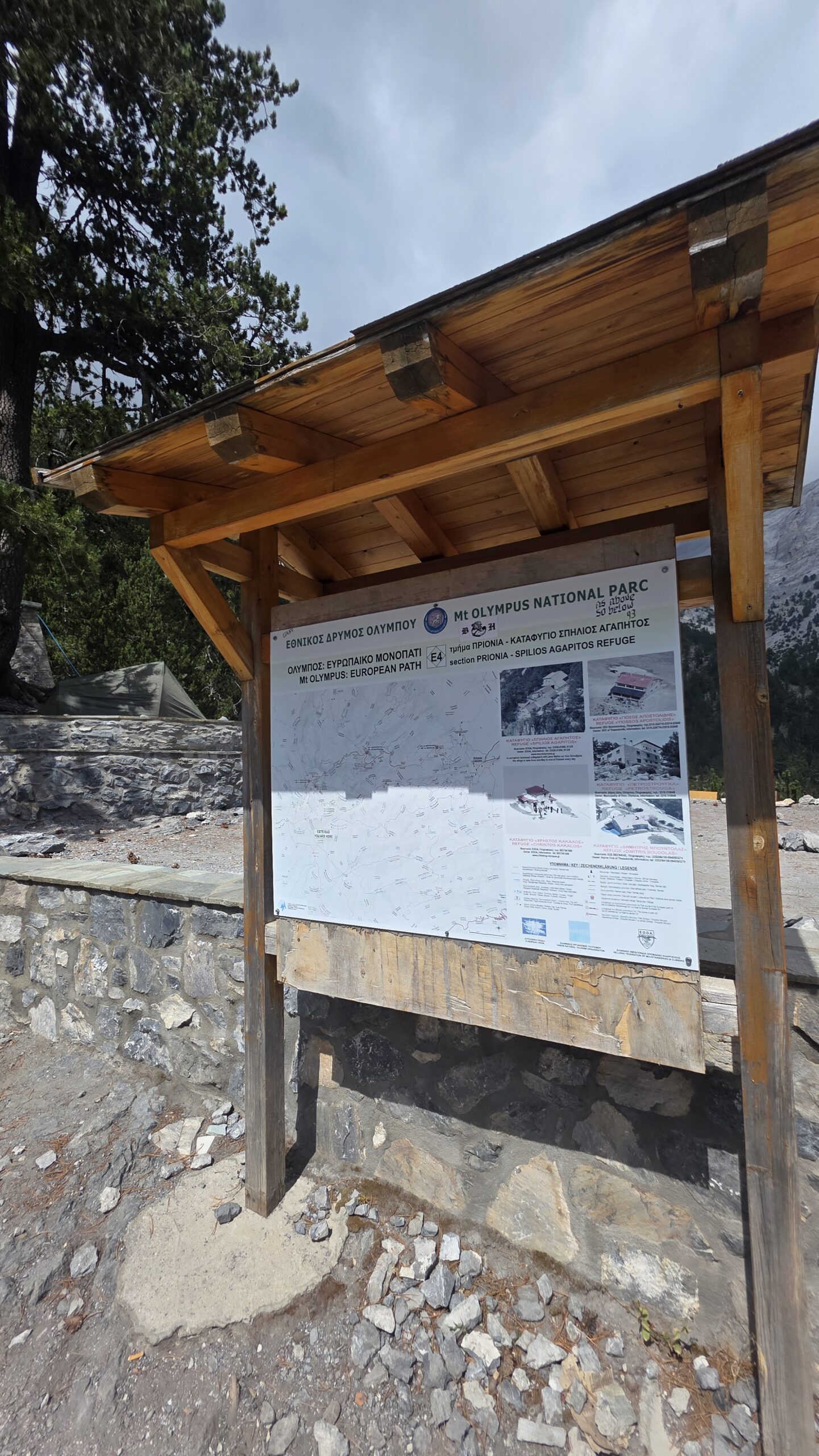
Start with the Olympus National Park trail map PDF and the Refuge A route downloads. Identify your exact approach, refuge, summit option and return before saving a track. A GPX file is a line recorded or prepared at another time; it is not a live safety assessment.
Massif overview centred near Mytikas, not a verified ascent track or live access map. © OpenStreetMap contributors.
Save the practical information together
- Correct start: Prionia or your deliberately chosen alternative.
- Approach, overnight booking and summit objective.
- Guide, refuge and return transport contacts.
- Checkpoints, turnaround decisions and expected return.
- Emergency number and a way to share your location.
The gorge is a separate route decision
The lower Enipeas walk is not interchangeable with starting at Prionia. The refuge’s gorge page carries a damaged-bridge warning. Ask the park about current access, bridges and water crossings on the exact section you intend to use; do not assume an old track proves it passable. Read the gorge and bridge information.
My recorded activity figures later in this guide describe my own outing. They do not certify the line of a downloadable route or tell you the appropriate pace for your group.
17 / Respect the national park
A protected landscape.
A shared responsibility.
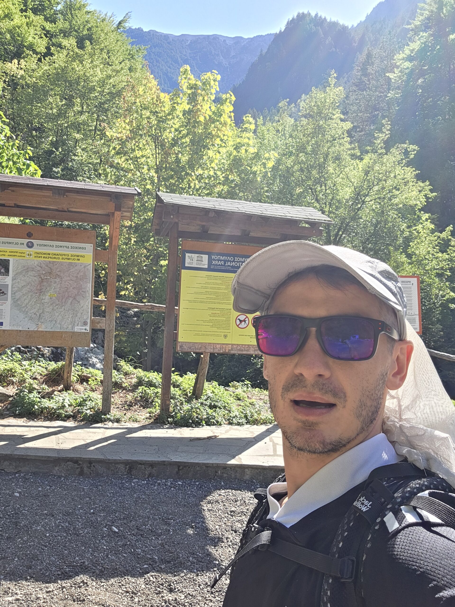
Check current visitor information and access notices through the Olympus management unit. If your plan includes camping, a dog, a drone or an activity beyond the usual walking itinerary, ask about the actual rules before making arrangements. A photograph of somebody doing something is not permission to repeat it. Park management information · Current official contacts.
Leave the path as you found it
Stay on the established route, carry out litter and avoid damaging vegetation for a viewpoint. Keep breaks clear of narrow passages and let others move without pressure. Do not build a new cairn or rearrange the landscape for a photograph.
Plan an authorised overnight stay
Confirm any camping arrangement with the relevant host and park authority. An appealing patch of ground beside a trail is not an automatic campsite. Observe refuge instructions and keep noise low around resting walkers.
18 / Beyond the summit
Ancient Dion.
A slower side of Olympus.
Dion Archaeological Park
The ancient sanctuary landscape gives a different connection to Olympus from a summit ascent. Give the visit its own time and comfortable footwear, especially in warm weather. Check opening hours and the exact ticket directly. Official archaeological park visitor information.
Dion Archaeological Museum
The museum is a separate visitor destination with its own published information. Do not assume the park ticket includes it or that both keep identical hours. Together they can make a coherent cultural day without needing to climb higher. Official museum information.
Litochoro and the coast
Use the town as more than a place to collect a taxi. Leave time for a meal, supplies and a recovery morning. If staying near the sea, build in the actual road transfer for the mountain day rather than treating the coastline and Prionia as the same base.
A lower walk needs its own check
A shorter outing can be an excellent alternative, but choose an appropriate section with current local advice. The full Litochoro–Prionia gorge route is a substantial itinerary, and the bridge warning needs checking. It is not a casual add-on after a Mytikas descent.
The spare day is part of the journey. Giving it a worthwhile purpose makes it easier to wait for better conditions instead of forcing the summit into the wrong forecast.
19 / Photography notes
From forest texture
to cloud and pale rock.
Olympus gives you a natural visual story: the start in the forest, the first open slopes, the refuge terrace and the shift to bare rock. Photograph those transitions. They tell the viewer more about the day than a sequence of summit portraits alone.
Keep the camera out of the movement problem
On exposed ground, put the camera away when you need your hands and full attention. Stop only in a suitable place where you do not block others. A photograph of a difficult step is not worth making the step harder for the person taking it.
Work with the cloud
Cloud can hide the panorama and still produce a memorable image: a person against mist, a brief outline of a ridge or the texture of the summit stone. Accept the view you have rather than waiting until the descent becomes rushed.
My aerial photograph is part of the historical diary. It does not establish current permission to fly. Check the applicable aviation and protected-area rules for your intended location and date before bringing a drone into the plan.
20 / My September climb
14:10.
On Greece’s highest point.
3 September 2025. After Velika Rudoka, the expedition brought me to Olympus.
I had stayed in Gevgelija, in North Macedonia, before continuing to Prionia. It was already late morning when my mountain day began. The lower approach was warm and bright, with forest around the trail and the upper mountain still ahead.
I passed Spilios Agapitos, paused for food and water, then continued higher. The landscape opened into rock. The final continuation towards Mytikas demanded more attention than its size on the map might suggest: this was no longer simply the same walk with a little more height.
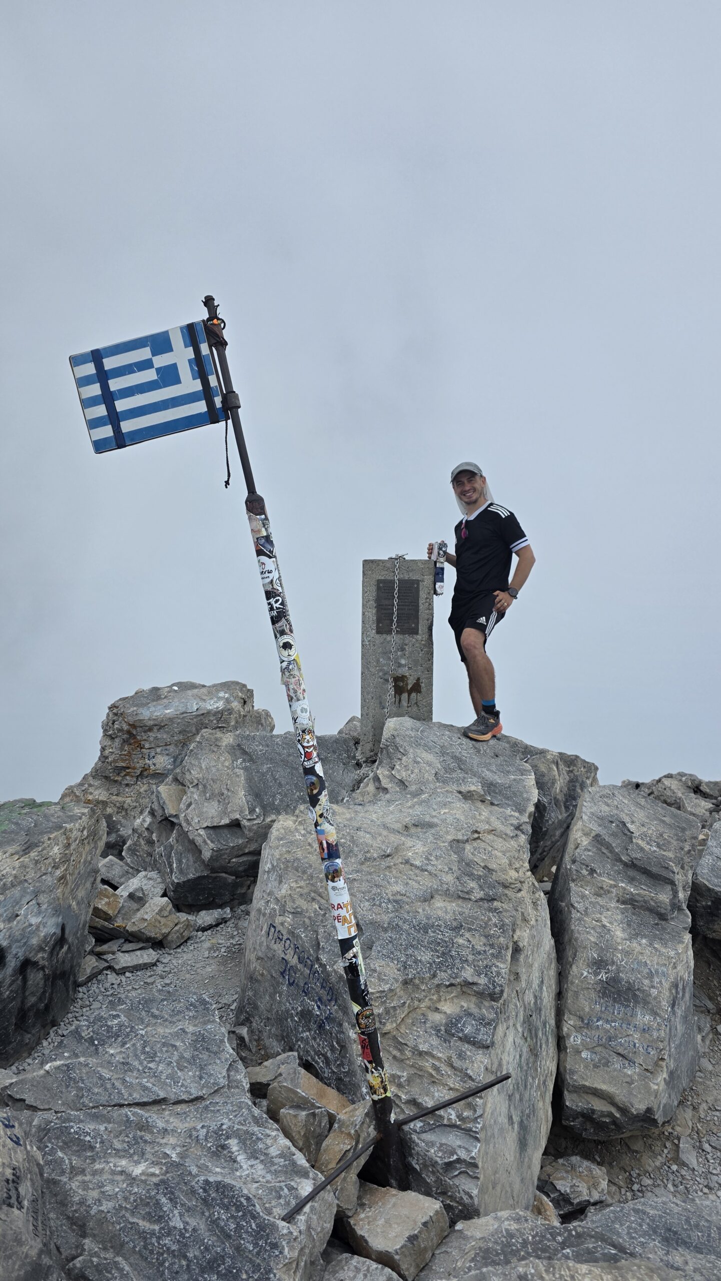
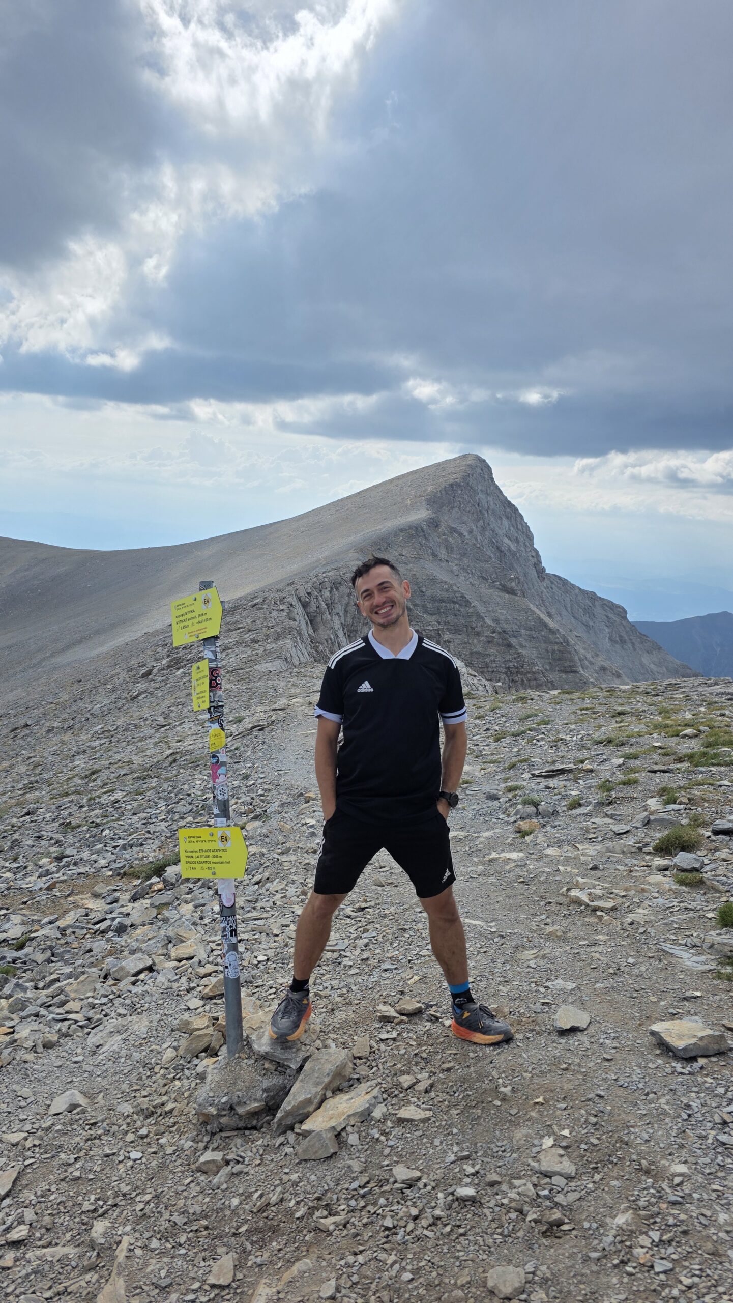
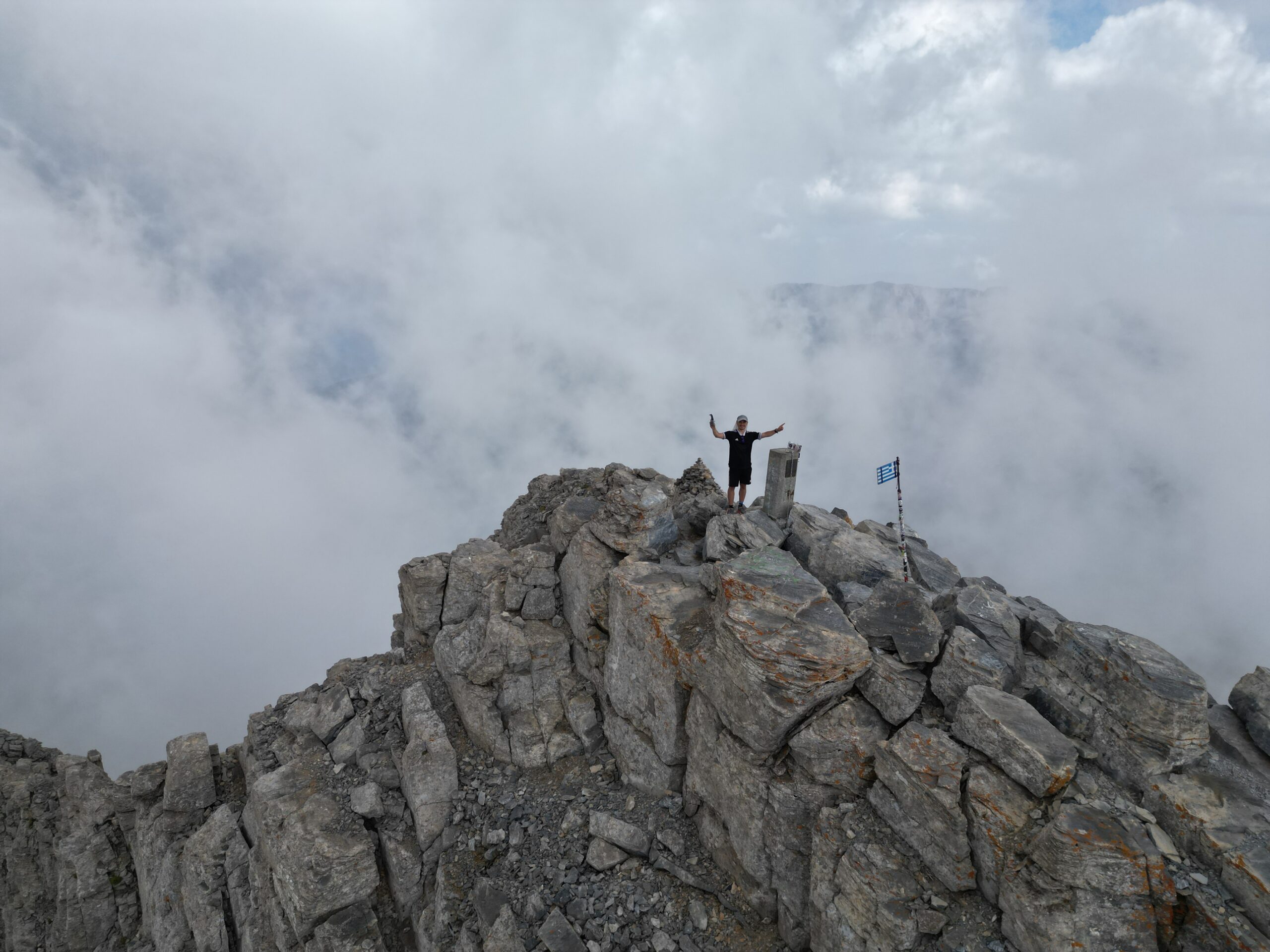
I reached Mytikas at 14:10. Cloud and cool air had replaced the warmth below. The flag, pale rock and mist made the moment feel very different from the forest start.
My activity image records 17.85 km, 2,011 m of ascent, 4:55:44 moving time and 6:57:51 elapsed. The diary places my return to Prionia around 17:00. These are historical expedition records, not a recommended schedule, a verified standard route length or a target pace.
I was moving quickly through countries and mountains. Looking back as a travel guide, I would give a first Olympus visit more space: time at the refuge, time to choose the right summit and a margin for the weather. The mountain has enough character to deserve that.
21 / Questions answered
The useful questions.
Is Olympus the same as Mytikas?
Olympus is the massif. Mytikas is its highest summit. Skala, Skolio and Stefani are different peaks or objectives.
How high is Mytikas?
The park trail map uses 2,918 m; Visit Greece displays 2,917 m. This guide uses about 2,918 m without presenting it as a new measurement.
Is the usual Mytikas route just a hike?
No. The continuation from Skala via Kakoskala involves exposed scrambling and needs appropriate experience, equipment and judgement, including for the descent.
Can I hike high without climbing Mytikas?
Skala and Skolio are alternative objectives in appropriate conditions. They still require mountain fitness, navigation and a plan for the full return.
Do I need a mountain guide?
For Mytikas without established exposed scrambling and downclimbing experience, arrange an appropriately qualified guide. Discuss your route and actual experience before booking.
Is a helmet enough for Mytikas?
No piece of equipment replaces route judgement or the skills to use an appropriate protection system. Discuss the complete plan with the competent person leading the outing.
Where does the classic approach start?
Prionia, at about 1,100 m, is the familiar road start for Refuge A. Starting lower in the Enipeas valley creates a different and longer itinerary.
How long is Prionia to Refuge A?
The operator gives about three hours as a reference, with real variation. Adjust for your group, pack, heat and stops, and arrive within the agreed booking window.
Can I do Mytikas in one day?
It is a major outing with roughly 2,000 m of ascent and a demanding upper section. A refuge-based plan gives a first dedicated visit more room. My fast diary is not a default timetable.
Is Refuge A open in winter?
The operator describes seasonal opening and a secured winter closure. Do not assume staff, services or an accessible winter room; confirm dates directly.
How much is a refuge bed?
The displayed tariff checked on 31 October 2026 was €18 for a non-member adult bed, with other eligibility categories. Verify your current price and reservation with the host.
Is Louki an easier alternative to Kakoskala?
Do not treat it as a casual bypass. It is a separate route with its own climbing terrain and rockfall considerations.
Can I use the Enipeas gorge approach?
Check the exact section with the park first. The refuge’s route page carries a damaged-bridge warning; a historical track cannot confirm current crossings.
Can I take a bus all the way to Prionia?
Do not assume that regional services provide the mountain road transfer. Check the actual KTEL journey and arrange the final transfer and return separately.
What number should I call in an emergency?
Call 112 in an emergency and follow the operator’s instructions. Have your location, party information and incident details ready.
Is this a winter ascent guide?
No. The main itinerary concerns suitable snow-free conditions. Snow, ice and winter hazards require a different route assessment, equipment and skills.
22 / Useful links & sources
Your Olympus planning desk.
Research checked on 31 October 2026. Photographs and personal activity figures are from 3 September 2025. Published tariffs, refuge status and transport information are dated references, not live availability.
Use NECCA for park access, the actual refuge host for bookings and route context, the professional association to check guiding credentials, and operators for transport. Confirm the exact date, service and route you intend to use.
Mountain, mythology and regional context
The current management unit and links to park information
Find the Olympus unit for current access and visitor enquiries
The mountain’s trail network; not a live conditions report
Published uphill reference; distinguish it from a complete return day
Upper approach and the change to exposed scrambling
A different summit objective, without the Mytikas scramble
A separate upper-mountain route; not a casual shortcut
The scale of a one-day ascent and rockfall context
Confirm the current gorge route and bridge condition before walking
Dated bed prices, visitor facilities and actual operating status
Bedding, personal items and indoor requirements
Seasonal opening and winter closure information
Check current food choices and prices directly
Confirm dates, arrival, meals and booking conditions with the host
GPX files for specific routes; check conditions before using any track
Compare the relevant mountain elevation and forecast period
A dated visual reference, not proof of conditions on the summit route
Plateau of the Muses accommodation and reservation contacts
A starting point for checking the person leading your intended route
Date-specific local bus planning and operator contacts
Regional connections; check the actual itinerary for your date
Verify actual rail services and the onward transfer
Emergency communication and location information
Fire-risk information; also check any actual access restrictions
Current warnings and official instructions
A separate cultural visit with current hours and tickets
Museum information; its hours and ticket are a separate check