
01 / Start here
Start here.
Yr Wyddfa, also known as Snowdon, is Wales’s highest mountain at 1,085 m. Eryri National Park grades the Rhyd Ddu Path hard and strenuous; its official there-and-back route is 12 km with a suggested six hours. Official route.


02 / Choose your route
Choose your route.
Rhyd Ddu climbs the western side and has a rocky, exposed upper section. Llanberis is more gradual but still strenuous; Pyg, Miners, Watkin and Snowdon Ranger each have different terrain and logistics. Compare routes.
03 / Start at Rhyd Ddu
Start at Rhyd Ddu.
The official route starts at Rhyd Ddu car park off the A4085. Check current parking and bus arrangements before your visit and use the park authority map. Route information.
04 / Lower approach
Lower approach.
From the start, the route follows an old quarry track before rising more steeply over rough and rocky ground. Use the official route description and map for the junctions. Rhyd Ddu route.


05 / Llechog and Bwlch Main
Llechog and Bwlch Main.
The higher route reaches Llechog and continues toward Bwlch Main, with narrow rocky sections and steep slopes. Strong wind, ice or poor visibility can make the exposed ground unsafe; turn back if unsure.
06 / The summit
The summit.
The final climb reaches the summit area, which can be crowded. Expect colder, windier conditions than the valley and avoid assuming visibility will be good.

07 / Descent
Descent.
Plan to retrace your route unless you have researched a different descent and transport. Identify the Rhyd Ddu junction carefully before leaving the summit, particularly in cloud.
08 / Llanberis and other routes
Llanberis and other routes.
Eryri describes Llanberis as 14.5 km return and around seven hours, with a gradual but still hard ascent. Pyg and Miners start near Pen y Pass and have their own hazards and parking constraints. Llanberis Path.
09 / Crib Goch is different
Crib Goch is different.
Crib Goch is an exposed technical ridge, not an ordinary variation for a first summit hike. Do not accidentally follow it while navigating other routes; research it separately if appropriately experienced.
10 / Railway and summit facilities
Railway and summit facilities.
Snowdon Mountain Railway and summit facilities operate under their own schedules and conditions. Do not rely on an unbooked train for the descent and never walk on the railway tracks. Railway safety.
11 / Getting to Rhyd Ddu
Getting to Rhyd Ddu.
The park describes Sherpa’r Wyddfa connections to Rhyd Ddu from Caernarfon and, with a change, from Porthmadog. Check current timetables and the return service. Public transport.
12 / Parking
Parking.
Rhyd Ddu parking can fill early in busy seasons. Check current charges, use a legal space and consider the bus; do not block local roads or driveways. Park advice.
13 / Where to stay
Where to stay.
Rhyd Ddu, Beddgelert, Caernarfon and nearby communities offer different bases. Compare transport to your actual trailhead and check accommodation terms and parking.
14 / Explore Eryri
Explore Eryri.
Give yourself time beyond the summit: explore villages, woodland and lower-level walks that match the weather. Choose a separate route from the park authority and check transport.
15 / Mountain weather
Mountain weather.
Check the mountain forecast for wind, rain, cloud base, visibility and temperature, not just the forecast in town. Conditions can change rapidly; postpone or turn back if needed. Met Office mountain forecasts.
16 / Season and winter
Season and winter.
Longer summer daylight can help, but rain and cold remain possible. Snow and ice require additional winter skills and equipment; choose a different objective if your party is not prepared.
17 / Experience and fitness
Experience and fitness.
A popular mountain is still a strenuous day out. Choose a route for the least experienced member, build hill fitness, and practise using a map and compass before relying on them in cloud.
19 / What to pack
What to pack.
Take waterproofs, warm layers, appropriate footwear, food, water, a headtorch, first aid, an emergency shelter, navigation and spare phone power. Adjust equipment for conditions and the experience of your party.
20 / Food and water
Food and water.
Carry enough food and water for the full walk and a reserve for delays. Do not assume summit services are open or that untreated stream water is safe.
21 / When to turn back
When to turn back.
Decide your turnaround time before setting out and reassess if the weather, pace, visibility or health of anyone in the group deteriorates. Reaching the top is only half the journey.
22 / Walking with dogs
Walking with dogs.
Check local access rules, use a lead around livestock and wildlife, and consider steep ground, weather and the ability of your dog. Never assume a scrambling route is suitable for a dog.
23 / Families and accessibility
Families and accessibility.
Assess the full route for every person in your group, including the descent, weather and daylight. Rough paths and steep terrain limit wheelchair and pushchair access; consult the land manager for alternatives.
24 / Emergency plan
Emergency plan.
Call 999 or 112, ask for Police and then Mountain Rescue, and give your location and details of the incident. Keep the casualty warm and follow instructions; signal and rescue response may be limited. Mountain rescue advice.
25 / Care for the landscape
Care for the landscape.
Keep to established paths where safe, close gates, respect livestock and other visitors, and take all litter home. Avoid shortcuts that damage fragile mountain vegetation.
26 / Photography
Photography.
Weather and visibility change quickly. Keep your camera secure in wind and rain, protect it from moisture, and never step off a safe path for a photograph.
27 / A mountain day
A mountain day.
Allow time for your chosen route, breaks, navigation and the return. Keep a spare day or a lower-level alternative in case the mountain forecast is unsuitable.
28 / Costs and budget
Costs and budget.
Budget for travel, accommodation, parking, food and any transport. The calculator below uses your own current prices in pounds, with no live fares or prices implied.
28 / Saved checklist
Prepare for a mountain day.
Saved only in this browser. Rhyd Ddu is a hard mountain route with steep, exposed sections. Check the mountain forecast and ground conditions; allow ample time and carry full hillwalking equipment.
29 / Cost calculator
Use your own quotes.
Plan in pounds sterling.
Enter your own current prices in GBP. Vehicle and main travel are shared; the other amounts are per person. Include any park, guide and transfer quotes under the appropriate fields. Blank entries count as zero.
My story, FAQ & sources
Rain and a race against the clock.
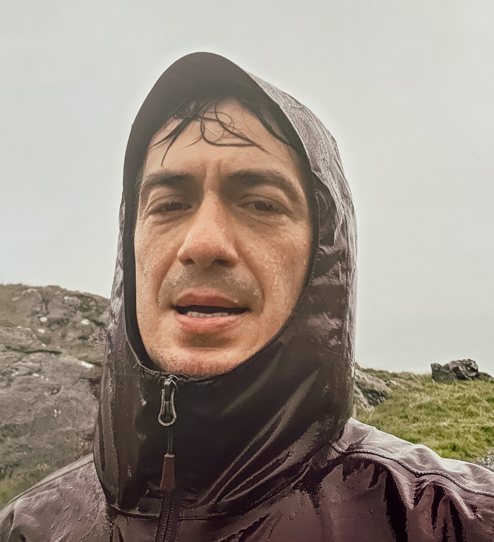
After Scafell Pike I drove to Wales and slept in the car at Rhyd Ddu. In the morning, heavy rain seemed to end my plans.
I began driving toward Manchester, but about five kilometres from the mountain the rain stopped. I turned around, took only my camera and phone, and set off on the Rhyd Ddu Path with the hire-car return on my mind.
I reached the summit in 1 hour 15 minutes. The wind and rain were fierce and visibility was almost zero. I ran down and later returned the car at 11:00. My confirmed 2 hours 15 minutes covers the ascent and descent only, not the drive.
That hurried trip with minimal equipment is my personal history, not a safe plan: allow much longer, carry proper gear and turn back if conditions become unsafe.
Frequently asked questions
What is Snowdon called in Welsh?
Yr Wyddfa.
How high is it?
1,085 m.
How long is the Rhyd Ddu Path?
The national park lists 12 km return and around six hours.
Is Rhyd Ddu easy?
No. Eryri grades it hard and strenuous, with exposed rocky sections.
Where does the path start?
At Rhyd Ddu car park off the A4085.
Can I take a bus to Rhyd Ddu?
Sherpa’r Wyddfa serves the area; check current routes and return times.
Is Llanberis easier?
It is more gradual but remains a strenuous mountain route.
Can I use the railway as my descent?
Do not rely on an unbooked train; check the operator and have a walking descent plan.
May I walk on the railway?
No. Stay off the railway tracks.
Is Crib Goch part of the standard Rhyd Ddu Path?
No. It is an exposed technical ridge and a distinct objective.
Can I hike in winter?
Only with suitable winter skills, equipment and conditions.
Is the summit café always open?
No. Check the operator before relying on facilities.
What should I carry?
Waterproofs, warm layers, navigation, food, water, headtorch and emergency supplies.
How long did Adrian take?
He confirmed 2 hours 15 minutes for the ascent and descent; this is not a recommended schedule.
What if the weather worsens?
Turn back if the route or conditions become unsafe.
How do I call mountain rescue?
Call 999 or 112 and ask for Police and Mountain Rescue.
Sources and current information
Research checked 3 November 2026. Conditions, access and prices can change.
- Eryri National Park: Rhyd Ddu Path ↗ — Official route, map and difficulty
- Eryri: choosing a path ↗ — Comparison of the main routes
- Eryri: getting to Yr Wyddfa ↗ — Bus and parking information
- Eryri: Llanberis Path ↗ — Llanberis route and railway safety
- Met Office: calling mountain rescue ↗ — Emergency planning and mountain rescue
- Met Office: mountain forecasts ↗ — Regional mountain weather forecasts