
01 / Start here
Start here.
Slieve Donard is Northern Ireland’s highest mountain. The National Trust gives its height as 852 m and describes the Glen River approach from Newcastle as a strenuous climb. National Trust.

02 / Choose the Glen River
Choose the Glen River.
The Glen River route begins at Donard Park in Newcastle, climbs through woodland and open mountain terrain to the Donard–Commedagh saddle, then continues toward the summit. Check the current route and conditions. National Trust information.
03 / Donard Park and woodland
Donard Park and woodland.
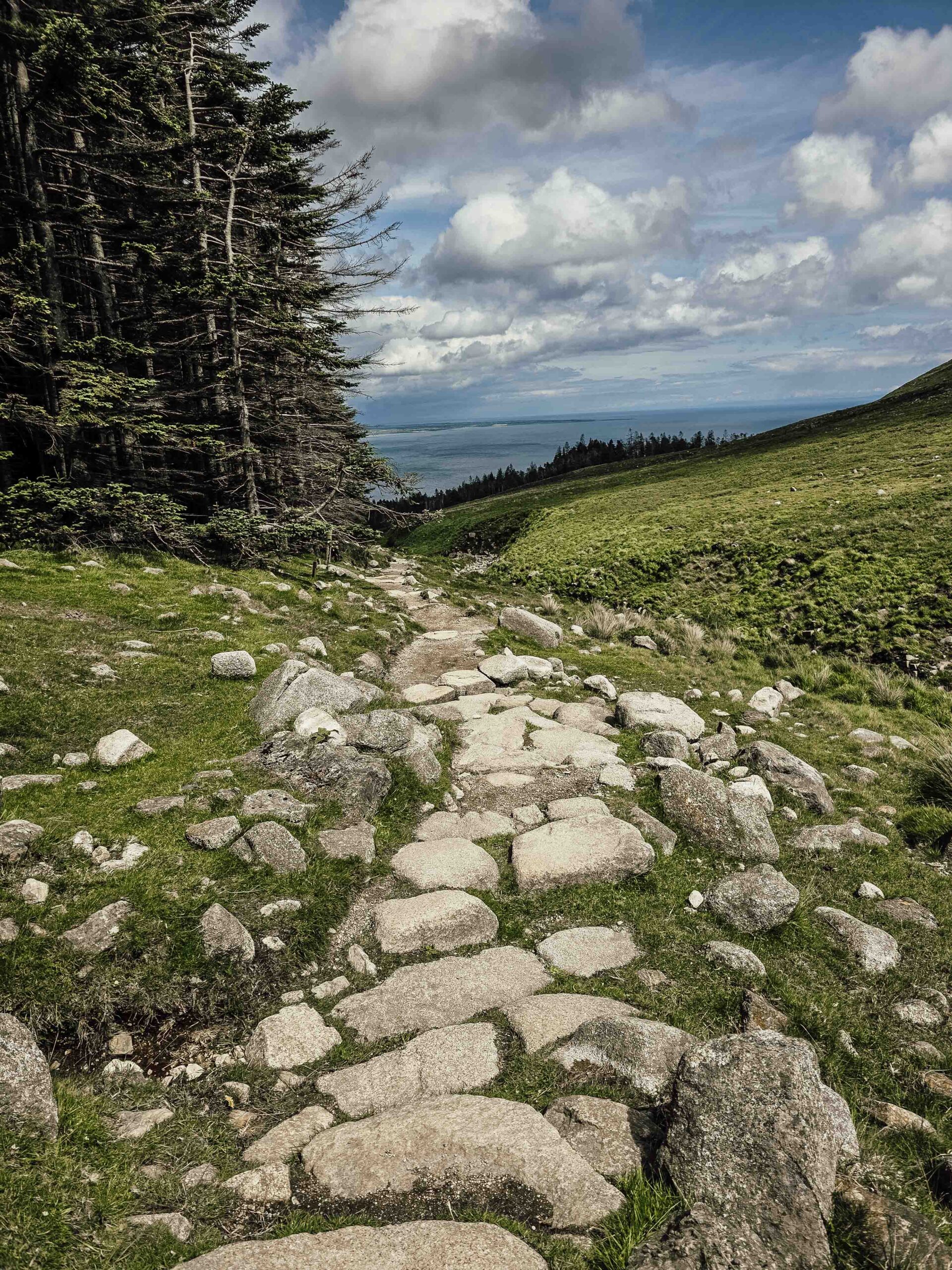
From Donard Park follow the Glen River through the trees toward the mountain foothills. Surfaces can be wet and uneven; use current local signs and a map.
04 / Along the Glen River
Along the Glen River.
The path rises beside the river before the valley opens up. Rain can change water levels and make rock slippery; avoid unsafe crossings and reassess if conditions deteriorate.
05 / The saddle
The saddle.
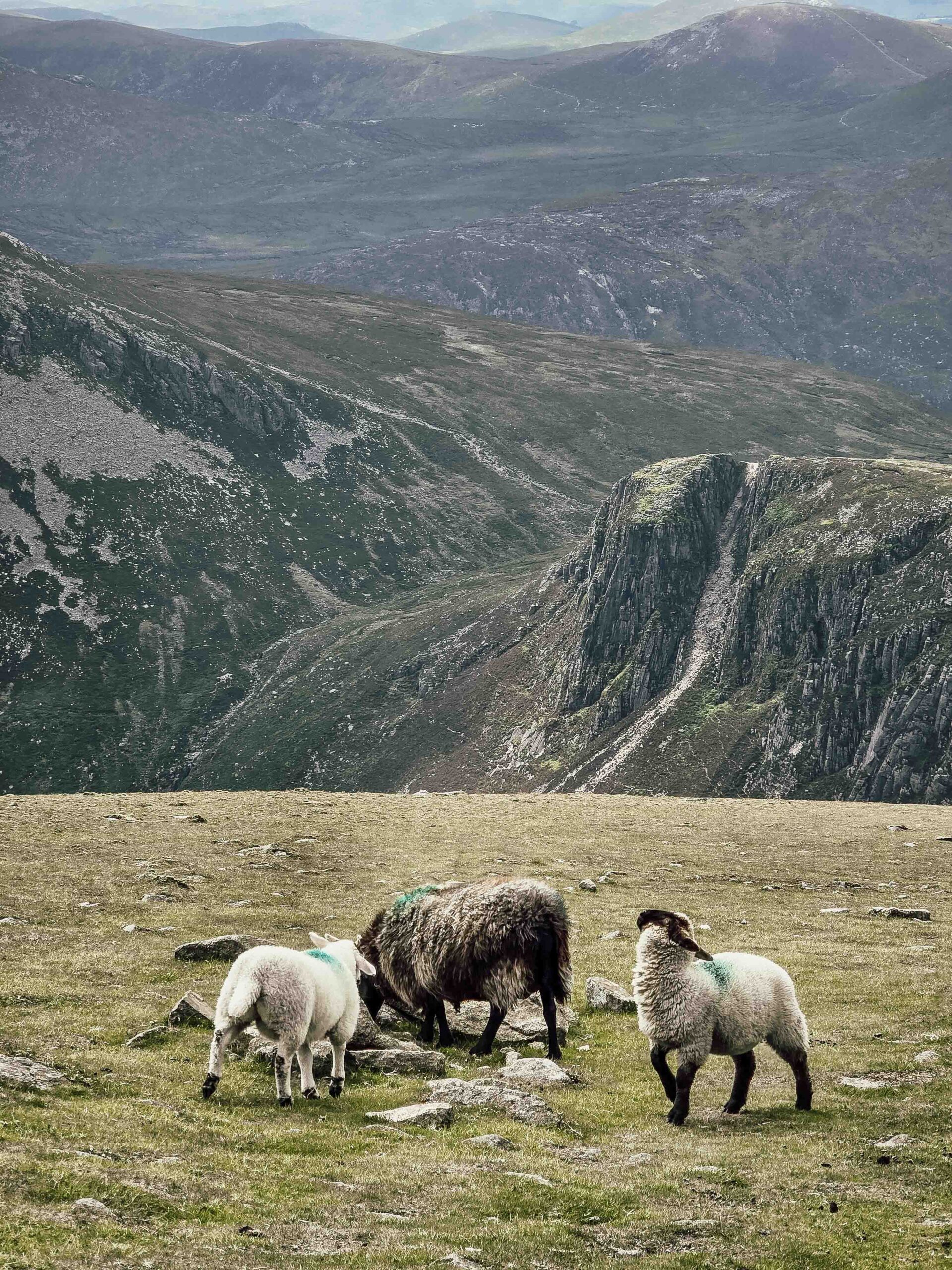
The Glen River Path leads toward the col between Donard and Commedagh and the Mourne Wall. Stay on the established route and consult a map at junctions. The Mournes.
06 / Mourne Wall and summit
Mourne Wall and summit.
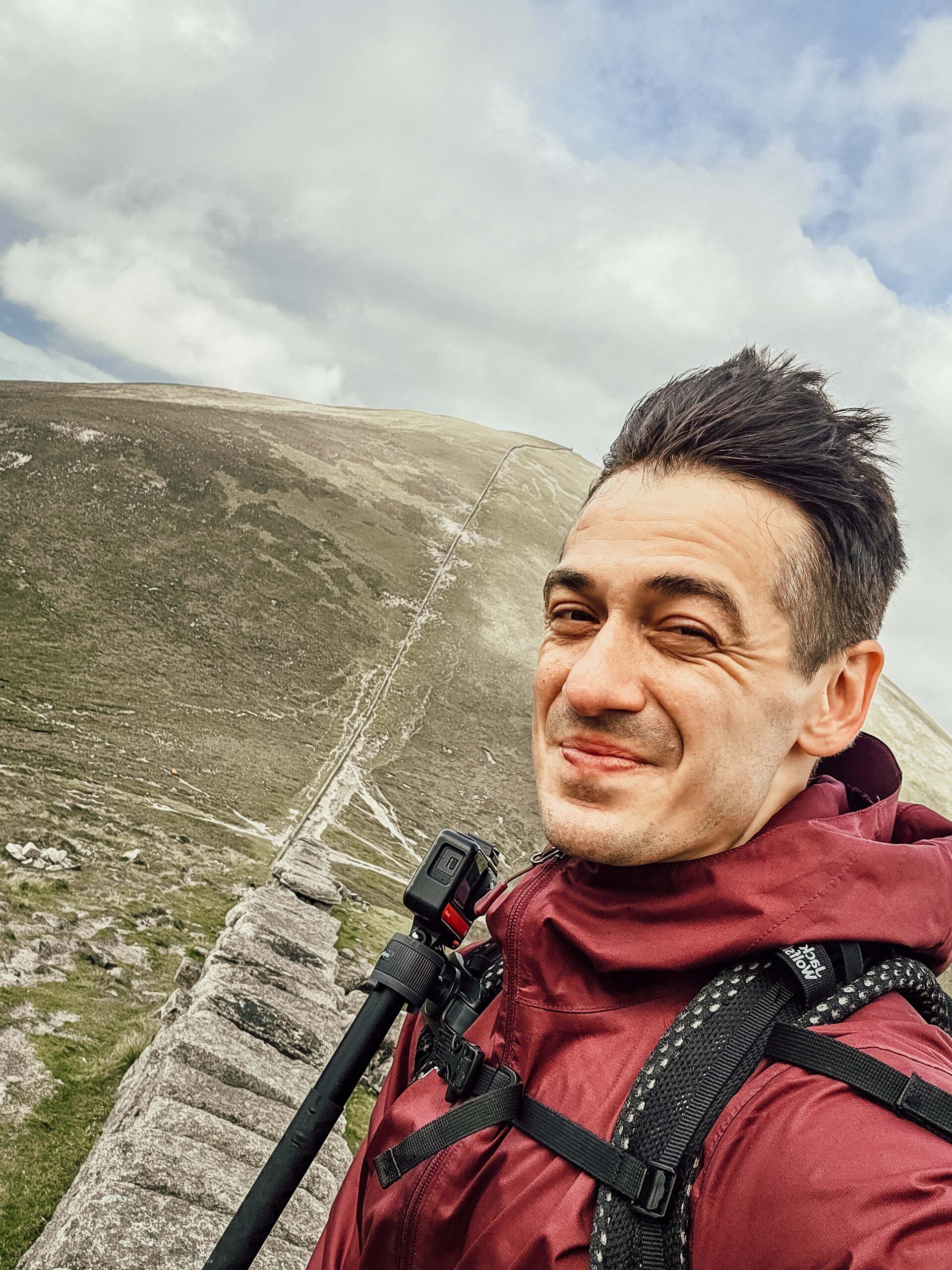
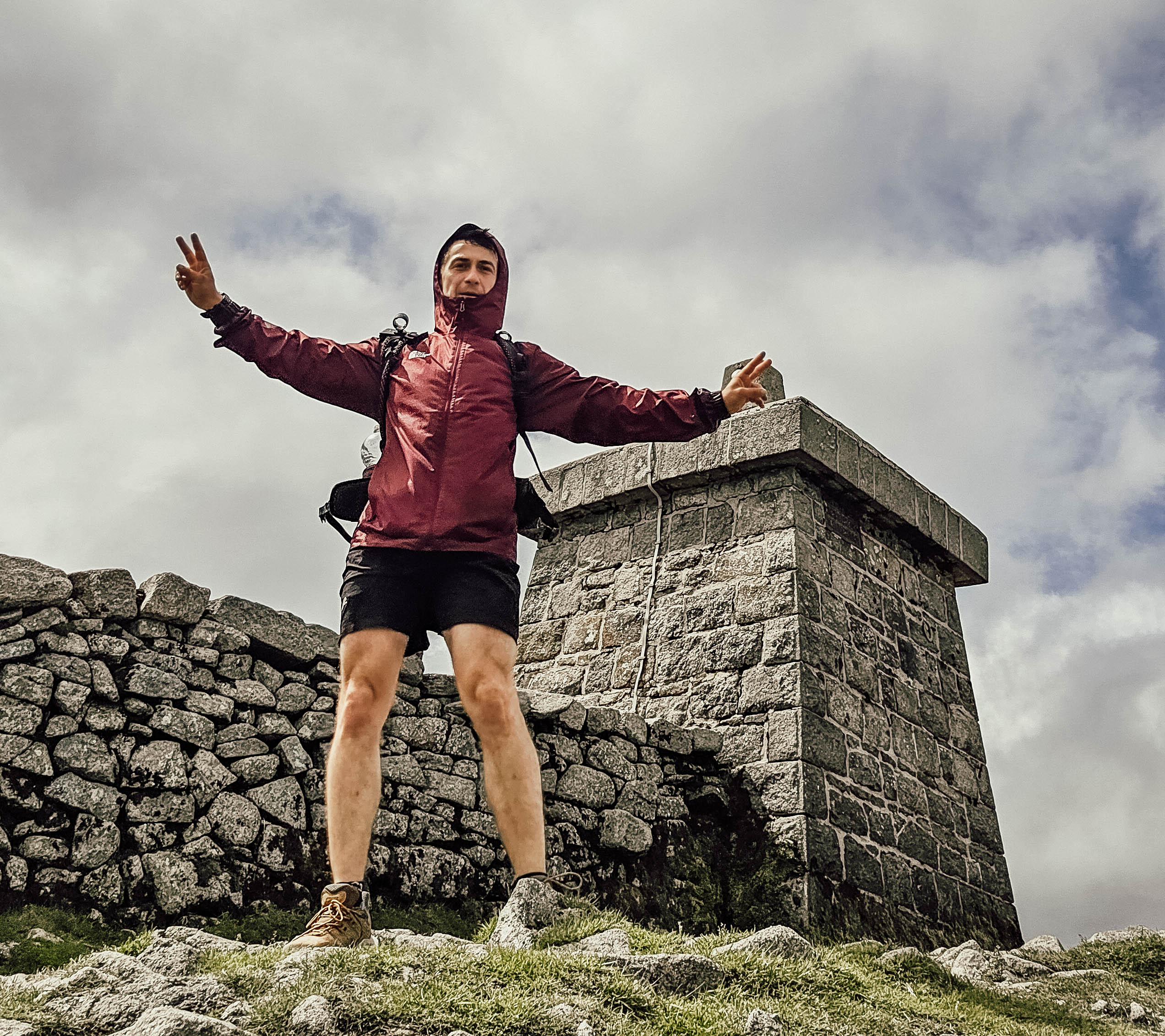
From the saddle the climb continues steeply toward Donard. The summit area is exposed to wind and cloud; the wall is a useful feature but does not replace navigation or a weather decision.
07 / Return to Newcastle
Return to Newcastle.
For an out-and-back walk, return toward the saddle and retrace the Glen River route to Donard Park. Identify the direction before leaving the summit and allow for wet or slippery descent.
08 / Other approaches
Other approaches.
Bloody Bridge is another access point in the Mournes. It is a different route with different terrain and logistics; research its full ascent and descent before choosing it. Mournes visitor information.
09 / Distance and difficulty
Distance and difficulty.
The terrain includes steep steps and uneven mountain paths. Distance and time depend on the exact start and route; use a current detailed map and allow a generous mountain day rather than copying another walker.
10 / Getting to Newcastle
Getting to Newcastle.
Newcastle is a base for the Mournes. The National Trust lists a Belfast–Newcastle bus connection; check the current operator, timetable and final walk to Donard Park. Getting here.
11 / Parking at Donard Park
Parking at Donard Park.
The National Trust identifies Donard Park in Newcastle as parking for Slieve Donard. Check current restrictions, capacity, facilities and charges, and avoid blocking residents or access. Visitor information.
12 / Where to stay
Where to stay.
Newcastle offers a convenient base close to the coast and trailhead. Check your accommodation terms, travel times and parking before booking.
13 / The Mourne Wall
The Mourne Wall.
The Mourne Wall crosses the high ground and is a prominent landmark. Treat it as part of the landscape, avoid damaging it and do not assume following any wall is sufficient navigation.
14 / Explore County Down
Explore County Down.
Allow time for Newcastle’s seafront, the Mourne landscape or a lower-level coastal walk. Choose an outing suited to the forecast and check current local access.
15 / Mountain weather
Mountain weather.
Check the mountain forecast for wind, rain, cloud base, visibility and temperature, not just the forecast in town. Conditions can change rapidly; postpone or turn back if needed. Met Office mountain forecasts.
16 / Season and winter
Season and winter.
Longer summer daylight can help, but rain and cold remain possible. Snow and ice require additional winter skills and equipment; choose a different objective if your party is not prepared.
17 / Experience and fitness
Experience and fitness.
A popular mountain is still a strenuous day out. Choose a route for the least experienced member, build hill fitness, and practise using a map and compass before relying on them in cloud.
19 / What to pack
What to pack.
Take waterproofs, warm layers, appropriate footwear, food, water, a headtorch, first aid, an emergency shelter, navigation and spare phone power. Adjust equipment for conditions and the experience of your party.
20 / Food and water
Food and water.
Carry enough food and water for the full walk and a reserve for delays. Do not assume summit services are open or that untreated stream water is safe.
21 / When to turn back
When to turn back.
Decide your turnaround time before setting out and reassess if the weather, pace, visibility or health of anyone in the group deteriorates. Reaching the top is only half the journey.
22 / Walking with dogs
Walking with dogs.
Check local access rules, use a lead around livestock and wildlife, and consider steep ground, weather and the ability of your dog. Never assume a scrambling route is suitable for a dog.
23 / Families and accessibility
Families and accessibility.
Assess the full route for every person in your group, including the descent, weather and daylight. Rough paths and steep terrain limit wheelchair and pushchair access; consult the land manager for alternatives.
24 / Emergency plan
Emergency plan.
Call 999 or 112, ask for Police and then Mountain Rescue, and give your location and details of the incident. Keep the casualty warm and follow instructions; signal and rescue response may be limited. Mountain rescue advice.
25 / Care for the landscape
Care for the landscape.
Keep to established paths where safe, close gates, respect livestock and other visitors, and take all litter home. Avoid shortcuts that damage fragile mountain vegetation.
26 / Photography
Photography.
Weather and visibility change quickly. Keep your camera secure in wind and rain, protect it from moisture, and never step off a safe path for a photograph.
27 / A mountain day
A mountain day.
Allow time for your chosen route, breaks, navigation and the return. Keep a spare day or a lower-level alternative in case the mountain forecast is unsuitable.
28 / Costs and budget
Costs and budget.
Budget for travel, accommodation, parking, food and any transport. The calculator below uses your own current prices in pounds, with no live fares or prices implied.
28 / Saved checklist
Prepare for a mountain day.
Saved only in this browser. This is a steep, exposed mountain walk. Check the Mourne forecast, carry navigation and warm waterproof layers, and be prepared to turn back.
29 / Cost calculator
Use your own quotes.
Plan in pounds sterling.
Enter your own current prices in GBP. Vehicle and main travel are shared; the other amounts are per person. Include any park, guide and transfer quotes under the appropriate fields. Blank entries count as zero.
My story, FAQ & sources
Where the journey began.
Slieve Donard was the first summit of my Crown of Europe project. I took an early flight from London, collected a hire car in Belfast and drove to Newcastle.
From Donard Park I walked through woodland and along the Glen River, then climbed into open, rockier terrain. Clear skies brought wide views across the Mournes and toward the Irish Sea.
At the summit strong gusts reminded me that even a clear day can feel serious on an exposed mountain. Standing on Northern Ireland’s highest point felt like the start of something much bigger.
Frequently asked questions
What is Northern Ireland’s highest mountain?
Slieve Donard.
How high is it?
The National Trust gives 852 m.
Where does the Glen River route start?
At Donard Park in Newcastle.
Does the route follow the river?
It follows the Glen River from woodland towards the mountain.
What is the saddle?
The col between Slieve Donard and Slieve Commedagh.
Is the route easy?
It is a steep, strenuous mountain walk with uneven ground and exposure.
How long does it take?
Allow a generous mountain day; the time depends on your precise route, conditions and group.
Is it suitable for beginners?
Only if they are prepared for strenuous terrain and supported by someone with suitable navigation experience.
What is the Mourne Wall?
A prominent stone wall crossing high ground in the Mournes.
Is the summit sheltered?
It is exposed and can be windy even on a clear day.
Can I reach Newcastle by bus?
The National Trust lists a Belfast connection; check current services.
Where can I park?
Donard Park is a recognised starting area; check current arrangements.
Can I use a wheelchair or pushchair on the mountain?
The National Trust describes steep, uneven paths and steps.
Can I take a dog?
Check current local guidance and keep dogs controlled around livestock and wildlife.
What should I bring?
Waterproofs, warm layers, suitable footwear, map, compass, food and water.
Was this Adrian’s first project summit?
Yes, his first Crown of Europe summit.
How do I call for help?
Call 999 or 112 and ask for Police and Mountain Rescue.
Sources and current information
Research checked 3 November 2026. Conditions, access and prices can change.
- National Trust: The Mournes ↗ — Glen River, parking and visitor information
- National Trust: Mournes path project ↗ — Mountain height, habitat and path restoration
- Met Office: calling mountain rescue ↗ — Emergency planning and mountain rescue
- Met Office: mountain forecasts ↗ — Regional mountain weather forecasts