
01 / Start here
A border summit.
A bigger Balkan journey.
Midžor rises to 2,169 m on the Serbian–Bulgarian border in Stara Planina. From Serbia, the mountain lodge below Babin Zub is a useful starting point for a rewarding ridge walk.
My own August 2025 climb began near Gornji Lom on the Bulgarian side. The photographs document that outing: they are not a photographic description of the Serbian approach. Below, practical planning for Babin Zub is kept separate from my diary.
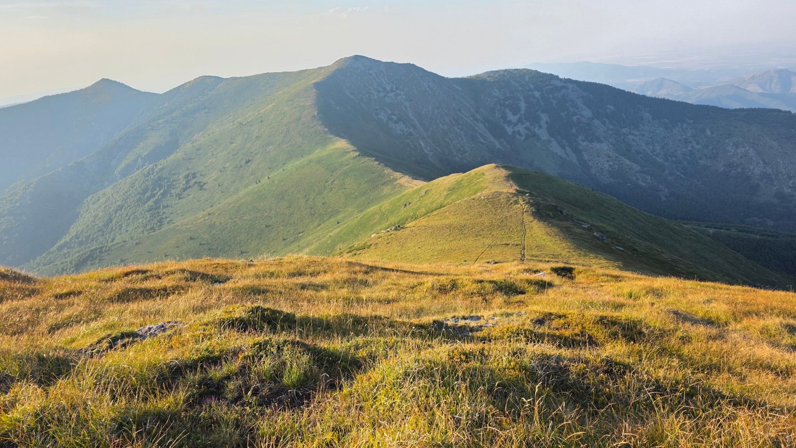

- Summit
- 2,169 mStara Planina, Serbian–Bulgarian border
- Serbian start
- Babin ZubMidžor mountain lodge
- Distance
- 8.6 kmOperator estimate, one way
- Plan for
- A full dayAllow for the return and changing conditions
- My climb
- 21 August 2025From the Bulgarian side
- Serbian rescue
- 063 466 461Stara Planina; verify before travel
Read the Serbian route description · Check the forecast · Check rescue contacts.
02 / Compare the routes
Choose your side.
Plan the whole return.
| Approach | Best for | Planning point |
|---|---|---|
| Babin Zub, Serbia | A published ridge approach from the lodge | Operator: 8.6 km one way, about three hours up; allow extra for descent and breaks. |
| Gornji Lom area, Bulgaria | A different side of the mountain and my personal story | Research the precise start, route and current access separately with Bulgarian sources. |
| Longer local routes | Experienced walkers with a mapped itinerary | Confirm current route, border arrangements and transport before committing. |
The lodge operator gives 8.6 km and about three hours for the ascent. These are estimates, not a promise for your exact track or the return journey. Stara Planina: pedestrian route maps · Stara Planina: accommodation.
03 / Recommended approach
From Babin Zub.
A ridge walk with room to turn back.
For a first Serbian visit, use the published route from the mountain lodge below Babin Zub to Midžor and return the same way. The route leads over open mountain terrain towards the border ridge. Take a current hiking map and verify the line locally; this overview is not a substitute for navigation.
Begin early enough for the complete return, breaks and delays. The lodge’s three-hour ascent estimate is not a round-trip time. Agree a turnaround time before setting off. See regional walking maps · Check the lodge description.
04 / At the trailhead
Start at the lodge.
Check the right line.
The Midžor mountain lodge is below the distinctive Babin Zub rocks. Confirm where to park and the current beginning of the signed route with the lodge or local tourism office. Look at your map before leaving: the Babin Zub rock and Midžor are different objectives.

Take a photograph of any current trail information and note the return junctions. If the line is unclear, resolve it at the start rather than hoping to improvise later.
05 / Meadows and ridge
Find the high ground.
Keep checking the map.
The published approach leads from the lodge towards the summit. In clear weather the open country helps with orientation; mist can remove that advantage. Compare the ground with a downloaded topographic map and the signs you actually find. Do not assume an unverified colour or a single set of footprints identifies the route.
As the group settles into its pace, check the time, water and weather. If anyone is struggling on the approach, allow for the same distance back.
06 / Midžor summit
A shared horizon.
One more decision before the photo.
Midžor stands on the border and is known as Midzhur in Bulgarian. Take time to identify your return direction before leaving the summit marker. Even a broad ridge can become difficult to navigate in low cloud.

Do not assume that reaching a border summit authorises a crossing into another country. Check current border rules and carry the documents appropriate to your route.
07 / Return
Follow the known route.
Save energy for the way home.
Reverse your outward route to Babin Zub. Look back at junctions on the ascent, check the map when visibility changes and keep the group together. Wet grass or mud can slow the descent. Tell your contact when the whole party is back safely.
08 / Other approaches
Gornji Lom is different.
Do not join two itineraries by assumption.
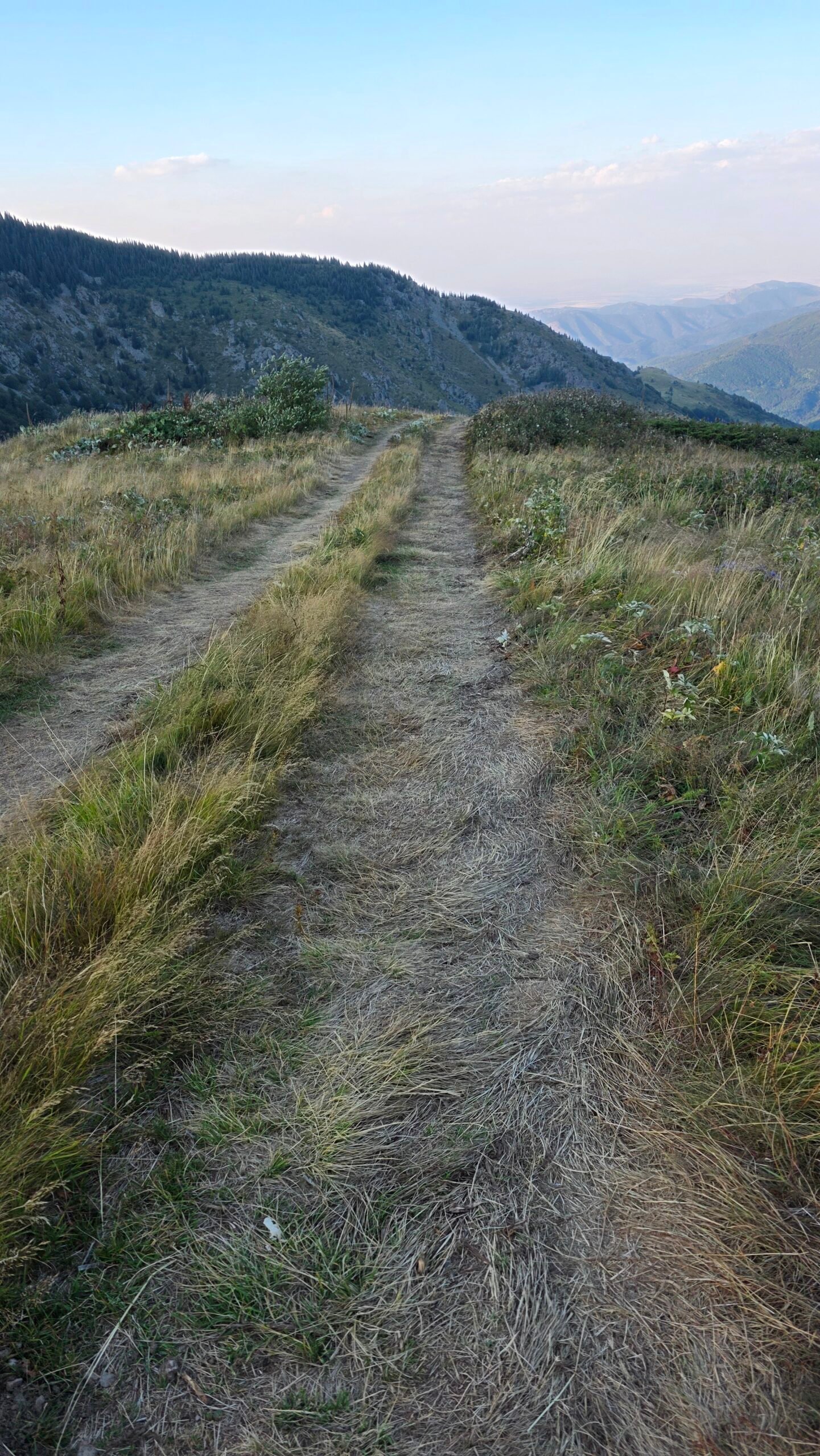
My outing began in the Gornji Lom area on the Bulgarian side. It was not the Babin Zub approach described above. Before using a Bulgarian route, obtain a current map and local advice on its exact trailhead, route conditions, distance and border-area requirements. Bulgarian Mountain Rescue Service.
Longer approaches and traverses need a separate plan for every stage and the return transport. A summit pin alone is not a route.
09 / Getting to the region
Make time for eastern Serbia.
Knjaževac is a practical town to investigate for the Babin Zub side; Pirot is another base for exploring the wider Stara Planina region. Choose accommodation around the roads and trailhead you actually intend to use rather than the shortest line on a map. Ask local tourism.
10 / Getting to Babin Zub
Arrange the last leg first.
The regional operator lists the Niš–Svrljig–Kalna approach and a Pirot–Temska–Kalna approach to Babin Zub. Confirm your chosen road with your accommodation and where the vehicle can be left. See the operator’s directions Mountain access and winter restrictions can change. Download the road route as well as the trail map, and fuel up before leaving the larger settlements.
11 / Driving and parking
Ask for a current road report.
Road surface, weather damage, restrictions and parking arrangements can change. Ask the lodge or local tourism office shortly before travelling about your intended road, vehicle and parking location. Check rental terms and official road notices. Do not infer today’s conditions from an old trip report. Roads of Serbia · Contact the lodge.
12 / Public transport
Separate the train or bus from the mountain transfer.
Check current rail and bus services to your chosen regional town, then arrange the final transfer to and from Babin Zub explicitly. Do not assume a bus meets the trailhead or that a return service operates after your walk. Have a confirmed alternative if delays occur. Ask about local transfers.
13 / Accommodation
Sleep close or explore from town.
Midžor lodge and Hotel Babin Zub are listed by the regional operator. A nearby stay can reduce the morning drive; a town or village base gives more options for a longer trip. Confirm opening, beds, meals, payment and cancellation terms directly before planning around them. See accommodation contacts.
14 / Season
Choose conditions, not just a month.
Snow-free summer conditions are the most straightforward choice for a conventional hike, but snow, storms, mud and wind can change the outing. Stara Planina also has a snowy winter season. Snow and ice require different equipment, navigation and judgement; seek local conditions before leaving. Read about the region.
15 / Weather
The ridge is exposed.
Check the dated forecast and warnings shortly before departure. Consider wind, thunderstorms, visibility and temperature at altitude, not just the weather in town. Turn back early if the forecast deteriorates, navigation becomes uncertain or the group cannot return within its daylight margin. Official Serbian forecast.
16 / Water and food
Carry what your group needs.
Do not plan a critical refill around an unverified spring or an assumed open café. Bring enough water for the forecast, group and complete day, plus food and a reserve. If you intend to use a water source, confirm availability and carry a suitable treatment method.
17 / Safety
Long and open still means mountain terrain.
The walk involves a substantial round trip and exposed navigation. Storms, fog, heat, snow and fatigue can turn an apparently gentle ridge into a serious problem. Carry layers, protection from rain and sun, a headlamp, first aid and backup navigation. Share your route and return deadline with a trusted contact.
For Serbian mountain rescue the GSS website lists 063 466 461 for Stara Planina and 062 464646 nationally. Save and recheck the numbers before travel. Tell rescuers your location, situation and number of people, and follow their instructions. GSS contacts.
18 / Experience
Be comfortable with a full day on foot.
Assess the group against the complete distance and ascent, not only the one-way estimate. You should be able to navigate in poor visibility and turn back without relying on another party. Children and less experienced walkers may need more time and a shorter alternative.
19 / Local guide
Local knowledge can make the day easier.
A local mountain guide or organised group can help with transport, current conditions and route finding. Ask about qualifications, the exact itinerary, group size, equipment, cancellation and what happens if weather prevents the summit. A guide does not remove the need for suitable fitness and clothing.
20 / The protected landscape
Walk lightly in Stara Planina.
Stara Planina contains protected habitats, including the Babin Zub reserve. Follow current signs and local rules, stay on established routes, take litter away and give wildlife and livestock space. Do not collect plants or assume camping and vehicle access are permitted. Explore the nature park.
21 / Beyond the summit
Water, villages and heritage.
Serbia’s tourism organisation highlights the Bigar stream valley, the Temštica meanders, Donja Kamenica’s church and Temska monastery. Choose one area for a separate day rather than rushing after a long hike. Check current access, opening and road conditions locally. See regional attractions.

22 / Itineraries
One day or a longer escape.
One day: arrive at Babin Zub early, complete the out-and-back walk with a fixed turnaround time, and leave the evening free for the return drive.
Three days: arrive and explore Knjaževac or a village on day one; reserve day two for Midžor, with day three as a weather alternative or a separate Bigar/Temštica excursion. Swap days if the forecast demands it and confirm each transfer.
23 / Maps and communications
Download more than a summit pin.
Save an up-to-date topographic map covering the start, route and return, carry a charged phone and backup power, and know how to use a compass or other backup. Check roaming arrangements near the border. Record the trailhead and share the complete plan with someone who can raise the alarm if you are overdue.
24 / Packing checklist
Prepare for the ridge.
Ticks are stored only in this browser. Snow and ice require additional skills and equipment.
25 / Budget
Enter your own prices.
Plan in Serbian dinars.
Use current quotes in RSD. Vehicle and main travel totals are shared; remaining costs are per person. Blank fields count as zero. This is not a live price list.
26 / Photography
Show the journey as well as the summit.
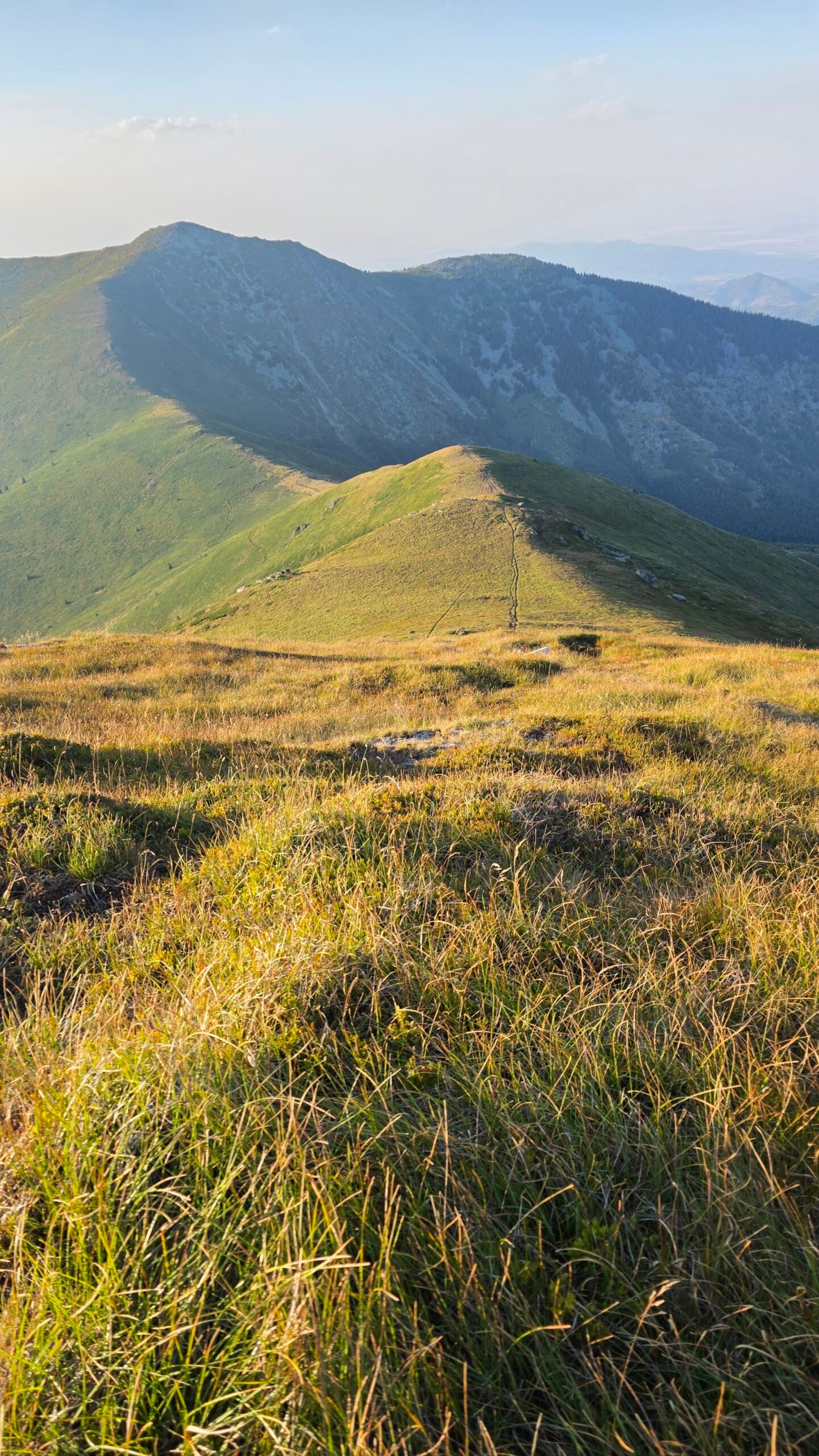
My photographs show woodland signs on the Bulgarian side, the summit marker and the evening mountain landscape. They illustrate my own experience, not individual stages of the Serbian route. Look for changing light and layers of ridges, but take photographs from stable ground and keep the return ahead of the light.

27 / My August climb
The climb I almost didn’t do.
On 21 August 2025, the summit was never the most important thing on my mind.
After Maglić, I had hoped to climb Rudoka in Kosovo, but fatigue, time and logistics stopped that plan. My journey took me towards Midžor. While preparing near Gornji Lom in Bulgaria, Magda suddenly became seriously ill. I drove her down the winding roads to hospital in Montana and stayed until she was stabilised. Those hours were tense, and the expedition suddenly seemed far less important.

Once Magda was safe and recovering, I returned to the Gornji Lom area and began climbing at about 17:05. I pushed at a near-running pace, worried about her and torn between that worry and continuing the project. My record lists 13.86 km, 1,319 m of elevation gain and a 5.6 km/h average for the outing. I reached the summit at about 19:00 under a calm evening sky, took a few photographs and started down.
I was back at the car around 20:00 and drove back to Montana. Late that evening I reached the hospital, tired and dusty, and was relieved to see Magda resting and feeling better. Technically, Midžor felt among the easier summits of the expedition; emotionally it was among the hardest. It reminded me that real life and the people who matter wait beyond the summit.
My late start and unusually fast pace reflected exceptional circumstances. They are not a recommended plan. Start early, allow a generous margin for the complete route and do not rush a mountain descent or a drive.
28 / Questions answered
Before you go.
Where is Midžor?
On the Serbian–Bulgarian border in Stara Planina, at 2,169 m.
How far is it from Babin Zub?
The lodge operator gives 8.6 km one way. Allow for the return as well.
How long should I allow?
The lodge estimates about three hours for the ascent. Protect a full day for the return, breaks and a margin.
Is Adrian’s route the Babin Zub route?
No. My 2025 outing began near Gornji Lom on the Bulgarian side.
Can I cross the border at the summit?
Check current rules with the relevant authorities before planning any crossing; do not assume it is permitted.
Is there water on the route?
Do not depend on an unverified source. Carry enough or confirm a suitable refill and treatment plan.
Can I hike in winter?
Snow and ice change the skills and equipment required. Get current local advice and plan accordingly.
Where can I stay?
Investigate Midžor lodge, Hotel Babin Zub or regional accommodation, and confirm availability directly.
29 / Sources
Check before you travel.
Research checked 2 November 2026. Verify dynamic conditions, access, prices and contacts directly before setting out.
- Mountain Rescue Service of Serbia ↗ — Emergency contacts and mountain rescue advice
- Serbian Hydrometeorological Service ↗ — Forecasts and warnings
- Stara Planina: accommodation ↗ — Midžor lodge and its published summit route estimate
- Stara Planina: location and road approaches ↗ — Regional driving approaches
- Stara Planina: pedestrian route maps ↗ — Regional walking maps
- Tourism Organisation of Serbia: Stara Planina ↗ — Nature and cultural attractions
- Tourism Organisation of Serbia: Stara Planina ↗ — Seasonal and regional information
- Knjaževac Tourism Organisation ↗ — Local accommodation and visitor information
- Public Enterprise Roads of Serbia ↗ — Road information and notices
- Bulgarian Mountain Rescue Service ↗ — Bulgarian mountain conditions and rescue information