

01 / Start here
A limestone summit.
A journey through Sutjeska.
Maglić rises to 2,386 m on the Bosnia and Herzegovina–Montenegro border. It is Bosnia and Herzegovina’s highest summit, but the mountain, Perućica forest and Trnovačko Lake make a visit much more than a high-point checklist.
Routes vary sharply in difficulty. The direct Prijevor ascent is steep and partly equipped with cable; the lake approach is longer and crosses international territory. Neither should be mistaken for a casual walk. Read the park’s route overview.

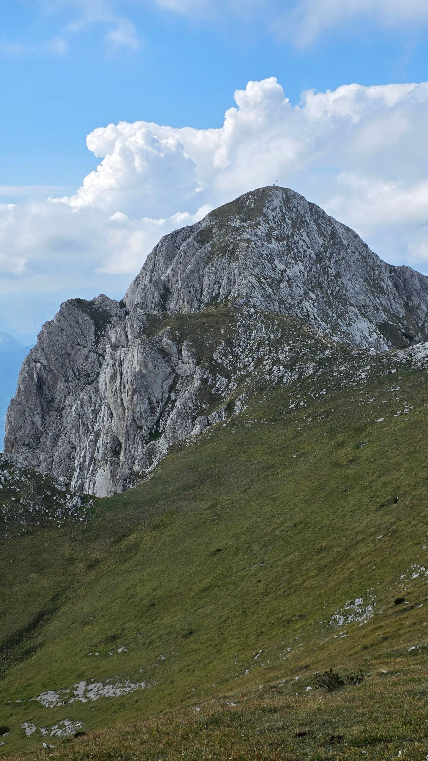
- Summit
- 2,386 mBorder of Bosnia and Herzegovina and Montenegro
- Common start
- PrijevorMountain road from the Sutjeska area
- Direct route
- Steep & exposedSome demanding sections have cable
- Lake route
- LongerTrnovačko Lake is in Montenegro
- My climb
- August 2025Via Trnovačko Lake
- Park advice
- Check firstConditions, border rules, road and fees
02 / Compare routes
Pick the route for your group.
Not just the shortest line.
| Route | Character | Decision |
|---|---|---|
| Prijevor direct | Shortest and most demanding according to the park; steep rock, scree and partly cabled sections | For experienced, sure-footed mountain walkers in suitable conditions |
| Via Trnovačko Lake | Longer approach, then a steep ascent from the lake side | Confirm border permission, complete route and daylight before departure |
| Lokva Dernečišta / Vučevo | The park describes it as less technical than the direct route | Research the specific start, transport and current line separately |
| Park-guided circuit | Direct ascent, ridge, lake and return via Suva Jezerina | Ask the park about guide, current conditions and cross-border arrangements |
The park describes its guided circuit as 8–9 hours overall, including 6–7 hours hiking. This is an estimate for that particular organised itinerary, not a guarantee for an independent party. Review the park’s itinerary.
03 / Choose your plan
The lake is beautiful.
The return still matters.
My own account describes a Prijevor-area approach via Trnovačko Lake and back. Treat it as a personal account rather than a surveyed route. For a current first visit, ask Sutjeska National Park which line suits your experience and whether its guided circuit is operating.
Check the complete route, the direction of travel, the place you will leave your vehicle and any border procedure. If permission or safe conditions cannot be confirmed, choose an authorised alternative on the same side.
04 / Prijevor access
The mountain road is part of the day.
The park’s guided trip begins at Tjentište and uses off-road vehicles to Prijevor, with an advertised transfer of approximately 50–60 minutes. Surface condition and access can change: ask the park about the current road, closures, vehicle suitability, parking and available transfers before leaving the valley. Contact the park.
Do not treat another visitor’s successful drive as permission to take a rental car on a rough road. Check the rental agreement, fuel and spare tyre; allow extra daylight if you must walk from a lower parking place.
05 / At the trailhead
Prijevor and the first junction.
Prijevor is a high plateau below the mountain, around 1,670 m in the park’s description. Find the correct signed trail and compare it with a current map before walking. The direct summit path and the route towards the lake are different decisions.

Photograph the junction for the return and ask the park about any recent damage or snow. A trail sign is useful, but it cannot replace a map or a sensible turnaround time.
06 / Towards Trnovačko Lake
Leave time for the valley.
The park’s circuit connects Prijevor and the lake through Suva Jezerina. Terrain descends and rises again; distance to the lake is not the end of the day. The lake lies in Montenegro, so confirm lawful crossing arrangements before using this route. Carry the documents the authorities require. Park itinerary · Montenegro border information.

07 / Trnovačko Lake
A lake beneath limestone walls.
Trnovačko Lake is on the Montenegrin side, within the Piva region. Take a break away from the shore’s fragile vegetation and leave no litter. Check local access and current charges directly; the park’s published excursion may not reflect today’s fees. Montenegro water authority · Piva Nature Park.

The lake can be an objective in its own right, but a cross-border walk still needs its own legal, transport and return plan.
08 / From the lake to the ridge
Steep ground above the water.
The lake-side approach is described by the park as less technical than the direct Prijevor route, not as effortless. The park’s guided itinerary descends between the ridge and lake by Šarena Lastva over scree; if travelling in the opposite direction, expect sustained uphill effort and check the current signed route.
Loose stone, steep grass and poor visibility can slow the group. Keep distance where stones can fall, avoid shortcuts and turn back if you cannot identify the line or safely descend it later. Compare the park’s routes.
09 / The direct ascent
Shorter does not mean easier.
The park calls the Prijevor direct route its shortest and most demanding approach. It describes steep, mountaineering terrain and cables on some difficult sections. The cable does not turn the whole route into a protected via ferrata: check its present condition and whether your skills and equipment are appropriate.

Choose a dry, stable forecast, wear a helmet where rockfall risk makes it appropriate, and do not enter steep ground beneath another party. A local guide is a sensible choice if exposure or route finding is unfamiliar. Park safety description.
10 / Summit ridge
Read the terrain.
Keep a margin for the descent.
The park’s circuit follows the ridge towards Carev Do after the summit. Before continuing, reassess weather, visibility, fatigue and the return line. A ridge can be exposed to wind and lightning; do not continue into a storm because the lake or summit looks close.

11 / The summit
At 2,386 metres.
From the Bosnian high point the park describes views towards Volujak, Bioč, Zelengora and Trnovačko Lake. Look, take your photographs and keep enough energy and light for the whole descent. The nearby Montenegrin summit is a separate point: identify your objective on a reliable map.

12 / Return choices
A known descent or a planned circuit.
Returning by your ascent gives familiar junctions, but a steep direct descent can be intimidating and slow. The park’s guided circuit descends by Šarena Lastva to the lake and returns through Suva Jezerina. Do not improvise that circuit: check conditions, border arrangements and the full itinerary before departure. See the park’s circuit.
13 / Border arrangements
The lake is across a border.
A line on a hiking map is not proof that crossing is authorised. Contact the relevant border authorities and both protected-area managers before travelling to establish current permissions, documents, permitted crossing points and any advance procedure for your nationality and itinerary. A guided excursion listing alone does not establish your personal right to cross. Montenegro border information · Piva Nature Park · Sutjeska contacts.
14 / Getting to Sutjeska
Give the journey its own time.
Tjentište is the park’s visitor base, with Foča and Gacko useful towns for planning a wider itinerary. Check your exact road and current conditions before leaving; mountain driving can take longer than distance suggests. Confirm the final Prijevor transfer separately from the journey to Tjentište. Explore the park and region.
15 / Parking and the road
Ask before driving up.
Parking, gate arrangements and the mountain road can change with weather and maintenance. Contact the park for a current report, where parking is permitted and whether your particular vehicle can reach Prijevor. Never block the track or rely on a transfer that has not been booked.
16 / Without a car
Book the last leg.
Investigate current intercity connections to the region and a confirmed transfer to your accommodation and trailhead. The park advertises transport as part of its guided excursion; ask about meeting place, availability, language and return arrangements. Do not assume a bus runs to Prijevor. Ask the park.
17 / Where to stay
Stay near the park or make a wider journey.
Ask Sutjeska about accommodation in Tjentište and compare it with stays in nearby towns. Confirm opening, food, breakfast timing, parking and cancellation directly. A night close to the park makes an early start easier; a second night gives you a weather alternative.
18 / Season
Summer is a window, not a guarantee.
The park advertises June–October for its guided excursion, subject to conditions. Snow can linger, and a calendar date does not confirm the route is clear. Wet rock, lingering snow or ice change the technical demands; ask the park for current conditions and choose another day when needed. Check the guided trip.
19 / Weather
Do not gamble on the ridge.
The park warns against climbing when thunderstorms are possible and notes that fog can occur throughout the year. Check the dated forecast, wind and warnings, then ask for mountain-specific conditions. Agree a turnaround time and leave before conditions deteriorate. Official forecast · Park advice.
20 / Water and food
Carry a reserve.
The park’s guided itinerary mentions springs, but flow and drinking-water quality can change. Confirm them before the trip and do not depend on a refill you have not verified. Carry enough water, food and an emergency reserve for the full route and potential delays.

21 / Safety and rescue
Steep rock deserves respect.
Exposure, loose rock, fog and sudden weather changes are the main planning concerns. Carry reliable navigation, warm and waterproof clothing, a headlamp, first aid and a charged phone; share your route and deadline. Avoid disturbing rocks above other walkers. A helmet may be appropriate where rockfall is possible.
In Montenegro, mountain rescue identifies 112 as an emergency contact. On the Bosnian side, agree the correct local rescue contact with the park before the walk; the Foča tourism information in the Piva brochure lists +387 66 776 465 for GSS Foča, but verify that number and coverage before travel. State your side of the border and precise location. Montenegro rescue advice · Bosnian rescue information.
22 / Experience and guide
Be honest about exposure.
The direct trail is for people comfortable on steep rocky ground, route finding and descent. A good general fitness level alone is not enough if exposure causes difficulty. Ask the park about a licensed guide, group size, current equipment, transport and cancellation. The park describes its own excursion as difficult. Guided ascent details.
23 / Sutjeska and Perućica
Protect the forest and its quiet.
Sutjeska’s attractions include the Perućica primeval forest and viewpoints above it. Ask the park which areas require an official guide and which paths are open. Follow signs, use established trails and take everything you bring back with you. Plan a park visit.
24 / Beyond Maglić
Stay for the landscapes.
Plan a separate visit to a Perućica viewpoint, the Tjentište memorial area or the lakes and ridges of Zelengora. Access and guided-visit rules vary, so check them with the park. A rest or weather day makes more sense than rushing these places after a demanding summit day.
25 / Itineraries
One day or a longer stay.
One day: arrive early, use a confirmed transfer, follow a route matched to the group and retain a generous buffer for descent and the mountain road.
Three days: reach Tjentište and visit an accessible viewpoint; reserve the best forecast day for Maglić; use the third for a guided Perućica experience, Zelengora or a weather alternative. Confirm permissions and opening before travelling.
26 / Saved checklist
Prepare before the road.
Saved only in this browser. Snow and ice demand additional skills and equipment.
27 / Cost calculator
Use your own quotes.
Plan in convertible marks.
Enter current prices in BAM. Vehicle and main travel are shared; the other amounts are per person. Include any park, guide and transfer quotes under the appropriate fields. Blank entries count as zero.
28 / My Maglić day
A peaceful day after the cursed mountains.
After Zla Kolata, I drove 251 km from Vusanje through Montenegro towards the Prijevor area, arriving late on winding roads and sleeping a few hours in the car near the park gate.
My account records a start at 11:38 and a route via Trnovačko Lake. Forest opened towards the lake and steep limestone walls. After a short break, I continued up the rocky path towards the summit ridge. I reached the top at about 15:40; my record lists 19.5 km and 1,444 m of ascent for the outing. These are my figures, not a standard route estimate.

At the summit I met a Polish couple. We shared stories and photographs; he told me about his project building futuristic bicycles inspired by luxury cars. After weeks of hard travel and climbs, the conversation and the broad views made the day feel unusually calm.
My descent felt light and joyful, and I recorded returning to the car by 18:00. Maglić reminded me why I began: sometimes a mountain day is memorable because it leaves space to breathe. The original article dates the climb 19 August, while my expedition summary gives 18 August; the precise date remains unconfirmed.
My late start and pace are not a safe template. Start early, plan the full return and check the legal border arrangements and weather before committing.
29 / Questions answered
Before you go.
Is Maglić the highest summit in Bosnia and Herzegovina?
Yes: the park gives the Bosnian high point as 2,386 m.
Is the direct route easy?
No. The park describes it as steep, demanding and partly equipped with cable.
Is Trnovačko Lake in Bosnia and Herzegovina?
No. It lies in Montenegro; confirm border arrangements before planning a cross-border walk.
How long does the circuit take?
The park’s guided excursion is advertised as 8–9 hours total, including 6–7 hours hiking. Your party and conditions will differ.
Can a normal car reach Prijevor?
Conditions change. Ask the park about the road and your vehicle, and check rental terms.
Should I copy Adrian’s 11:38 start?
No. It is a diary record, not a recommended timetable. Start early with a generous return margin.
Where do I find a guide?
Sutjeska National Park advertises a guided ascent. Confirm availability and details directly.
30 / Sources
Check before departure.
Research checked 2 November 2026. Conditions, access, border rules and prices can change.
- Sutjeska National Park: Maglić ↗ — Routes and terrain
- Sutjeska National Park: guided ascent ↗ — Guided route, timings and park contact
- Piva Nature Park ↗ — Local visitor information for the Montenegrin side
- Montenegro Ministry of the Interior: borders ↗ — Official border information
- Federal Hydrometeorological Institute ↗ — Bosnia and Herzegovina forecasts
- Mountain Rescue Service of Montenegro ↗ — Emergency response in Montenegro
- Mountain Rescue in Bosnia and Herzegovina ↗ — Mountain rescue information
- Piva Nature Park: regional visitor brochure ↗ — Published Foča rescue contact; verify before use
- Tourism Organisation of Republika Srpska: Sutjeska ↗ — Regional sights and activities
- Montenegro Water Administration: Trnovačko Lake ↗ — Lake location in Montenegro