
01 / Start here
A mountain, a country, and a journey with meaning.
Hoverla (2,061 m) is Ukraine’s highest peak, on the Chornohora ridge of the Ukrainian Carpathians. Its forest paths and open high ground deserve preparation, and today the wider security situation must come first.
The UK FCDO advises against all but essential travel to both Ivano-Frankivsk and Zakarpattia regions, where Hoverla lies. The US advises against all travel to Ukraine. Russian missile and drone attacks can affect western Ukraine; airspace is closed and martial law applies. Check your own government’s current advice, insurance, alerts and local rules. This guide does not recommend a recreational trip against official advice. UK advice · US advisory
- Elevation
- 2,061 mUkraine’s highest mountain
- Range
- ChornohoraUkrainian Carpathians
- Park route
- 10.5 kmOne way from park checkpoint
- Park estimate
- 5 hoursOne way, not from Zarosliak
- My climb
- 11 August 2025From Kozmeshchyk
- Before plans
- Check adviceWar and local restrictions
02 / Current travel advice
War changes the context of any journey.
On 2 November 2026 the UK FCDO advises against all but essential travel to Ivano-Frankivsk and Zakarpattia. It warns that attacks can reach western regions and that airspace is closed. Follow alerts and shelter instructions, check curfews and insurance, and monitor your own government’s advice. The US advisory says do not travel to Ukraine. UK FCDO · US State Department.
03 / Park and route access
Confirm the exact route before making plans.
Martial-law rules and access restrictions can change. Ask the national park and relevant regional and border authorities about your exact trail, start, return, opening and any permits. The Zakarpattia administration publishes information on border areas and routes prohibited during martial law. A map or my 2025 journey does not prove a route is open today. National park · Regional restrictions.
04 / Compare approaches
Two starting points, two different journeys.
Park checkpoint via Zarosliak: the national park lists its full route as 10.5 km and five hours one way, from the Hoverla park checkpoint, through Zarosliak, to the summit; it rates the route hard. A return needs additional time.
Kozmeshchyk: the approach in my diary is different. My recorded 15.81 km and 1,227 m gain describe my personal round trip and cannot be transferred to the checkpoint route or treated as a typical time. Confirm current access for either. Official park description.
05 / Checkpoint to Zarosliak
From the checkpoint towards Zarosliak.
The park describes a start at its Hoverla checkpoint near Vorokhta, followed by a forest road alongside the Prut valley through Foreshchanka to the Zarosliak sports base. The full park distance begins at the checkpoint, not at Zarosliak. Confirm registration, current opening, fees and whether vehicle access is permitted with the park. Official stages.
06 / Forest ascent
Through the spruce forest.
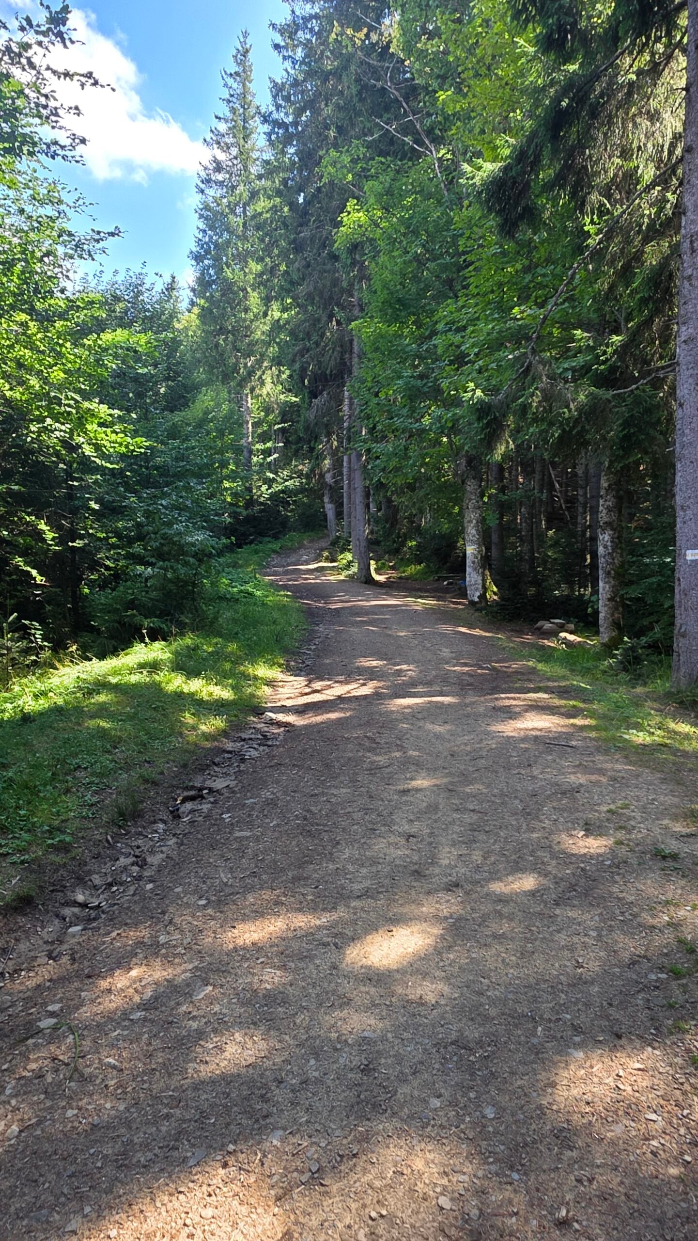
From Zarosliak the park describes a trail through spruce forest, climbing towards the upper tree line. Follow the current designated route and park instructions; do not assume every informal path or GPS track is authorised. The exact conditions and markings should be checked locally. National park route.

07 / Above the trees
Open ground calls for good visibility.
Above the trees, the park route reaches more exposed high ground and meadows. Cloud, rain and wind can make navigation and temperature feel very different from the forest. Keep the group together and turn back before conditions make your return uncertain. Park route information.
08 / At the summit
Ukraine’s highest point.
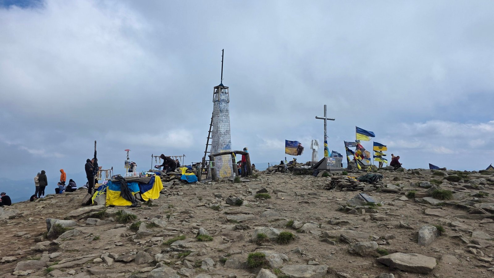
Hoverla rises to 2,061 m on the border of Ivano-Frankivsk and Zakarpattia regions. In clear weather the national park describes views across the Chornohora ridge. Do not count on those views or lingering time: make descent and daylight part of the plan. Park summit description.

09 / The descent
Keep enough energy for the return.
Plan the descent before starting and confirm your route with the park. Returning the way you came can simplify logistics where permitted, but slippery ground, fatigue and cloud may slow you down. Do not rely on my fast descent as a benchmark.
10 / Kozmeshchyk approach
My route began on another side.
My original diary records a Kozmeshchyk–Hoverla–Kozmeshchyk return through forest and open mountain ground. This is a personal account, not a current route clearance. Access and possible border-area restrictions must be confirmed with the responsible authorities; if they cannot confirm it, choose another authorised plan. Regional guidance.

11 / Getting to the region
Travel planning starts with the security picture.
Vorokhta is associated with the park’s checkpoint approach; Kozmeshchyk was my own starting point. They are not interchangeable. Since Ukrainian airspace is closed, do not plan a flight into Ukraine. Check government guidance, border crossing rules and transport with official operators. Travel advice.
12 / Getting to the trailhead
The last leg needs its own confirmation.
Ask the park or a reliable local provider whether your exact trailhead is accessible and which transport is currently allowed. Confirm the return pickup, operating hours and curfew implications before setting out. Do not assume a minibus, taxi or checkpoint will be available because I used one in 2025.
13 / Road and parking
Road, checkpoint and parking.
The observatory’s map describes a dirt-road connection from the checkpoint towards Zarosliak. Surface conditions, closures and access can change; ask the park before driving and check rental terms. Park only where permitted and do not block the checkpoint or emergency access. Observatory route overview.
14 / Public transport
Check the outward and return connections.
Use Ukrainian Railways for current train information and ask local operators about connections to the start and back. Services and border procedures may change at short notice, and a rail journey does not imply public transport reaches the trailhead. Ukrainian Railways.
15 / Where to stay
Choose a base with a realistic return.
Vorokhta can be a base for the park side; for other approaches confirm which settlement actually serves your chosen trail. Ask accommodation directly about opening, transport, shelter, power cuts and curfews. Do not depend on an unconfirmed mountain shelter being staffed or available.
16 / When to hike
Choose a season, then check conditions.
Snow-free months generally offer longer daylight, but storms and cold remain possible even in summer. The actual condition of the route matters more than the calendar. Check the park and weather service for current closures and warnings, and leave sufficient daylight for descent.
17 / Weather
A forecast for the mountains, not just the town.
Check the Ukrainian meteorological service and local park advice for wind, rain, thunderstorms and visibility. A town forecast is not a summit forecast. Change or cancel the plan if conditions are unsuitable, and account for the much colder exposed ridge. Ukrainian weather service.
18 / Winter and snow
Snow requires a different skill set.
Ice, snow, avalanche terrain and limited daylight can transform the mountain. A winter outing requires appropriate equipment, avalanche assessment and experience; get advice from local mountain rescuers and a qualified local guide. Do not treat the summer trail description as a winter route.
19 / Food and water
Carry sufficient water and food.
Bring water and food for the entire confirmed route, plus a reserve. Do not assume any source is safe to drink or that a shop or shelter will be open. Keep enough in reserve for delays and the journey back.
21 / Mountain safety
Prepare for a serious mountain day.
The park grades its checkpoint route hard. Carry suitable footwear, warm and waterproof layers, food, water and first aid; share your itinerary and expected return. Travel with people whose experience matches the route, and turn back for weather, access restrictions or fatigue.
22 / Rescue and emergencies
Tell rescuers where you plan to go.
The park asks hikers to notify the State Emergency Service of planned mountain travel and links to an online form and regional rescue contacts. Save the current relevant contacts before travelling, and also tell a trusted person your return time. In an emergency follow local instructions and provide your location. Registration and rescue contacts.
23 / Protect the park
Stay on the authorised trail.
The park identifies rare plants and prohibits leaving the route, littering, damaging vegetation and lighting fires outside designated places. Take waste home, give wildlife space and follow current forest and fire restrictions. Park regulations.
24 / Explore the region
Discover the Carpathians beyond one summit.
The park’s landscapes and communities reward more than a summit checklist. Explore its official information on nature and cultural heritage; the UNESCO-listed wooden tserkvas of the Carpathian region are spread across Ukraine and Poland. Check current safety, access and individual opening before visiting. Carpathian National Nature Park · UNESCO listing.
25 / Itineraries
Build in flexibility.
If current official advice and local access allow: a mountain day needs enough daylight for your confirmed approach and descent, plus transport and contingency. On another day explore an open cultural site or local community.
Under the current advice: postpone non-essential travel; use the time to research Ukrainian culture and review current official updates rather than booking a mountain trip.
26 / Photography
Photograph respectfully.
Weather, woodland and summit light can tell the story of a mountain day. During martial law follow current local rules and avoid photographing checkpoints, military personnel or sensitive infrastructure. Ask before photographing people. Current advice.
27 / Costs
Budget only with current information.
Check current quotes for travel, accommodation, food, local transport and any park or guide charges. Confirm that insurance covers your destination and activity; travelling against government advice may invalidate it. The calculator uses your own amounts in Ukrainian hryvnia, not live prices.
28 / Saved checklist
Prepare for the Carpathians.
Saved only in this browser. Check current travel advice and route access before any journey.
29 / Cost calculator
Use your own quotes.
Plan in Ukrainian hryvnia.
Enter your own current prices in UAH. Vehicle and main travel are shared; the other amounts are per person. Include any park, guide and transfer quotes under the appropriate fields. Blank entries count as zero.
30 / My climb, FAQ & sources
A fast climb with a heavy meaning.
Before my climb on 11 August 2025, after Mulhacén, I drove to Málaga Airport and slept there before an early flight to Bucharest. I rented a car and drove towards the Ukrainian border, a long journey of narrow roads, checks and growing fatigue.
Early on the day of my climb I crossed on foot and used local minibuses and shared rides to reach Kozmeshchyk. Language barriers, confusing timetables and the rush against time made the journey challenging.

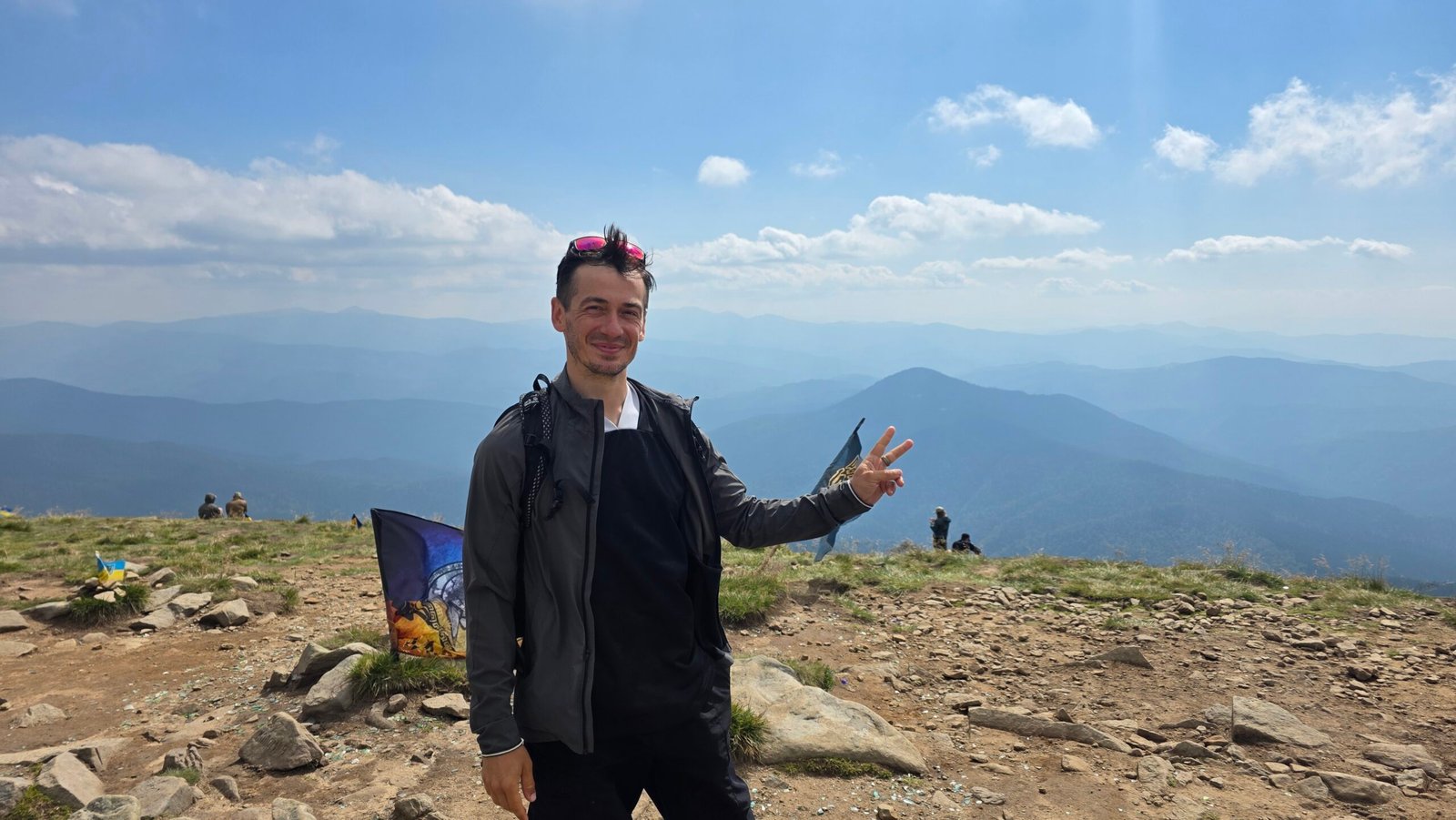
I started at 13:36. The route climbed through forest into open mountain ground; the air was warm and humid, clouds hung over the ridges and the wind picked up near the top. I pushed hard and reached the summit at 15:30. I stayed only a few minutes. The flag and quiet summit felt emotional in a country living through war: gratitude and sadness at once.

I descended by the same route. My Strava record shows 15.81 km and 1,227 m of ascent, about 3 hours 2 minutes moving and 3 hours 34 minutes elapsed. Exhausted but relieved, I found transport back towards Solotvyno and crossed into Romania around 21:00. These are my own times and circumstances, not a recommended pace or evidence that the route is currently open.
My 2025 trip took place during the war. The security situation and rules change; consult current official advice and authorities before any journey.
Questions answered
How high is Hoverla?
The national park gives its elevation as 2,061 m.
How long is the park’s route?
The park lists 10.5 km and five hours one way from its checkpoint via Zarosliak. The return is additional.
Is the Kozmeshchyk route currently open?
Do not assume so. Confirm current rules for the exact route with the authorities.
Should I travel to Ukraine for a hike now?
At the research date, the UK advises against all but essential travel to Hoverla’s regions and the US advises against all travel to Ukraine. Check your own government’s current advice.
Sources and current information
Research checked 2 November 2026. Security, access, prices and transport can change.
- UK FCDO: Ukraine travel advice ↗ — War, regional advice and air alerts
- US State Department: Ukraine travel advisory ↗ — Do-not-travel advisory
- Carpathian National Nature Park: Hoverla ↗ — Official checkpoint route, regulations and rescue registration
- Carpathian Observatory: tourist map ↗ — Historic route descriptions; confirm access locally
- Zakarpattia tourism: travel during war ↗ — Regional restrictions and border-area information
- Ukrainian Railways ↗ — Check train services directly
- Ukrainian Hydrometeorological Centre ↗ — Official weather and warnings
- UNESCO: Wooden Tserkvas of the Carpathian Region ↗ — Regional heritage