
01 / Start here
A small country, a serious summit.
Vordergrauspitz is Liechtenstein’s 2,599 m high point, on the Swiss border in the Rätikon. It is a demanding alpine objective with loose terrain and exposure. The Alpine Club describes unmarked terrain; its illustrated alternatives vary in difficulty and are not interchangeable. Liechtenstein Alpine Club.

02 / Routes
Study the actual line carefully.
There is no official marked mountain path to Schwarzhorn and Grauspitz in the Alpine Club description. Its route from Obersäss crosses trackless terrain and the club maps alternatives with different grades. Obtain current local guidance and a qualified guide if route-finding or exposed terrain exceed your experience. Alpine Club route description.

03 / Two summits
Hintergrauspitz is not the high point.
The double summit comprises Hintergrauspitz, also called Schwarzhorn, at 2,574 m, and Vordergrauspitz at 2,599 m. Reaching Schwarzhorn alone does not mean you have reached Liechtenstein’s high point. Summit information.
04 / Malans approach
A Swiss approach needs careful planning.
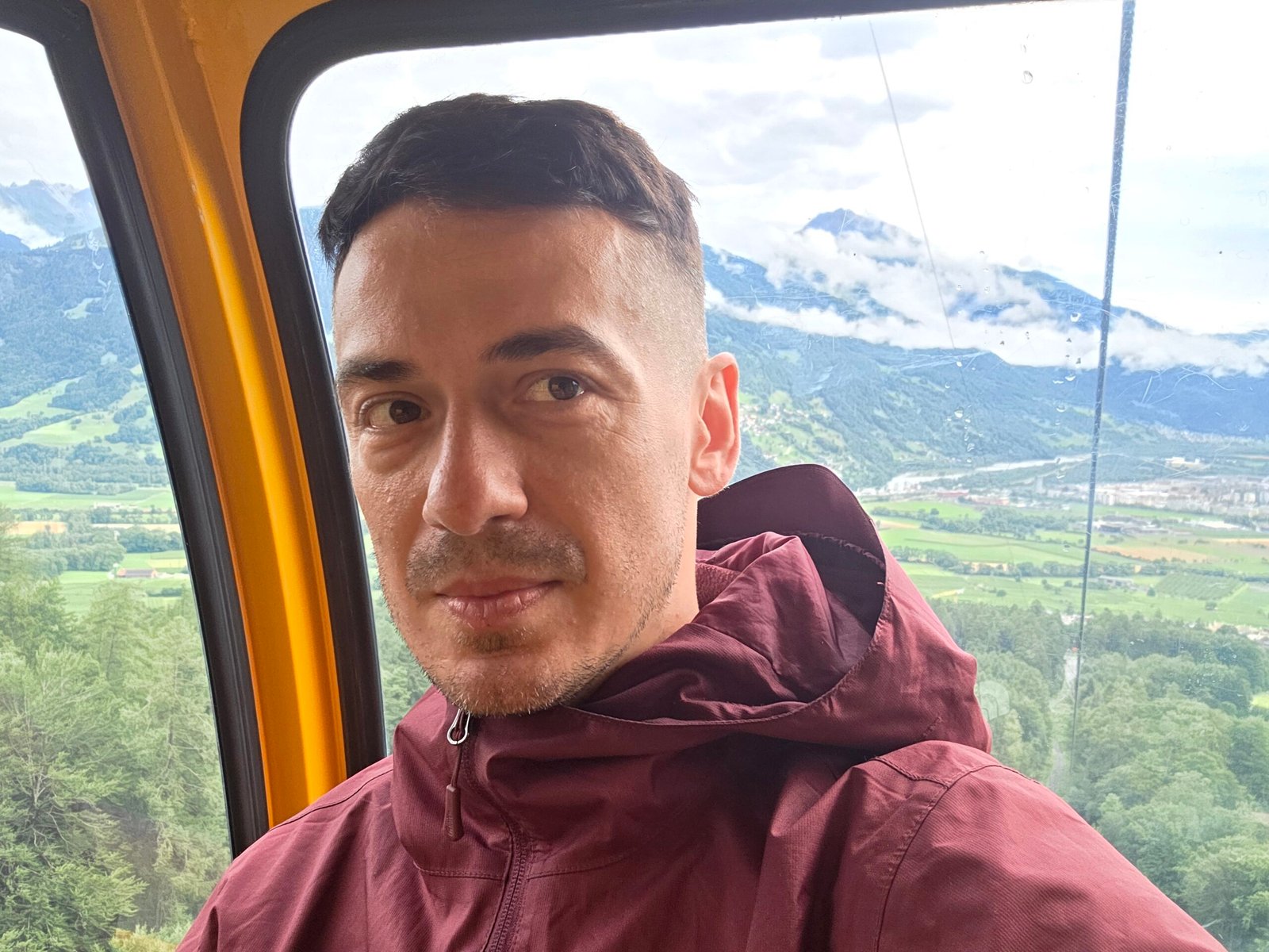
My own trip began with a cable-car approach from Malans in Switzerland. Lift access shortens part of the journey but does not remove the exposed and unmarked terrain ahead. Check the exact service, its schedule and your entire return plan.
05 / Valüna approach
A route from the Liechtenstein side.
The Alpine Club describes an approach through Valünatal and from Obersäss toward Ijesfürggli and Schwarzhorn. The upper terrain is pathless and its described line avoids more difficult ridge sections; study the club map and obtain current advice. Club route PDF.
06 / Exposed ground
Do not assume the ridge is a trail.
Narrow ridges, steep grass and unstable rock create fall and rockfall hazards. The Alpine Club distinguishes a T4 option from more difficult T5 and T6 sections on its map. A direct ridge traverse can be significantly more serious than another line. Route map.
07 / Mountain safety
Turn back before conditions trap you.
Rain, fog, lingering snow or strong wind can make route-finding and steep slopes dangerous. Allow generous time, agree on turnaround criteria and never let a lift deadline push your group into unsafe decisions. Emergency number 112 can connect emergency services.
08 / Hiring a guide
Experience matters more than a summit target.
A qualified local mountain guide can advise on current conditions, suitable lines, equipment and whether the objective is appropriate. The Alpine Club recommends professional accompaniment when a person cannot independently interpret the terrain and map. Alpine Club advice.
09 / Weather
A forecast is only the beginning.
Check mountain wind, precipitation, thunderstorms and visibility just before setting off. A sunny valley can hide cloud or snow on the ridge. Postpone if reliable navigation or safe movement is doubtful. MeteoSwiss.
10 / Season
Ask about actual ground conditions.
Summer is the usual alpine hiking season, but snow may remain and fresh snow can fall outside winter. Wet grass and loose rock are serious in any month. Local conditions and daylight matter more than the date alone.
11 / Ability
This is not an ordinary hill walk.
Strong endurance is useful but does not replace sure-footedness, judgement on exposed ground and the ability to navigate pathless terrain. Choose a different objective if any member of the group is uncomfortable with the route.
13 / Equipment
Match the equipment to the route.
Sturdy boots, waterproof layers, insulation, food, water, headlamp and first aid are a starting point. A helmet and technical equipment may be needed for the selected line; a guide can advise. Equipment alone does not supply the skills to use it.
14 / Cable car
Know the final descent and a backup.
Check the service from Malans and any seasonal restrictions with its operator, including the last departure and ticket conditions. If it closes, a feasible descent on foot must be planned before starting, not improvised at the end.
15 / Getting there
Travel via Liechtenstein or Switzerland.
Your trailhead depends on the selected approach. Check current train and local bus connections and the walking distance from the final stop. Malans is in Switzerland, not Liechtenstein. Swiss rail planning.
16 / Parking
Use the correct starting point.
If travelling by car, find an authorised car park for your actual route, read the current conditions and leave access clear. Confirm whether a lift descent returns to the same place.
17 / Where to stay
Stay near your chosen approach.
Vaduz and the wider Rhine valley offer places to stay; Swiss-side approaches require appropriate cross-border planning. Compare travel time, transport and cancellation terms against your weather window.
18 / Food and water
Carry enough for delays.
Do not assume that water, food or shelter will be available on the upper mountain. Carry a reserve and check any facilities on your exact approach. Streams are not automatically safe drinking water.
19 / Group decisions
Choose the pace of the whole group.
Discuss exposure, turnaround points and the slowest member before departure. Avoid separating in fog. If someone is uncertain or the route no longer matches the plan, retreat while the descent remains manageable.
20 / Emergency
Prepare location details.
Call 112 in an emergency and explain your position, injuries and conditions. Swiss rescue organisation Rega can provide specific guidance for its services; rescue and phone coverage may be affected by terrain and weather. Rega.
21 / Respect the landscape
Leave the mountain as you found it.
Follow access rules, respect grazing animals and private land, carry rubbish out and avoid dislodging rocks. Check the local rules before using a drone; restrictions and weather can change.
22 / Alternatives
A lower walk can be a better day.
If the weather or your experience does not suit Grauspitz, choose a marked valley or lower mountain walk with current local advice. Liechtenstein tourism provides ideas for the wider region. Regional information.
23 / Itinerary
Allow room for weather.
Arrive near your chosen approach, review current conditions and consult a guide where needed. Start early, maintain a turnaround time and keep a spare day or alternative objective rather than relying on a narrow weather window.
24 / Costs
Plan with Swiss francs.
Include travel, parking, accommodation, lift fares, food, guide and equipment in your estimate. The calculator uses your own CHF figures, not live prices; verify currency and cross-border charges with providers.
25 / The border
One summit, two countries.
Grauspitz lies on the border of Liechtenstein and the Swiss canton of Graubünden. Check current crossing and access requirements for your itinerary; the mountain route itself remains the central challenge. Alpine Club.
28 / Saved checklist
Prepare for serious alpine terrain.
Saved only in this browser. Grauspitz is a serious alpine objective with unmarked terrain, loose rock and exposure. Choose a qualified mountain guide if your skills are insufficient.
29 / Cost calculator
Use your own quotes.
Plan in Swiss francs.
Enter your own current prices in CHF. Vehicle and main travel are shared; the other amounts are per person. Include any park, guide and transfer quotes under the appropriate fields. Blank entries count as zero.
My story, FAQ & sources
The race against the clouds.
On 25 July 2025, after Iceland, I travelled from the Milan area with my father toward Malans. I took a cable car and began walking shortly after 10:00, aware of the last descent.
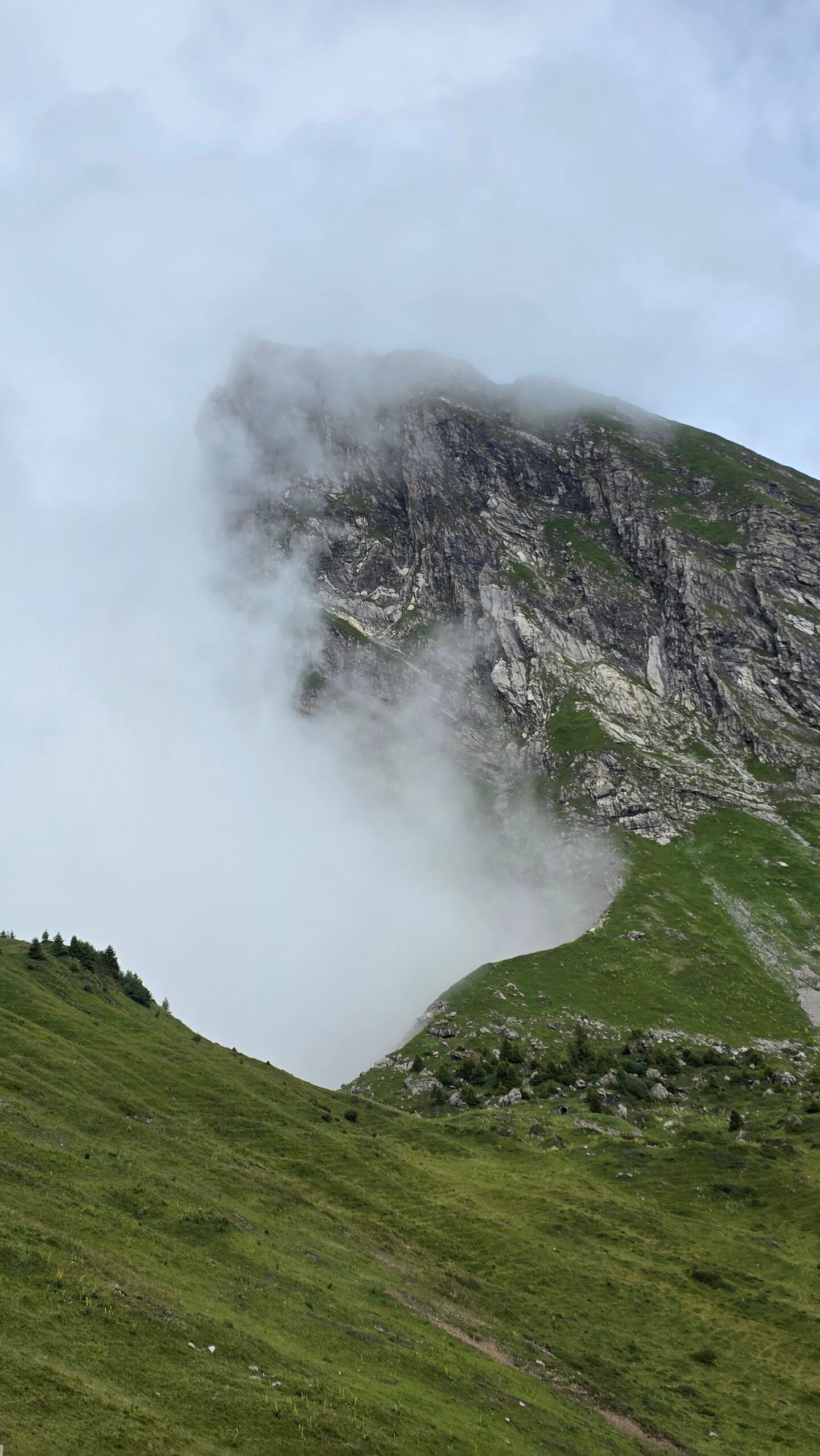
Rain soaked the path and low clouds reduced visibility. My account describes steep, muddy ground and slippery rock. After Hintergrauspitz I continued to Vordergrauspitz, reaching the high point around midday in wind and fog.
The return felt stressful, and I made the final cable car. A drone disappeared into the fog during the climb. The day taught me how quickly weather and a fixed schedule can combine to make a mountain more serious; today I would urge anyone to give the route a generous margin and turn back when conditions demand it.


Frequently asked questions
How high is Grauspitz?
Vordergrauspitz is 2,599 m above sea level.
Is Hintergrauspitz the high point?
No. Hintergrauspitz, also called Schwarzhorn, is lower than Vordergrauspitz.
Where is Grauspitz?
On the border of Liechtenstein and the Swiss canton of Graubünden in the Rätikon.
Is there a marked trail to the summit?
The Alpine Club states that there is no official marked mountain path to Schwarzhorn and Grauspitz in its route description.
Is Grauspitz suitable for beginners?
It is a serious alpine objective with route-finding and exposed terrain. Choose another route or seek a qualified guide if you lack experience.
Is the direct ridge easy?
No. The Alpine Club maps some alternatives as T5 or T6; do not assume the ridge and its T4 alternative are equivalent.
Can a cable car shorten the approach?
There are Swiss-side lift approaches, but verify the exact service and operating times; exposed mountain terrain remains.
Should I hire a guide?
A qualified local mountain guide is advisable when your route-finding or alpine skills are insufficient.
Is rain a problem?
Yes. Wet grass, rock and reduced visibility can make the terrain considerably more dangerous.
Can snow remain in summer?
Yes. Check recent local reports and postpone if conditions exceed your skills.
What currency should I budget in?
Swiss francs are used in Liechtenstein and Switzerland; the calculator accepts your own CHF estimates.
Where did Adrian start?
His account describes a cable-car approach from Malans in Switzerland.
When did Adrian climb?
On 25 July 2025.
What is the emergency number?
Call 112 and give the dispatcher your location and situation.
Sources and current information
Research checked 2 November 2026. Conditions, access and prices can change.
- Liechtenstein Alpine Club: Grauspitz ↗ — Summits and difficulty
- Liechtenstein Alpine Club: route description ↗ — Unmarked approaches and exposed terrain
- MeteoSwiss ↗ — Mountain weather and warnings
- Swiss Federal Railways ↗ — Travel planning
- Liechtenstein tourism ↗ — Regional visitor information
- Swiss air rescue Rega ↗ — Alpine rescue information