

01 / Start here
Norway’s highest mountain is a serious day out.
Galdhøpiggen rises to 2,469 m in Jotunheimen National Park. Choose between the strenuous marked walk from Spiterstulen and the higher Juvasshytta start, whose route crosses a glacier.
Styggebreen contains crevasses hidden by snow. Join a qualified guided group unless your entire team has glacier travel and rescue training and appropriate equipment. A rope alone is not sufficient. Juvasshytta’s guidance.

- Summit
- 2,469 mNorway’s highest
- My start
- SpiterstulenMarked mountain route
- Alternative
- JuvasshyttaGlacier crossing
- Terrain
- High mountainSnow can persist
- My climb
- 28 July 2025Fog and sleet above
- Emergency
- 112 / 113Police / ambulance
02 / Compare routes
Two starts, two different challenges.
Spiterstulen: more ascent and a strenuous marked route that need not cross a glacier in suitable conditions. The lodge lists 6 km one way and 4–6 hours up; allow extra for the descent and breaks.
Juvasshytta: starts higher but crosses Styggebreen. Book a qualified guide unless your party has appropriate glacier skills, rescue equipment and training. Compare conditions for the specific day. Spiterstulen · Juvasshytta.
03 / Spiterstulen route
A big ascent from Visdalen.
The national park describes the marked route from Spiterstulen as physically demanding but not requiring glacier guiding when the correct route is followed in suitable conditions. Snow and ice can still create hazards. The lodge estimates approximately nine hours in total at a steady pace including a margin; your group may need longer. Park guidance · Lodge times.
04 / Bridge and first climb
Cross the bridge and begin steadily.
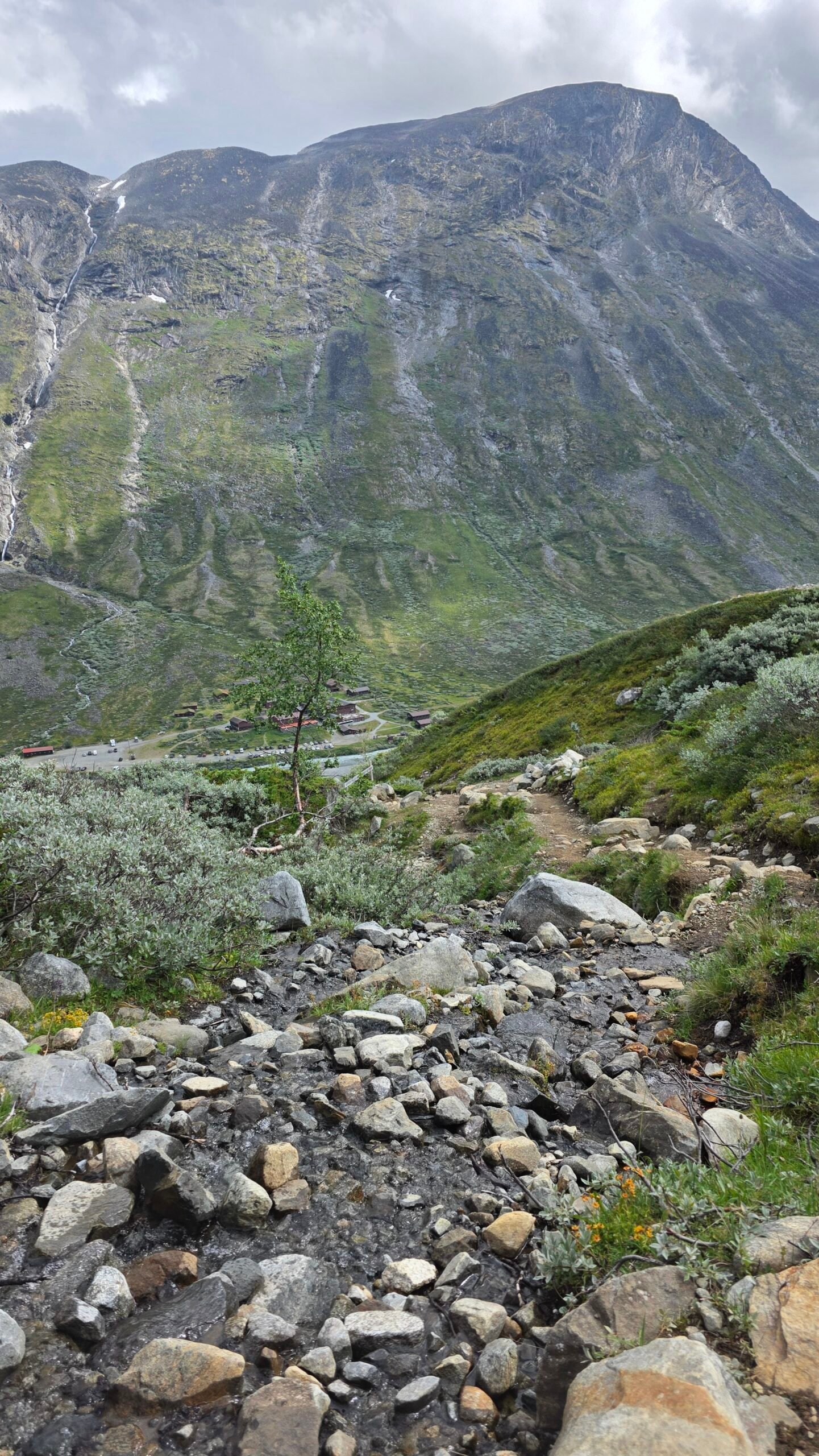
Spiterstulen describes crossing the bridge by the lodge and following the marked route to the right. The path climbs above the valley through rough ground. Confirm current signs and the route with the lodge before departure. Lodge route description.
05 / The upper ascent
Expect sustained climbing.
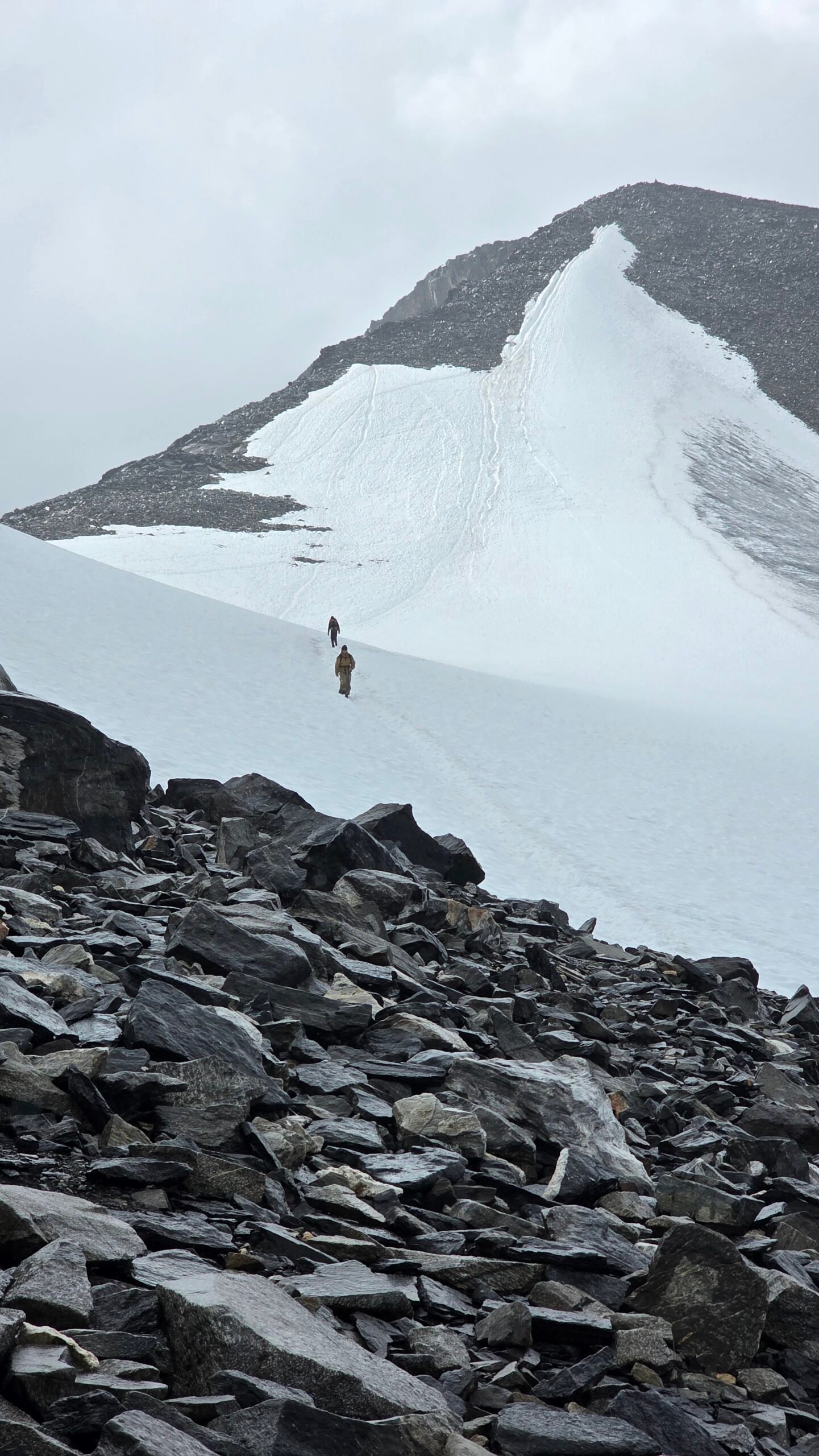
The ascent continues onto exposed rocky ground, with loose gravel and possible snow. Weather and visibility can change quickly. Keep the group together and make conservative decisions before reaching icy or uncertain terrain. Route stages.
06 / Keilhaus topp
The summit is not the first high point.
The lodge describes the route passing Svellnose and Keilhaus topp before a short descent and the final climb. Allow for this additional ascent on the return and do not mistake an intermediate top for the destination. Spiterstulen route.
07 / The summit
On the roof of Norway.
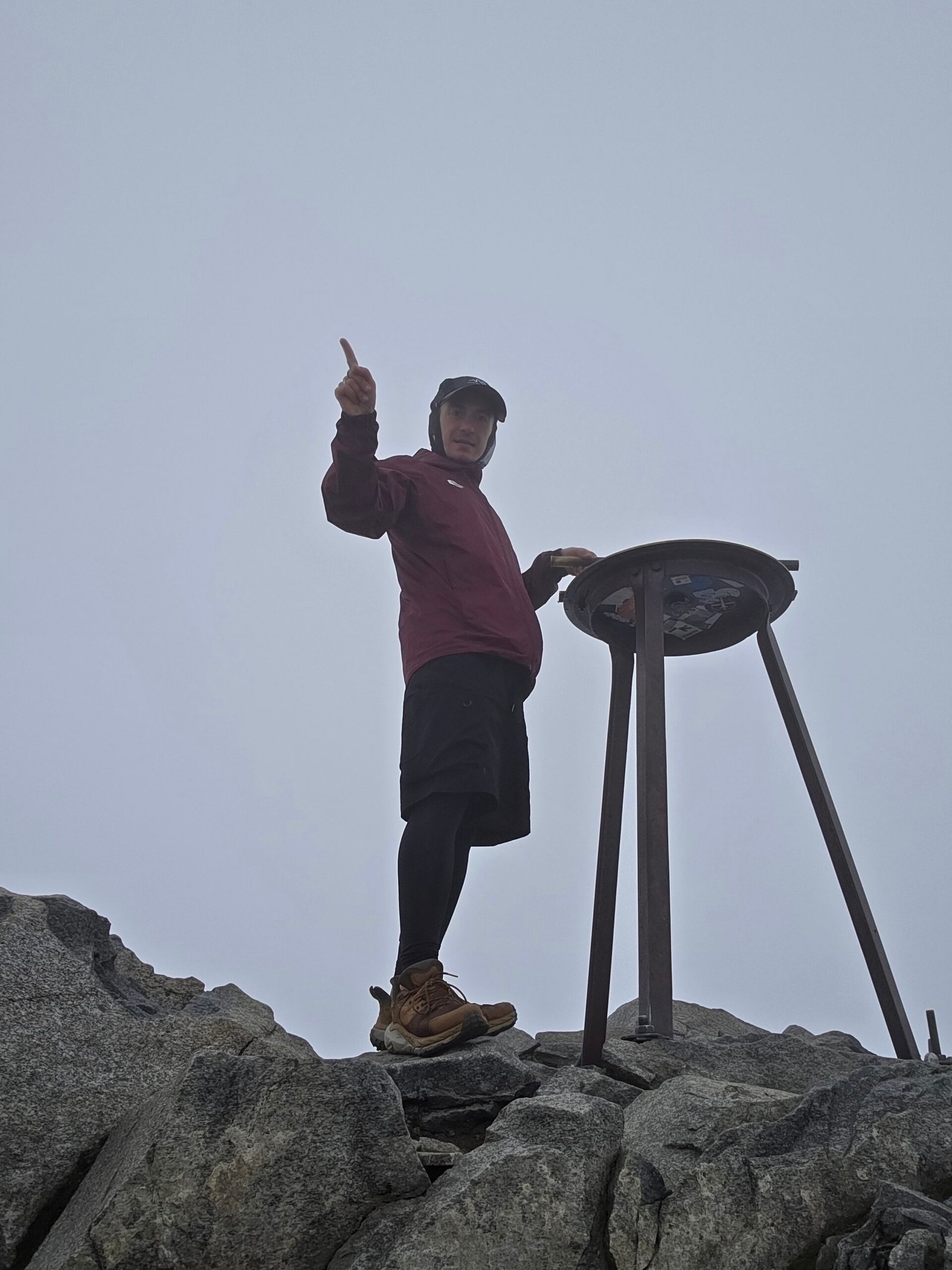
The 2,469 m summit can be cold and windy even in summer. A summit cabin may have seasonal opening; check the operator rather than relying on shelter, food or opening hours. Keep enough time and energy for a safe return. National park.
08 / The descent
Descent requires attention too.
Return by your planned route, watching for loose stones, snow and changing visibility. A different descent to Juvasshytta crosses a glacier and requires a separately planned guided crossing or a properly skilled, equipped team. Do not improvise a glacier crossing.
09 / Juvasshytta route
The higher start crosses Styggebreen.
Juvasshytta’s guided trip approaches the glacier, crosses it in rope teams and continues up steep ground to the summit. The operator describes a 2.8 km approach to the glacier and explains its guided procedure. Verify current dates, meeting times, requirements and conditions directly. Guided trip details.
10 / Glacier safety
Hidden crevasses can be fatal.
Snow bridges may conceal deep crevasses. Do not walk onto a glacier alone or without suitable team training, ropes, equipment and crevasse-rescue competence. Hire a qualified glacier guide if you lack these skills. Follow their instructions and be prepared to turn back. Operator safety guidance.
11 / Choosing a guide
Ask about qualification and conditions.
For a guided trip confirm the operator, route, meeting point, minimum fitness, age rules, equipment included, cancellation policy and current weather. On the non-glacier Spiterstulen route, a mountain guide can also help when experience or navigation is uncertain.
12 / Getting to Jotunheimen
Choose your start before booking travel.
Spiterstulen lies in Visdalen; Juvasshytta is a separate higher start. The national park identifies the Spiterstulen road turnoff from Fv. 55 at Røisheim. Check the full trip from your accommodation and allow time for mountain roads. National park.
13 / Driving and roads
Roads and weather change.
Check seasonal opening, road conditions and restrictions with the lodge and road authority. Allow for narrow mountain roads and weather-related closures. Confirm your rental terms and never assume a navigation app reflects a closure. Norwegian road information.
14 / Parking
Confirm parking at your chosen lodge.
Ask the relevant lodge about current parking, charges, opening and overnight restrictions. Park only where permitted and leave access for staff and emergency vehicles. Do not assume both trailheads share the same parking arrangements.
15 / Public transport
Plan the last leg in advance.
Check current train and bus connections to the Jotunheimen region and onward arrangements to the specific lodge. Services may be seasonal and trailhead transport cannot be assumed. Confirm the return connection before setting out.
16 / Where to stay
Lodges make an early start easier.
Spiterstulen and Juvasshytta are different accommodation options and starting points. Confirm opening, booking, meals, facilities and cancellation terms directly; the summit cabin is not a guaranteed overnight refuge.
17 / When to climb
Summer does not guarantee summer conditions.
Snow and freezing weather can persist at altitude. Check the route and lodge with local experts before deciding whether conditions match your experience. Winter and spring ski or snow routes require additional specialist planning.
18 / Mountain weather
Check the mountain forecast.
Consult Yr and local guides for wind, precipitation, temperature and visibility at elevation. A mild valley forecast is not a summit forecast. Postpone for storms, poor visibility or conditions beyond your skills. Yr forecast.
19 / Snow and ice
Snow and ice change the route.
Snow patches on the Spiterstulen route can be slippery or conceal terrain. Ice, exposure and avalanche conditions may require specialist equipment and skills. Ask local guides about the current route and turn back if uncertain.
20 / Water and food
Bring enough for a long day.
Carry drinking water, food and a reserve. Do not rely on a stream or summit café being available or safe. Ask the lodge about current water sources and opening before departure.
22 / Equipment
Dress for a high mountain.
Bring mountain footwear, waterproof shell, warm layers, hat and gloves, food, water, first aid, headlamp and emergency shelter. Check whether snow or ice equipment is needed; a glacier guide will specify the specialist gear for their trip.
23 / Safety and rescue
Leave a route and return time.
Tell someone where you are going and when you expect to return; reception is not guaranteed. In Norway call 112 for police or 113 for ambulance; give your location and follow instructions. Norwegian emergency numbers.
24 / Protect the park
Stay on the designated route.
Respect national park rules, keep away from wildlife, take litter home and leave the landscape undisturbed. Use existing paths where appropriate and avoid shortcuts on fragile or eroding ground. National park.
25 / Explore Jotunheimen
Make room for the wider park.
Jotunheimen offers valleys, lodges and cultural history as well as summits. Klimapark 2469 near Juvasshytta introduces mountain climate and ice; check opening and guided access directly before visiting. Park visitor ideas.
26 / Itineraries
Give the mountain its own day.
One day: choose one route, start early, allow generous time for descent and avoid fixed onward connections.
Longer stay: add an easier valley day or a separate visitor attraction; select each outing according to weather, ability and current access.
27 / Costs
Use your own Norwegian kroner estimates.
Budget for transport, road tolls or parking, accommodation, food, insurance and guiding if needed. Check current charges directly. The calculator uses your own NOK figures and does not display live prices.
28 / Saved checklist
Pack for Galdhøpiggen.
Saved only in this browser. Glacier travel requires specialist skills and equipment.
29 / Cost calculator
Use your own quotes.
Plan in Norwegian kroner.
Enter your own current prices in NOK. Vehicle and main travel are shared; the other amounts are per person. Include any park, guide and transfer quotes under the appropriate fields. Blank entries count as zero.
30 / My climb, FAQ & sources
Into the mist above Scandinavia.
After a family day at Møllehøj, my family took me to Odense bus station. I travelled by bus to Copenhagen, flew to Oslo and slept at the airport. The next day I collected a rental car and drove to Spiterstulen.
On 28 July 2025 I started at 12:40. Below 2,000 m conditions were mild, but higher up fog reduced visibility and rain turned to sleet on the rocks. At 16:48 I reached the cloud-covered summit. Inside the small summit café I shared coffee and conversation with a Norwegian mountain guide.
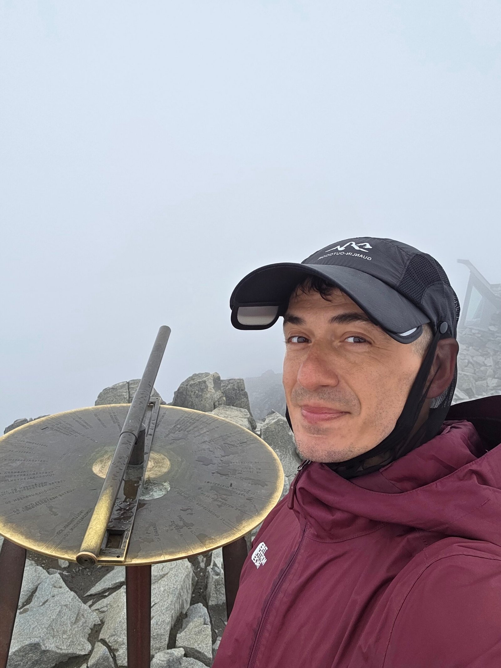
On the descent the wind grew stronger and the fog darker. I reached the car shortly before heavy rain arrived. My Strava record lists 17.68 km, 1,465 m of ascent, 4:58 moving and 6:27 elapsed. These are my personal figures, not a suggested itinerary or pace.

The mountain reminded me that a summit can be meaningful even without a view. The changing weather also makes a cautious plan essential.
Frequently asked questions
How high is Galdhøpiggen?
It is 2,469 m and Norway’s highest mountain.
Which route did Adrian take?
I followed the standard route from Spiterstulen on 28 July 2025.
Does Spiterstulen require a glacier crossing?
The marked standard route need not cross a glacier in suitable conditions, but snow and ice still require assessment.
Does Juvasshytta cross a glacier?
Yes, the common route crosses Styggebreen with hidden crevasses.
Do I need a glacier guide?
Join a qualified guide unless your whole party has the skills, equipment and training for glacier travel and crevasse rescue.
How long is the Spiterstulen walk?
The lodge lists 6 km one way and 4–6 hours up; allow for descent and breaks.
Is Juvasshytta easier?
It starts higher, but the glacier introduces a different serious hazard.
Can I visit without a summit?
Consider a suitable valley walk or Klimapark 2469, subject to opening and conditions.
Is there snow in summer?
Snow can persist. Check current conditions and do not assume snow-free ground.
Is the summit café always open?
No. Check seasonal opening directly and carry your own supplies.
What emergency numbers apply?
In Norway 112 is police and 113 ambulance.
What currency does the calculator use?
Norwegian kroner; enter your own current estimates.
Sources and current information
Research checked 2 November 2026. Conditions, opening and prices can change.
- Jotunheimen National Park: Galdhøpiggen ↗ — Official approach comparison
- Spiterstulen: Galdhøpiggen route ↗ — Route stages from the lodge
- Spiterstulen: long hikes ↗ — Indicative hiking times
- Juvasshytta: guided Galdhøpiggen ↗ — Glacier crossing and guided trips
- Norwegian Meteorological Institute: Yr ↗ — Forecasts and warnings
- Norwegian Public Roads Administration ↗ — Road conditions
- Visit Norway: emergency numbers ↗ — Emergency numbers
- Jotunheimen National Park: attractions ↗ — Klimapark and other sights