

01 / Start here
Start here
Carrauntoohil is Ireland’s highest mountain, in County Kerry’s MacGillycuddy’s Reeks. Kerry Mountain Rescue ↗ gives its height as 1,039 m; my original diary recorded 1,038 m. It is a serious mountain outing despite its modest height by Alpine standards.

02 / Route at a glance
Route at a glance
The traditional Devil’s Ladder route starts at Cronin’s Yard or Lisleibane and travels through Hag’s Glen to a steep, loose gully. Kerry Mountain Rescue advises allowing around six hours for the round trip. Your party, conditions, breaks and chosen start can make it longer; my own times are not a target.
03 / Choose your route
Choose your route
Devil’s Ladder is a popular but eroded gully with loose rock and stonefall risk. Alternatives such as Brother O’Shea’s Gully or the Coomloughra Horseshoe require their own route research, experience and suitable conditions. Do not treat any alternative as automatically safe or easier in poor weather.
04 / Is this walk for you?
Is this walk for you?
Expect a long day on wet paths, uneven ground and steep loose rock, with exposed upper slopes and demanding navigation in cloud. You need fitness, appropriate equipment and map-and-compass skills. If uncertain, walk with a more experienced person or a suitably qualified local guide, as Kerry Mountain Rescue ↗ recommends.

05 / Starting at Cronin’s Yard
Starting at Cronin’s Yard
Cronin’s Yard is one established access point. Check current parking arrangements and facilities directly with Cronin’s Yard ↗ before travel. Follow the permitted access route, respect residents and farmland, and leave gates as you find them.

06 / Starting at Lisleibane
Starting at Lisleibane
Lisleibane is another access point for Hag’s Glen. Check current local access and parking arrangements and plan the return to the same start. Rural roads are narrow: do not obstruct gateways, passing places or emergency access.
07 / Into Hag’s Glen
Into Hag’s Glen
From your chosen access follow the route described by Kerry Mountain Rescue into Hag’s Glen. The two approaches join in the glen. Keep to established paths, consider the weather and daylight early, and note landmarks for the return.

08 / River crossings
River crossings
The approach includes water crossings; Kerry Mountain Rescue warns that the ford in the glen demands care after prolonged heavy rain. Water levels change. Never enter a crossing that looks unsafe, and be prepared to turn back rather than becoming stranded on the far side.
09 / Between the lakes
Between the lakes
The route continues between Lough Gouragh and Lough Callee and then towards the foot of the gully. Beyond the rise the ground can be waterlogged and the path less distinct. A map and compass remain necessary even when other walkers are present.
10 / Devil’s Ladder
Devil’s Ladder
The Ladder is a steep gully of loose scree and boulders, with severe erosion especially towards its upper section. Rock can be dislodged by people above or by your own party. Kerry Mountain Rescue advises against leaving the gully for apparently easier flanking ground, especially on descent. If the conditions or other parties make it unsafe, turn around before committing.

11 / Above the gully
Above the gully
From the top of the Ladder the route turns towards the summit slope. Visibility can vanish quickly and tracks branch. The local rescue team warns against straying towards dangerous ground above Curraghmore or onto a narrow track towards the Heavenly Gates. Navigate from a suitable map and do not rely on this summary alone.
12 / At the summit
At the summit
The summit cross is a distinctive landmark, but wind and cloud may make the top cold and exposed. Keep a safe distance from steep ground, take a bearing for your planned descent and allow enough time for the entire return. Views are never guaranteed.

13 / The descent
The descent
Plan your descent before leaving the summit and keep your party together. Going down the loose Ladder can be slower and more awkward than going up; be aware of people above and below. If you cannot safely use your planned descent, seek a safe place and professional assistance rather than improvising on unfamiliar cliffs.

14 / Other mountain routes
Other mountain routes
Kerry Mountain Rescue describes several routes in its route guide ↗. Brother O’Shea’s Gully and ridge options have different hazards, route-finding demands and exposure. Study a detailed map and the full description for your chosen route; do not select one solely because it looks shorter on a screen.
15 / Bothar na Gige
Bothar na Gige
The old zigzag route on Cnoc na Toinne is sometimes used as an alternative to the Ladder, but the local rescue team notes extra ascent, erosion, loose ground and accidents in wet or icy conditions. It is not a risk-free escape route. Research it in advance and choose according to experience and conditions.
16 / Getting to Kerry
Getting to Kerry
Killarney is a useful base for the Reeks. Check current rail and coach services with Iarnród Éireann ↗ and Bus Éireann ↗. Public transport to your exact mountain start may be limited, so confirm the final connection and return before relying on it.
17 / Driving and parking
Driving and parking
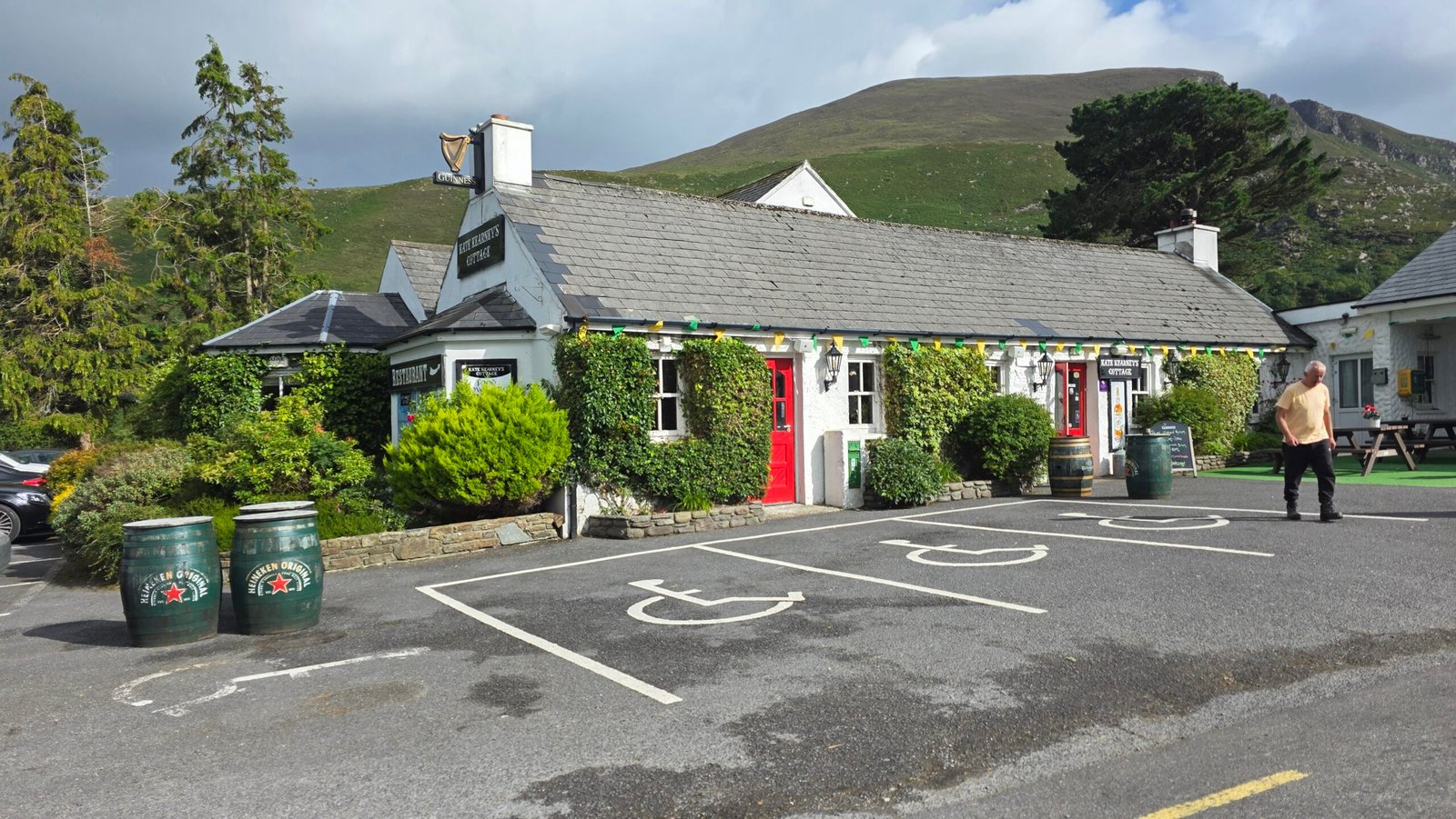
Approach on narrow rural roads with care and use an authorised parking area. Check current conditions and fees with the operator, leave room for farm traffic and emergency vehicles, and do not block gates or passing places. A historical report is not a current parking reservation.
18 / Where to stay
Where to stay
Killarney and the surrounding villages offer accommodation at different budgets. Compare the drive to your chosen trailhead and arrange a restful night before and after the walk. In busy periods, check availability and cancellation terms before booking.
19 / Best season and daylight
Best season and daylight
Longer summer daylight can give a more forgiving schedule, but rain, cloud and strong wind occur at any time. In winter or whenever snow and ice are present, the route can require specialist equipment and skills. Check daylight and current conditions, then set a realistic turnaround time.
20 / Mountain weather
Mountain weather
Check Met Éireann’s mountain forecast ↗ and current warnings shortly before departure. Consider gusts, cloud, rain, temperature and visibility at mountain height; valley weather can be misleading. Be willing to postpone or turn around if the forecast or actual conditions are unsuitable.
22 / Equipment and clothing
Equipment and clothing
Bring waterproof jacket and trousers, warm layers, hat and gloves, suitable mountain footwear, food, water, a headtorch, first aid, an emergency shelter and a charged phone. Adapt equipment to the forecast and your group. Snow, ice and technical terrain need additional skills and equipment.
23 / Food water and facilities
Food water and facilities
Carry sufficient food and water for the planned day and delays. Do not assume streams are safe to drink or that facilities will be open when you return. Check current services at your start and carry all litter home.
24 / Emergency and rescue
Emergency and rescue
In an emergency call 999 or 112 and ask for Mountain Rescue; in the Republic the emergency system will connect you with the Gardaí. Give your location, nature of the emergency, party details and callback number, and follow instructions. Mountain Rescue Ireland ↗ explains how to request help; mobile reception cannot be relied on everywhere.
25 / Access and dogs
Access and dogs
Much of the mountain is accessed with the goodwill of local landowners. Kerry Mountain Rescue ↗ says dogs are not permitted on Carrauntoohil. Respect that request, livestock, gates and any current signs or access restrictions.
26 / Protect the Reeks
Protect the Reeks
Use established paths where appropriate, respect farmland and other walkers, and leave no litter. Avoid widening eroded tracks or dislodging rocks. Review Leave No Trace Ireland ↗ principles and local notices before visiting.
27 / Plan your day
Plan your day
Check the mountain forecast and daylight, choose the route to match your least experienced member, tell a trusted person your route and expected return, and agree a turnaround time. Reassess at the glen and before the Ladder. A low-level alternative is a good plan when the mountain is not suitable.
28 / Plan and costs
Plan and costs
Enter your own prices in euros below. Vehicle and main travel are shared between the party; lodging, food and other listed amounts are per person. Check current charges with the relevant provider. The calculator runs locally and gives an estimate, not live prices.
Enter your own prices in euros. Vehicle and main travel are shared; the other amounts are per person. Blank entries count as zero.
Saved planning checklist
Saved only in this browser.
29 / My climb on 4 August 2025
My climb on 4 August 2025
After Dufourspitze and the ice of the Alps, I travelled back through Milan to London, spent a night at home repacking and flew to Cork early on 4 August. My Irish friend Brendan met me at the airport. We drove west to Cronin’s Yard, catching up and laughing along the way; after weeks of travelling, it was good not to be alone.
We started just after 11:00 and followed the Devil’s Ladder route. Recent rain had left the steep, rocky ground slick, and the wind strengthened as we climbed. At 14:10 we reached the summit cross, with cloud and gusts around us. We stayed only a few minutes, then returned carefully by the same route and reached the parking area at 17:11. These are my personal times, not recommended targets.
Afterwards Brendan and I had lunch in a local pub and drove back to Cork. I spent the night in a hostel and set my alarm for 05:00 for the flight to Edinburgh and the next mountain. After the intensity of the Alps, the day reminded me to breathe, appreciate a friend’s company and feel grounded. Thank you, Brendan, for the stories and a memorable day.

30 / Questions answered
Questions answered
How high is Carrauntoohil?
Kerry Mountain Rescue gives 1,039 m. My original expedition account recorded 1,038 m; sources use slightly different figures.
Is Carrauntoohil Ireland’s highest mountain?
Yes. It lies in the MacGillycuddy’s Reeks in County Kerry.
How long does Devil’s Ladder take?
Kerry Mountain Rescue suggests allowing around six hours for the round trip. Weather, fitness, navigation, breaks and your starting point can change that substantially.
Is the Devil’s Ladder easy?
No. It is steep and eroded, with loose rocks, stonefall risk and potentially difficult conditions in rain, ice or busy traffic.
Where does the route start?
Cronin’s Yard and Lisleibane are established starts for Hag’s Glen. Check current access, parking and return arrangements for the one you choose.
Can beginners climb Carrauntoohil?
It is a demanding mountain day. If you lack experience with steep ground and navigation, go with an experienced party or suitably qualified guide and choose suitable conditions.
Is Devil’s Ladder dangerous in rain?
Wet rock, loose ground, reduced visibility and swollen crossings increase the challenge. Turn back when the route or a crossing is unsafe.
Can I avoid the Ladder?
Other routes exist, but they have their own hazards and navigation demands. Study the full local rescue descriptions and a suitable map before choosing one.
Can I bring my dog?
Kerry Mountain Rescue says dogs are not permitted on Carrauntoohil; respect local landowners’ wishes.
What map should I take?
Kerry Mountain Rescue lists several suitable maps, including the 1:25,000 MacGillycuddy’s Reeks map and Discovery Series sheet 78. Carry a compass and know how to use both.
What is the best season?
Longer summer daylight helps planning, but conditions can be severe in any season. Check the actual forecast and daylight rather than relying on the calendar.
Can I climb in winter?
Only with appropriate winter mountaineering experience, equipment and suitable conditions. Ice and snow can transform the route.
Is there parking at the start?
Parking exists at established access points; check current arrangements and charges with the relevant operator. Never block gates or emergency access.
Can I get there by public transport?
Killarney has rail and coach services, but connections to a specific trailhead may be limited. Verify the complete outward and return journey.
Do I need a guide?
A guide is not automatically required, but is sensible if your navigation or steep-ground experience is insufficient. Choose a suitably qualified local guide.
Can I drink from streams?
Do not assume untreated water is safe. Carry enough for the day and allow for delays.
What if someone needs rescue?
Call 999 or 112 and ask for Mountain Rescue. Give your location and incident details and follow the emergency operator’s instructions.
Sources and current information
Research checked 2 November 2026. Conditions and services can change.