
01 / Start here
Start here.
Mont Blanc is a high-altitude mountaineering objective, not a hike made safe by popularity. The Goûter route includes a rockfall-exposed couloir, steep ground, glacier travel and an exposed summit ridge. Appropriate experience, acclimatisation, equipment and current conditions are essential. Saint-Gervais route information.


02 / The Goûter route
The Goûter route.
A common approach uses the Mont Blanc tramway toward Nid d’Aigle, continues to Tête Rousse and the Grand Couloir, climbs to the Goûter refuge, then crosses high glacier terrain toward the summit. The exact itinerary and access depend on current conditions and closures. Official route overview.

03 / Grand Couloir rockfall
Grand Couloir rockfall.
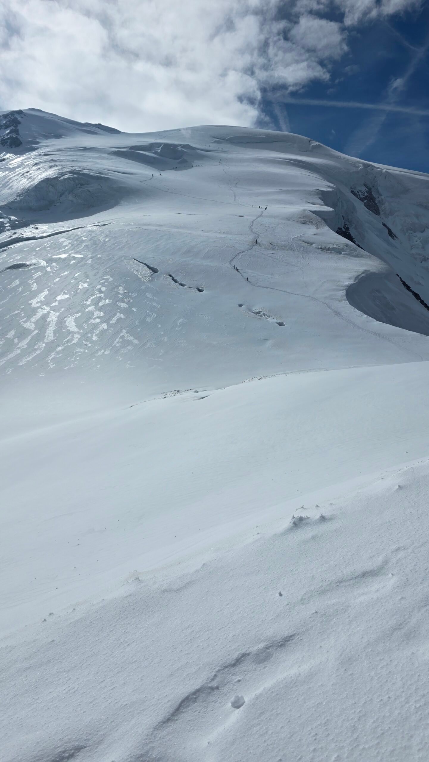
The crossing between Tête Rousse and Goûter is exposed to potentially fatal rockfall. A helmet cannot eliminate the hazard. Seek current information from guides and authorities and be ready to cancel or turn back; no crossing time guarantees safety. Saint-Gervais warning.
04 / Closures change
Closures change.
Following major rockfall in August 2026, Saint-Gervais closed the Tête Rousse and Goûter refuges and later announced reopening from 26 August. That historical reopening is not a statement of current safety or opening: check live official notices for your dates. Closure notice · Reopening notice.
05 / Glacier and ridge
Glacier and ridge.
Crevasses can be concealed, weather can deteriorate rapidly and the Bosses ridge is exposed. A competent rope team must have glacier travel and crevasse-rescue skills and equipment. A GPS track or popular route does not make a glacier safe.


06 / Choose a guide
Choose a guide.
Saint-Gervais recommends a local mountain guide for the ascent. Discuss your prior experience, acclimatisation, group size, equipment, weather decisions and cancellation terms. A guide cannot eliminate objective hazards. Official advice · Local guides.
07 / Huts and reservations
Huts and reservations.
Saint-Gervais says climbers using the normal route need a reservation at one of the specified route refuges, and hut access is regulated. Check the current prefectural rules, hut opening and reservation terms for your dates. Do not assume a bed is available on arrival. Hut information.
08 / Camping and bivouac
Camping and bivouac.
The protected-area rules restrict camping and bivouacking, including on the normal route except in force majeure, with specific arrangements for the Tête Rousse base camp. Check current official rules and authorisations before making plans. Official protected-area rules.
09 / Tramway approach
Tramway approach.
The Mont Blanc tramway connects Le Fayet with the Nid d’Aigle area in season. Check the actual terminal, timetable, tickets and service status; weather and works may change the service. My ascent started in the valley on foot and should not be used as a typical tram itinerary. Tramway information.
10 / Height and geography
Height and geography.
My 2025 diary used 4,808 m. The French surveyors’ 2026 campaign reported 4,807.47 m; the snow-and-ice summit changes over time. Mont Blanc is the highest mountain in the Alps and Western Europe; the France–Italy summit border is historically disputed. 2026 survey.
11 / Acclimatisation
Acclimatisation.
At nearly 4,800 m, altitude adds risk even for very fit people. Plan a progressive acclimatisation period with your guide before the ascent and allow time to descend if anyone becomes unwell. A hut reservation does not replace acclimatisation.
12 / Altitude illness
Altitude illness.
Headache, nausea, unusual fatigue or poor coordination at altitude can be serious. Tell your guide immediately, do not continue upward with worsening symptoms and descend as advised; in severe illness seek urgent rescue. Discuss personal medical concerns with a qualified clinician before travel.
13 / Fitness and prior skills
Fitness and prior skills.
Train for repeated long days carrying a pack, but endurance is only one part of readiness. Prior experience with crampons, ice axe, roped glacier travel, exposed terrain and rescue is important. A qualified guide can assess suitable preparation.
14 / Weather
Weather.
Check a current high-mountain forecast for wind, temperature, visibility, precipitation and storms. Conditions can change while you are on the mountain; use conservative turnaround criteria and follow your guide. Météo-France mountain forecasts.
15 / Season
Season.
Conditions, hut operations and tram schedules vary. Summer does not guarantee safe snow, stable weather or a safe couloir. Outside the main season, winter conditions introduce additional hazards and specialised requirements.
16 / Technical equipment
Technical equipment.
Confirm the exact list with your guide. It commonly includes appropriate boots, crampons, ice axe, helmet, harness, rope and crevasse-rescue equipment, as well as insulation, waterproof layers, sun protection, navigation and a headlamp. Equipment requires training and correct use.
17 / Other routes
Other routes.
The Trois Monts route via the Aiguille du Midi and Cosmiques is a different mountaineering route with serious glacier, steep-snow and serac hazards. Do not switch to it as a casual fallback. Discuss any alternative with a qualified guide.
18 / Time and distance
Time and distance.
Saint-Gervais describes a standard ascent plan using two nights and three days, excluding prior preparation and acclimatisation. My continuous valley-to-summit day was exceptional and hazardous, not a recommended schedule. Official hut planning.
19 / Turnaround decisions
Turnaround decisions.
Set a turnaround time and weather limits before departure, but change them sooner if your group or conditions demand it. Leave energy and daylight for a descent; the summit is only halfway through the journey.
20 / Getting there
Getting there.
Saint-Gervais, Le Fayet and the wider Chamonix valley are common bases. Plan rail, local transport, the tramway and the final return together. Check current operators and do not assume your descent ends at your starting point.
21 / Where to stay
Where to stay.
Reserve a suitable valley base for preparation and check the prescribed high huts for the chosen route. Confirm terms directly and keep contingency for weather or a cancelled climb.
22 / Food, water and pack
Food, water and pack.
Agree a realistic load with your guide, including water, food and a reserve. My over-heavy pack cost me energy; do not under-carry essentials to copy a lighter pack. Verify hut services and reliable refill plans.
23 / Care for the massif
Care for the massif.
Follow protected-area rules, use appropriate routes, carry waste down and respect hut staff and other parties. The high mountain is fragile and crowded in good weather. Protected-area rules.
24 / Emergency
Emergency.
Call 112 in an emergency and provide location, injuries and conditions. Rescue can be delayed or impossible in dangerous weather. Independent teams must have the skills to respond immediately to a crevasse incident.
25 / Plan a weather window
Plan a weather window.
Allow preparation and acclimatisation before a staged climb, reserve required huts and include a spare weather window. Choose an alternate lower objective if the route or forecast is unsafe.


26 / Costs
Costs.
Budget for transport, accommodation, required huts, guide fees, equipment hire, insurance and food. The calculator uses your own current euro quotes rather than live prices.
27 / Insurance and rescue cover
Insurance and rescue cover.
Check that your policy covers high-altitude mountaineering, glacier travel, guided or independent climbing and rescue where relevant. Read exclusions and altitude limits directly with the insurer.
28 / Saved checklist
Prepare for a serious alpine climb.
Saved only in this browser. Mont Blanc is a serious high-altitude glacier and mountaineering ascent. The normal route is not a beginner hike; seek qualified guiding and current route advice.
29 / Cost calculator
Use your own quotes.
Plan in euros.
Enter your own current prices in EUR. Vehicle and main travel are shared; the other amounts are per person. Include any park, guide and transfer quotes under the appropriate fields. Blank entries count as zero.
My story, FAQ & sources
Valley to summit to valley.
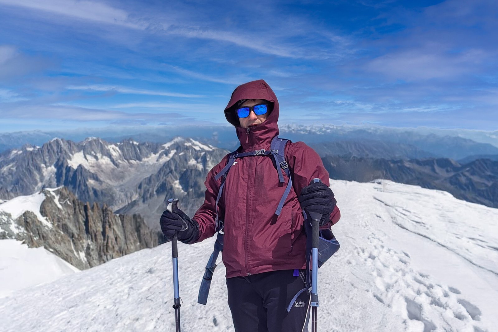
On 15 July 2025 I started from Les Houches at 00:50 after very little sleep. It was my second solo Mont Blanc climb, nine years after my first. I carried too much water and delayed putting on warmer layers as the cold intensified.
I continued toward Goûter and into strong wind higher on the mountain. My diary records reaching the summit around 12:05, exhausted, and turning back after a short stop. On an icy slope during the descent I slipped and managed to stop myself with my ice axe.
Below Goûter I strayed onto an old secured route before finding my way back. Around 21:00 I reached Bionnassay, where my father was waiting. The roughly 38 km and 3,794 m gain in my record describe my own demanding day, not a route recommendation.
I came away aware that I had taken serious risks. This account is not an instruction to repeat a solo ascent: a staged itinerary, competent partners or qualified guidance, acclimatisation and a willingness to turn back are central to planning.
Frequently asked questions
Is Mont Blanc a hike?
No. Even the normal route is a serious high-altitude mountaineering ascent involving glacier, exposure and objective hazards.
Can a beginner climb Mont Blanc?
It is not an introductory climb. Build alpine and glacier experience and seek assessment from a qualified mountain guide.
Do I need a guide?
Saint-Gervais recommends a local guide; independent climbers need the skills, equipment and judgement to manage the full route.
What is the Goûter route?
A normal-route approach via Tête Rousse and Goûter, then high glacier terrain and the summit ridge.
What is the Grand Couloir?
A rockfall-exposed crossing between Tête Rousse and Goûter. Fatal rockfall can occur and no timing removes all risk.
Is the Goûter route currently open?
Conditions and closures change. Check current notices, hut status and advice from local guides before departing.
Were the huts closed in 2026?
Saint-Gervais closed them after major August rockfall and announced reopening from 26 August 2026; this is not current-condition advice.
Do I need to reserve a hut?
Saint-Gervais says a reservation at one of the specified normal-route refuges is required. Verify the current rules for your dates.
Can I camp on the normal route?
Camping and bivouac are restricted by protected-area rules, with specific exceptions and arrangements; check the current official text.
Can I climb in a day?
My diary describes a continuous day, but it was exceptionally demanding and risky. Follow current rules and plan a staged climb with acclimatisation and expert advice.
Does the tram reach the summit?
No. It serves the approach to the Nid d’Aigle area, far below the summit.
How high is Mont Blanc?
My diary used 4,808 m. French surveyors measured 4,807.47 m in 2026; the snow-and-ice summit varies.
Is it Europe’s highest mountain?
It is the highest mountain in the Alps and Western Europe; Europe-wide rankings depend on the geographical boundary used.
How long does the ascent take?
Saint-Gervais describes a standard two-night, three-day climb, excluding prior preparation and acclimatisation. Conditions and parties vary.
Do I need crampons and an ice axe?
Technical equipment is normally necessary, but exact requirements depend on current conditions and your guide’s assessment.
Are there crevasses?
Yes. Snow may conceal crevasses, so glacier travel and rescue skills are essential.
What happens if I feel unwell at altitude?
Tell your guide immediately, avoid further ascent with worsening symptoms and descend or seek urgent help as appropriate.
What if I cannot book a hut?
Do not assume you can camp or bypass current rules. Choose different dates or another objective.
What is the emergency number?
Call 112 and give your position and situation.
When did Adrian climb?
15 July 2025; the diary describes his second solo ascent.
Sources and current information
Research checked 2 November 2026. Conditions, access and prices can change.
- Saint-Gervais: Mont Blanc route ↗ — Normal route, guides and hut reservations
- Saint-Gervais: rockfall and hut closures ↗ — August 2026 closure after rockfall
- Saint-Gervais: hut reopening ↗ — Reopening on 26 August 2026
- Haute-Savoie: protected-area rules ↗ — Camping and access regulations
- Saint-Gervais: Mont Blanc huts ↗ — Hut planning and reservations
- French surveyors: 2026 summit measurement ↗ — 2026 altitude measurement
- Saint-Gervais: Mont Blanc tramway ↗ — Approach transport
- Météo-France mountain forecasts ↗ — Mountain weather
- Compagnie des Guides de Saint-Gervais ↗ — Local mountain guiding