
01 / Start here
Start here
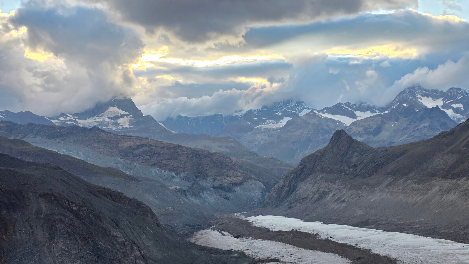
Dufourspitze (4,634 m), in the Monte Rosa massif, is Switzerland’s highest summit. This is a serious high-altitude mountaineering objective involving glaciers, crevasses and an exposed rocky ridge. It is not an ordinary hike: experience, technical competence, acclimatisation and current local advice are essential.

02 / Current hut and access status
Current hut and access status
When checked on 2 November 2026, the Monte Rosa Hut ↗ reported that the hut and its official approach were closed for the season. This is a dated status, not a prediction for your trip: check the hut directly for current opening, access and bookings before planning.
03 / The route at a glance
The route at a glance
The Swiss Alpine Club route portal ↗ lists the normal route from Monte Rosa Hut via the saddle and west ridge as AD−, with 7–8 hours and about 1,750 m ascent for the ascent. This excludes the return and hut approach. Conditions, acclimatisation, rope work and the party can change timings substantially.
04 / Is Dufourspitze for you?
Is Dufourspitze for you?
You need sound glacier travel, crevasse-rescue and rope-team skills, confidence on exposed mixed alpine terrain, excellent fitness and the judgement to retreat. A qualified mountain guide can provide local knowledge and leadership, but clients still need the fitness, preparation and equipment agreed in advance. Discuss experience and acclimatisation honestly with your guide.
05 / Choose the right objective
Choose the right objective
The normal west-ridge route is a demanding alpine climb, not a beginner’s first glacier trip. Other routes have different hazards and are not automatic bad-weather alternatives. A lower-altitude Zermatt day, training course or a guide-selected objective may be more appropriate; decide with current conditions and your own experience in mind.
06 / Getting to Zermatt
Getting to Zermatt
Zermatt is car-free. Plan the rail connection from Täsch and the onward Gornergrat railway to Rotenboden using current operator information. Zermatt tourism ↗ and the Gornergrat Bahn ↗ provide current travel details. Check first and last services for the actual day and allow for disruption.
07 / From Rotenboden
From Rotenboden
The approach to Monte Rosa Hut is itself an alpine journey. The hut’s current access guidance ↗ describes summer routes from Rotenboden involving glacier crossings, moraine and demanding alpine paths. Check the current recommended approach and seasonal access directly with the hut; old tracks may no longer be safe.

08 / Crossing the glacier to the hut
Crossing the glacier to the hut
The hut says glacier access and crossing lines change continually. Its current guidance requires mountain boots and crampons and notes that a harness, ice axe and poles are recommended; depending on conditions a rope may be advisable or necessary. Follow current hut and professional guidance, not an old GPX or someone else’s footprints.
09 / Monte Rosa Hut
Monte Rosa Hut
The hut is a key base for the climb, but staffing, reservation rules and access change with the season. Check its official website ↗ for availability and instructions. A booked bed does not make an approach or summit route safe in unsuitable conditions.
10 / Acclimatisation
Acclimatisation
At 4,634 m altitude illness is a real risk even for very fit people. Build a gradual acclimatisation plan with your guide, allow extra days and do not assume rapid travel to a high hut is sufficient. Symptoms, progression and individual responses vary; no summit schedule justifies ignoring them.
11 / Preparing for summit day
Preparing for summit day
Agree the route, equipment, rope strategy, forecast limits, turnaround time and contingency plan before leaving the hut. A very early start is common but timing depends on conditions and the guide’s judgement. My 2025 schedule and exhausted state are not a template.
12 / Glacier travel
Glacier travel
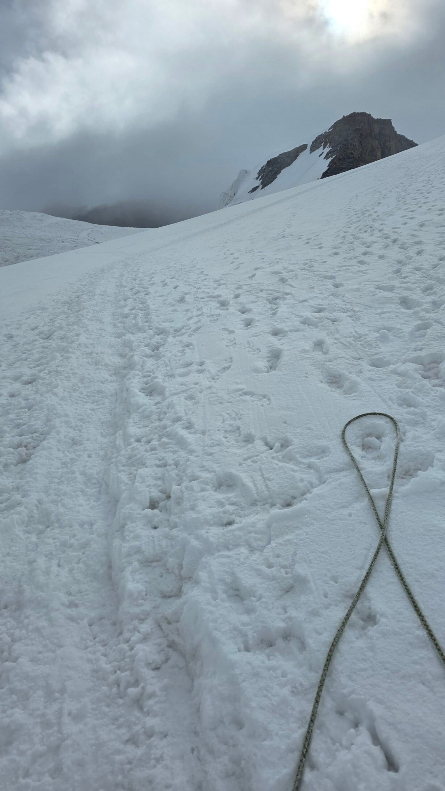
The glacier can contain concealed crevasses, unstable snow bridges, exposed ice and changing terrain. A rope team must know how to assess conditions, travel appropriately and perform crevasse rescue. A rope by itself does not make a glacier safe; seek professional instruction and current advice.
13 / The upper slopes
The upper slopes
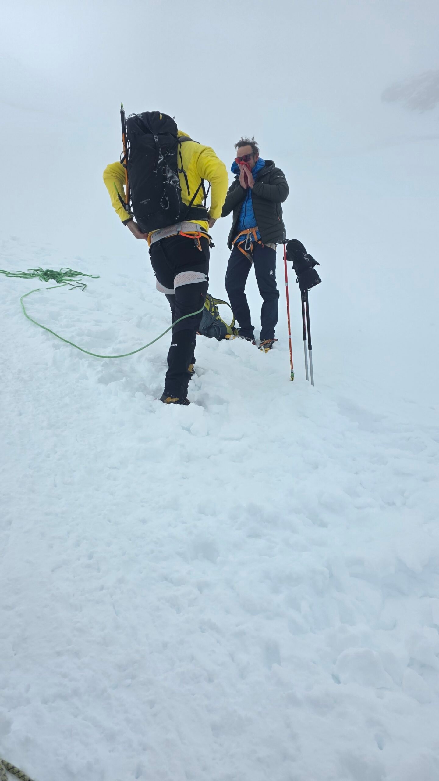
The ascent is long and exposed to wind, cold, snow and changing visibility. Conditions can deteriorate rapidly and movement at altitude is often slower than expected. Keep the group together, monitor each other and turn back before the margin for a safe descent disappears.
14 / The west ridge
The west ridge
The normal route includes an exposed rocky ridge with mixed conditions possible. Appropriate rope management, route-finding and climbing competence are required; snow, verglas and high winds can make the same terrain much more serious. Consult the SAC route and a qualified guide rather than using this summary as a technical route description.
15 / At the summit
At the summit
The summit is a narrow high-alpine location, not a place to linger in bad weather. Assess the weather, remaining energy and descent continuously. A safe return matters more than a photograph or reaching a coordinate.
16 / The descent
The descent
The summit is only part of the day. Fatigue, warming snow, changing glacier conditions and the long return to the hut or transport all affect the descent. Follow a pre-agreed plan, maintain rope-team discipline and leave a generous margin for delays.
17 / Returning to Rotenboden
Returning to Rotenboden
The journey from the hut to Rotenboden includes another serious alpine approach and glacier crossing. Check the hut’s current descent recommendations and railway timetable; the recommended line can change as the glacier moves. Do not rush because of a train reservation.
18 / Weather and storms
Weather and storms
Check MeteoSwiss ↗ forecasts and warnings for the relevant altitude and time, and discuss current mountain conditions with the hut and guide. Wind, snowfall, freezing level, visibility and thunderstorms can invalidate a plan quickly. A forecast is not a guarantee: turn back or postpone when conditions exceed the party’s margin.
19 / Snow ice and avalanche
Snow ice and avalanche
Fresh snow, wind loading and unstable snow can create avalanche hazards even outside the main winter season. Consult the SLF avalanche bulletin ↗ when available and seek current local assessment. A missing bulletin is not proof of safety; glacier and serac hazards also remain.
20 / Equipment and skills
Equipment and skills
Agree a complete equipment list with your guide. It normally includes suitable mountaineering boots, crampons, ice axe, helmet, harness, rope-team and crevasse-rescue equipment, warm layers, waterproof protection, gloves, eye and sun protection, headtorch and navigation. Equipment must fit the route and conditions, and everyone must know how to use it.
21 / Cold and frostbite
Cold and frostbite
Numb or painful extremities, wet clothing and strong wind need immediate attention. If frostbite is suspected, get to shelter if safely possible and seek medical help; do not rub the affected area or apply direct heat. The NHS frostbite guidance ↗ explains warning signs and first aid. My later account of minor frostbite was a personal experience, not a diagnosis for others.
22 / Altitude illness
Altitude illness
Headache, nausea, unusual fatigue or impaired coordination at altitude deserve attention. If symptoms occur, stop ascending and seek expert medical advice; serious or worsening symptoms require urgent descent and emergency help. Follow your guide’s and medical professionals’ instructions rather than trying to push through.
23 / Food water and energy
Food water and energy
Plan enough food and fluid for the approach, summit day, return and delays. Check what the hut supplies and when. At altitude and in the cold, eating and drinking may be difficult; practising your routine before the climb and keeping supplies accessible can help.
24 / Emergency and rescue
Emergency and rescue
For an emergency in Switzerland call 112 or 144; Rega ↗ can be reached on 1414 for Swiss air rescue. Give your location, party details and the problem, and follow the dispatcher’s instructions. Network coverage and flying weather are not guaranteed; rescue may take time and may involve costs.
25 / Insurance and guides
Insurance and guides
Check that your travel or alpine insurance explicitly covers high-altitude mountaineering, glacier travel, rescue, helicopter evacuation and your intended routes, including exclusions and limits. Check qualifications, group size, inclusions and cancellation terms with the guide or provider before booking.
26 / Stay and travel alternatives
Stay and travel alternatives
Allow extra days in Zermatt or Täsch for acclimatisation, a weather window and recovery. Compare accommodation with your rail connections and budget. If conditions prevent the climb, choose a suitable lower-level activity with your guide rather than switching casually to another glacier or exposed ridge.
27 / Plan and costs
Plan and costs
Enter your own quotes in Swiss francs below. Shared vehicle and main travel costs are divided between the group; accommodation, food, transfers, guide or equipment and other costs are per person. Verify current prices and reservation terms with providers; the estimate is calculated in your browser.
Enter your own prices in Swiss francs. Vehicle and main travel are shared; the other amounts are per person. Blank entries count as zero.
Saved planning checklist
Saved only in this browser.
28 / My climb on 2 August 2025
My climb on 2 August 2025
After Halti, poor weather prevented my planned Kebnekaise climb. I drove through northern Norway and flew from Tromsø via Gdańsk to Milan. After an overnight drive and only brief sleep in the car, I travelled via Täsch, Zermatt and Rotenboden to the Monte Rosa Hut, arriving around 18:00 on 1 August. I shared dinner with other climbers and my guide, Leo, then went to bed exhausted.
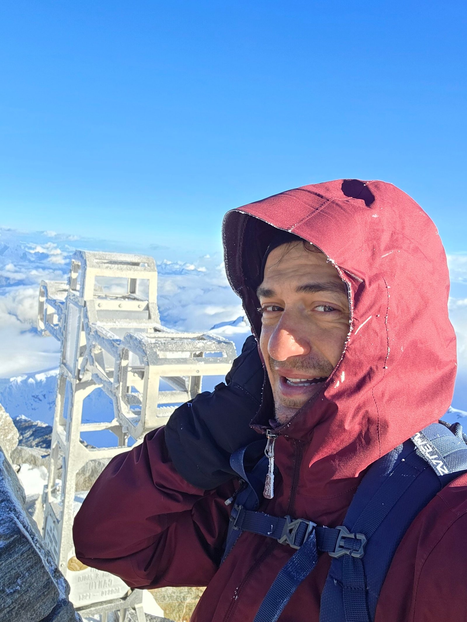
The alarm rang at 02:20. We roped up in darkness, fog and blowing snow. The glacier was hard ice with crevasses requiring detours; higher up the storm intensified and I could barely feel my feet. At 07:50 I reached the summit in cloud and wind, feeling empty and still rather than triumphant. I later realised that I had suffered what I described as minor frostbite on both toes.
We descended carefully, reached the hut around 11:00 and, after a short rest and soup, returned to Rotenboden by 16:30. The day tested my endurance after weeks of travel. In my original reflection I wrote that quitting never felt like an option; that was how I experienced the day, not advice for future climbers. Turning back is a responsible decision when safety margins disappear.
29 / Before you commit
Before you commit
Speak to the hut and your guide about current glacier access, weather, snow, acclimatisation and the descent plan. Check the hut’s seasonal status and transport both ways. Be ready to postpone or turn around; neither a booking nor my 2025 ascent guarantees safe conditions today.

30 / Questions answered
Questions answered
How high is Dufourspitze?
The Swiss Alpine Club gives its height as 4,634 m; it is Switzerland’s highest summit.
Is Dufourspitze a hiking route?
No. It is a serious high-alpine mountaineering objective involving glacier travel and exposed terrain.
Which route is usually called the normal route?
The SAC lists the route from Monte Rosa Hut via the saddle and west ridge as the normal route. Conditions and the line can change.
How long does the climb take?
The SAC lists 7–8 hours for the ascent from the hut, excluding descent and approach. Your party and conditions may require considerably more time.
Is the Monte Rosa Hut open?
Its website reported the hut and official approach closed for the season when checked on 2 November 2026. Check its current notice and bookings for your dates.
Can beginners climb it?
It is not a suitable first glacier outing. Build relevant mountaineering experience and discuss fitness, acclimatisation and skills with a qualified guide.
Do I need a guide?
A guide is not automatically required for every competent party, but is strongly advisable if your experience or local knowledge is insufficient. You remain responsible for being prepared.
Are crampons needed to reach the hut?
The hut’s current summer guidance says mountain boots and crampons are essential for its glacier approach; other equipment can be necessary depending on conditions.
Can I use an old GPX track?
Treat it as historical information only. Glacier crossings move and may change at any time; obtain current guidance from the hut and qualified professionals.
How do I get to Rotenboden?
Travel by rail via car-free Zermatt and use the Gornergrat railway. Check current timetables and connections with the operator.
Can altitude illness affect fit climbers?
Yes. Fitness does not guarantee protection. Acclimatise gradually and take symptoms seriously.
What weather should I check?
Check mountain-height wind and gusts, snowfall, visibility, freezing level and storm risk with MeteoSwiss, the hut and your guide.
Is there avalanche danger in summer?
Fresh snow and wind can create danger outside the main winter season. Consult current information and local experts; no bulletin does not mean no risk.
What if I suspect frostbite?
Seek shelter and medical help, avoid rubbing or direct heat, and follow professional advice. Cold injury can worsen with continued exposure.
Can I descend to Rotenboden the same day?
It depends on conditions, your party and transport. The return from the hut includes glacier and alpine terrain, so plan a substantial margin and avoid rushing for a train.
What insurance do I need?
Check explicit coverage for high-altitude mountaineering, glacier travel, rescue and evacuation, including limits and exclusions, with your insurer.
How do I call for rescue?
In Switzerland call 112 or 144; Rega’s Swiss air-rescue number is 1414. Give your location and details, and follow the dispatcher’s instructions.
Sources and current information
Research checked 2 November 2026. Conditions and services can change.