
01 / Start here
A little hill.
A different kind of Latvia.
Gaiziņkalns is Latvia’s highest hill, but the pleasure of visiting is wonderfully small-scale: a forest path, a quiet summit and the rolling countryside of Vidzeme.
This is a place for a relaxed walk and a wider regional journey. Follow the nature trail, listen to the stories behind the landscape, then choose a lake, a town or a cultural stop. The summit can be the beginning of your day rather than its entire purpose.
I visited on 31 August 2025 and reached the top at 11:02, after Suur Munamägi in Estonia. Grey clouds had replaced the clear northern morning. The hill was green, quiet and beginning to feel the rain.
- Country & region
- Latvia · VidzemeMadona district and the Vidzeme uplands
- Highest point
- About 312 mOfficial tourism material also uses 311.5 m
- Classic nature trail
- About 2 kmA marked circuit, not my short summit activity
- My planning allowance
- 60–90 minutesAn unhurried circuit with pauses; adjust to your group
- Regional alternative
- 8 km itineraryGaiziņkalns, Abriena Hill and Lake Viešūrs
- My visit
- 11:02 · 31 August 2025A brief expedition stop, with a story beyond the summit
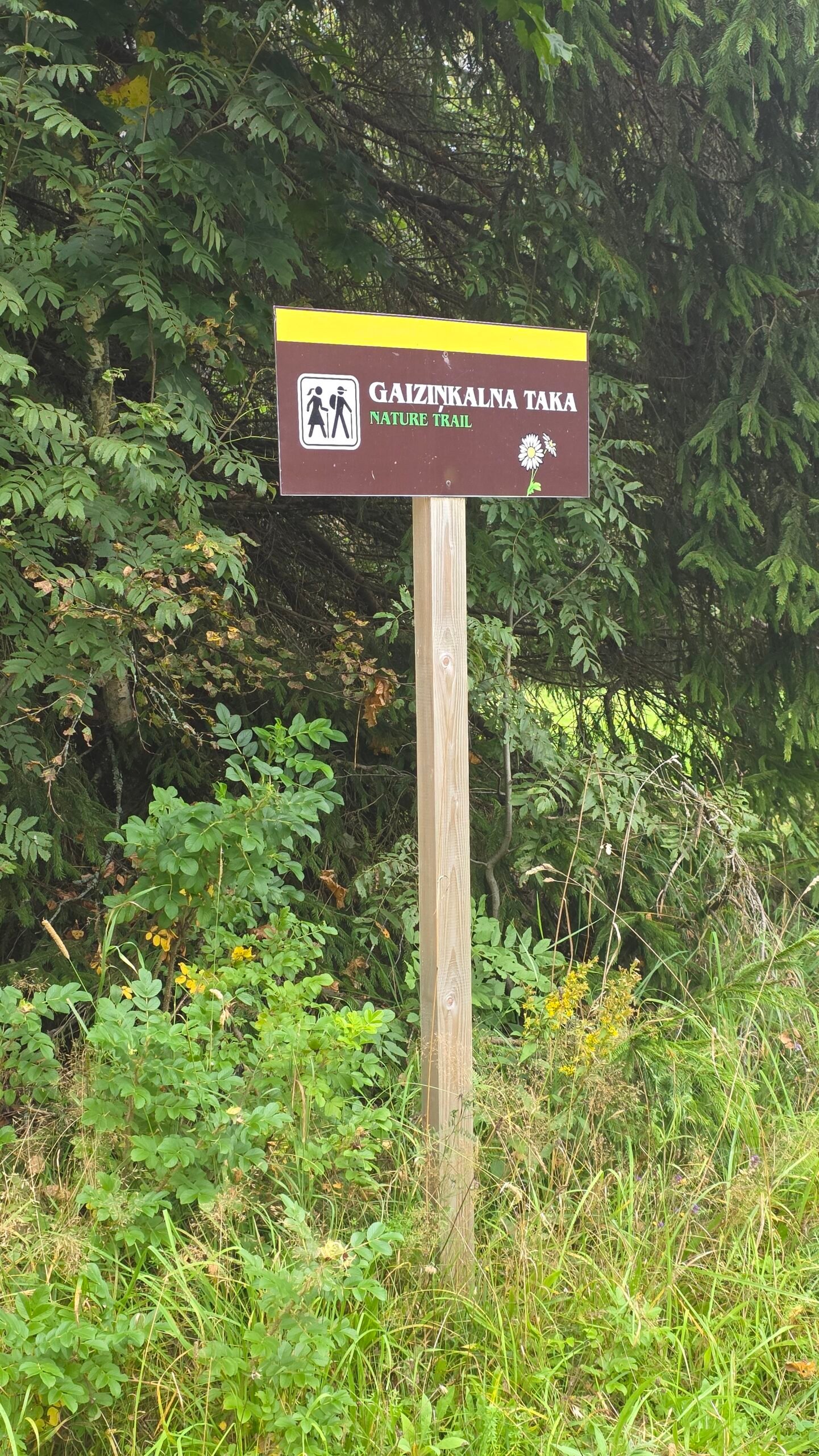
Use this guide for the walking options, transport, a realistic budget and places nearby. My short personal activity appears later; it is different from the full advertised nature-trail circuit. National tourism overview · Official regional walking brochure.
02 / Know Gaiziņkalns
The high point.
And the landscape around it.
Gaiziņkalns sits in the Vidzeme uplands, in a landscape of wooded slopes, fields and lakes. The Nature Conservation Agency protects the area as a nature park within the Vestiena protected landscape. This is not an alpine national park or a mountain with a technical summit route.
Which height should you use?
The national tourism page gives 311.5 m; regional hiking material commonly prints 311.94 m or rounds it to 312 m. This guide uses about 312 m. The small differences do not change the walking plan, and the figure is elevation above sea level—not the amount you will climb from the trailhead.
Expect a wooded hill
Do not arrive expecting an uninterrupted panorama from a tall summit platform. Views are connected to the slopes and openings, while trees frame much of the visit. Slow down for the path, the light and the information boards.
The name on the map
Save Gaiziņkalns, the intended parking or start, and the route map. “Gaiziņš” also appears in tourism and business listings around the hill. A business address, the summit and the beginning of a particular walking circuit are not necessarily the same pin.
03 / Choose your walk
A short summit visit.
Or time to explore.
| Option | What it offers | What to plan |
|---|---|---|
| A direct summit visit | A short forest approach and time at the landmark | Use the appropriate signed access; return to your actual start |
| The approximately 2 km nature circuit | The hilltop, slopes, information and a fuller walk | Steps, uneven surfaces and enough time for the whole loop |
| The approximately 8 km regional itinerary | Gaiziņkalns, Abriena Hill and Lake Viešūrs | Road walking, navigation, weather and a longer return |
| A regional day by car | The hill plus a cultural or lakeside visit | Opening hours, driving time and a coherent sequence |
For most first visits
I would choose the nature circuit if the weather and your group allow it. Reserve roughly an hour to an hour and a half as an initial allowance for walking, reading and photographs. That is my suggested visit duration, not an official completion time.
For a quick stop
A brief summit outing can fit a travelling day, but identify the current public access and parking first. Do not equate my 0.66 km recorded visit with the full 2 km trail. They answer different questions.
For a longer walk
The regional 8 km itinerary includes countryside roads and unmarked sections beyond the hill trail. It deserves its own map and pace. Do not simply keep following a “summit” sign and assume it completes the longer circuit.
04 / Getting there
Make the final road
part of the plan.
By car
Gaiziņkalns works well as a regional drive through the Madona and Vestiena area. Save the intended trailhead before setting off, check the final approach and use the current local parking instructions. Avoid treating a summit coordinate as a car-park address.
From Rīga
Think of this as a countryside excursion rather than a quick stop within the capital. Give the drive and the hill their own time, then choose one sensible additional visit. Road conditions, breaks and daylight matter more than a best-case navigation estimate.
Public transport to Madona
Vivi’s route information includes the Rīga–Madona–Gulbene line. Check your actual travel date, direction and any changes; a line on the network map does not promise a convenient service every hour. The 1188 planner can help compare dated connections. Vivi journey planning · Official network information · Public-transport planner.
The final transfer
Reaching Madona is not the same as reaching the hill. Confirm a bus, taxi, host transfer or other workable arrangement to the exact walking start, together with the return. Do not assume a regional bus stop is beside the summit trail.
Road surfaces and seasons
Choose roads appropriate to your vehicle and the actual conditions. In wet or wintry weather, allow extra time and check official road information. Ask the host or visitor office about the final local section if unsure. Latvian State Roads.
Keep the driver’s day reasonable. My expedition linked countries quickly; a holiday visit can be more enjoyable with fewer kilometres and time to stop.
05 / The nature trail
Take the marked path.
Notice the small things.
The regional hiking brochure describes an approximately 2 km marked circuit over the summit and along the foot of the hill. It mentions stairs on the northern side, behind the café, and a gazebo at the top. Use the current signs on arrival rather than relying on a historical photograph of an entrance.
1. Identify the start
Read the information board and locate the circuit on a map. Check where you will return to the road or parking area. Establish that before you start following an inviting path through the trees.
2. Climb without rushing
The outing is modest compared with the higher mountains on this site, but slopes and steps can still require care. Choose footwear with grip, keep children close where needed and let the slowest walker set a comfortable pace.
3. Spend time at the summit area
Make a photograph, read the signs and look at how the clearing sits within the forest. The summit model is a useful visual memory, but the route is more than a single object.
4. Complete the intended loop
Follow the marked circuit back towards its foot-of-hill section. Pay attention at junctions rather than assuming every downhill line returns to your vehicle. If a section is closed or unsuitable, follow local instructions and adapt the visit.
The circuit description is a planning overview. Current surface conditions, closures and your group’s needs determine the day. Read the municipal walking reference.
06 / The audio-guide walk
Let the hill
tell its own story.
VisitMadona describes an audio guide for the Gaiziņkalns circuit in English, Latvian and Estonian. It uses the izi.TRAVEL platform, follows the approximately 2 km loop and includes seven story locations.
Prepare it before arrival
Follow the official link, find “Gaiziņkalna taka” and check the language and download options before relying on a connection at the start. Familiarise yourself with how the app locates a story point.
Why it is worth considering
A short walk can be richer when a place has a voice. The guide connects historical images and local information to the landscape, making it useful for visitors who would otherwise only photograph the summit landmark and leave.
Make room for listening
Allow pauses without blocking steps or narrow sections. Keep the volume considerate, and remain aware of other walkers and road traffic. A phone-based guide adds context; it does not replace the route signs.
07 / The tower & survey history
A model at the summit.
A bigger story behind it.
The old observation tower
Older photographs show a much larger concrete observation tower. Madona’s municipal archive records its demolition in December 2012. Do not use those images as evidence of a tower you can climb today. Municipal historical record.
The landmark in my photographs
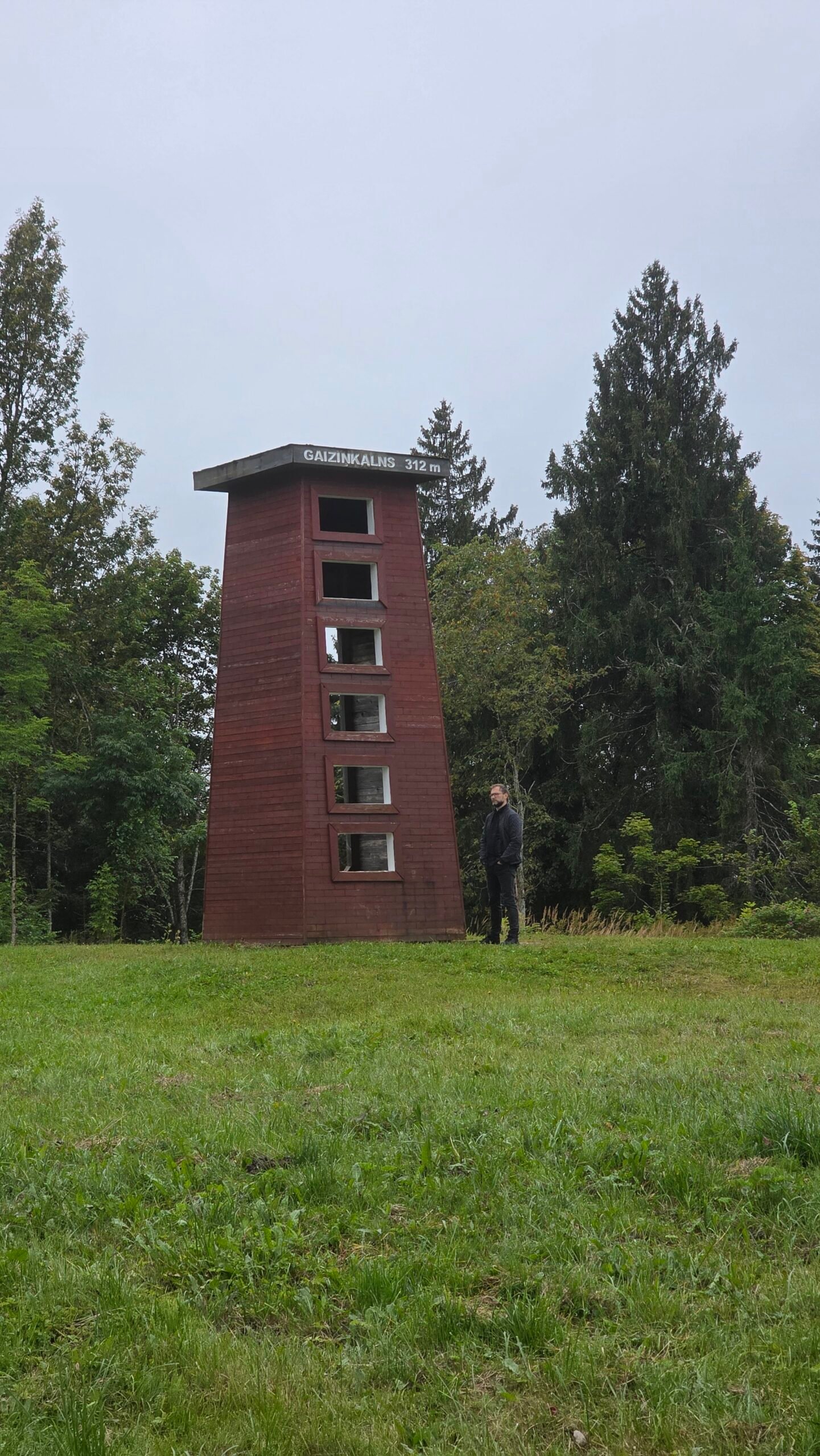
My August 2025 pictures show a small red tower-shaped model beside the summit clearing. It is a landmark and a reminder of the place’s history, not the former full-size viewing tower. Check the current visitor information if a particular observation platform is central to your plans.
Struve and measuring the Earth
Gaissa-kalns is linked to the wider Struve survey story. The Latvian Geospatial Information Agency describes regional routes connecting Gaissa-kalns, Sestu-kalns and Nessaule-kalns. The story gives a small hill a connection to a much larger scientific landscape. Latvian mapping agency’s route project.
A useful UNESCO distinction
The Struve Geodetic Arc World Heritage property contains 34 selected station points. Its two listed Latvian components are Sestu-kalns / Ziestu and Jacobstadt / Jēkabpils. Gaiziņkalns’s historical connection to the arc does not make it one of those two inscribed components. UNESCO’s overview · Check the component list.
If that history interests you, use the regional route map to build a separate heritage outing. Verify actual access to each place rather than collecting survey names without a road plan. Regional Struve route map PDF.
08 / The longer countryside route
Beyond the hill.
Into the Vidzeme landscape.
VisitMadona publishes an 8 km itinerary linking Gaiziņkalns, Abriena Hill and Lake Viešūrs. It starts in the area of the Gaiziņš recreation complex and combines the hill trail with countryside roads.
Different surfaces, different expectations
The municipal description makes clear that the wider road route is unmarked and requires its map. Walking on a road or its verge needs more attention to traffic than a forest footpath. Reflective or visible clothing can help you be seen in poor light.
Read the route before choosing a direction
Save the official stage descriptions, junctions and start coordinates. The page gives the recreation-complex area as 56.875722, 25.962389; that is a starting reference, not the summit location or a guarantee of current parking availability.
Allow a proper half-day
Price the walk in time as well as kilometres. Add pauses, the hill ascent and your own pace on road sections. Bring water and a snack rather than assuming a café will be serving halfway round.
On a bicycle or by car
The regional itinerary discusses several travel modes, but the Gaiziņkalns nature-trail section is for walking. Do not interpret a driving option on the larger route as permission to drive or cycle over the footpath.
09 / Families & accessibility
A manageable adventure.
Choose the right version.
A short wooded hill can be an appealing change from a day spent in the car. There is a clear destination, a small landmark to find and enough variety to make the walk feel like an outing. Match the route to the people with you rather than only to the advertised length.
With children
Make the nature trail a small exploration: look for the route sign, notice different trees and stop at the information points. Leave time for snacks and questions. A comfortable pace is more useful than trying to reproduce my brief expedition stop.
Steps and pushchairs
The regional description explicitly mentions stairs, and the route passes over a hill. Do not assume the complete circuit is suitable for a pushchair, wheelchair or someone who needs a level surface. Ask local visitor staff about the exact entrance, gradients, steps and any appropriate shorter option.
For a mixed group
Choose a shared objective and meeting point. Someone who prefers a very short walk can still enjoy a regional day, provided the parking, waiting place and return arrangement work. A café symbol on a map is not a promise that there is an open indoor place to wait.
Good footwear, weather-appropriate layers and time to enjoy the forest matter more here than specialist mountain equipment.
10 / Seasons & weather
Fresh green.
Autumn colour. Winter quiet.
Spring
A visit can focus on the changing woodland, but check the ground and final road after wet weather. Choose footwear that copes with damp surfaces and let current conditions determine whether the longer countryside walk is appealing.
Summer
Allow time for the trail and a lakeside or garden visit afterwards. Carry water, sun protection and insect protection as appropriate. The forest provides part of the atmosphere; it is not a reason to ignore a forecast for heavy rain or strong wind.
Autumn
Look for colour and softer light, with a realistic allowance for mud, wet leaves and shorter daylight. My late-August visit was already grey and humid, showing how quickly the mood can change without making the place less interesting.
Winter
The region has a skiing tradition, but a summer walking description does not establish the condition of the paths, steps or operating slopes in winter. Confirm what is open and keep walking away from active sports areas where instructed. Match footwear and transport to snow and ice.
Check Latvia’s official weather service before travelling. For an emergency requiring assistance, call 112, explain the location and incident, and follow the dispatcher. Official emergency guidance.
11 / Beyond the summit
A hill walk.
A whole region to discover.
The best reason to stay longer is the countryside around Gaiziņkalns. Choose one or two places that fit your direction, rather than filling the day with distant pins.
Madona
Use the town as a practical stop for supplies, a meal and regional visitor information. The municipal highlights include the local history and art museum and exhibition spaces. Check the actual opening if a museum visit is important to the day. Madona’s official visitor highlights.
Cesvaine Castle and its surroundings
For a cultural contrast to the forest, consider Cesvaine’s castle and manor area. The visitor directory lists the castle at Pils iela 1 and the wider complex nearby. Check the date’s access, tour arrangements, ticket and last admission directly; a photograph of a building does not establish that every room is open. Official Cesvaine visitor information.
Kalsnava Arboretum
Latvia’s State Forests operates a tree and shrub collection with paths and a viewing tower. It suits a day focused on plants, photography and a different perspective on the landscape. It is a separate destination with its own entrance rules and ticket, not part of the free hill walk. The operator’s pet rules also need checking if travelling with a dog. Operator’s visitor information.
Lake Kāls / Kāla ezers
The municipal information identifies a public recreation site by the lake. Pick that intended access rather than an arbitrary private shore. Confirm seasonal services, weather and any activity requirements before planning swimming, boating or angling. Fishing has its own licensing arrangements. Find the public recreation site · Municipal lake information.
Lake Viešūrs and Vestiena
The longer Gaiziņkalns itinerary provides one way to connect the hill with a lake landscape, while regional routes and the Struve map give further ideas around Vestiena. Choose a public route and keep the road travel realistic. Browse the regional routes.
For a relaxed day, I would choose either the hill and one cultural visit, or the hill and a properly planned lakeside pause. Both leave room for the weather and for enjoying the places between the headline attractions.
12 / Plan your day
A relaxed afternoon.
Or a Vidzeme weekend.
A simple half-day near the hill
Arrive at the intended start, read the route board and walk the nature circuit at a comfortable pace. Use the audio guide if it interests you. Afterwards, allow time for a picnic or a confirmed local meal and a short drive through the upland scenery.
A full regional day
Choose Gaiziņkalns for one part of the day and a single substantial second visit: Cesvaine for architecture and history, Kalsnava for trees and gardens, or a public lakeside spot for a slower outdoor pause. Order the stops around their opening times and your arrival direction.
A two-day version
Day one: travel into the region, settle into your accommodation and make a manageable town or cultural visit. Day two: give the hill and its surroundings time, then continue without a rushed evening departure. Swap the outdoor and indoor parts if the forecast changes.
For the longer walker
Make the 8 km countryside route the main activity rather than adding it after the day’s other visits. Pack food and water, save the route description and think about the road sections. Leave the afternoon flexible.
On a Baltic highpoints journey
Aukštojas in Lithuania and Suur Munamägi in Estonia are different destinations with substantial travel between them. My expedition joined them quickly, but that is a personal record rather than a model for a relaxed itinerary. Give each region a purpose beyond its highest point.
Keep an alternative that you will actually enjoy. A museum, a meal or a shorter walk makes it easier to change the outdoor plan when conditions are unpleasant.
13 / Where to stay
Close to the countryside.
Or comfortably in town.
| Base | Why it can work | Check before booking |
|---|---|---|
| Madona | A town base with supplies and regional transport | The final hill transfer, parking and your onward journey |
| Around Vestiena / Gaiziņkalns | A quieter rural stay near the landscape | Exact location, road surface, meals and arrival time |
| Cesvaine | A cultural stop that can anchor a wider visit | Actual drive to the hill and seasonal visitor services |
| A booked campsite or holiday house | An outdoor-focused weekend | Facilities, legal access, opening and the specific pitch or property |
Choose the actual property
“Near Madona” can cover quite different travel plans. Check the host’s precise address and how it fits the hill, meals and any other attraction. Ask about late check-in if arriving after a long road journey.
Food at a rural stay
Confirm whether meals are offered, need advance booking or are not part of the stay. A kitchen or a breakfast arrangement can make a quiet country base easier to use. Do not rely on a seasonal café for every meal.
Camping
Use a real listed campsite or another arrangement confirmed with the responsible owner or authority. A quiet lake or summit clearing does not automatically give permission to stay overnight. Official campsite and recreation listings.
Start with the municipal accommodation directory, then verify the host, dates, facilities and final price directly.
14 / Food & local stops
Keep the picnic simple.
Make the meal worthwhile.
A walk of this scale leaves room for a proper meal elsewhere in the region. Bring water and a snack for the circuit, then choose the café, town stop or booked meal that fits the rest of the day.
Do not build the visit around an unconfirmed café
Tourism descriptions mention food services around the hill, but opening can depend on the business and season. Confirm directly if you need a meal, toilets or somewhere warm to wait.
A comfortable picnic
Use an appropriate designated or permitted resting place, keep the route clear and take all rubbish with you. Bring food that works without a complicated setup. A wet day is easier when you have a plan for shelter or a short journey to a confirmed indoor stop.
Keep the diary’s geography clear
The cepelinai and kvass in my original Baltic account were an evening meal in Vilnius, Lithuania, after leaving Latvia. They are part of my travel story, not a restaurant recommendation for Gaiziņkalns.
15 / Costs & calculator
A modest walk.
An honest trip budget.
The larger costs are likely to come from travel, accommodation and what you choose to do around the hill. Price the whole excursion rather than only the walking stop. This calculator uses EUR and your own confirmed quotes.
The trail and the extras
Latvia’s national tourism material describes the nature trail as free to visit. Parking arrangements, food, accommodation, guided services and other activities are separate questions; confirm what applies to your chosen start and date. National tourism visitor reference.
A dated nearby-attraction price
On 1 November 2026, the Kalsnava Arboretum operator displayed a standard adult entry of €8 and a 50% low-season discount from 1 November to 30 April. Event prices and eligibility categories differ. Check the exact ticket for your visit rather than treating that as a quote for every date. Check the operator’s current tariff.
Make the fields match your quote
Split a room price into your share. Include fuel in the shared car total or local travel, but not both. Leave nights at zero for a day trip and adjust food days to the actual visit.
16 / Simple packing checklist
Bring what helps.
Leave room to enjoy it.
For a short hill visit, comfortable everyday walking preparation is usually more useful than an expedition pack. Adapt the list to the route, season and your group. The 8 km road-and-countryside outing needs more time, supplies and navigation than a brief summit stop.
For a family day
Add whatever makes the particular group comfortable: spare clothing, appropriate food and a manageable plan if someone wants to stop early. Check access rather than assuming a pushchair will work on the complete circuit.
For the rest of the region
A towel, a change of footwear or other activity-specific items only make sense if you have planned that activity and checked the access and conditions. Keep the hill walk separate from a spontaneous unprepared swim or a longer road walk.
17 / Maps & practical links
Find the hill.
Save the right start.
The overview below places Gaiziņkalns in the uplands. The marker follows the regional visitor-map reference; it is geographical context rather than a parking instruction or a verified walking track.
Hill overview, not a live access map. © OpenStreetMap contributors.
Save three separate things
- The actual trailhead and return point.
- The map for the walk you have chosen.
- Your onward stop, opening and transport arrangement.
Useful references
Municipal hiking brochure · Full 8 km route description · Audio-guide instructions · Nature-park management information.
My screenshot is a personal record
The original activity image records my brief summit visit. It does not provide a downloadable GPX or verify the complete nature circuit. Use it for the diary figures, then plan from the official route information and current local signs.
18 / Respect the nature park
A small footprint.
A better visit for everyone.
Gaiziņkalns Nature Park protects a characteristic upland landscape and its natural and cultural values. Follow local signs, respect landowners and use the established visitor routes. Read the Nature Conservation Agency’s information.
Leave the clearing and trail as you found them
Take litter home, leave signs and monuments alone and avoid making shortcuts through vegetation. Keep access clear for other visitors and for the people maintaining the place.
Dogs, camping and fires
Check the current site rules before bringing a dog or planning an overnight stay. Use a confirmed camping arrangement and observe fire restrictions and designated facilities. A forest clearing should not become an improvised campsite merely because the walk is quiet.
At the lakes and other attractions
Each destination has its own access and visitor conditions. A dog accepted on one walk may not be allowed inside a garden; a public recreation site does not make every shore public. Check the place you actually intend to use.
The easiest way to support the region is practical: respect the landscape, use local services where suitable and leave each stop ready for the next visitor.
19 / Photography notes
Forest green.
Grey sky. A quiet portrait.
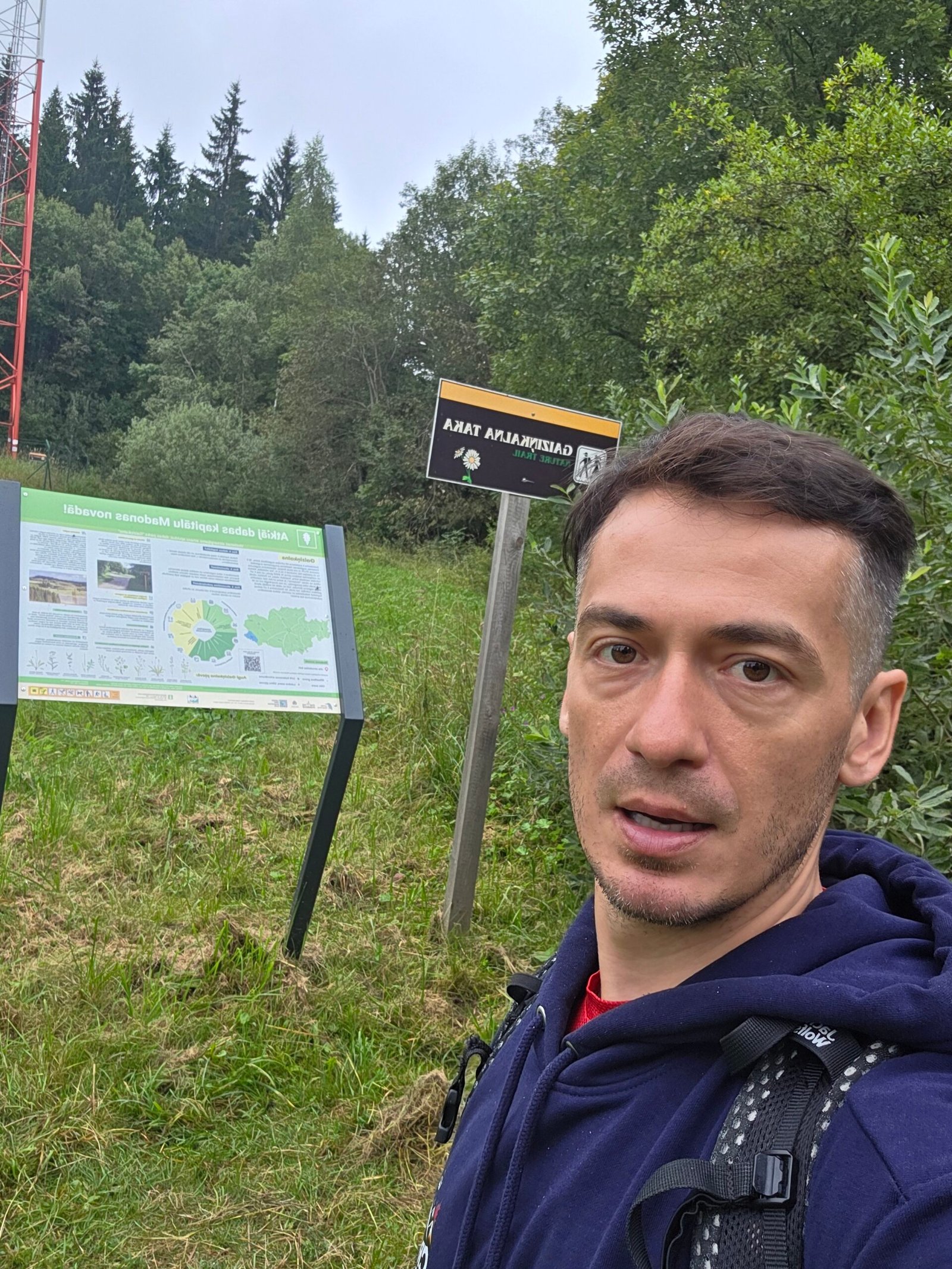
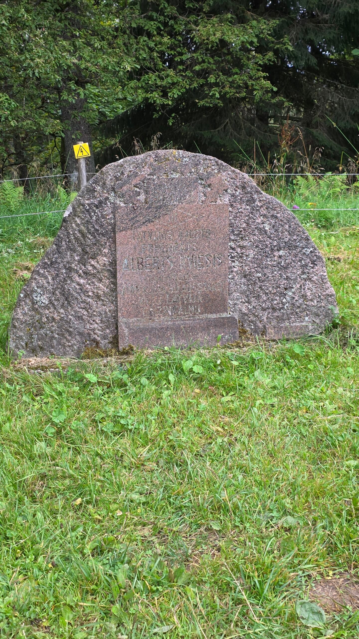
My Gaiziņkalns photographs are about a place and a pause: the route sign, a stone, the tower-shaped landmark and a few portraits beneath a cloudy sky. There was no need for a dramatic mountain backdrop to make the day memorable.
Build a short visual story
Photograph the entrance, something along the path and the clearing before making a portrait. A small detail helps explain the walk. Keep people and signs in context rather than making every frame a tight crop of the same landmark.
Let the weather set the mood
Overcast light can suit a green forest and a portrait. Protect the camera when rain arrives and enjoy the softer atmosphere instead of waiting for the place to look like somebody else’s sunny photograph.
A considerate summit photograph
Give other people room, avoid blocking the path and keep the model and memorials untouched. You can tell the story without climbing onto an object that was not intended as a viewing platform.
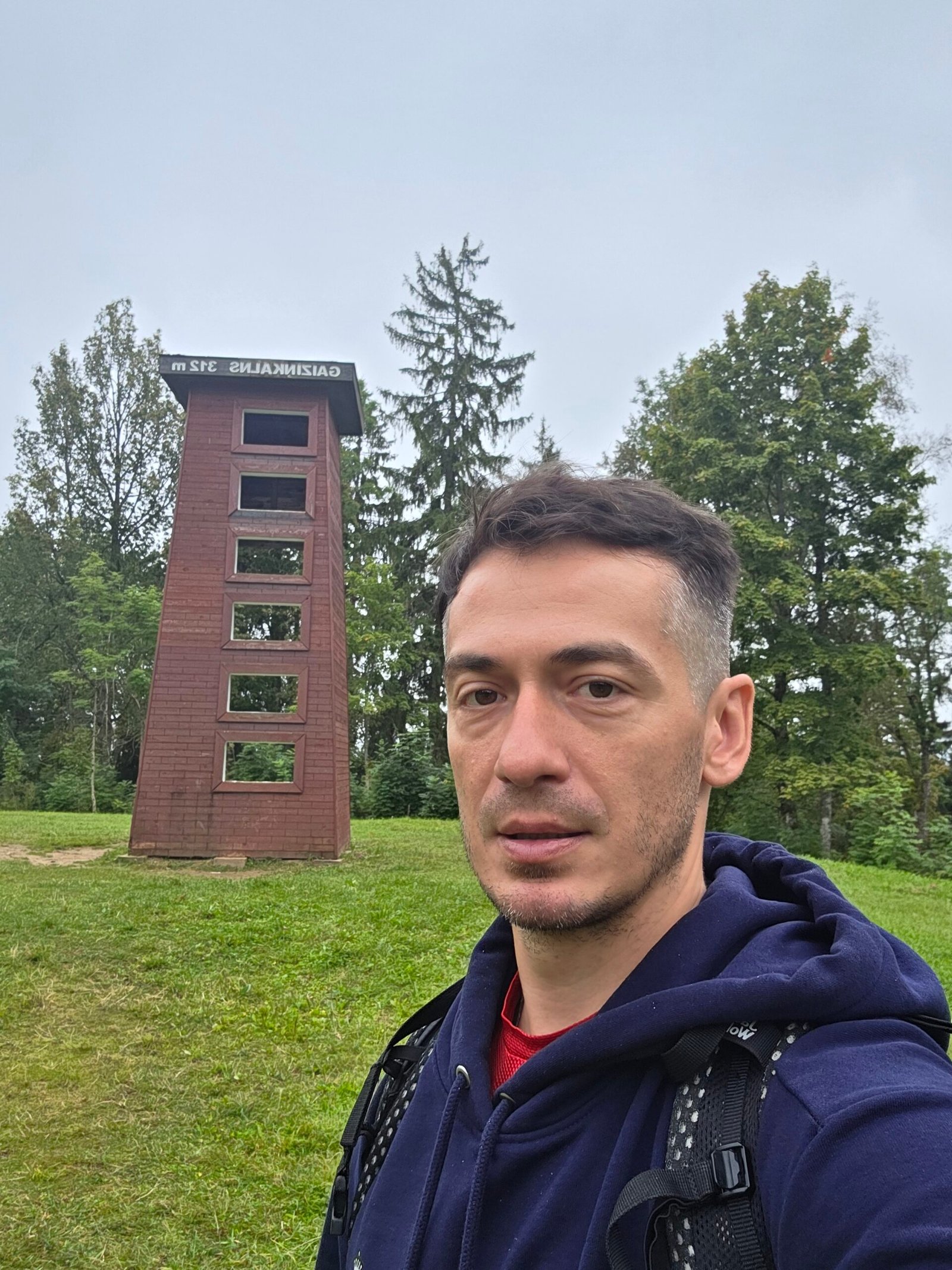
20 / My August visit
11:02.
Clouds over Latvia.
31 August 2025. Estonia had given me early light; Latvia brought green woodland and the first drops of rain.
After visiting Aukštojas in Lithuania, I had spent the night at Villa Roza in Latvia before continuing to Suur Munamägi in Estonia. I reached that summit at 08:44, then drove south again towards Gaiziņkalns.
The road passed through quiet farmland and forest. By late morning the sky had changed. I followed a short forest path to the summit area and stood beside the landmark at 11:02. It was humid and still, with heavy cloud overhead. The first drops began as I finished the photographs.


My activity screenshot records 0.66 km, 20 m of ascent, 9:43 moving time and 14:25 elapsed. That was my brief summit outing, not the full 2 km nature circuit. It should not be used to describe the length or timing of another visitor’s walk.
Afterwards, I continued to Vilnius for the evening bus to Kraków. A walk through the old town and a meal of cepelinai with kvass rounded off the Baltic chapter before I travelled south towards bigger mountains.
What stayed with me was the change of pace: a small high point, a quiet path and a moment without the demands of an alpine climb. For a holiday, I would give the Latvian countryside around it more time than the expedition schedule allowed.
21 / Questions answered
The useful questions.
Is Gaiziņkalns Latvia’s highest point?
Yes. This guide uses about 312 m. National and regional tourism sources also print 311.5 m and 311.94 m.
How long is the nature trail?
The municipal walking material describes an approximately 2 km marked circuit over the hill and along its foot. Check current signs and any local changes.
How much time should I allow?
For an unhurried circuit, 60–90 minutes is my initial planning allowance, including pauses. Adjust to your group, conditions and interest in the audio guide.
Why is Adrian’s recorded walk only 0.66 km?
It was a brief personal summit visit, not the full advertised circuit. The activity figures belong to the diary rather than a standard route specification.
Is there a tower to climb?
The large former tower was demolished in December 2012. My 2025 photographs show a small tower-shaped model. Verify current viewing facilities locally rather than relying on old tower photographs.
Is Gaiziņkalns itself a UNESCO-listed Struve component?
It has a historical Struve Arc connection, but the two Latvian components in UNESCO’s list are Sestu-kalns/Ziestu and Jacobstadt/Jēkabpils. The wider historical network and the inscribed components are different things.
Is the walk suitable for children?
It can be a manageable outing for a suitably prepared family. Consider steps, surfaces, weather and the actual children; choose a comfortable route and allow pauses.
Can I take a pushchair or wheelchair around the full loop?
Do not assume that. The route description mentions stairs and hill terrain. Ask about the precise entrance, surfaces, gradients and any suitable alternative.
Do I need mountain equipment or a guide?
The ordinary snow-free visit is a short hill walk, not an alpine ascent. Comfortable footwear, weather preparation and the right route are the starting point. A local guide or audio guide can add cultural context.
Is there an audio guide in English?
Yes. VisitMadona describes English, Latvian and Estonian versions through izi.TRAVEL, with seven story locations on the approximately 2 km circuit.
Can I get there by train?
Vivi serves the Rīga–Madona–Gulbene line, but check date-specific services and arrange the separate final journey from Madona to the trailhead and back.
Is the nature trail free?
National tourism material describes it as free. Check separate parking, services and activity charges for the actual visit.
What is the longer 8 km route?
It is a regional itinerary linking Gaiziņkalns, Abriena Hill and Lake Viešūrs, including countryside roads and unmarked sections beyond the hill trail.
What should I combine it with?
Choose a coherent regional day: Madona, Cesvaine, Kalsnava Arboretum or an appropriate public lakeside visit. Check driving and opening times rather than trying to fit everything into one afternoon.
Can I visit in winter?
Check current access, surfaces, road conditions and sports operations. A summer walking map does not describe icy steps or an active ski slope.
What number should I call in an emergency?
Call 112 when emergency help is needed, give your location and incident details, and follow the dispatcher’s instructions.
22 / Useful links & sources
Your Latvia planning desk.
Research checked on 1 November 2026. All photographs on this guide are Adrian Mazur’s own images from 31 August 2025. Historical tower information is dated; transport, visitor facilities and seasonal prices need checking for the actual travel date.
Begin with VisitMadona for the walk and the region, the Nature Conservation Agency for the protected landscape, the relevant operator for bookings and tickets, and current official transport and weather information for the journey.
National tourism overview and the character of the hill
The marked 2 km circuit, northern stairs and summit gazebo
Protected landscape, official boundary and management information
English, Latvian and Estonian narration around the 2 km circuit
An 8 km regional route; road sections differ from the hill footpath
More walks and the right map for each separate outing
Historical demolition reference, not a current observation-tower listing
The regional Gaissa-kalns, Sestu-kalns and Nessaule-kalns route project
Gaiziņkalns, historical survey context and surrounding places
The wider scientific project and World Heritage property
Distinguish the historical arc from the specific inscribed sites
Official visitor information for the district
Castle, manor complex and visitor contacts
Current visitor services, seasonal prices and access conditions
Find the public site and verify the exact shore access
Public recreation, boat access and licensed angling information
Choose the location and verify the host’s actual availability
Arrange a legal overnight stay rather than assuming any shore is a campsite
Date-specific rail journeys, tickets and service changes
Includes the Rīga–Madona–Gulbene line
Check the chosen date and direction, then the operator’s current service
Official road information for the regional drive
Current weather information and warnings
Emergency communication and location information
Lithuanian-language national tourism reference describing free nature-trail access