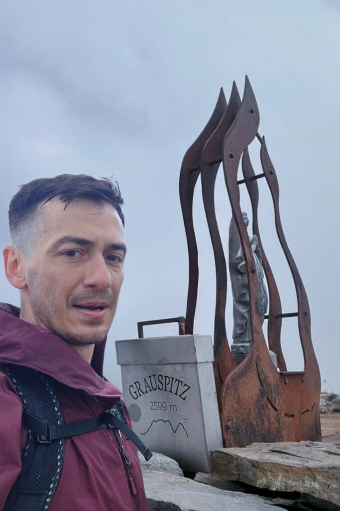
Altitude: 2,599 m
Coordinates: 47.054774° N, 9.587507° E
Route: Malans – Cable car to mountain station – Hike via Hinter Grauspitz to Vorder Grauspitz – Return
Transport to region: 3,423 km total
• 375 km Sandfell → Reykjavík
• Flight Reykjavík → Milan Malpensa (2,814 km)
• 234 km Milan Malpensa → Malans, Liechtenstein
Accommodation: Apartment near Milan (23–24 July), car night (24–25 July)
Conditions: Rainy, foggy, slippery terrain with minimal visibility
🧭 Overview
Grauspitz, the highest point of Liechtenstein, may not reach the same heights as the Alpine giants, but it demands respect, especially when the weather turns hostile. Narrow ridges, wet grass, and unstable visibility can make even simple terrain feel endless.
After the perfect conditions in Iceland, I was thrown straight back into the chaos of European summer, unpredictable rain, rushing schedules, and one of the most stressful climbs of the project.
✈️ From Ice to Rain
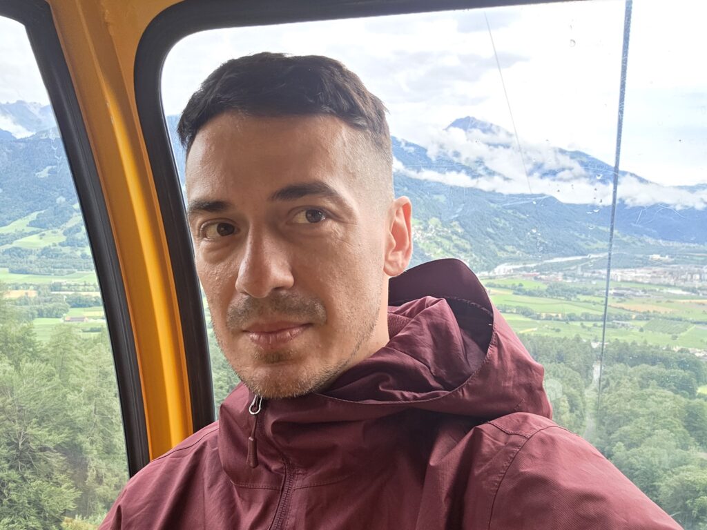
After summiting Hvannadalshnúkur in Iceland, I took a day to unwind,, soaking in natural hot springs, finally allowing my body to rest. On the evening of 24 July, I flew from Reykjavík to Milan Malpensa, where my father met me. We spent the night in a small apartment near the airport, packing and recharging for another long drive.
At dawn we set off, covering 234 kilometres to reach Malans, just across the Swiss border. The goal: catch the first cable car and reach the summit before the last one came down. There was no margin for delay.
🌧️ The Climb
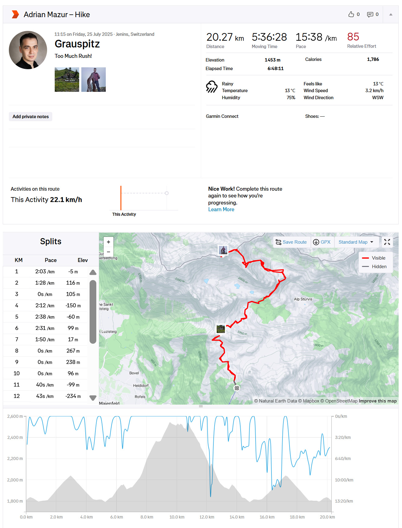
By the time I started hiking — shortly after 10:00 a.m. — the weather had already turned.
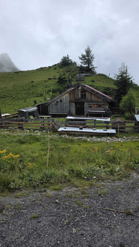
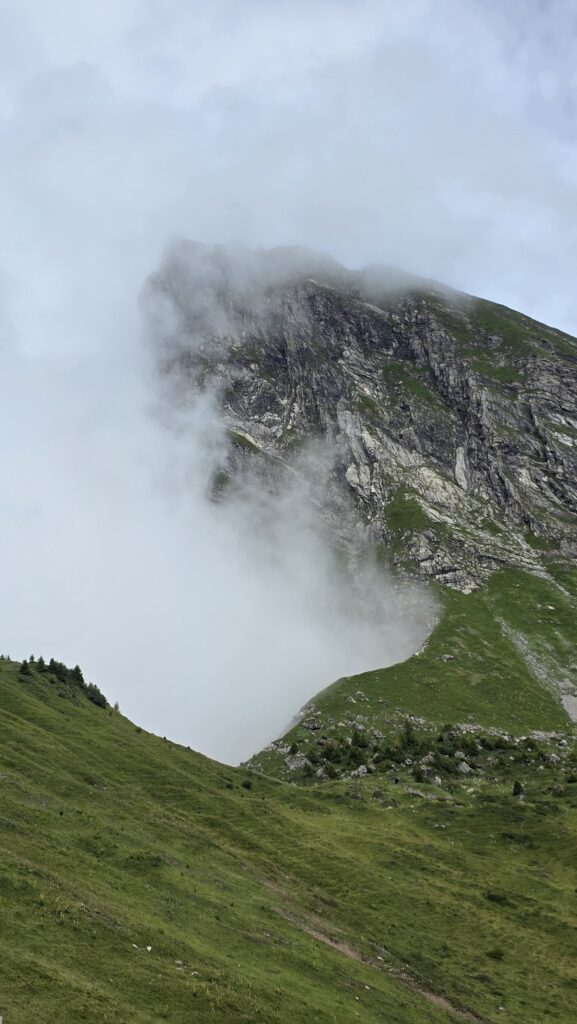
Low clouds rolled through the valleys, and steady rain soaked the narrow mountain path. Within minutes, my boots and gear were drenched.
Visibility dropped to a few metres, and I had to rely almost entirely on GPS to stay on route. The trail became steep and muddy, alternating between grass and slippery rock. I moved fast, knowing I had to make it back in time for the last cable car down.
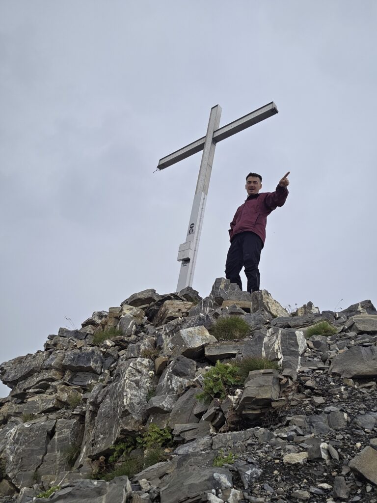
After reaching Hinter Grauspitz, I continued carefully to Vorder Grauspitz, the true high point of the country — a short but exposed ridge crossing that felt far longer in the fog.
Around midday, I reached the summit. There was no view, only the roar of the wind and a few brief gaps in the cloud revealing distant rock faces. I stayed a few minutes, took a photo, and turned back quickly. The descent was even more stressful: slippery slopes, rushing clouds, and the constant fear of missing the lift.
💥 The Rush and the Loss
I made it back just in time for the final cable car, soaked, muddy, and utterly drained.
Somewhere during the climb, one of my drones caught a gust of wind and disappeared into the fog, vanishing somewhere above the ridge. Losing it stung, not for the cost, but for the missing footage of such a wild day.
Still, there was relief: another country complete, against all odds.
💬 Reflection
Grauspitz reminded me that not every summit comes with beauty or ease. Sometimes the win is simply showing up, pushing through fear, fatigue, and bad weather, and still making it home safe.
After the calm perfection of Iceland, this was chaos, but also reality. Mountains don’t care about your schedule, your camera, or your comfort. They test your patience more than your strength.
Date: 25 July 2025′