
01 / The adventure, at a glance
Gerlachovský štít at a glance.
A granite summit above the lakes. A rope, a long descent and a view across the highest mountains in the Carpathians.
Gerlachovský štít is the roof of Slovakia, the Tatras and the Carpathian range. But the thing that makes it memorable is not simply its position in a list. It is the change of scale as you leave the valley: the lake becomes smaller, the walls close around you and the mountain asks for more concentration than an ordinary hiking trail.
I reached the summit on 7 September 2025 at 09:58, during my Crown of Europe expedition. Rysy followed that afternoon. The two mountains made an exceptional day; they are not the itinerary I would hand to a first-time visitor. This guide gives Gerlach its own space, with the practical decisions that make a well-organised visit possible and my personal account further down.
- The mountain
- Slovakia’s high pointAlso the highest summit of the Tatras and Carpathians
- Elevation references
- 2,654.4 / 2,655 mTANAP’s figure / the common tourism figure
- Usual high base
- Sliezsky domBeside Velické pleso, around 1,670 m
- Trip character
- An alpine ascentNo ordinary marked hiking trail to the summit
- Standard guided day
- Roughly 6–8 hoursOne operator’s hotel-based reference; allow more margin
- Height gain
- About 1,100 mA hotel-based reference, excluding a walk up from the valley
References: TANAP elevation · national tourism overview · Sliezsky dom · one guided-day reference. The duration is not a promise for every route or group.
The three things to organise first
A suitable qualified guide. For a visitor without the relevant mountaineering qualification, this is the normal planning route.
The actual start. Meeting in Tatranská Polianka, sleeping at Sliezsky dom and walking up from the valley are different schedules.
A weather margin. A reservation should allow a sensible decision about conditions, rather than pressure to climb at any cost.
Think of this as a small alpine trip, not a famous summit to fit between two road transfers. A rested start, a clear conversation with the guide and enough time afterwards to recover can transform the experience. The summit is one moment inside a day that still needs to work on the way down.


02 / More than a height on a map
Know the mountain.
Gerlach rises between the Velická and Batizovská sides of the High Tatras. Sliezsky dom is the familiar high starting point for the classic outing. From there, the mountain is a collection of gullies, ridges, traverses and rocky steps, rather than a single obvious path pointing to a summit sign.
Why the elevation looks different in different guides
TANAP lists 2,654.4 metres; Slovakia’s tourism portal uses 2,655 metres. Both refer to Gerlachovský štít. This guide shows the difference openly rather than presenting a commonly used tourism figure as a new survey result. Park reference · Tourism reference.
“Normal route” does not mean normal hiking
In mountaineering, the normal route is simply the usual or less difficult way up that mountain. On Gerlach, it still enters climbing terrain and requires judgement about movement, protection and route finding. Calling a section an easy scramble in a sunny photograph tells you very little about descending it tired or in deteriorating weather.
The national guides association describes Gerlach as mountaineering terrain. Its explanation also sets out why qualified access matters. Read the association’s Gerlach explanation. The useful question is not whether somebody online has done a harder mountain. It is whether your own preparation and the day’s organisation match the terrain you will actually encounter.
Put the approach and the climb on separate lines
A distance measured from Sliezsky dom omits the journey to the hotel. A route measured from Tatranská Polianka may include a substantial walking approach, while a guided package may use an arranged transfer. Check the start and finish of every number you read. A shorter-looking itinerary can simply be counting a different part of the day.
The same applies to photographs. The wooded approach, a lakeside path and the summit cross belong to the same landscape, but they do not describe the same difficulty. Use the images for a sense of place; use your guide and current information for the decisions that determine the outing.
03 / Understand the access before booking travel
Who can climb Gerlach?
There is no ordinary marked hiking trail to the summit. For a visitor without the relevant mountaineering qualifications, the practical answer is to arrange a properly qualified mountain guide. Independent access is a separate, regulated mountaineering activity, not a privilege gained by buying equipment or a club card.
| Your situation | The relevant planning route | Where to check |
|---|---|---|
| A visitor without recognised climbing qualification | Book an appropriately qualified mountain guide and agree the route and preparation. | NAHV SR guide information and directory. |
| An appropriately qualified mountaineer | Check the exact qualification, equipment, registration and access conditions for the intended terrain. | TANAP and SHS JAMES. |
| A participant in organised club training | Confirm the specific authorisation and all its limits with the organiser. | The relevant KST decision and training rules. |
NAHV SR’s explanation · SHS JAMES qualification guidance · KST training information.
Membership is not the whole qualification
For lower-difficulty mountaineering terrain, SHS JAMES explains the certificate process and the distinction between summer and winter competence. Its English-language conditions are useful for international visitors. If your background is outside Slovakia, establish how your qualification is recognised before arriving. Do not infer eligibility from another country’s membership scheme.
Registration and documents
TANAP publishes an online registration entry point. For a guided outing, ask the provider who completes the registration, what information is required and which identity documents you should carry. For an independent climb, read the park’s requirements yourself and resolve uncertainties with the park or relevant federation. Current mountaineering rules.
The specific KST training exemption
A decision dated 22 June 2026 grants defined access for KST members undertaking specified training with authorised instructors. Gerlach is included in its climbing-terrain list; the decision is time-limited to 31 October 2027. It is not blanket permission for any tourist to leave the trail. If this is your route to the mountain, have the organiser explain exactly how you meet the decision’s conditions. Read the actual exemption decision.
Access rules and mountain readiness answer different questions. Meeting a formal requirement does not establish that a route is suitable for a particular day, group or person. A good plan needs both.

04 / Choose the person, not only the price
Finding the right
mountain guide.
Start with the person who will actually lead you. Ask for their full name, current professional credentials and relevant experience. The NAHV SR directory is a useful verification source. If the provider will allocate a guide later, ask when you will receive the name and how substitutions are handled.
A mountain guide and a walking leader are different roles
Internationally qualified mountain guides use the IFMGA / UIAGM designation. A walking or hiking qualification is not automatically authority to lead clients in Gerlach’s climbing terrain. The guides association explains the mountain-guide profession, recognised professional activity and the scope of other mountain professions. Check the actual qualification instead of relying on the word “guide” in an advertisement.
Group size depends on conditions
The association’s requirements effective from January 2026 list three clients for Gerlach via the Velická and Batizovská próba in standard summer conditions. The same document specifies smaller ratios in mixed snow/rock/ice terrain. Three is therefore a conditional maximum, not a number a provider should promise regardless of the mountain. Read the official ratio document.
If your party has four or more people, ask how many guides are needed and how the groups will work. If you are booking a shared departure, clarify what happens when another client cancels or has a different ability. A lower price is not helpful if the resulting arrangement no longer fits the conditions or your experience.
Questions worth asking before paying
- Which route is intended, and what could change that choice?
- Who leads the outing, and how can I verify the qualification?
- How many clients will be on the rope?
- What equipment is included, and what boots will you accept?
- Are hotel access, transfers, parking and insurance included?
- What happens if weather prevents the start, or we turn back after starting?
- Can we move to a spare day, and what happens to the booking price?
- Where and when do we meet, and when is that confirmed?
Give an honest account of your recent mountain experience, exposure comfort and any limitation that could affect the day. The goal is a suitable outing, not passing an interview by sounding more experienced than you are.
05 / Legal access and climbable conditions are separate
When to go.
For a first guided summer ascent, begin with the main summer period and let current conditions refine the date. June can retain snow; September and October can bring frost and early winter conditions. A legal date does not promise dry rock, a useful forecast or a normal summer equipment list.
The mountaineering calendar is route-specific
TANAP’s published general periods are 1 June–31 October and 15 December–15 April. Its extended Gerlach exception identifies Gerlachovský hrebeň in both directions from Sliezsky dom; it is not a blanket extension for every route on the massif.
Do not turn a statement that “Gerlach is open in November” into a booking assumption about the classic próba route. Ask the qualified guide to confirm the intended variant and its legal access for the exact date. Read the park’s route-specific rules.
Check the approach and the exit too
Nearby hiking trails have separate seasonal closures. The upper Velická valley and the red traverse from Sliezsky dom toward Batizovské pleso appear in the park’s closure list. A hotel remaining accessible does not mean every trail beyond it is open. Read the hiking-trail closure appendix · October 2026 park announcement.
| Seasonal situation | What can change | Your planning response |
|---|---|---|
| Early summer | Residual snow and an outing that needs different equipment or a smaller group. | Ask for a current route assessment; keep a lower alternative. |
| Main summer | Storm timing, wind, busy routes and hot approach conditions. | Protect a broad forecast window, hydration and enough time for the descent. |
| Autumn | Short daylight, frost, fresh snow and icy rock. | Reassess the route and equipment; do not rely on midsummer photos. |
| Winter | A different technical undertaking with snow, ice and avalanche considerations. | Arrange a specifically appropriate winter plan, not an improvised version of a summer booking. |
Early starts still have rules
The published park rules include the approach and descent in the permitted activity hours: daylight for summer mountaineering and a defined winter window. Have the guide set a compliant meeting and activity schedule. An operator’s generic “5 a.m.” meeting example is not authority to ignore the actual date or access restrictions. Full visitor regulations.
When choosing dates, value flexibility before a perfect-looking forecast screenshot. A spare day is useful only if your guide, accommodation and onward travel can actually move with the weather.
06 / From the railway to the high base
Tatranská Polianka
and Sliezsky dom.
Arrive in the Slovak Tatras
Poprad and the Tatra electric railway network make useful starting points for a car-free itinerary. Tatranská Polianka is a distinct stop, not a synonym for Poprad or Štrbské Pleso. Use the ZSSK journey planner for your date and the regional railway overview to understand the connections.
Do not assume that the first train will suit an early guide meeting. If it does not, sleep closer to the agreed start or arrange the necessary transfer in advance. On the return, leave more than a narrow interval between an estimated descent and the last connection.
Walking up to Sliezsky dom
The hotel describes the road approach from Tatranská Polianka as around 6.8 kilometres, with up to about 2½ hours depending on pace. That is an approach reference, not part of the hotel-based climbing time quoted above. The marked walking path and the access road are not identical lines throughout. Hotel walking-access information.
If you want to walk in, arriving the afternoon before can make the trip feel much less compressed. Organise your overnight pack so the summit kit is easy to separate. An approach that leaves you exhausted is a reason to reconsider the following day, not a reason to conceal how you feel.
Arranged transfers
Guiding providers may organise a transfer from Tatranská Polianka, while the hotel has arrangements for its guests. Confirm which vehicle, meeting point, departure, return and fee belong to your booking. These are not necessarily the same service. Contact the hotel · Example of a guiding provider’s meeting arrangements.
Private cars and parking
Do not drive up merely because a navigation app shows a road. Hotel-side parking is limited, requires prior reception confirmation and, at the research check, was listed at €30 per car per night with permission for one ascent and one descent. Valley parking has its own charges. Read the hotel’s current parking and access rules.
- Check the precise meeting point the day before.
- Allow time to park, prepare and change footwear.
- Save the guide’s number, bookings and tickets offline.
- Confirm how to get down if the outing ends at a different time.
- Plan rest before a long drive or an international connection.

07 / Understand the choices before choosing one
The route conversation.
Route names help you understand a booking. They are not turn-by-turn instructions for navigating the massif. Ask the guide which variant is appropriate for your background and the conditions, and whether the quoted duration describes a full round trip from the hotel.
| Route discussion | The broad character | What to clarify |
|---|---|---|
| Classic Velická / Batizovská outing | The familiar summer arrangement: ascent from the Velická side and descent toward the Batizovská side. | Exact variant, expected time, current fixed aids, protection and return to Sliezsky dom. |
| Martinovka / Martin’s route | A longer, more demanding ridge objective for a different level of experience. | Prerequisite experience, client ratio, weather margin and whether it is suitable at all. |
| Other technical variants | Specialist options, not shortcuts around the normal route’s difficulties. | The guide’s assessment of the exact line, season and skills required. |
Landscape and route context: Slovakia.travel · Mountain Pro Guiding route options. Neither a list of names nor a line in an app establishes current suitability.
The classic route in geographical terms
The usual ascent leaves the Sliezsky dom / Velické pleso side toward the Velická próba and higher terrain around the Gerlachovský kotol. The descent commonly uses the Batizovská side, returning by the lake and marked route to the hotel. Think of that as the shape of the outing, not a way to recognise the correct gully in poor visibility.
The massif contains terrain where a plausible-looking line can lead somewhere quite different. A good guide manages that choice alongside movement, timing, weather and the group. The fact that several groups are visible ahead does not make following them an independent navigation method.
Why the return route matters at booking time
Some visitors focus on the most photogenic ascent while barely asking about the descent. Ask which kind of down-climbing or rope-assisted movement may be involved, how long it normally takes and what happens if somebody becomes uncomfortable. The complete route should fit the least confident person, including their ability to concentrate after the summit.
If an advertised variant sounds exciting but unfamiliar, tell the provider what you have actually done. Let the route be the result of that conversation. There is no need to book the most exposed ridge in order to have a memorable Gerlach experience.
08 / The summit is the middle of the story
What the day
can feel like.
A guided day has a rhythm that is different from setting off along a marked hiking path. There are preparations, transitions in terrain, pauses to manage the group and a return that can require as much attention as the ascent. Leave room for those things instead of treating them as delays.
Meet, check and agree the plan
Be ready at the actual meeting time. Expect a conversation about conditions, equipment and the intended route. Say immediately if something has changed since booking: illness, an injury, poor sleep or a problem with the boots.
Settle into the approach
Start at a pace that leaves energy for later. The approach is a good time to notice rubbing footwear, a poorly adjusted pack or somebody who is working harder than expected.
Prepare for climbing terrain
The guide will organise equipment and explain how the group should move. Listen, ask when unclear and stow items that interfere. This is not the moment to discover that the camera, poles and loose straps are all in the way.
Move with attention
Focus on the instructions and your footing. Communicate discomfort early. A small problem is easier to resolve before it becomes a frightened person on exposed ground.
Take the summit moment as it comes
The view may be clear, clouded or brief. Let conditions determine the length of the stop. You do not need to recreate somebody else’s pose to make the ascent yours.
Stay engaged on the descent
Keep eating, drinking and listening. Tiredness does not lower the consequences of a slip. The day finishes when the group has returned to an appropriate place, not when the camera is put away at the cross.
How long should you really leave?
One guiding operator publishes 6–8 hours and about 1,100 metres of ascent from Sliezsky dom; another describes around eight hours. These are references with different assumptions, not a fixed duration you can safely subtract from a train departure. Ask for the provider’s realistic full schedule and add your approach, transfers and recovery separately. First operator · Second operator.
The regional tourism overview itself warns that headline times can be misleading. Use the exact start and finish of your booking to plan the whole day.
09 / Honest preparation makes a better booking
Fitness, exposure
and confidence.
You need more than the ability to walk uphill. Gerlach combines sustained effort with movement where concentration matters. The useful preparation is a progression of long mountain days, time on uneven rock, comfort with exposure and enough experience to know how you respond when you become tired.
Give the guide concrete examples
Instead of saying “I am fit”, describe a recent mountain day: distance, height gain, duration, terrain and how you felt on the descent. Mention the most exposed ground you have encountered and whether you were comfortable moving down it. A truthful description lets the provider assess the match much better than enthusiasm alone.
One operator uses the ability to manage a demanding 15 km hike with over 900 m of ascent plus descent as an indicative fitness reference. It is not a pass certificate or a guarantee that exposure will feel manageable. Read that provider’s readiness description.
Practise the parts that last
- Spend time on rocky terrain with controlled descents, not only uphill cardio.
- Use the boots and pack you intend to bring.
- Learn how you manage food, water and layers over a whole mountain day.
- Build familiarity with exposure through appropriate instruction and a sensible progression.
- Arrive rested rather than trying to recover from overnight travel on the approach.
Be clear about fear of heights
There is a difference between ordinary nervousness and becoming unable to move. Tell the guide what you know about your response to steep ground. If you do not know, arrange a suitable preparation outing before making Gerlach the first test. A rope can be part of an appropriate system; it does not switch off every psychological difficulty.
Families and mixed groups
Assess the individual, not an age label. A provider’s advertised minimum age is a business condition, not proof that a particular child is ready. Similarly, the strongest adult’s ambition should not decide the route for everyone else. Ask for a plan that works for the person who needs the most support.
A good training goal is to finish your preparation days with enough control and energy to descend well. Getting to a top while using every reserve is not the standard you want to bring to an alpine booking.
10 / Protect the day around the climb
Three sensible
trip structures.
These are planning suggestions, not packaged itineraries. The details depend on the guide, season, accommodation and transport you confirm. For a first visit, I would value one well-prepared Gerlach day above an overfilled list of summits.
A flexible Tatra base
- Arrive and prepare. Settle in, check equipment and have a modest local day.
- Best weather window. Use the most suitable agreed day for Gerlach.
- Flexible day. Swap it with the climb if needed, or choose an appropriate lower walk.
- Recover and travel. Add a recovery night if your onward journey is long.
Discuss the flexibility with the guide before booking. A blank day in your own calendar does not help if the guide is fully committed elsewhere and no alternative arrangement exists.
Sleep at Sliezsky dom
- Walk or transfer to the hotel using the agreed access arrangements.
- Prepare the summit pack, confirm the plan and get a proper night’s rest.
- Climb in the suitable window, then return for recovery and the agreed journey down.
This can remove a same-morning approach or transfer, but it creates its own booking questions. Ask about the guide’s meeting place, any extra guide transport or accommodation charge, early food arrangements and the effect of a changed forecast.
A valley night and arranged summit day
Sleep near the meeting point, use a confirmed transfer and return to the valley afterwards. This can work, but it gives you less flexibility if the only available date is unsuitable. Avoid connecting it to an evening flight or a long drive that assumes the mountain will run on schedule.
Gerlach and Rysy in one day?
My expedition account contains exactly that combination. It does not make it a sensible default holiday plan. The two objectives involve different terrain, a substantial transfer on foot and a finish on the other side of the range. Give them separate days and separate decisions. Use the Rysy guide to plan that mountain properly ↗.
Do not schedule the next objective so tightly that you are already thinking about it while descending Gerlach. The best itinerary lets you remain present in the mountain day you are actually having.
11 / A useful base beats a convenient assumption
Where to stay.
Sliezsky dom
The mountain hotel beside Velické pleso is the obvious high-base conversation. It is a hotel with several accommodation categories, not simply a first-come sleeping shelter. Compare the actual room options and ask what meals, taxes and arrival arrangements are included.
For visitors happy with shared space, the hotel advertises a tourist room category. Get a direct quote rather than assuming a bed price mentioned by a guide applies to your date or room. A shared option can change the budget substantially, but it still needs a confirmed reservation.
What to ask reception
- How do I reach the hotel on my arrival day?
- Is the booked transfer separate from the guide’s summit-day transport?
- Can breakfast or a packed meal work with the agreed meeting time?
- What is the cancellation or date-change policy?
- Can I leave overnight luggage during the climb?
- What happens if our return is later than the usual check-out time?
Use the hotel’s direct reception contacts and keep the answers alongside your guide confirmation.
Valley accommodation
Tatranská Polianka and settlements on the electric railway can make useful bases. Choose around the actual meeting point and the return, not only an attractive room photograph. A room farther away may be fine for a flexible walking holiday and awkward for a specific early collection.
If arriving after a flight or a long road journey, add enough time to sleep, eat and prepare. A hotel chosen to save a little money can cost you a great deal in tiredness if it requires a late transfer and another early departure.
Camping is a separate access question
Do not assume that a small tent can be placed beside the lake or hotel. Use authorised accommodation and follow the park’s rules for camping and overnight activity. An emergency shelter in your pack is an emergency item, not a plan for avoiding accommodation restrictions. TANAP visitor regulations.
For this particular mountain, I would spend effort on a restful base, food at the right time and an uncomplicated return. Those are practical parts of the ascent, even though they do not appear in the summit photograph.
12 / Compare complete quotes
What does
a Gerlach trip cost?
Guiding prices are often quoted for a whole party, while beds, food, transfers and insurance may be per person. That distinction is more useful than a single headline “price to climb Gerlach”. Check what is included, how many people the quote covers and what happens if conditions require a smaller group.
| Published example | Party price | Approximate guiding share |
|---|---|---|
| One client | €420 | €420 per person. |
| Two clients | €460 total | €230 per person. |
| Three clients, suitable standard summer outing | €500–€510 total across the two example providers | About €166.67–€170 per person. |
Dated examples checked 31 October 2026: Ervín Velič’s published Gerlach page and Mountain Pro Guiding’s Gerlach page. These are examples for comparison, not a market-wide tariff, endorsement or future price guarantee. More demanding variants and changed conditions can have a different price and ratio.
Read the inclusions line by line
A helmet and harness may be included, but do not assume that every item is. Transfers may be extra; a provider may include limited rescue insurance while another expects you to arrange your own. Confirm the scope, day and activity covered, not just the presence of the word “insurance”. One provider’s inclusion and equipment FAQ.
For hotel-side vehicle access, the hotel’s published parking example was €30 per car per night, subject to approval and its access conditions. Accommodation and valley parking need separate quotes. Hotel parking information.
Your own budget, without mixing party and person prices
Enter the total guiding quote for your whole party in the first cost field. The calculator divides it by the number of participants. Enter all other costs per person in EUR. If your group needs more than one guide, include the complete guiding cost for all of them. The participant count does not determine a permitted guide ratio.
The cancellation question matters
Ask separately about cancellation before the day, cancellation at the meeting point and turning back after the outing starts. One provider’s terms distinguish those situations and may charge differently. Read the terms that apply to your booking and request clarification where the wording is unclear. Example cancellation terms.
A weather reserve is a better use of money than a schedule that makes turning around feel financially impossible. Agree the practical consequences while everyone is still at home.
13 / Pack for movement and pauses
The Gerlach checklist.
Use the guide’s specific equipment requirements as the starting point. Confirm what will be supplied, how it is fitted and which boots are suitable. Technical equipment is only useful as part of an appropriate system and the competence to use it. The guides association’s equipment requirements and HZS safety guidance provide the wider context.
The pack should support the climbing
Choose a pack that stays close and leaves room to move. Secure straps, stow poles when needed and keep gloves, food and a warm layer reachable. Avoid hanging a camera or a collection of accessories where they can catch against rock or interfere with the rope.
Do not discover footwear problems above the valley
Test the boots before the trip. If renting or borrowing, arrange enough time to check fit and compatibility. Tell the provider exactly what you intend to bring; a general description such as “hiking shoes” can mean very different things to different people. Example of an operator’s boot and packing requirements.
Food, water and warmth are part of concentration
Plan enough fluid and food for your duration and conditions, including a reserve. Confirm any refill opportunity rather than assuming a stream or an open service will solve the problem. A sunny approach can be warm while a pause in exposed shade feels cold. Pack for the pauses as well as the moving time.
My expedition photographs show a particular day, not an equipment standard for yours. Choose the kit for the actual route, current conditions and qualified advice.
14 / Make room for the mountain’s answer
Weather, judgement
and rescue.
Use the forecast, observations and current warnings together. Valley weather is not a reliable summary of wind, cloud or freezing conditions on the massif. Look at when conditions may change, not only whether the weather icon is a sun or a cloud.
Your information desk
HZS conditions and warnings · SHMÚ weather forecasts · mountain observations · avalanche information · Sliezsky dom webcam.
A camera shows one place at one moment. A forecast and a current route assessment still matter above it.
Discuss a change of plan before you need one
Ask how the guide handles a deteriorating forecast, a client who is uncomfortable or a route that has become inappropriate. Make room for a different objective, a postponed day or a turnaround. A professional decision to stop is part of the service you are booking, not evidence that the outing has failed.
Steep snow and ice change the undertaking
Snow or ice can alter the route, protection, equipment, group size and pace. The relevant question is not whether another group continued but whether your guide’s assessment and your preparation support the plan. A small traction aid does not turn steep frozen ground into an ordinary walking surface.
When snow and avalanche terrain are relevant, use current avalanche information and appropriate winter expertise. A bulletin is a regional aid to judgement, not a guarantee about each gully. Outside its reporting period, a missing bulletin does not demonstrate a missing hazard.
Emergency contacts
Slovak mountain emergency
HZS: 18 300 · European emergency number: 112.
If the local short number will not connect on your phone or roaming setup, use 112. Be ready to explain the location, route, people involved, injuries and current conditions. Official rescue service.
Save contact numbers and know how to find your coordinates before departure. The official HZS app can support emergency communication and trip planning. Learn its functions in advance. No app can promise a usable mobile connection in every part of the massif.
Rescue insurance
HZS explains that adults in Slovak mountain areas may be liable for search and rescue costs, with specified exceptions. Check insurance for the actual mountaineering activity, including guiding, relevant altitude, search/rescue and any exclusions. If a provider includes cover, ask for its scope rather than assuming it replaces every part of travel insurance. HZS’s explanation.
A well-organised day still needs a realistic response if things change. Keep the return and recovery in the plan, and give the guide accurate information that helps them make appropriate decisions.
15 / A map is context, not qualification
Maps and orientation.
This overview centres on Sliezsky dom, using the hotel’s published coordinates. It shows the relationship between the high base, Gerlach and the surrounding valleys. It is not a plotted climbing route or a GPX track.
Open a larger overview map ↗ · Map data © OpenStreetMap contributors. Marker coordinates: the hotel’s contact page.
What to understand before the outing
- Your actual meeting point and the way you reach it.
- The difference between the valley, high hotel and summit day.
- The broad ascent and descent valleys discussed with the guide.
- The intended return point and transport after the climb.
- The current access rules for any separate walks.
Save appropriate offline mapping for travel and the marked approach, with a suitable backup. For qualified independent mountaineering, the necessary route knowledge and technical preparation are a separate task. A breadcrumb line in a phone cannot evaluate loose rock, snow, legal access or a difficult descent.
Plan the exit around your actual outing
A classic hotel-based round trip usually brings the logistics back to Sliezsky dom. A traverse or an additional objective may not. Know what you have booked. If the plan changes, make sure the people expecting your return understand the revised finish and timing.
Use TANAP’s hiking maps and mountaineering rules for access context. Your guide’s route assessment supplies something that the overview map deliberately does not: a decision about the line appropriate to the day.
16 / Give the valley a day of its own
Beyond the summit.
Staying below Gerlach does not mean missing the landscape. The hotel, Velické pleso, the valley walls and the changing light give a Tatra visit more depth than one summit appointment. Choose the outing for its current conditions and effort, rather than using “not Gerlach” as a synonym for easy.
Sliezsky dom and Velické pleso
A planned walk to the hotel and time around the lake can be a satisfying day in its own right. Check the approach you intend to use and the forecast; accessibility in principle does not remove winter or storm hazards. Ask reception about facilities that will actually be available. Hotel approach information.
Batizovské pleso
The marked traverse towards this lake is a separate mountain walk, with its own seasonal access and weather considerations. It is also part of the wider landscape that stayed with me after the climb. Check the exact section in the park’s closure list before planning it, particularly outside summer.
Poľský hrebeň
The hotel describes a marked route up the Velická valley to the pass, including an upper secured section. It is an alternative mountain objective for suitable conditions and experience, not a guaranteed bad-weather substitute. Read the route description and use the current park restrictions alongside it.
Rysy on another day
If the wider trip includes Poland’s high point, give it its own plan. The marked approaches, lakes and cross-border logistics are quite different from Gerlach. Read the complete Rysy guide ↗.
A rest day is allowed to be restful
A good meal, dry kit and a night of proper sleep may improve the trip more than another rushed objective. If the forecast is genuinely poor, choose a town or indoor day instead of searching for a different high ridge. The point of flexibility is to use the region well, not to keep climbing regardless.
17 / Record the journey without directing it
Photographing Gerlach.
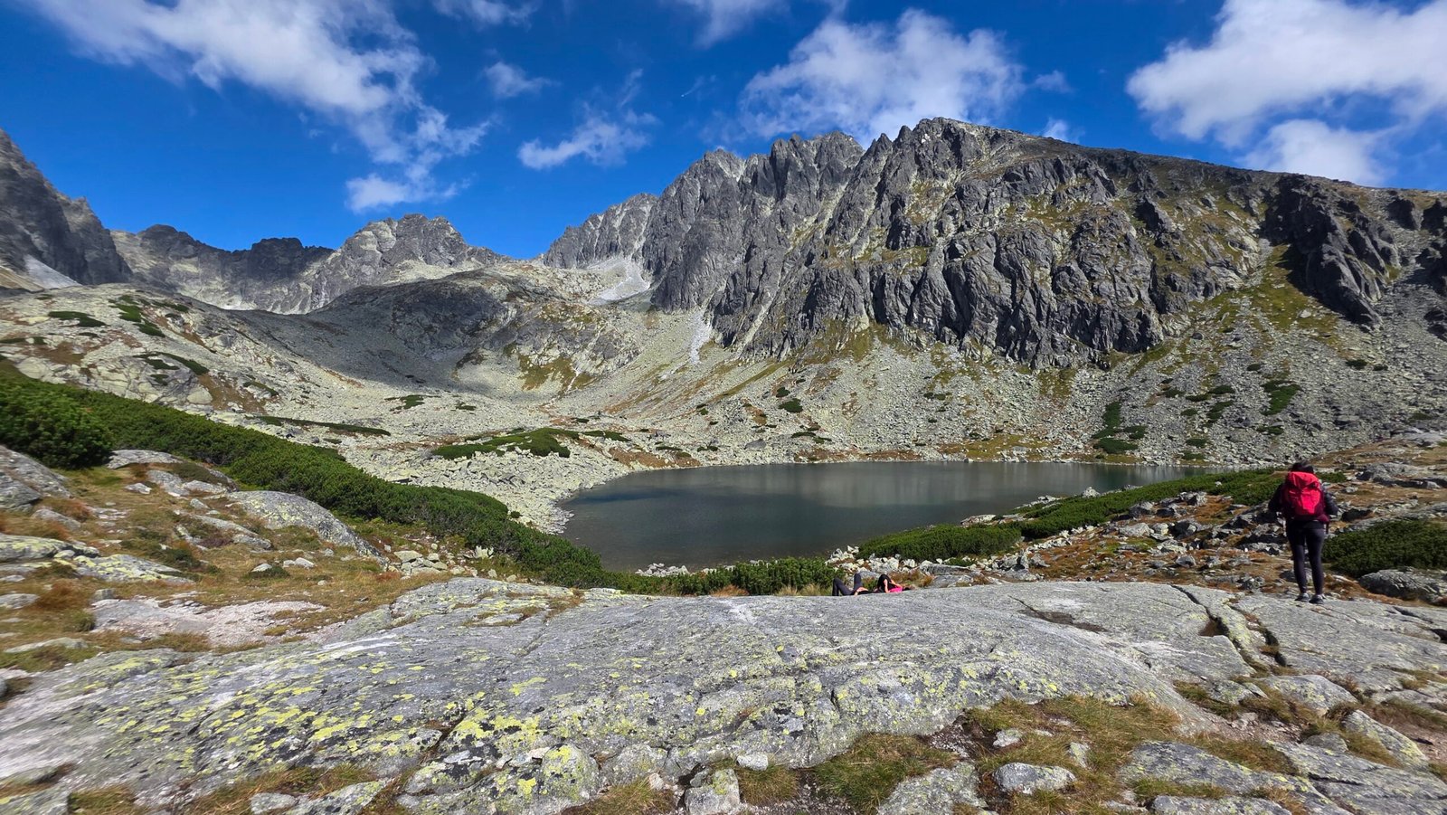
The summit cross is a natural photograph, but it is not the whole visual story. Start with the wooded approach, record the first open views and the scale of the rock, then leave room for the landscape after the descent. A small sequence can say more than dozens of nearly identical summit poses.
Make the camera easy to put away
Choose equipment that can be secured inside or close to the pack. On technical ground, movement and the rope system take priority. Ask the guide where it is appropriate to stop for a photograph, and wait for a stable place rather than taking a hand off the rock in an awkward position.
Use the weather you actually have
Cloud can give the massif depth and atmosphere. Do not treat a clear summit panorama as something the outing owes you. If the group needs to descend, the right photograph may be a brief frame at a suitable point rather than a long session at the top.
- Use people already moving appropriately to show the scale of the terrain.
- Keep narrow passages and rope-management space clear.
- Protect batteries from cold and preserve phone power for essential use.
- Stay inside the access rules; a photography goal does not create off-route permission.
- Check park drone restrictions separately rather than assuming a mountain booking includes flight permission.
My photos here belong to September 2025 and a particular expedition day. They are not evidence of today’s route condition. Keeping that distinction clear makes the pictures more useful as memories and keeps practical planning tied to current information.
18 / My expedition diary
09:58.
A moment on Slovakia’s roof.
7 September 2025. I had moved from Moldova’s quiet farmland to the granite heart of the Tatras in what felt like a sudden change of worlds. Bălănești Hill was behind me; a flight to Kraków and the drive south had brought the expedition back into high mountains.
I stayed in Poronin before the climb. My friend Kuba, from Zakopane, joined the approach at the beginning of the day. The original ambition was enormous: Gerlachovský štít first, then Rysy if the day allowed. Looking back, the most useful thing to preserve is the experience, not the pressure of that schedule.
A diary from an exceptional expedition
This account records my experience. It does not establish a route, qualification, guide arrangement or equipment standard for somebody else. The planning sections above describe the current access and organisation a new visitor should resolve independently of my photographs.
The mountain before the summit
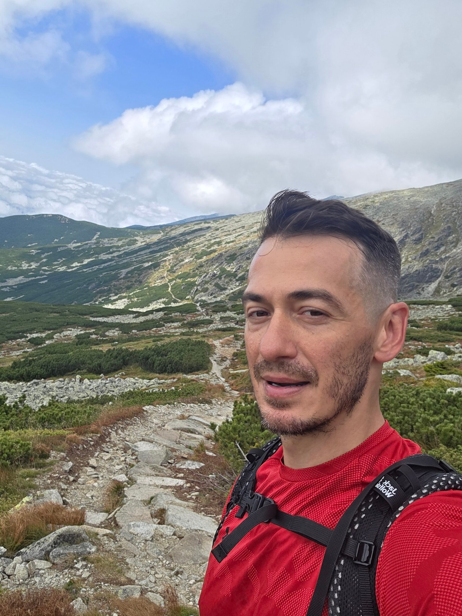
The morning had uncertainty in it. My account describes wet rock, loose ground and cold patches in the shaded terrain. Cloud hovered over the higher mountain, occasionally breaking enough to illuminate the valley. I remember moving with focus, aware that the landscape was asking for attention.
There is a very particular feeling when the broad walking world falls away and the day becomes rock, movement and concentration. The next section matters more than the distant summit. The weather is no longer a forecast on a screen; it is the visibility around you and the surface under your feet.
The first summit of the day
At 09:58, I recorded reaching Gerlachovský štít. The mountain carried the weight of being Slovakia’s highest point, but the moment itself felt quieter than the label. There was wind, rock and cloud moving through the valleys. I stayed only a short time.
After so many journeys across Europe, arriving on a national high point always contained two feelings: the satisfaction of getting there and the knowledge that the descent was still ahead. On Gerlach, I remember that combination especially clearly. The summit was a pause inside a much larger day.


Back towards the lakes
My route continued down toward Batizovské pleso and then onwards towards Popradské pleso. The sky began to open. The landscape changed from the enclosed concentration of the climb to trails, water and much wider views. Those scenes are as important to my memory as the cross.

By around 13:30, my diary places me in the Popradské pleso area. I continued toward Rysy and recorded the second summit at 15:30. The full day eventually ended on the Polish side, after Morskie Oko and the walk out to Palenica Białczańska.
My original account gives more than 36 kilometres and roughly 2,800 metres of ascent for the combined outing. Those totals describe the exceptional day, not a Gerlach route distance and not a recommended visitor itinerary.
What remains
The strongest memory is the transition: the grey uncertainty of the morning, the concentration on Gerlach and the afternoon opening across the Tatras. A peak list can record a date and a height, but it cannot hold the way those hours felt.
For a return, I would keep the curiosity and allow more space around the mountain. More rest, more time in the valleys and fewer demands on one day. The summit would still matter, but the landscape would have more room to become the story.
Continue with my Rysy guide and the second summit of that day ↗
19 / The questions that shape a better booking
Gerlach questions,
answered.
Is Gerlachovský štít a hike or a climb?
The summit routes enter mountaineering terrain. There is no ordinary marked hiking path to the top. A classic guided summer outing can include walking, scrambling and protected climbing movement; the exact experience depends on the route and conditions. Guides association explanation.
Do I need a mountain guide?
For a visitor without the relevant mountaineering qualification, booking a properly qualified guide is the normal planning route. Qualified independent climbing and specific authorised club training have their own requirements. Do not treat club membership alone as complete permission. Qualification guidance · KST arrangements.
How do I verify the guide?
Ask for the actual leader’s name and current credentials, then check the relevant professional register. A hiking-leader qualification is not automatically a mountain-guide qualification. NAHV SR directory · Professional recognition.
How many clients can one guide take?
The association’s current document lists up to three for the classic Velická / Batizovská outing under defined standard summer conditions. Snow, ice, route and client needs can require a smaller group. Confirm the ratio for your specific booking. Official requirements.
How high is Gerlach: 2,654.4 m or 2,655 m?
TANAP publishes 2,654.4 m, while the national tourism portal uses the familiar 2,655 m figure. They identify the same mountain. This guide records both sources instead of treating the difference as a new measurement. TANAP · Slovakia.travel.
How long does the climb take?
Published hotel-based operator references include roughly 6–8 hours and around eight hours. Your guide should give the appropriate full schedule for the route, group and conditions. Walking from the valley, transfers and breaks can change the total. Operator reference · Second reference.
Can I drive to Sliezsky dom?
Only under the relevant confirmed access arrangements. Hotel parking is limited and needs advance reception approval. Otherwise organise the valley meeting, walking approach or transfer. Do not drive up simply because the app shows a road. Official hotel parking information.
Is there a cable car to the summit?
No summit cable car forms part of the Gerlach ascent described here. A vehicle transfer to Sliezsky dom only reaches the high base; it does not remove the climbing day. Check the actual start and finish of anything advertised as transport for Gerlach.
When is the normal summer season?
June–October is the starting period for summer planning, subject to current conditions and legal route access. Outside it, mountaineering rules have specific dates and exceptions. The hotel being open does not mean every summit variant is permitted. Park mountaineering rules.
Can I climb in November?
Do not assume the classic summer route is available. TANAP’s extended Gerlach exception specifies the Gerlachovský ridge in both directions. Ask a qualified guide to confirm the exact route, access and winter preparation; this guide is not a winter itinerary. Full regulations.
Are a helmet and harness supplied?
Often, but confirm it with your provider. Ask about fitting, footwear compatibility and any extra seasonal equipment. A listing that includes a helmet does not establish that every other item or instruction is included. Example equipment FAQ.
Can I do it as my first mountain day?
It is a poor first mountain objective. Build experience on long rocky walks and appropriate exposed terrain, or arrange a suitable preparation outing. Describe your real experience to the guide so the route and expectations can be matched to you.
Can children join?
That needs an individual assessment by the provider: experience, stamina, equipment fit and response to exposure matter. An advertised minimum age is not a general readiness certificate. A lower-level Tatra visit may be a much better plan.
Can I bring a dog?
Not on the mountaineering ascent: TANAP’s mountaineering conditions exclude accompanying animals. A hotel accepting pets or an approved lower walking route does not extend permission to the summit. Mountaineering access rules.
Does the guide price include insurance?
Inclusions differ. Confirm cover for the actual activity, dates and rescue costs, and arrange anything missing. Read the insurer’s terms rather than assuming a general travel or medical policy covers the full mountain risk. HZS insurance information.
What happens if the weather is bad?
The outing may be postponed, changed or stopped. Agree the cancellation and refund rules beforehand: a pre-start cancellation and a turnaround after starting can have different costs. Example of provider terms.
Should I combine Gerlach and Rysy?
I would normally give them separate days and decisions. My combined expedition day was an outlier with a long cross-border finish. Use the Rysy guide to plan that mountain on its own terms.
Is this a live conditions report?
No. Research was checked on 31 October 2026; the diary and photographs describe September 2025. Recheck the park, HZS, weather and your guide for the actual date of travel.
20 / Your planning desk
Useful links.
Go straight to the source.
The park sets access conditions; the professional bodies explain qualifications and guiding standards; the hotel and operators confirm the service you can actually book. Use those sources for different questions instead of relying on a single destination summary.
What is fixed, what is dated, what must be checked again
The guide separates the valley approach from the hotel-based climb, a party guiding price from a per-person budget, and the September 2025 expedition from a suggested visitor plan. It also distinguishes standard summer ratios from changed conditions and the park’s route-specific exceptions from a blanket “open all year” claim.
Quoted service prices were checked on 31 October 2026. Route choice, weather, access, availability, equipment requirements and your final booking terms must be confirmed for your own visit. If a generic tourism page simplifies access differently from the park or current professional guidance, use the more specific current source.
The park lists Gerlachovský štít at 2,654.4 m
Landscape and classic-route context; use the park for current access rules
Qualifications, registration, seasonal access and permitted hours
Full regulations and appendices
Official registration entry point
Access for the marked approach and alternative walks
Nearby marked-trail restrictions are separate from mountaineering access
A dated reminder to check seasonal access
The national mountain-guides association explains access and qualifications
The mountain-guide profession and training
Professional credentials and recognition
Check the person who will actually lead your trip
Mountain guiding and other outdoor qualifications are different
Client ratios, conditions and equipment requirements
The qualification process; membership alone is not the complete answer
Read the actual training and recognition conditions
Specific club training arrangements, not general tourist access
The scope and conditions of the time-limited club exemption
The high base beside Velické pleso
Compare room types and live availability
A shared-space alternative to hotel rooms
Confirm arrival, transfers, food and accommodation directly
Restricted hotel parking and valley transfer arrangements
Separate the road approach from the summit outing
A local visual reference, not a summit forecast
A separate marked mountain walk with its own conditions and seasonal limits
The overall trip; its route headline is not an all-in schedule
Find the exact connections for your travel dates
The regional electric and cog railway network
One provider’s current quote basis, equipment and transfer details
A second provider for comparing duration, route and price structure
Equipment, meeting arrangements and what that provider includes
An example of why weather cancellation and turning back can have different costs
Read before departure and again before the climb
Rescue-service preparation and emergency guidance
Potential liability for search and rescue costs
Slovak mountain emergency contact: 18 300
Emergency communication and trip-planning tools
National forecasts and weather warnings
Observations to use alongside a forecast
Seasonal snow and avalanche information
Before you book the final connection
Confirm the guide and route, the approach or transfer, a weather margin and the return. Then leave enough room for the Tatras to be a journey, not a deadline.