
01 / The adventure, at a glance
Two countries meet on a rocky skyline. Below it: deep lakes, granite walls and a day that deserves more thought than a summit selfie.
Rysy is one of those mountains that feels close to civilisation until it suddenly does not. You can arrive by train, sleep in a comfortable valley town and walk past a busy mountain lake. Higher up, the ground becomes steep, exposed and unforgiving of a careless step. The transition is part of its appeal, and the reason to plan the whole day rather than only the top.
I climbed Rysy on 7 September 2025, after Gerlachovský štít earlier that day. It was an exceptional expedition effort. This guide is built around a more useful question for your own visit: which approach gives you the best chance of an enjoyable, well-prepared mountain day? Start with the practical information, then read my two-summit diary for the personal story.
- Poland’s highest point
- 2,499 mThe north-western, border summit
- Higher summit
- Slovak territoryUsually quoted as 2,503 m; not Poland’s high point
- Polish approach
- Morskie OkoA long approach, then steep ground and chains
- Slovak approach
- Popradské plesoVia Chata pod Rysmi; fixed aids below the hut
- Trip character
- A full mountain dayFitness, exposure and the descent all matter
- Slovak seasonal rule
- 1 Nov–31 MayThe upper marked Rysy trail is normally closed
Summit references: Zakopane’s official route guide. Seasonal access: TANAP’s closure list, item 13.
Make these three decisions first
Choose your side. Returning to the same trailhead is simpler than crossing the mountain and organising transport around the range.
Choose your margin. Protect daylight, allow for slow movement at chains and keep a day available if the forecast changes.
Choose an appropriate challenge. The Slovak route is the less committing starting point for many visitors, but it still has exposed terrain and fixed aids. Neither side is a substitute for mountain experience.
The strongest version of this trip is not necessarily the fastest. A night near the start, a clear weather window, a lighter summit pack and enough time to stop above the lakes can make more difference than squeezing another peak into the schedule. Give yourself permission to enjoy the mountain without making the summit a condition of success.

02 / A border, not a single number
Which Rysy summit
are you aiming for?
If you are collecting national high points, the distinction matters: Poland’s highest point is the north-western border summit, conventionally given as 2,499 metres. The higher summit lies entirely in Slovakia and is commonly quoted as 2,503 metres. Do not assume that standing on the highest-looking rock automatically means you have reached the Polish high point. PTTK summit reference.
Rysy is a small cluster of summits, not a broad, uncomplicated plateau. The regional tourism board distinguishes the north-western border top, the main middle top and a lower south-eastern top. Regional tourism-board overview. Maps and publications can use different elevation figures or rounding. The practical job is to identify your intended top and the marked approach, rather than settle a surveying debate while standing on exposed rocks.
| Your objective | What to identify | What to avoid assuming |
|---|---|---|
| Poland’s national high point | The north-western summit on the border. | That every summit photograph labelled “Rysy” shows this exact point. |
| A rewarding Tatra mountain day | A suitable marked route, current conditions and a sensible turnaround plan. | That visiting several tops is necessary to make the day worthwhile. |
| A crossing between countries | Your descent route, both parks’ rules and transport after the walk. | That a border crossing solves the return journey to your car. |
Make the summit a place to pause, not a place to improvise
Study a proper map before you arrive. If you are uncertain about the final rocks, ask for local advice or go with a qualified guide. Follow the marked route and avoid scrambling toward an apparently quieter viewpoint simply to escape a queue. A short distance near the top can contain a very large change in exposure.
For a photograph, first find a position where you can stand without obstructing others or edging into danger. Take the photograph, check your return direction and leave room for the people arriving behind you. There is no extra achievement in extending your time on exposed ground when weather or crowding is making the situation worse.
03 / Pick the experience that fits you
Poland or Slovakia?
The choice is about the entire journey: how far you walk before the steep ground, where you sleep, how you respond to exposure and how you get home afterwards. Choose the route your group can descend confidently, not just the route it might manage to climb.
| Approach | Published reference | What it means |
|---|---|---|
| Poland: Morskie Oko hut → Rysy | 4.7 km one way; 4 h 15 min ascent in the official town guide. | This starts at the lake. It excludes the long walk from Palenica Białczańska. |
| Slovakia: Popradské Pleso rail stop → Rysy → rail stop | 18.6 km return; about 1,253 m ascent; 4 h 15 min up + 3 h 05 min down in the regional route reference. | Walking time is not total trip time. Breaks, queues, conditions and your pace can add substantially. |
| Slovakia: a Štrbské Pleso itinerary | The national tourism portal describes a longer circuit of about 8½ hours. | Its approach and return differ. Do not mix its time with another starting point. |
| Crossing over Rysy | Combine two different approaches with a separate transport plan. | A one-way mountain crossing is not an easy circular walk. |
Route references: Zakopane · regional Popradské Pleso route · Slovakia.travel’s Štrbské Pleso itinerary. These are descriptive references, not live route-condition reports.
My starting recommendation
For someone already comfortable with long mountain walks who wants to understand Rysy before committing to the steeper Polish side, I would first consider the Slovak approach with a return the same way. You have a clear valley base and a hut below the summit. That is a planning preference, not a claim that it is easy or safe in poor conditions.
The Polish side makes particular sense if Morskie Oko and the Polish Tatras are central to your trip, you have the relevant experience and you can give the outing enough time. A hut night can separate the approach from the summit day. Starting at the roadhead and doing everything in one push needs a much more demanding time and energy calculation.
A simple readiness check
- Can everyone manage sustained ascent and a long descent on uneven stone?
- Have you experienced exposed terrain before, including descending it?
- Can you change the plan when one person is slower or uncomfortable?
- Do your transport and accommodation bookings leave room for that change?
- Have you chosen the route for the least confident person in the group?
If those answers are uncertain, spend the first day on a less committing walk, arrange guiding or choose a valley-focused visit. The photographs from below Rysy are not a consolation prize.
04 / The calendar is part of the route
When to go.
When to stay below.
For ordinary summer hiking, aim for a suitable snow-free weather window within the legal access period. A date in July, August or September may be a sensible starting point for research, but it does not promise dry rock, clear views or snow-free chains. Ask about the actual upper route immediately before your attempt.
Slovak upper trail: seasonal closure
TANAP lists the red trail from Rázcestie nad Žabím potokom via Chata pod Rysmi and Váha to Rysy among routes closed 1 November–31 May. The restriction includes the approach to the high hut, not only the final summit rocks. Read appendix 3, item 13.
The park’s announcement dated 30 October 2026 confirms the upcoming November–May closure period. Check for additional notices before planning the next season. Read the current park announcement.
| Period | The planning issue | A useful response |
|---|---|---|
| Early summer | Legal reopening can precede straightforward walking conditions. | Get current snow and ice information; choose a lower walk if conditions exceed your skills. |
| Main summer | Crowds, storms, heat on the approach and delays at fixed aids. | Protect a broad weather window and account for queues. |
| September / October | Less daylight and possible frost, ice or new snow. | Recalculate the day from the legal start and return window, not midsummer memories. |
| Winter / spring | Different hazards and Slovak seasonal restrictions. | Make a separate, appropriately qualified plan; this summer guide is not a winter itinerary. |
Early starts have rules
On the Polish side, TPN prohibits movement on tourist trails from dusk to dawn between 1 March and 30 November. On the Slovak side, hiking is generally a daylight activity; TANAP describes a limited exception for the shortest necessary arrival at booked hut or hotel accommodation. That exception is not permission for a night-time summit ascent. TPN rules and notices · TANAP hiking rules.
“Start at 3 a.m.” is therefore not responsible default advice for this trip. If the route will not fit your group’s daylight window, shorten the objective, use suitable accommodation or change the date. A headtorch belongs in the pack as backup; it does not override park access rules.
Keep your spare day genuinely spare
Do not fill the alternative weather day with another non-refundable summit booking. Leave it available until you know which day is best for the mountain. If none is suitable, use it for a lower-level itinerary or a town day. Good planning should still work when the top disappears into cloud.
05 / Get the first and last hour right
Getting to the trailheads.
Poland: Zakopane to Palenica Białczańska
For the Polish approach, distinguish Zakopane, the Palenica Białczańska / Łysa Polana parking area and Morskie Oko. They are not interchangeable starting points. TPN describes roughly 8 kilometres of approach road to the lake and suggests allowing about 2½ hours each way for that walk. Add the summit route separately. TPN’s Morskie Oko planning guide.
If driving, buy through the official TPN parking service. Parking allocation depends on arrival order; a booking can place you farther from the entrance rather than in the closest spaces. TPN uses variable pricing. Look up your actual date instead of copying a fixed parking amount from an old itinerary. Read how the parking areas work.
Public transport can simplify the day, especially if you are not returning to a car. TPN says regular Zakopane–Palenica services are run by external operators and, from January 2026, the park no longer sells their tickets. Confirm the actual first and last journeys with the operator. Optional e-bus services have their own availability and booking rules; do not make a long summit day depend on an assumed transfer. Current transport information.
Slovakia: the railway stop is below the lake
Popradské Pleso railway stop is not the same place as Popradské pleso lake. The tourism-board route begins with about 1 hour 15 minutes up the approach road. A booking at the lakeside hotel does not remove that arrival walk. The hotel also states that guests cannot simply drive their own cars up to it. Route start and approach · Hotel access information.
The Tatra electric railway connects the principal Slovak mountain settlements with Poprad. Use ZSSK’s journey planner for the date of travel and the exact station name. The regional railway overview is helpful for understanding the network. A diagram shows where trains go, not whether the first service suits your intended walking day.
Choose a base around the walk
Zakopane is a practical Polish town base; Štrbské Pleso or settlements on the Slovak rail network can work for the southern approach. Compare the whole journey from your room to the trail, including breakfast, the last return service and the recovery night. A cheaper room can become an expensive choice if it creates an awkward transfer.
- Save tickets, booking confirmations and contact numbers offline.
- Check which “Poprad” or “Popradské Pleso” your ticket actually names.
- Have a realistic fallback if you miss the last public connection.
- If crossing the mountain, arrange the return around the Tatras before starting.
- Leave room to rest before a long drive home.

06 / The southern approach
Rysy from Slovakia,
stage by stage.
The route rises through several distinct landscapes: approach road, woodland, lakes and high rocky ground. Think of each transition as a chance to reassess the day. This outline explains the route’s shape; it does not replace a topographical map, signs or current local advice.
Railway stop to Popradské pleso
Walk up to the lake and the accommodation beside it. Keep the pace comfortable: there is a substantial climb ahead. If you slept by the lake, this is the approach you have already separated from summit morning.
Lake to the Žabí potok junction
Follow the marked approach to Rázcestie nad Žabím potokom. Here the Rysy route branches onto red markings. Check that you are taking the Rysy branch rather than continuing toward another valley objective.
Climb toward the Žabie lakes
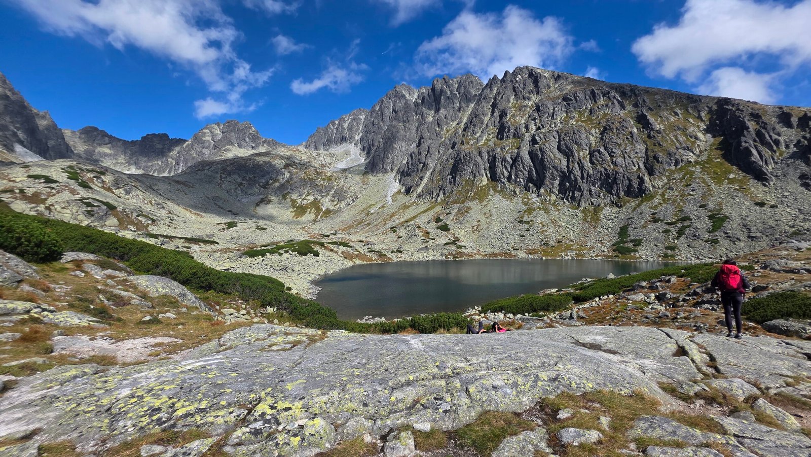
The landscape opens and the trail gains height. Keep food and a warm layer accessible. Enjoy the lakes from the established trail rather than walking across fragile ground for a photograph.
The secured rocky step
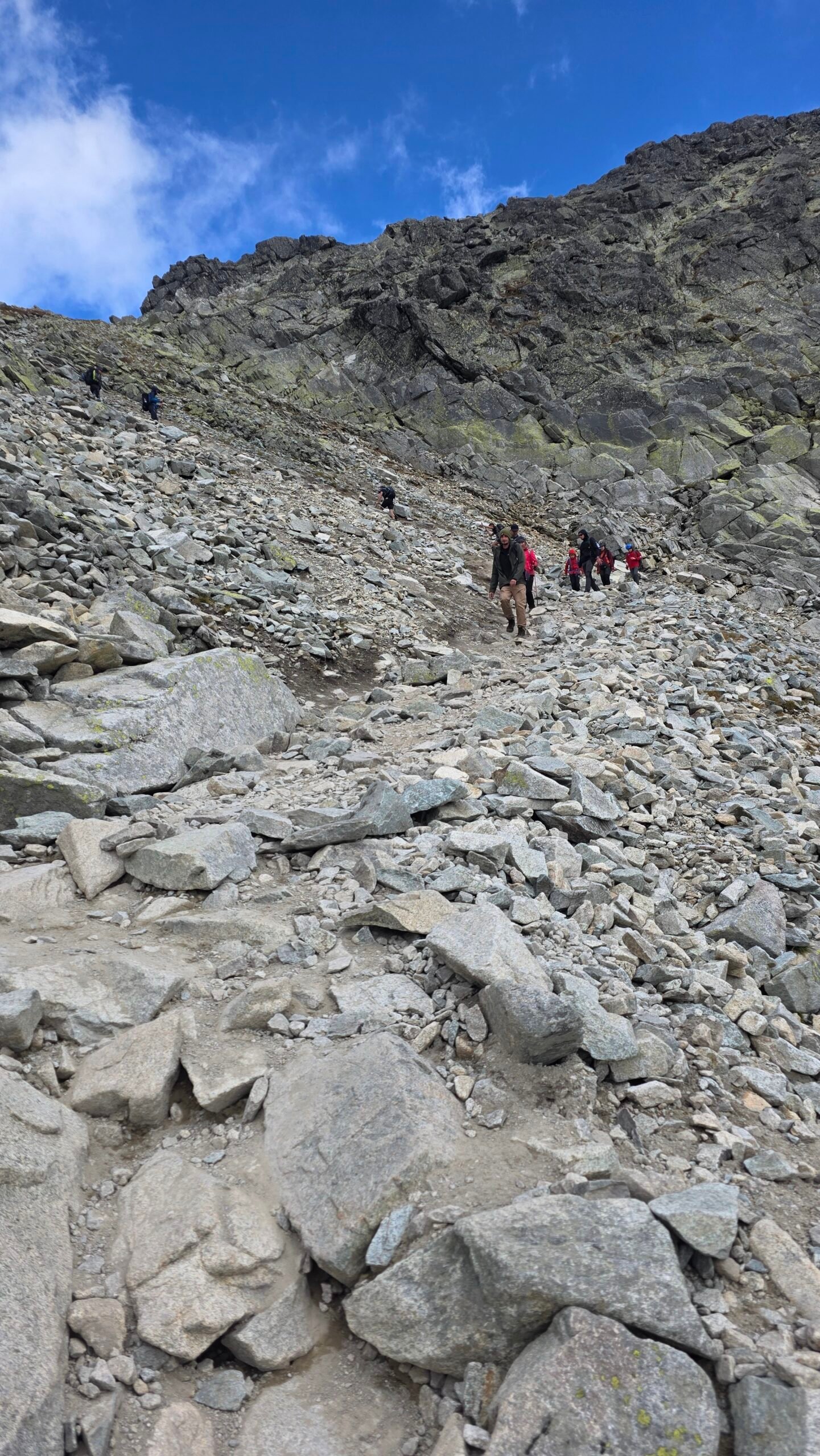
Below the high hut, the route crosses exposed ground with chains and other fixed aids. Expect two-way traffic. Leave space and treat your ability to descend the section as seriously as the ascent.
Chata pod Rysmi
Pause if the hut is operating, assess time and weather, and decide whether continuing still fits the day. Reaching a hut is a useful checkpoint, not a commitment to go higher.
Váha and the summit area
Continue on the marked upper route through the saddle area toward Rysy. On arrival, identify the intended summit and the route back. Keep enough concentration for the entire descent through the fixed aids and down to your start.
Route context: Slovakia.travel’s approach description and its longer Štrbské Pleso itinerary. Current access takes priority over descriptive route pages.
What makes the Slovak route demanding?
The difficulty is not contained in one dramatic move. It is the cumulative effect of height gain, rock underfoot, exposure, other people and a long return. Wet rock or residual snow can change the nature of a section that looks straightforward in a sunny photograph.
Use the lake and the hut as decision points. Ask whether your pace still matches the return window, whether everyone is eating and drinking, and whether the least confident person is comfortable. You do not need to wait for a crisis before deciding the top can wait.
07 / The northern approach
Rysy from Poland.
The lakes are the beginning.
Morskie Oko makes a magnificent start to the high route. It is also the place where an easy-to-underestimate day changes character. The walk to the lake does not demonstrate readiness for the upper mountain. If you arrive already tired, behind schedule or uncertain about the weather, the lake can be your destination.
Palenica to Morskie Oko
Allow for the approach road, your actual parking location and the time needed to organise yourself at the lake. A hut stay changes the schedule; an assumed early transfer may not.
Morskie Oko to Czarny Staw pod Rysami
Follow the red-marked approach around the lake and up to the higher tarn. This is a meaningful ascent on its own. Take stock before you commit to the much steeper terrain above.
Above Czarny Staw
The red route climbs toward Bula pod Rysami and the upper rocky ground. Lingering hard snow can be consequential. Do not copy a summer walking line across snow if you cannot assess and manage it.
The chain-assisted upper section
The marked route climbs the rocky boundary of the steep gully rather than offering a casual walk up its floor. Keep your attention on the route, footing and people above and below.
The border summit and the descent
Reach the summit area only if time, conditions and the group still justify it. The return requires controlled movement down the steep sections, followed by the lakeside trail and the long road out.
This is a planning outline based on the official Zakopane route guide. That guide describes the Morskie Oko–summit section as difficult and intended for experienced mountain visitors.
Why I would protect a hut night
If this is the side you want, compare a stay near Morskie Oko with doing the road approach and summit in one day. The hut night buys separation between arrival and the difficult objective. It does not remove the upper route’s exposure, but it may give you a better-rested start and more room in the legal daylight window.
Do not subtract the entire approach from your mental picture of the return. Tired legs still have to walk out. If you choose to descend into Slovakia, that should already be your planned itinerary with transport arranged, not an impulsive attempt to avoid going down the Polish chains.

08 / Take the exposed ground seriously
Chains, queues
and the way down.
Fixed aids can help movement, but their presence does not make a mountain route suitable for everyone. On Rysy, exposure and descent confidence matter as much as fitness. A person who can climb quickly on a broad trail may react very differently when the path narrows above steep ground.
Prepare before the narrow section
Eat, drink, adjust layers and secure loose equipment while you still have space. Put trekking poles away where you need your hands. Keep the camera stowed until there is a stable place to stop. Small jobs become harder when you are blocking the route or trying to hold on.
Leave room for other people
Do not push past someone who is concentrating on a difficult step. Give descending hikers space, avoid crowding a fixed-aid section and take care not to dislodge stones. If a queue is moving slowly, the solution is to recalculate your day, not to invent an unmarked bypass. Follow current rescue-service and park instructions. HZS safety guidance.
Helmet, harness, ferrata equipment?
A climbing helmet belongs in your preparation for the steep, rocky upper route. For additional self-protection, TPN’s current visitor notice recommends equipment such as a harness and via ferrata lanyard on trails with artificial aids. This is not a claim that every chain on Rysy is a standardised via ferrata installation or that clipping in removes the need for competence. Ask a qualified guide how the equipment should be used on your intended route. Read TPN’s current equipment recommendation.
If you need a technical system to feel comfortable but do not know how to use it, arrange instruction or guiding before the trip. Improvising a rope or attachment in exposed terrain can create new problems. The equipment conversation should happen in a shop, with a guide or during training, rather than at the first chain.
Snow changes the question
On steep hard snow or ice, the issue is not whether you can buy a small traction device. It is whether you have the right equipment, technique and judgement for a consequential slip. Microspikes are not a universal substitute for mountaineering crampons and an ice axe. If the conditions call for skills you do not have, choose another objective.
A useful turnaround test
Before continuing, ask: “Would I be willing and able to descend this same section if I were colder, more tired and surrounded by other hikers?” If the honest answer is no, use the safe opportunity to stop before the situation becomes more committed.
09 / Give the mountain a sensible place in the trip
Three ways to plan your days.
These are suggested structures, not operator packages. Adapt them to the season, your group and the actual connections. A spare day only helps if you can move the main attempt when the weather dictates.
Slovak base, one main objective
- Arrive and prepare. Settle into a base on the rail network or near Štrbské Pleso. Check conditions and organise food and equipment.
- Attempt Rysy in the best window. Return to the same start, allowing for the secured section and the full descent.
- Flexible day. Swap this with the summit day if needed, or enjoy a suitable lower walk and recover.
This structure avoids arriving exhausted and immediately asking your body to perform on exposed ground. It also gives you a useful alternative if the mountain forecast is worse than the weather in the valley.
A Morskie Oko hut plan
- Walk in, enjoy the lake and stay in booked accommodation.
- Use a suitable daylight window for the upper route, then return to the lake.
- Walk out with enough room for onward travel; add a flexible night if your booking allows.
Check bed availability first. Do not build an itinerary around a hut night that exists only as an assumption. Ask about arrival arrangements and what you should do if the forecast requires a change.
Slovakia up, Poland down
This can be a memorable way to experience both sides, but it combines different terrain and a difficult descent with a complicated return. Check both parks, allow enough daylight, carry appropriate identity documents and organise your onward transport. It is not the default plan I would give a first-time visitor.
What I would not copy from my expedition
My Gerlach-and-Rysy day was more than 36 kilometres with roughly 2,800 metres of ascent in my original account. That belongs in the diary, not in a template for somebody else’s holiday. The extra effort, technical terrain and compressed timing make it a very different undertaking from a Rysy hike.
The booking order that reduces friction
- Choose the side and whether you need a guide.
- Find accommodation that supports the actual start and finish.
- Keep a flexible block of dates rather than a single inflexible summit appointment.
- Match that block to transport, parking and any hut booking.
- Protect the recovery and return journey as carefully as the ascent.
10 / Sleep where it helps the next day
Where to stay.
Morskie Oko: the Polish lake base
The Morskie Oko hut is the obvious accommodation conversation for the Polish upper route. Its own contact page warns of heavy demand and recommends booking well in advance. Contact it directly for a confirmed bed, the current price and arrival arrangements. A webpage showing a hut is not evidence that a space will be available when you arrive.
A hut stay has a different rhythm from a hotel. Organise your pack before others are asleep, keep essential morning items together and be considerate about alarms and shared space. Ask about food times rather than assuming breakfast aligns perfectly with your intended departure. TPN’s shelter overview.
Popradské pleso: a lower Slovak base
The Mountain Hotel Popradské Pleso is beside the lake, above the railway stop. It can separate the arrival walk from summit day. Read its access information carefully: private-car access to the hotel is not available. Confirm meals, the type of room or dormitory and what you should bring for your booking.
Chata pod Rysmi: high and simple
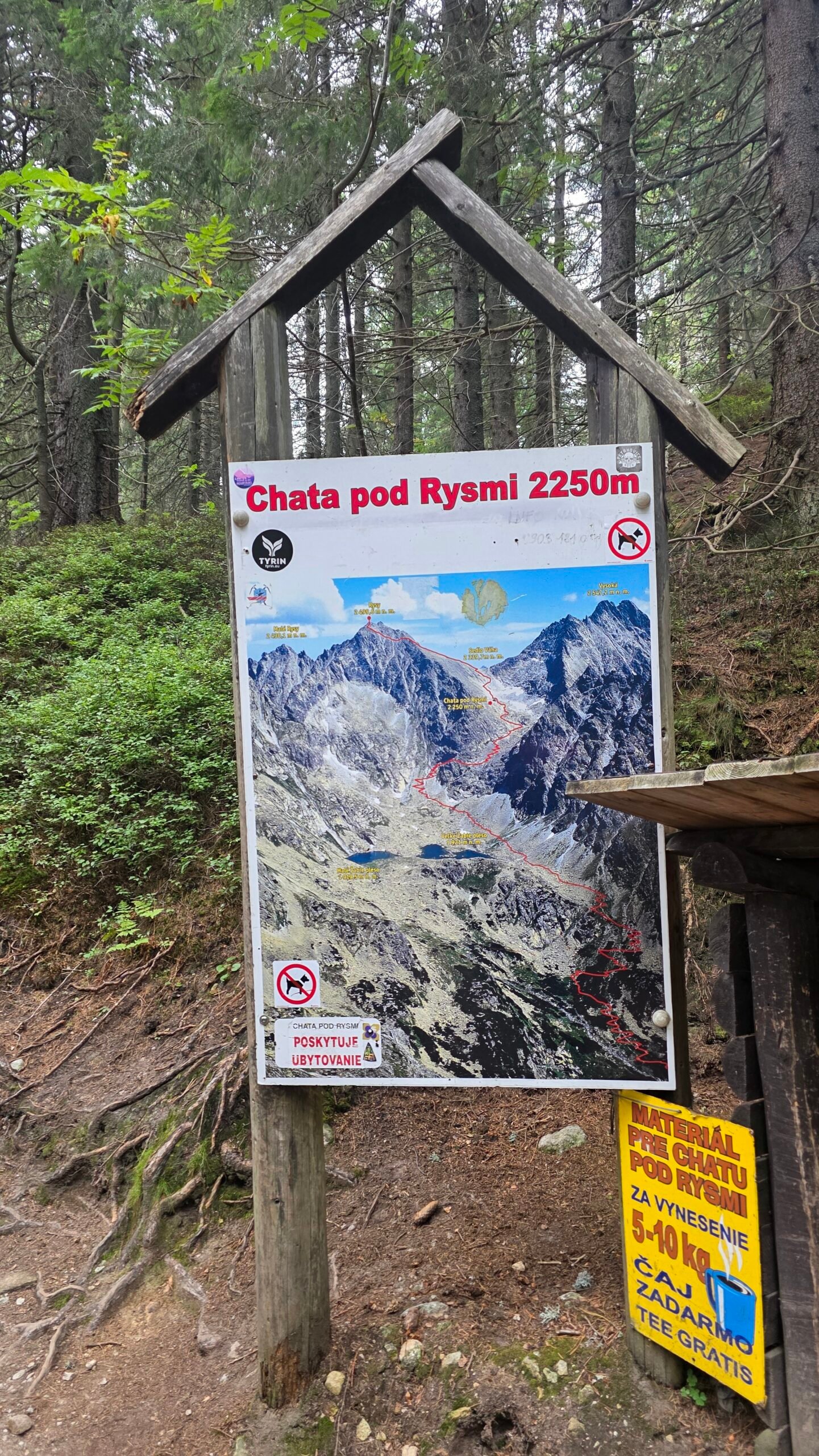
Chata pod Rysmi sits at approximately 2,250 metres and operates seasonally. This is a mountain hut, not a hotel experience. A high overnight stay also commits you to reaching the hut through the secured section, so it should fit your abilities and the conditions.
Its published 2026 accommodation page lists €65 per person for bed, breakfast and dinner, plus a €3.50 adult local tax and a €1 supplement for non-members of the listed clubs. It describes shared sleeping accommodation with supplied bedding/liner, no shower and dry toilets outside. Reservations are requested by email and only become valid after confirmation. Recheck the rules and prices for your season. Read the hut’s booking page.
Ask before you pack a sleeping bag
The high hut’s 2026 page specifically asks visitors not to bring their own sleeping bags for hygiene reasons and describes the supplied sleeping arrangement. Follow the current hut instructions instead of a generic packing list. Other accommodation may have different requirements.
A valley room can be the best choice
If you value a private bathroom, flexible meals or an easy weather-day alternative, stay in a valley settlement and accept the longer approach. Compare the early transport you can actually use with the cost and convenience of a higher bed. Comfort is useful when it helps you arrive rested, not when it conceals a rushed start.
Do not treat wild camping as the automatic cheap alternative. TPN prohibits camping; Slovak protected-area access and overnight rules also need to be respected. Use authorised accommodation and the relevant park guidance. Polish walking guidance · Slovak visitor regulations.
11 / Price the whole trip
Costs, tickets
and your own budget.
The mountain is only one part of the expense. Your meaningful total includes travel to the region, the last connection, parking or rail, park admission, meals, accommodation, equipment, insurance and room for a changed plan. Comparing only bed prices misses much of the trip.
| Item | Reference checked 31 October 2026 | What to do |
|---|---|---|
| TPN one-day admission | PLN 11 adult / PLN 5.50 reduced. | Check eligibility and the price for your visit. |
| Morskie Oko parking | Variable price and availability. | Look up the exact date in the official booking system; divide a shared-car cost per person. |
| Chata pod Rysmi | Published 2026 bed + breakfast + dinner: €65; listed supplements may apply. | Confirm a reservation and the final total directly with the hut. |
| Other beds, rail, guides and rental | Use actual quotes. | Save cancellation terms, service dates and what is included. |
Price sources: TPN admission · official parking · high-hut accommodation. These are dated references, not guaranteed future prices.
A calculator for either side of the border
Choose PLN or EUR and enter all amounts in that one currency, per person. Convert any foreign-currency quotes yourself using the rate you intend to budget with. Changing the selector changes the displayed unit; it does not convert existing inputs. Split shared costs first, and avoid counting meals twice when they are included with a bed.
Where I would spend a little more
- A useful extra night: it can protect a weather window and avoid tired driving.
- Competent guidance: valuable if exposure, route choice or equipment is outside your experience.
- Appropriate footwear and a helmet: fit and familiarity matter more than a last-minute bargain.
- A return plan: especially important for a crossing with a finish in another country.
Keep some usable payment options for the places you will visit, and ask each hut about its accepted methods. Do not arrive in the high mountains relying entirely on a phone payment, a live exchange-rate page or a connection you have not checked.
12 / Prepared, not overloaded
Your Rysy packing checklist.
Pack for the route and the forecast, including time spent waiting or helping somebody else. A light pack is useful only when it still contains the things the day requires. Confirm specialist equipment with a qualified guide when conditions go beyond ordinary summer walking. TPN preparation advice · HZS instructions.
Water and food deserve an actual plan
Work out how much you need for your duration, the weather and your own requirements. Confirm any refill or food opportunity directly instead of assuming a hut is open or every stream is suitable for drinking. Pack a reserve that remains available when the outing takes longer than expected.
Eat little and often enough that a technical section is not also the moment you discover you have run out of energy. Keep one snack and a warm layer accessible without emptying the whole bag. Share the plan with companions so the group does not rely on a single person carrying every essential.
A photograph is not an equipment recommendation
My expedition images show what I was doing on a particular day. They are not a model for your footwear, protection or pace. Choose equipment using the current route, professional advice and your own competence, including the ability to return safely when conditions change.
13 / Leave room for a good decision
Weather, rescue
and knowing when to stop.
Check a mountain forecast, current park restrictions and rescue-service notices together. A sunny forecast for Zakopane or Poprad is not enough information about wind, freezing conditions or visibility on a high ridge. Look at the timing of change as well as the headline weather icon.
Your pre-walk information desk
Poland: TPN trail report · mountain weather · TOPR avalanche information.
Slovakia: HZS warnings · SHMÚ forecasts · HZS mountain observations · avalanche information.
Write down the reasons you will turn around
Decide before the summit becomes emotionally important. Examples include slower progress than the daylight plan permits, worsening cloud or wind, snow or ice beyond your competence, or a companion who is not comfortable descending the ground ahead. A turnaround rule should be specific enough to act on, not an optimistic phrase about “seeing how it goes”.
Do not use a hut, another group’s progress or the fact you have paid for parking as proof that continuing is sensible. A booking is a logistical fact. The mountain decision depends on the group and the conditions in front of it.
Storms and winter conditions
Exposed ridges and fixed-aid sections are poor places to discover that the weather window has closed. Use official forecasts and local advice to keep the high part of the day out of a deteriorating period. If winter conditions are present, treat avalanche terrain and steep snow as separate technical problems. An absent or out-of-season avalanche bulletin is not evidence that the hazard is absent. TPN mountain safety · TOPR explains its bulletin’s limits.
Emergency contacts
| Where | Emergency contact | Prepare to explain |
|---|---|---|
| Polish Tatras / TOPR | 112 or +48 601 100 300; domestic mountain number 985. | Location, route, injuries, people involved and conditions. |
| Slovak Tatras / HZS | 18 300 or 112. | The same information, including which side of the mountain you are on. |
Official Polish emergency contacts · Slovak Mountain Rescue Service. Save the numbers before departure. If a short local number will not connect on your phone or roaming setup, use 112.
Know how to read your coordinates, keep the phone available for rescuers and follow their instructions. The official HZS app can support emergency communication and trip planning. Install and understand any app before travelling; a phone tool is not a promise of network coverage everywhere.
Check rescue insurance for the country you may enter
HZS explains that adults in Slovak mountain areas can be liable for search and rescue costs, with stated legal exceptions. Arrange cover appropriate to your activities and check both countries if you may cross the border. Read the policy’s terrain, altitude, rescue and activity conditions; do not assume a medical card or a general travel policy covers every mountain expense. Read HZS’s insurance explanation.
14 / Know both sides before choosing one
Maps and
the border crossing.
The overview below shows the Rysy area and the two approach valleys. It is geographical context only: not a plotted hiking route, not a GPX track and not evidence that a path is currently open or passable.
Open a larger overview map ↗ · Map data © OpenStreetMap contributors. The marker locates the Rysy area approximately, not an instruction for the final summit steps.
Use TPN’s geoportal for Polish park mapping and TANAP’s mapped routes and rules for the Slovak side. Download your chosen topographical mapping before travelling, test it offline and carry a suitable backup. An app drawing a line over the border does not check the park calendar for you.
A map preparation routine
- Mark your actual start: roadhead, rail stop or hut.
- Trace the approach, difficult upper sections and the entire descent.
- Identify the summit you intend to reach and the correct return direction.
- Check closures for every section, including any link used on the way home.
- Save enough map area to understand the surrounding valleys.
- Leave the route and expected return time with a reliable contact.
Crossing Rysy is a different itinerary
My own descent into Poland was part of an expedition with a friend helping with the return. If your car is in Slovakia, finishing at Palenica does not put you near it. Plan the road journey around the range, check services on your exact day and carry the travel documents appropriate to your nationality and itinerary.
Keep the option to return the way you came if that remains the appropriate plan. Do not commit to descending the opposite side simply because it looks shorter on the screen. Terrain, daylight, weather and transport all have to fit the crossing.
15 / The mountain is bigger than its summit
Beyond the top.
A spare day in the Tatras can be a very good day. The important thing is to choose an alternative for its actual conditions and effort, not just because its name is less famous than Rysy. Another high pass is not automatically a poor-weather fallback.
The Polish lakes
Morskie Oko is an entire outing in its own right. You can concentrate on the approach, the shore views and time at the hut without committing to the summit. Czarny Staw is a further mountain walk with additional ascent; assess the path and conditions separately. Use the park’s lake planning guide and current report.
Popradské pleso and the lower Slovak landscape
The lake and its established approach offer a way to experience the setting without the full upper route. Check the specific path you intend to use: summer and winter access arrangements are not identical. A meal, a slow approach and time looking up at the mountains can make a more enjoyable day than forcing a summit through cloud.
Build a town day into the trip
If the mountain weather is genuinely poor, use the settlements for food, culture, rest and planning. The weather day does not have to become another athletic challenge. Drying equipment, sleeping properly and rearranging transport may be the most useful things you do before a better window.
Gerlach is a separate conversation
Gerlachovský štít appears in my diary because it was the first summit of that exceptional day. It is not an extra marked-trail hike to attach casually to Rysy. Treat a Gerlach objective separately, with the relevant technical experience, qualified guidance and TANAP mountaineering requirements. Read the park’s mountaineering rules. Read my complete Gerlachovský štít guide ↗.
16 / Bring home the whole journey
Photographing Rysy.
The strongest photo story starts below the summit. Record the changing scale: a path through woodland, a signpost, the first open slopes, the lakes below the ridge and the quiet after the descent. Put those images beside one summit photograph and you have a journey rather than a collection of poses.
Let the light work with the route
Plan photography inside the legal daylight window and a sensible weather plan. Do not turn a desired sunrise image into a night-time ascent that ignores park rules. Beautiful light can happen lower down, and a broad landscape often tells more than a precarious position at the top.
Carry less, use it better
Choose a camera setup you can protect and stow quickly. On a hands-on section, it should be away rather than swinging against the rock. A phone is enough for a strong sequence if you pay attention to light and framing. Keep power reserved for navigation and emergency communication.
- Use a person already safely on the trail to show scale.
- Wait for a stable stopping place before changing lenses or taking out a camera.
- Avoid blocking chains, narrow paths or passing places.
- Leave wildlife space and stay on authorised routes.
- Keep altitude, location and conditions honest in captions.
Respect the park’s drone restrictions; a hiking trip does not confer permission to fly. The TPN visitor guidance explicitly tells visitors not to fly drones in the park. Your camera can tell a complete story from the ground.
17 / My expedition diary
Two Tatra giants.
One extraordinary day.
7 September 2025. Gerlachovský štít at 09:58. Rysy at 15:30. Those are the summit times in my original expedition account. They explain the intensity of the day; they are not times to chase on your own itinerary.
I had come from Moldova, moving within a short time from the farmland around Bălănești Hill to a flight into Kraków and then the High Tatras. After so many borders and journeys, the sudden arrival among granite walls felt like entering a different world.
Read this as a diary, not a route recommendation
The day combined technical mountain terrain, two summit objectives and a cross-border finish. The Gerlach section is separate from the marked Rysy hiking routes described above. For a new visit, I would organise appropriate guidance, a much less compressed schedule and more recovery.
A dawn approach from Tatranská Polianka
My friend Kuba, from Zakopane, joined the early part of the journey. We started at Tatranská Polianka, with the light only beginning to reach the mountains. The ambition was already enormous: Gerlach first, then Rysy if the day held together.


Gerlach: mist, rock and concentration
The first mountain carried a different atmosphere from the clear afternoon that followed. My account describes wet rock, loose ground and cold, shadowed patches on the way through the Velická valley area. Cloud hid and revealed the landscape in turns. I moved with concentration rather than any sense that the day was routine.
At 09:58, I reached Gerlachovský štít, Slovakia’s highest mountain. The wind, the rock and the shifting cloud made the moment feel quiet. I did not stay long. There was satisfaction, but also the knowledge that the first summit had used only part of the day’s commitment.


Between mountains
After descending toward Batizovské pleso, I continued toward Popradské pleso. The weather improved as I crossed the landscape. By about 13:30, according to my diary, I had reached the Popradské pleso area. The mountains reflected in the water, and the afternoon looked very different from the cold uncertainty of the morning.
It would have been perfectly reasonable to stop after the first mountain. Instead, with the sky clearing, I continued toward Rysy. That decision belonged to a compressed expedition, with all the accumulated effort and judgement it involved. It is not something a reader needs to repeat to understand why the landscape mattered to me.
15:30: the second summit
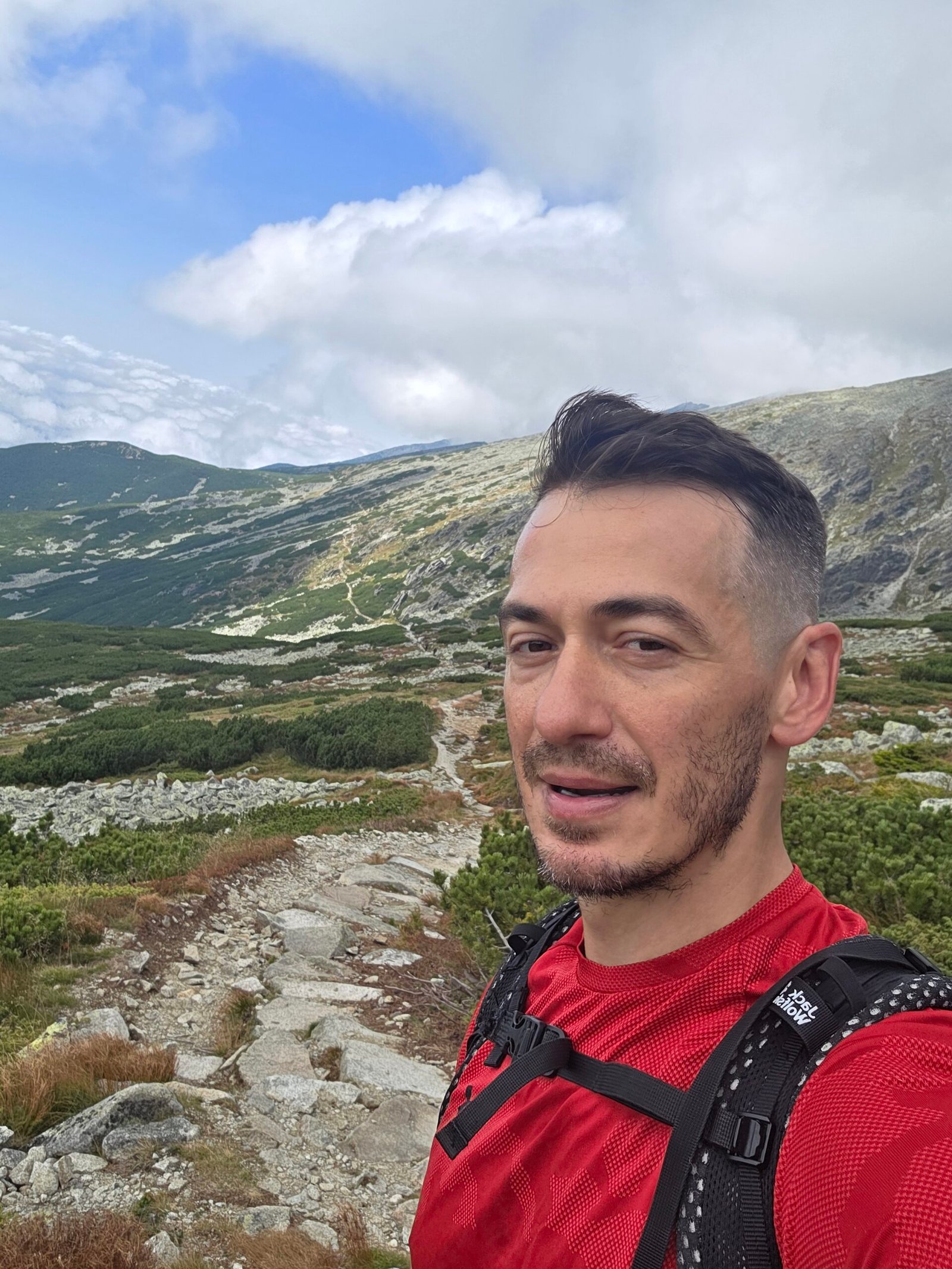
Rysy was a long climb on legs that had already worked hard. Yet the atmosphere kept changing in my favour: the cloud lifted, the views opened and the mountains became a wide arrangement of light, stone and distant lakes. At 15:30, I recorded the second summit.
Looking into Poland, with Morskie Oko far below, I felt the scale of the whole journey. The border was a line on a map, but the mountain scene was continuous. For a few moments, all the travel and timing that had brought me there became very simple: I was standing in the Tatras on a clear September afternoon.


The Polish descent, then the road home
I descended past Czarny Staw and Morskie Oko to Palenica Białczańska. My original record gives more than 36 kilometres and approximately 2,800 metres of ascent across the combined day. The summit photographs show only a fraction of that effort.
A local bus took me toward Zakopane, where Kuba collected me, and we returned to Poronin. The lasting feeling was a mixture of exhaustion and contentment. The day had moved from morning mist on Gerlach to afternoon clarity on Rysy, with two very different mountain experiences inside it.
“From the mist on Gerlach to the golden light on Rysy.”
What I would carry into a return visit
I would keep the curiosity and give the landscape more time. A less compressed plan allows the approach, the lakes and the changing weather to become part of the pleasure instead of problems to solve quickly. My day was memorable because of everything it contained. Your visit does not need to contain the same amount to be just as meaningful.
18 / The questions that change the plan
Rysy questions,
answered.
Which side is easier: Poland or Slovakia?
The Slovak approach is the less committing starting point I would consider for many experienced walkers planning a first Rysy visit. It still includes exposed terrain and fixed aids. The Polish upper route is steeper and the roadhead approach adds a substantial walk. Choose for your group’s descent ability, conditions and available time.
Can a beginner climb Rysy?
It is a poor choice for a first mountain day. Build experience with long rocky walks and exposure, or discuss an appropriate guided plan. Fitness alone does not resolve fear of heights, route judgement or movement down steep ground.
Is Rysy Poland’s highest mountain at 2,499 m or 2,503 m?
The Polish national high point is the north-western border summit, conventionally 2,499 m. The higher summit commonly quoted as 2,503 m is in Slovakia. Identify the intended top rather than relying on the article title or a single rounded number. PTTK summit reference.
How long does Rysy take from the Slovak railway stop?
The regional route reference gives 18.6 km return and 7 h 20 min of walking. That is not an all-in promise: breaks, queues, route conditions and pace can extend the day. An overnight start by the lake is a different itinerary. Route reference.
Does the Polish route time include the Morskie Oko road?
The official 4 h 15 min ascent reference starts at the Morskie Oko hut. It does not include the approach from Palenica or the return road. Keep those legs separate when planning. Upper route · Road approach.
When is the Slovak trail closed?
The upper red trail from Nad Žabím potokom through Chata pod Rysmi and Váha to Rysy is listed under the 1 November–31 May closure. Check current park notices for any additional restrictions. Official list, item 13.
Can I start in the dark for sunrise?
Do not assume so. TPN prohibits dusk-to-dawn trail movement from 1 March to 30 November. TANAP generally restricts hiking to daylight, with a limited accommodation-arrival exception. Plan inside the applicable rules. TPN · TANAP.
Do I need a guide?
The marked summer hiking route is distinct from technical objectives such as Gerlach. A qualified guide is a useful choice when exposure, route judgement or equipment exceeds your experience. Clarify the route and conditions with the guide rather than treating a booking as a summit guarantee. TPN guiding information.
Are there chains on both approaches?
Yes. The Polish upper route has chain-assisted rocky terrain; the Slovak approach includes a secured exposed section below the high hut. Neither should be described as an ordinary valley walk. Polish route · Slovak approach.
Can I take a dog?
Do not plan a Rysy summit trip with a dog. TPN prohibits dogs on this route, with limited exceptions such as assistance and rescue dogs under the applicable rules. TANAP restricts animals in designated sensitive high-mountain areas. Check its maps for any lower walk you are considering. TPN dog rules · TANAP animal-access rules.
Is it suitable for children?
Choose for the individual child’s demonstrated mountain experience, stamina and ability to move calmly in exposure, with appropriately experienced adult supervision. It is not a general family attraction. A lake-focused outing may be a much better trip; discuss uncertain cases with a qualified local guide.
Can I climb from Slovakia and descend into Poland?
A planned crossing is possible as an itinerary, but only when legal access, conditions, competence and daylight fit both sides. Arrange transport around the range and carry the documents appropriate to your trip. Do not treat the opposite descent as an unplanned shortcut back to a Slovak car.
Can I sleep at Chata pod Rysmi?
It provides seasonal shared accommodation. Reserve directly and wait for confirmation; its 2026 page specifies an email booking process. Check the opening period, price and supplied sleeping equipment for your visit. Hut booking information.
What if there is snow on the route?
Get a current assessment. Steep hard snow and ice can require mountaineering equipment and the competence to use it. A summer date or a small traction device does not remove a consequential fall hazard. Turn back or choose another objective if the conditions exceed your preparation.
Do I need rescue insurance for Slovakia?
HZS explains that adults can be liable for mountain search and rescue costs, with specified exceptions. Check suitable cover for the actual activity and both countries if relevant. Read the policy rather than assuming ordinary medical cover includes everything. HZS explanation.
Is this a live conditions report?
No. The research was checked on 31 October 2026. Use current park notices, rescue-service information, forecasts and direct accommodation contacts for the dates you plan to travel. The photographs and diary describe September 2025.
19 / Your planning desk
Useful links.
Go straight to the source.
Start with the parks and rescue services, then confirm transport and accommodation directly. The route descriptions explain the geography and effort. A current official closure or weather warning takes priority over an older destination article.
What was checked
This guide separates the Polish border summit from the higher Slovak top; the roadhead approach from the lake-to-summit route; published walking references from a realistic whole-day plan; and the September 2025 expedition from advice for a new visitor. Price examples were checked on 31 October 2026 and are not a promise for a later season.
The Polish and Slovak tops, exposure and hard lingering snow
Official town route description; the lake-to-summit section
Route reference from the regional tourism board; use TANAP/HZS for current restrictions
National tourism route description and the longer Štrbské Pleso itinerary
The mountain and the Slovak approach
Closures, snow and ice, warnings and visitor information
Slovak Mountain Rescue Service notices
Appendix 3; Rysy is listed under item 13
Dated confirmation of the November–May closure period
Daylight access, marked routes and seasonal restrictions
The visitor regulations, maps and appendices
Polish park walking guidance
Approach road, transport and practical visitor questions
Official parking tickets and the price for your date
How the official parking areas and allocation work
Current admission prices, concessions and ticket conditions
Live rail connections and tickets for Slovakia
The regional electric and cog railway network
Contact the hut directly for accommodation
The 2,250 m hut and its seasonal operation
Booking method, dormitory arrangements and the published 2026 price
Lakeside accommodation; private-car access is restricted
Official overview of Polish park accommodation
Preparation, weather, storms and mountain judgement
Current rescue-service guidance and downloadable instructions
Mountain forecasts and observations
Slovak national meteorological service
Mountain observations from the rescue service
Seasonal Polish Tatras avalanche information
Seasonal Slovak avalanche information
Polish mountain emergency contacts
Slovak mountain rescue; 18 300
Who can be liable for search and rescue costs in Slovakia
App features, emergency contact and trip planning
Park mapping, route access and current restrictions
Dog restrictions and the limited exceptions
Guiding information for the Polish Tatras
Separate rules for technical objectives such as Gerlach
Before you close the planning tabs
Confirm the route is open, choose a suitable forecast window, save your bookings offline and tell someone where you are going. Then leave enough flexibility to enjoy the Tatras even if Rysy keeps its summit for another day.