Turkey – Mahya Dağı (1,031 m)
⛰️ Altitude: 1,031 m
📍 Coordinates: 41°46′59″N 27°37′07″E
🗺️ Route: Approach by car from Malkoçlar – Short hike to military base area near summit
🚗 Transport to region: 1,102 km total
• 73 km drive Mount Olympus (Cyprus) → Paphos Airport
• 796 km flight Paphos → Istanbul
• 233 km drive Istanbul → Mahya Dağı (Strandzha Mountains)
💤 Accommodation: Slept at Istanbul Airport before the climb
🌤️ Conditions: Hot, sunny, and clear — classic mid-summer weather
✈️ From the Mediterranean to Europe’s far edge
After completing Mount Olympus in Cyprus, I crossed the island by local transport from Paphos to Larnaca, walking across the border into Northern Cyprus. From there, I boarded a late-night flight to Istanbul and spent a few short hours sleeping inside the airport my routine way of keeping the expedition in constant motion.
At sunrise, I picked up a rental car from Keddy and began the 230-kilometre drive west toward the Strandzha Mountains a quiet, forested region marking the European part of Turkey. The roads grew emptier with every kilometre, and soon I was driving through rural villages and vast green hills, feeling the proximity of the Bulgarian border.
🥾 The summit approach
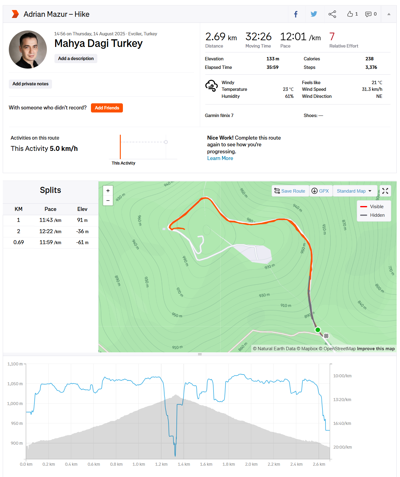
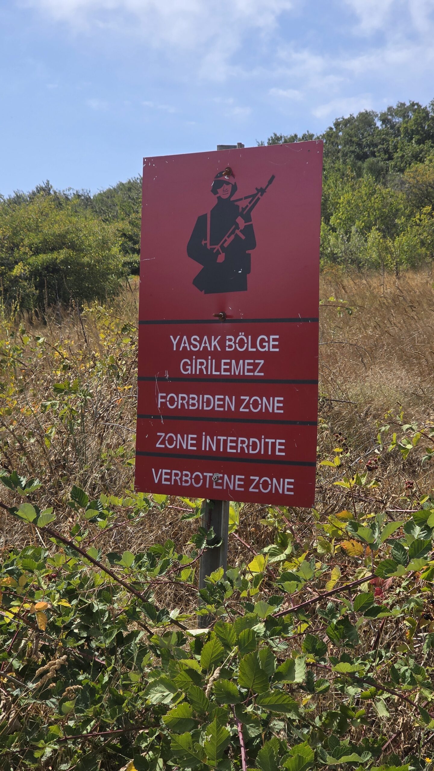
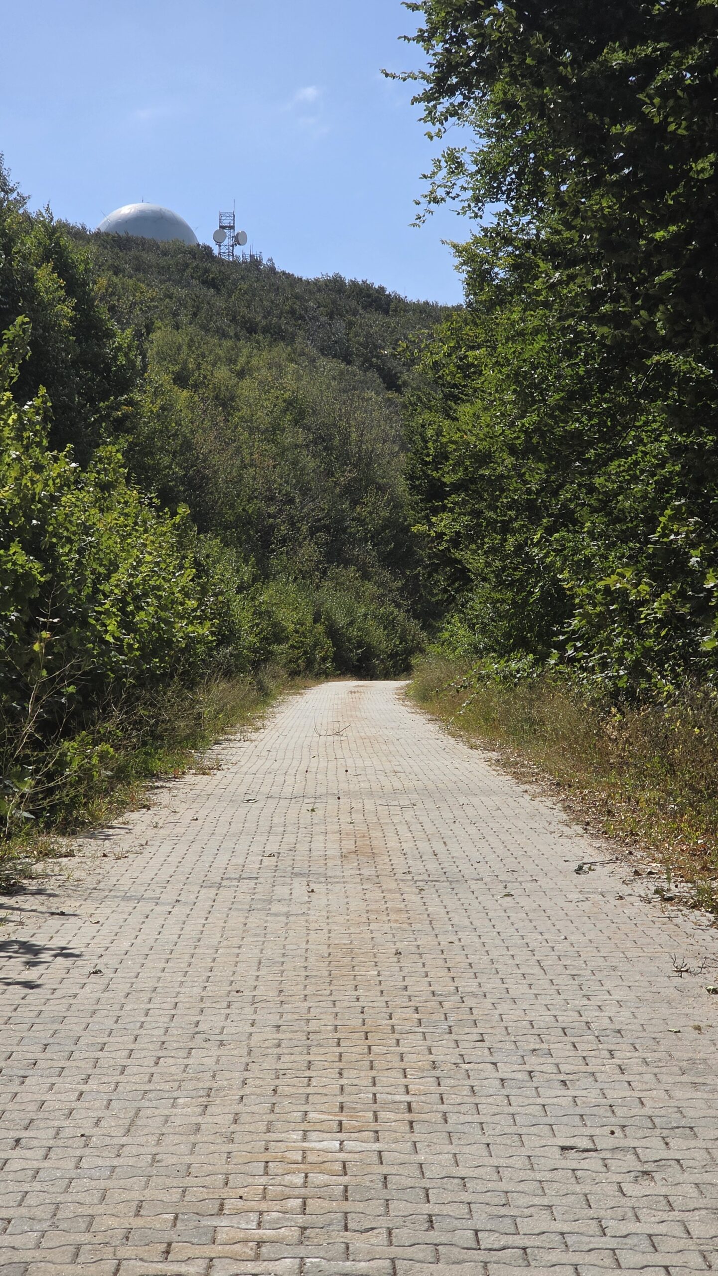
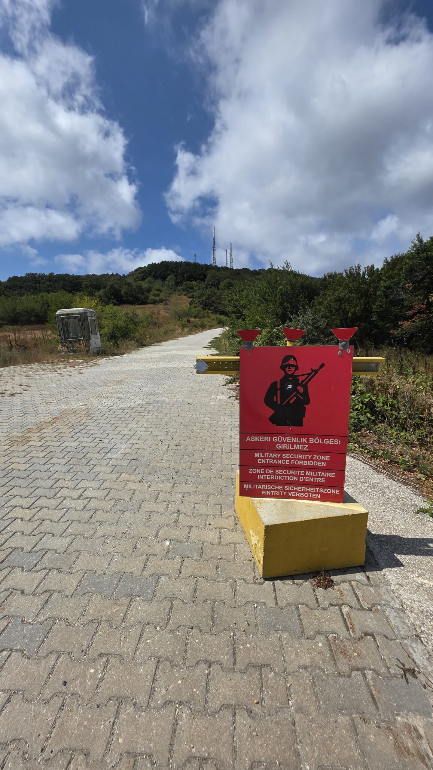
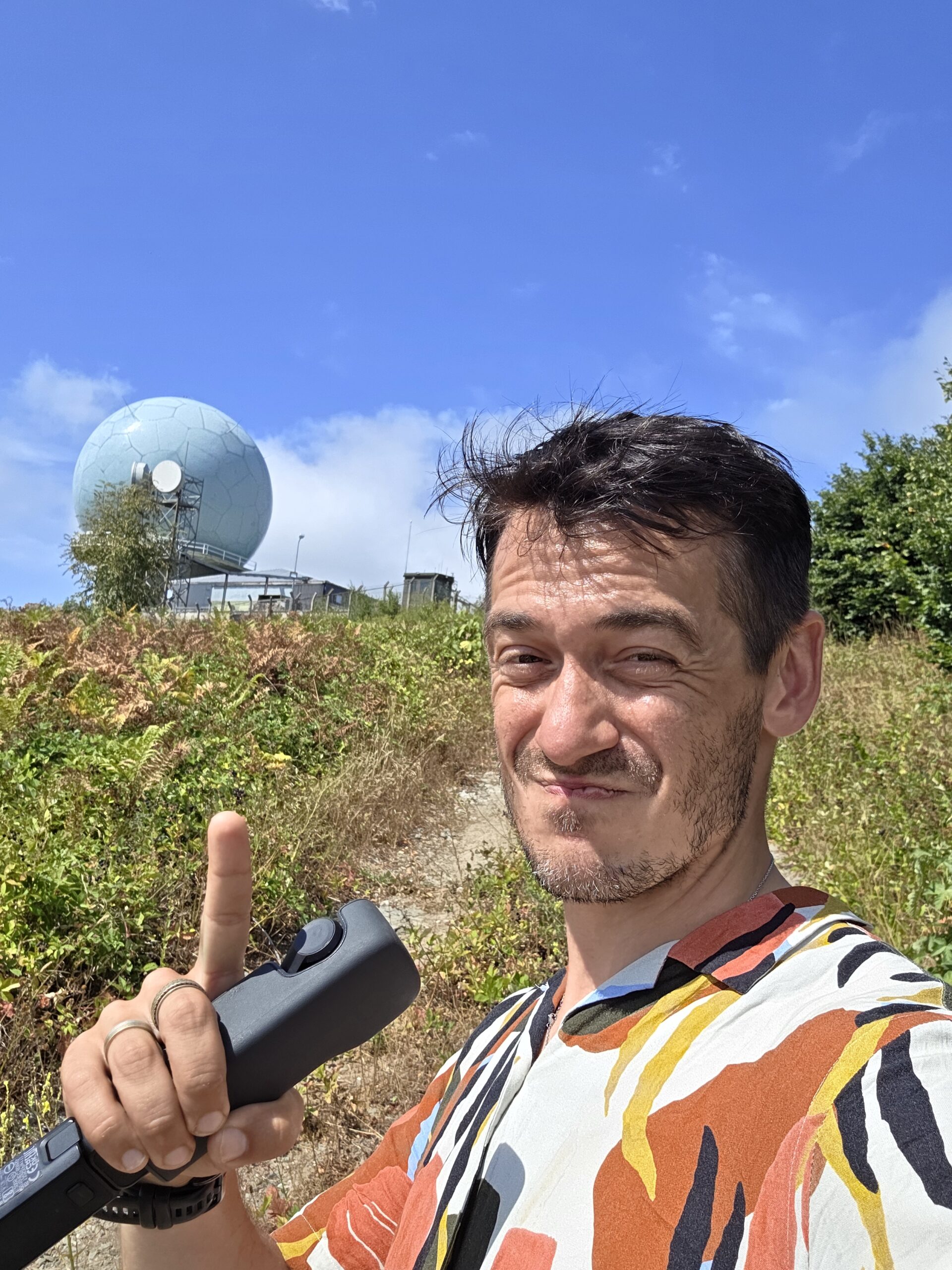
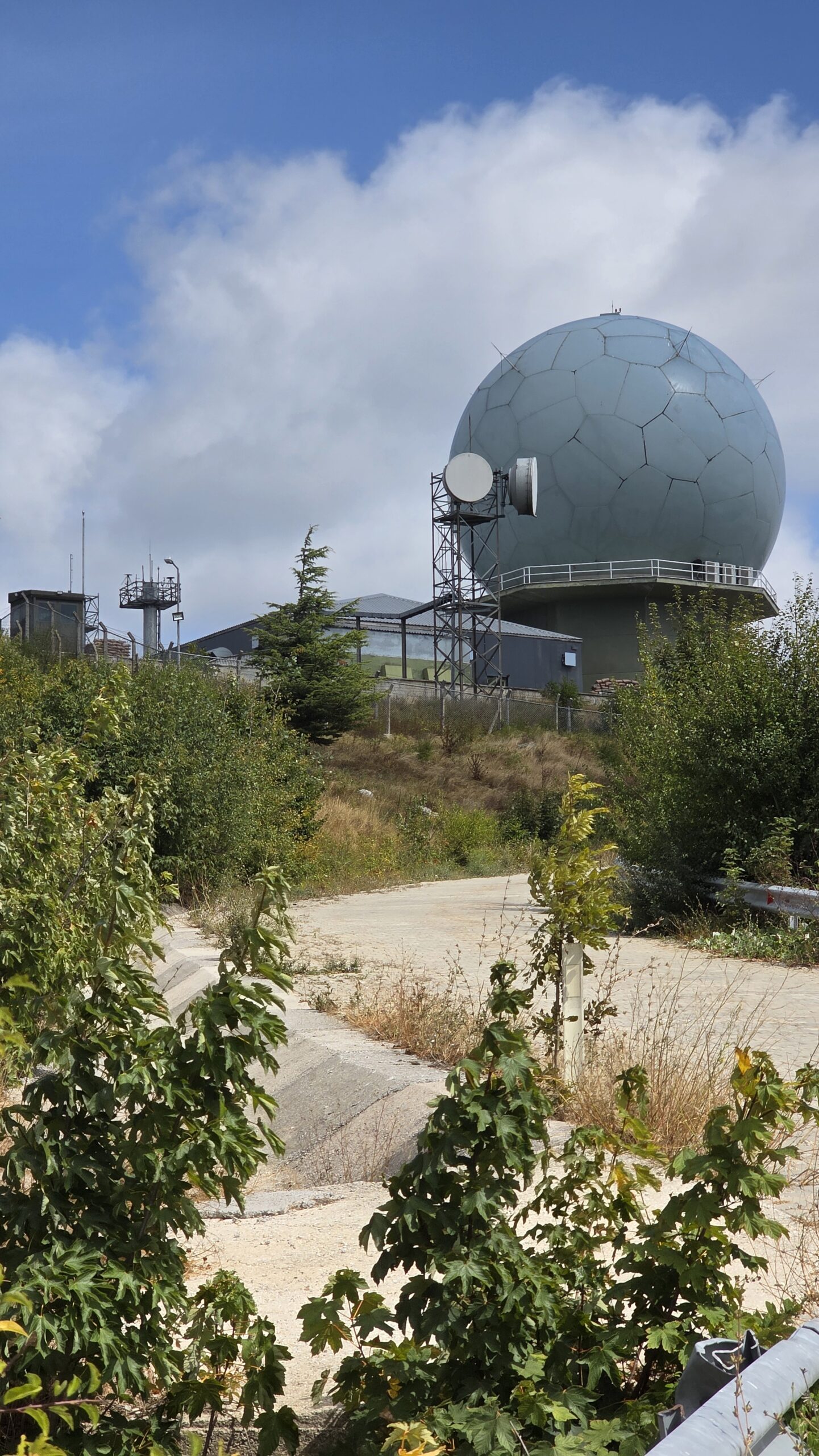
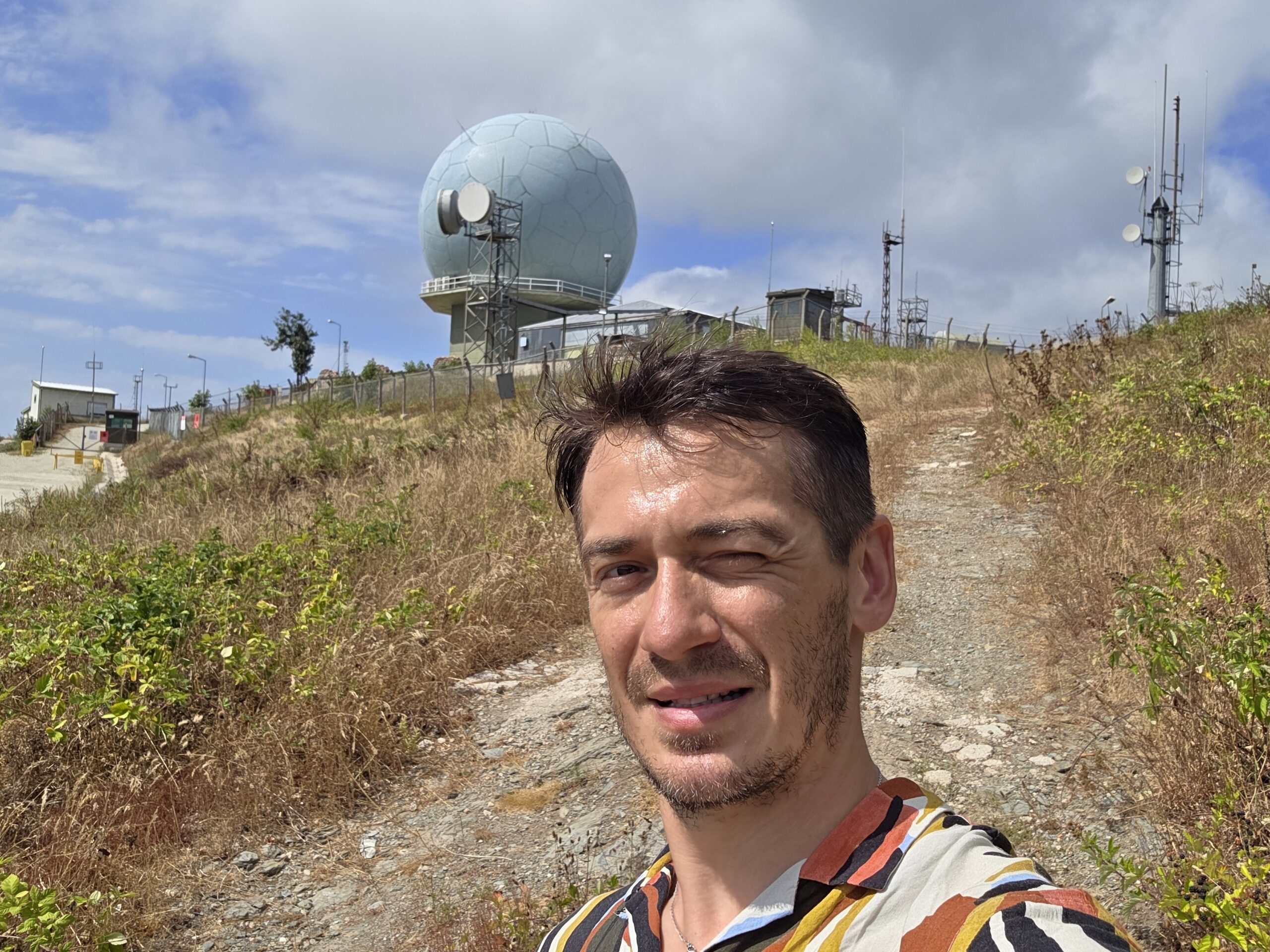
Mahya Dağı, standing at just over 1,000 metres, is the highest mountain in European Turkey. The actual summit lies within a restricted military area, marked by radar installations and fenced perimeters.
I parked the car at the last accessible point near Malkoçlar village and continued on foot along a gravel road winding through pine forest. The final section opened into a sunny plateau with radar towers visible ahead. Following local guidance and respecting all restrictions, I stopped just below the base fence as close as legally possible to the true summit.
At 15:12, I reached the highest accessible point. The surroundings were calm, the air hot and dry, and a wide panorama opened across the Strandzha range, stretching into Bulgaria and toward the Black Sea.
🌄 Reflection
Mahya Dağı may not be tall or technical, but it carries a special significance: it marks the easternmost peak of the European continent in the Crown of Europe project. Standing there, between two continents and two cultures, I felt a sense of completion the symbolic closing of Europe’s southern arc.
It was one of those quiet, reflective climbs where the journey mattered more than the challenge itself. The sound of cicadas, the warm wind, and the silence of the forest made the moment memorable in its simplicity.
After a few photos, I descended to the car and drove back toward Istanbul, ready for the next long connection north.
📅 Date: 14 August 2025